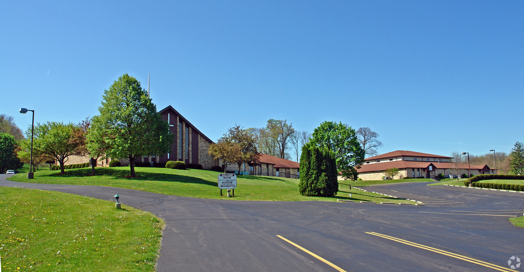
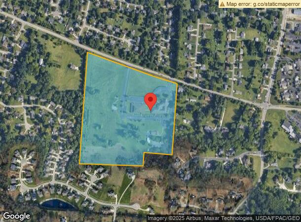
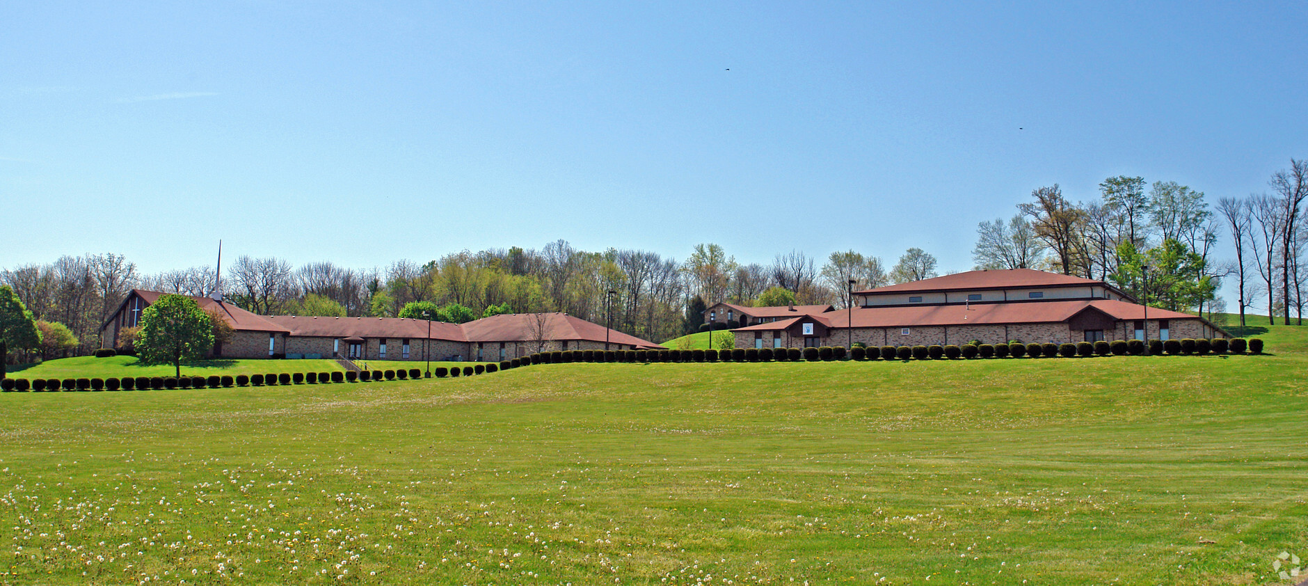
Property Record
3515 Shakertown Rd, Beavercreek, OH 45430
NEARBY LISTINGS FOR SALE OR LEASE
-
-
View all Beavercreek listings for sale on LoopNet.com
Property Detail
3515 Shakertown Rd
B42-0003-0016-0-0090-00
Sunset Bluff
Religious
7-2-1 E SIDE SE 1/4 3515 SHAKERTOWN RD
X
Greene
39057C0104E
Ohio
2023
29.27 AC
2023
East Dayton
210402
Cincinnati/Dayton
4,092 SF
Dayton, OH
DEMOGRAPHICS near 3515 Shakertown Rd
1 Mile
3 Mile
5 Mile
2024 Total Population
5,040
42,178
139,415
2029 Population
5,142
42,692
139,748
Pop Growth 2024-2029
+ 2.02%
+ 1.22%
+ 0.24%
Average Age
45
43
41
2024 Total Households
1,988
16,948
59,684
HH Growth 2024-2029
+ 1.96%
+ 1.13%
+ 0.06%
Median Household Inc
$109,677
$97,804
$76,697
Avg Household Size
2.50
2.40
2.30
2024 Avg HH Vehicles
2.00
2.00
2.00
Median Home Value
$248,376
$226,537
$188,409
Median Year Built
1973
1972
1966
Nearby Places
- Restaurants
- Banks
- Shops
- Fitness
- Groceries
PUBLIC TRANSPORTATION
AIRPORT
James M Cox Dayton International
DRIVE
WALK
Distance
James M Cox Dayton International
35 min
21.4 mi
Freight Ports
Port of Toledo
DRIVE
WALK
Distance
Port of Toledo
192 min
161.6 mi
Nearby Properties
Address
Land Use
TOTAL SIZE
Lot Size
Zoning
Address
Land Use
TOTAL SIZE
Lot Size
Zoning
752,874 SF
74.85 AC
Address
Land Use
TOTAL SIZE
Lot Size
Zoning
175,938 SF
49.33 AC
Address
Land Use
TOTAL SIZE
Lot Size
Zoning
53.48 AC
RP1
Address
Land Use
TOTAL SIZE
Lot Size
Zoning
1,951 SF
56.54 AC
Address
Land Use
TOTAL SIZE
Lot Size
Zoning
240,090 SF
1.93 AC
MXPUD02
Address
Land Use
TOTAL SIZE
Lot Size
Zoning
130,247 SF
14.12 AC
Address
Land Use
TOTAL SIZE
Lot Size
Zoning
Address
Land Use
TOTAL SIZE
Lot Size
Zoning
145,500 SF
32.62 AC
A1
Address
Land Use
TOTAL SIZE
Lot Size
Zoning
38,832 SF
30.51 AC
R-PUD 03-7
Address
Land Use
TOTAL SIZE
Lot Size
Zoning
1,008 SF
7 AC
R1A
Address
Land Use
TOTAL SIZE
Lot Size
Zoning
109,680 SF
32.24 AC
R4
Address
Land Use
TOTAL SIZE
Lot Size
Zoning
130,766 SF
1.68 AC
Address
Land Use
TOTAL SIZE
Lot Size
Zoning
152,844 SF
14.80 AC
Address
Land Use
TOTAL SIZE
Lot Size
Zoning
70,754 SF
75.48 AC
Address
Land Use
TOTAL SIZE
Lot Size
Zoning
89,176 SF
17.52 AC
Address
Land Use
TOTAL SIZE
Lot Size
Zoning
108,274 SF
25.08 AC
RPUD427
Address
Land Use
TOTAL SIZE
Lot Size
Zoning
100,450 SF
1.66 AC
MXPUD02
Address
Land Use
TOTAL SIZE
Lot Size
Zoning
148,309 SF
1.50 AC
MXPUD02
Address
Land Use
TOTAL SIZE
Lot Size
Zoning
309,331 SF
36 AC
Address
Land Use
TOTAL SIZE
Lot Size
Zoning
24,992 SF
17 AC
MULTIPLE
Address
Land Use
TOTAL SIZE
Lot Size
Zoning
20,144 SF
76.94 AC
A1
Address
Land Use
TOTAL SIZE
Lot Size
Zoning
7,694 SF
20.52 AC
MULTIPLE
Address
Land Use
TOTAL SIZE
Lot Size
Zoning
134,260 SF
11.75 AC
Address
Land Use
TOTAL SIZE
Lot Size
Zoning
54,604 SF
6.29 AC
MXPUD02
Address
Land Use
TOTAL SIZE
Lot Size
Zoning
20,832 SF
12.65 AC
Address
Land Use
TOTAL SIZE
Lot Size
Zoning
34,129 SF
4.92 AC
RPUD022
Address
Land Use
TOTAL SIZE
Lot Size
Zoning
72,824 SF
26.88 AC
A1
Address
Land Use
TOTAL SIZE
Lot Size
Zoning
318,166 SF
49.51 AC
Address
Land Use
TOTAL SIZE
Lot Size
Zoning
51,648 SF
9.36 AC
R-PUD 95-2
Address
Land Use
TOTAL SIZE
Lot Size
Zoning
87,120 SF
5.80 AC
MXPUD02
The World's #1 Commercial Real Estate Marketplace
Connect with us
© 2025 CoStar Group
The information above has been obtained from sources believed reliable. While we do not doubt its accuracy we have not verified it and make no guarantee, warranty or representation about it. It is your responsibility to independently confirm its accuracy and completeness. Any projections, opinions, assumptions, or estimates used are for example only and do not represent the current or future performance of the property. The value of this transaction to you depends on tax and other factors which should be evaluated by your tax, financial, and legal advisors. You and your advisors should conduct a careful, independent investigation of the property to determine to your satisfaction the suitability of the property for your needs.