Property Record
3515 Sw Archer Rd, Gainesville, FL 32608

NEARBY LISTINGS FOR SALE OR LEASE
Property Detail
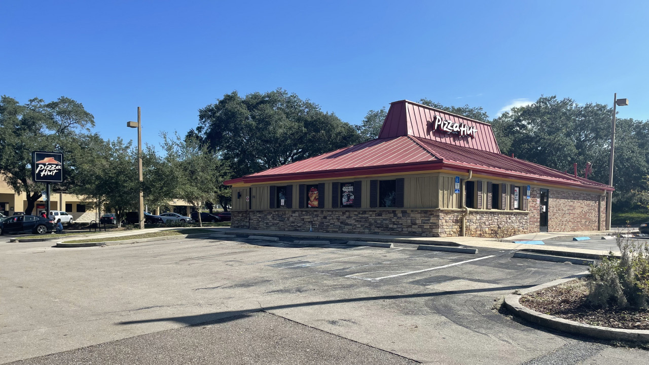
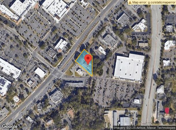
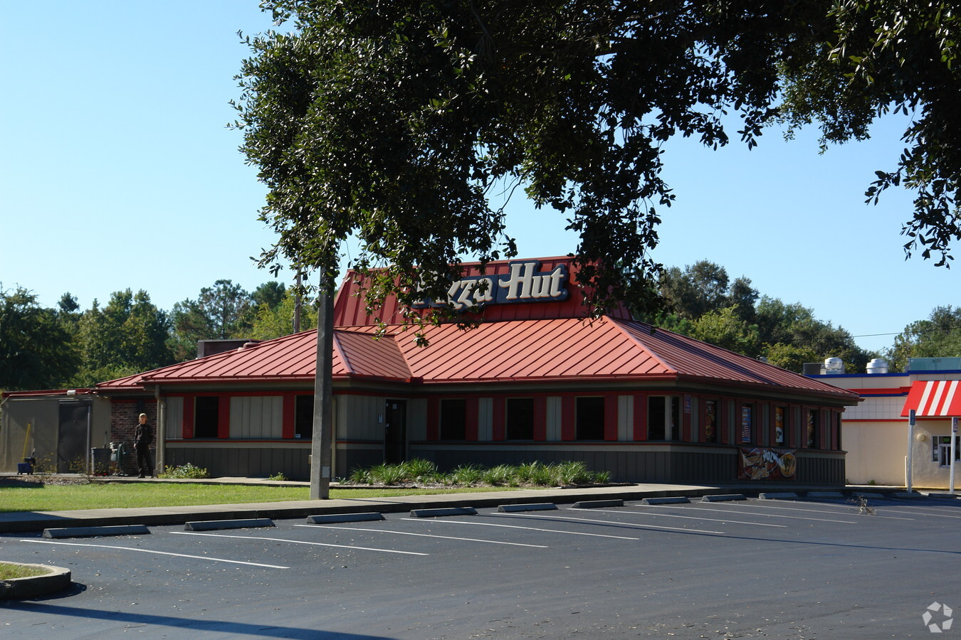
3515 Sw Archer Rd
06812-007-000
Capstone Quarters
Restaurantdrivein
COM INT S BDRY NE1/4 & SE R/W SR-24 NE ALONG SAID R/W 408.6 FT POB CONT ALONG SAID R/W 174.34 FT S 49 DEG E 129.21 FT S 233 FT N 49 DEG W 270.95 FT TO POB OR 3696/0702
X
Alachua
12001C0435E
Florida
2023
0.80 AC
2024
South Gainesville
001519
Other Market Areas
2,324 SF
Gainesville, FL
DEMOGRAPHICS near 3515 Sw Archer Rd
1 Mile
3 Mile
5 Mile
2024 Total Population
22,158
87,805
164,664
2029 Population
23,195
91,929
173,127
Pop Growth 2024-2029
+ 4.68%
+ 4.70%
+ 5.14%
Average Age
29
30
34
2024 Total Households
9,216
33,942
67,088
HH Growth 2024-2029
+ 4.32%
+ 5.00%
+ 5.33%
Median Household Inc
$33,436
$34,169
$47,818
Avg Household Size
2.10
2.10
2.20
2024 Avg HH Vehicles
1.00
1.00
2.00
Median Home Value
$190,992
$221,146
$267,304
Median Year Built
1990
1988
1986
Nearby Places
- Restaurants
- Banks
- Shops
- Fitness
- Groceries
PUBLIC TRANSPORTATION
AIRPORT
Gainesville Regional
DRIVE
WALK
Distance
Gainesville Regional
22 min
9.3 mi
Freight Ports
Jacksonville Port
DRIVE
WALK
Distance
Jacksonville Port
107 min
79.1 mi
SALE & LEASE HISTORY
LISTING DATE
SALE/LEASE

Oct 11, 2023
For Lease
Oct 11, 2023
For Sale
Nearby Properties
Address
Land Use
TOTAL SIZE
Lot Size
Zoning
Address
Land Use
TOTAL SIZE
Lot Size
Zoning
3,617,778 SF
276.74 AC
ED
Address
Land Use
TOTAL SIZE
Lot Size
Zoning
790,340 SF
526 AC
ED
Address
Land Use
TOTAL SIZE
Lot Size
Zoning
676,831 SF
24.04 AC
U9
Address
Land Use
TOTAL SIZE
Lot Size
Zoning
108,640 SF
20 AC
ED
Address
Land Use
TOTAL SIZE
Lot Size
Zoning
17.87 AC
ED
Address
Land Use
TOTAL SIZE
Lot Size
Zoning
382,760 SF
109.58 AC
MD
Address
Land Use
TOTAL SIZE
Lot Size
Zoning
430,590 SF
16.95 AC
ED
Address
Land Use
TOTAL SIZE
Lot Size
Zoning
682,400 SF
20 AC
ED
Address
Land Use
TOTAL SIZE
Lot Size
Zoning
399,130 SF
18.13 AC
ED
Address
Land Use
TOTAL SIZE
Lot Size
Zoning
969,726 SF
2.50 AC
PD
Address
Land Use
TOTAL SIZE
Lot Size
Zoning
20.95 AC
MD
Address
Land Use
TOTAL SIZE
Lot Size
Zoning
784,251 SF
106.08 AC
PD
Address
Land Use
TOTAL SIZE
Lot Size
Zoning
416,200 SF
20 AC
ED
Address
Land Use
TOTAL SIZE
Lot Size
Zoning
582,311 SF
20 AC
ED
Address
Land Use
TOTAL SIZE
Lot Size
Zoning
348,458 SF
81.44 AC
ED
Address
Land Use
TOTAL SIZE
Lot Size
Zoning
338,165 SF
1.79 AC
U9
Address
Land Use
TOTAL SIZE
Lot Size
Zoning
372,990 SF
20 AC
ED
Address
Land Use
TOTAL SIZE
Lot Size
Zoning
357,020 SF
20 AC
ED
Address
Land Use
TOTAL SIZE
Lot Size
Zoning
183,318 SF
1.25 AC
U8
Address
Land Use
TOTAL SIZE
Lot Size
Zoning
508,106 SF
27.40 AC
PD
Address
Land Use
TOTAL SIZE
Lot Size
Zoning
233,910 SF
3.64 AC
PD
Address
Land Use
TOTAL SIZE
Lot Size
Zoning
392,241 SF
25 AC
U9
Address
Land Use
TOTAL SIZE
Lot Size
Zoning
271,079 SF
0.94 AC
U9
Address
Land Use
TOTAL SIZE
Lot Size
Zoning
571,635 SF
55.49 AC
RMF6
Address
Land Use
TOTAL SIZE
Lot Size
Zoning
318,578 SF
21.24 AC
RMF7
Address
Land Use
TOTAL SIZE
Lot Size
Zoning
490,069 SF
40.15 AC
RMF8
Address
Land Use
TOTAL SIZE
Lot Size
Zoning
392,472 SF
11.38 AC
U9
Address
Land Use
TOTAL SIZE
Lot Size
Zoning
414,780 SF
1.99 AC
PD
Address
Land Use
TOTAL SIZE
Lot Size
Zoning
497,470 SF
33.60 AC
PD
Address
Land Use
TOTAL SIZE
Lot Size
Zoning
219,150 SF
9.99 AC
PD
The World's #1 Commercial Real Estate Marketplace
Connect with us
© 2025 CoStar Group
The information above has been obtained from sources believed reliable. While we do not doubt its accuracy we have not verified it and make no guarantee, warranty or representation about it. It is your responsibility to independently confirm its accuracy and completeness. Any projections, opinions, assumptions, or estimates used are for example only and do not represent the current or future performance of the property. The value of this transaction to you depends on tax and other factors which should be evaluated by your tax, financial, and legal advisors. You and your advisors should conduct a careful, independent investigation of the property to determine to your satisfaction the suitability of the property for your needs.