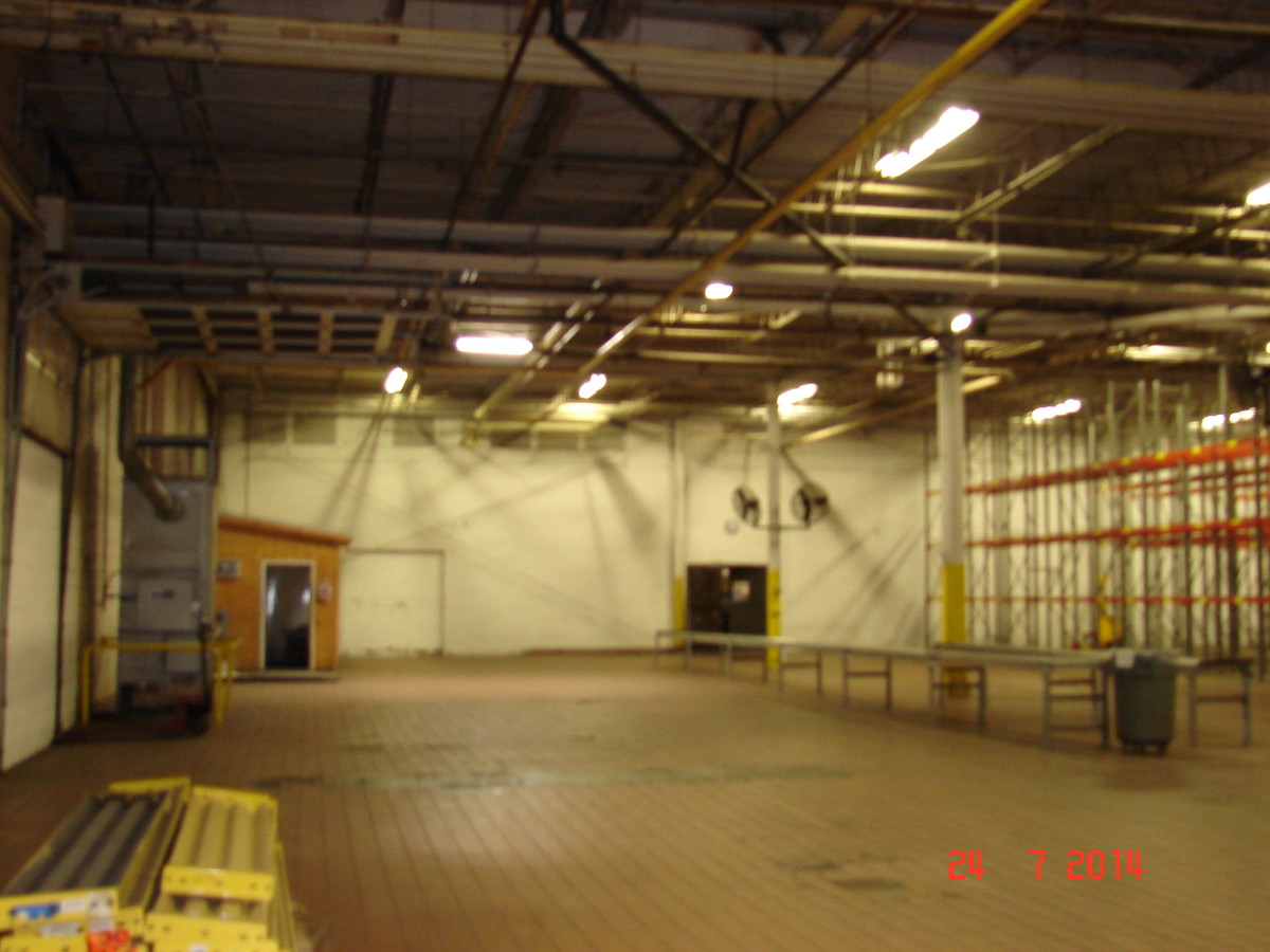
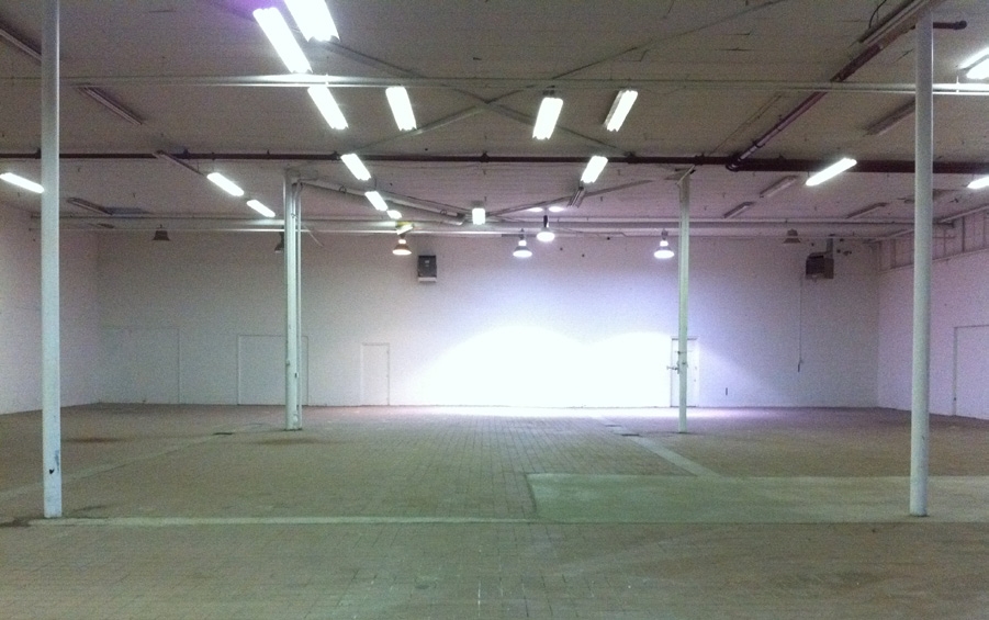
Property Record
352 N Fail Rd, La Porte, IN 46350

NEARBY LISTINGS FOR SALE OR LEASE
Property Detail
352 N Fail Rd
46-07-30-251-006.000-053
33-07-30-251-006 IN NE 1/4 S30 T37 R2 54.336AC
Lightindustrial
La Porte
X
Indiana
18091C0170D
54.34 AC
2023
South Bend/Elkhart
2024
Other Market Areas
042100
Michigan City-La Porte, IN
414,159 SF
DEMOGRAPHICS near 352 N Fail Rd
1 Mile
3 Mile
5 Mile
2024 Total Population
1,146
16,691
32,054
2029 Population
1,141
16,547
31,624
Pop Growth 2024-2029
(0.44%)
(0.86%)
(1.34%)
Average Age
40
39
40
2024 Total Households
414
6,528
12,643
HH Growth 2024-2029
(0.72%)
(1.04%)
(1.53%)
Median Household Inc
$83,144
$55,044
$61,870
Avg Household Size
2.60
2.40
2.40
2024 Avg HH Vehicles
2.00
2.00
2.00
Median Home Value
$219,947
$149,969
$170,680
Median Year Built
1990
1953
1960
Nearby Places
- Restaurants
- Banks
- Shops
- Fitness
- Groceries
PUBLIC TRANSPORTATION
COMMUTER RAIL
Hudson Lake (Laporte County) Station (South Shore Line - Northern Indiana Commuter Transportation District (South Shore Line))
DRIVE
WALK
Distance
Hudson Lake (Laporte County) Station (South Shore Line - Northern Indiana Commuter Transportation District (South Shore Line))
15 min
9.7 mi
AIRPORT
South Bend International
DRIVE
WALK
Distance
South Bend International
40 min
23.2 mi
Freight Ports
Port Milwaukee
DRIVE
WALK
Distance
Port Milwaukee
194 min
155.5 mi
SALE & LEASE HISTORY
LISTING DATE
SALE/LEASE

Mar 29, 2017
For Lease
Nearby Properties
Address
Land Use
TOTAL SIZE
Lot Size
Zoning
Address
Land Use
TOTAL SIZE
Lot Size
Zoning
222,443 SF
5.25 AC
Address
Land Use
TOTAL SIZE
Lot Size
Zoning
225,592 SF
3.72 AC
Address
Land Use
TOTAL SIZE
Lot Size
Zoning
482,301 SF
49.97 AC
Address
Land Use
TOTAL SIZE
Lot Size
Zoning
511,980 SF
45.42 AC
Address
Land Use
TOTAL SIZE
Lot Size
Zoning
294,600 SF
22.86 AC
Address
Land Use
TOTAL SIZE
Lot Size
Zoning
289,954 SF
15.78 AC
Address
Land Use
TOTAL SIZE
Lot Size
Zoning
47,659 SF
22.32 AC
Address
Land Use
TOTAL SIZE
Lot Size
Zoning
603,796 SF
18.96 AC
Address
Land Use
TOTAL SIZE
Lot Size
Zoning
18,620 SF
6.87 AC
Address
Land Use
TOTAL SIZE
Lot Size
Zoning
150,364 SF
14.26 AC
Address
Land Use
TOTAL SIZE
Lot Size
Zoning
56,034 SF
3.04 AC
Address
Land Use
TOTAL SIZE
Lot Size
Zoning
194,458 SF
17.50 AC
Address
Land Use
TOTAL SIZE
Lot Size
Zoning
50,562 SF
11.99 AC
Address
Land Use
TOTAL SIZE
Lot Size
Zoning
28,154 SF
2.68 AC
Address
Land Use
TOTAL SIZE
Lot Size
Zoning
84,600 SF
52.12 AC
Address
Land Use
TOTAL SIZE
Lot Size
Zoning
36,179 SF
6.15 AC
Address
Land Use
TOTAL SIZE
Lot Size
Zoning
52,830 SF
0.32 AC
Address
Land Use
TOTAL SIZE
Lot Size
Zoning
19,230 SF
2.32 AC
Address
Land Use
TOTAL SIZE
Lot Size
Zoning
130,620 SF
12.68 AC
Address
Land Use
TOTAL SIZE
Lot Size
Zoning
7,217 SF
0.40 AC
LBCCN
Address
Land Use
TOTAL SIZE
Lot Size
Zoning
31,483 SF
0.78 AC
Address
Land Use
TOTAL SIZE
Lot Size
Zoning
64,084 SF
4.54 AC
Address
Land Use
TOTAL SIZE
Lot Size
Zoning
39,424 SF
1.28 AC
Address
Land Use
TOTAL SIZE
Lot Size
Zoning
45,375 SF
4.67 AC
Address
Land Use
TOTAL SIZE
Lot Size
Zoning
10,506 SF
2.23 AC
Address
Land Use
TOTAL SIZE
Lot Size
Zoning
50,266 SF
10 AC
Address
Land Use
TOTAL SIZE
Lot Size
Zoning
11,404 SF
9.30 AC
Address
Land Use
TOTAL SIZE
Lot Size
Zoning
27,437 SF
3 AC
Address
Land Use
TOTAL SIZE
Lot Size
Zoning
13,150 SF
4.69 AC
The World's #1 Commercial Real Estate Marketplace
Connect with us
© 2025 CoStar Group
The information above has been obtained from sources believed reliable. While we do not doubt its accuracy we have not verified it and make no guarantee, warranty or representation about it. It is your responsibility to independently confirm its accuracy and completeness. Any projections, opinions, assumptions, or estimates used are for example only and do not represent the current or future performance of the property. The value of this transaction to you depends on tax and other factors which should be evaluated by your tax, financial, and legal advisors. You and your advisors should conduct a careful, independent investigation of the property to determine to your satisfaction the suitability of the property for your needs.