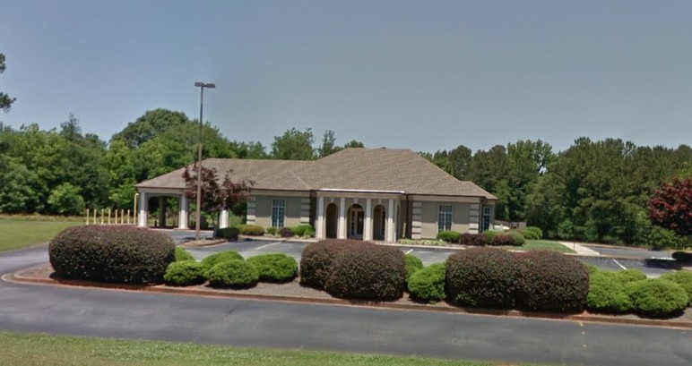
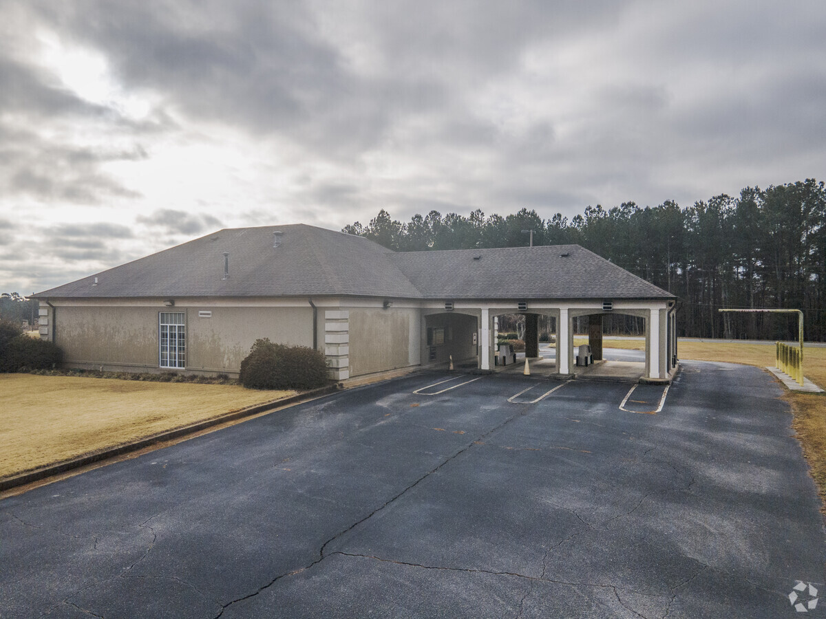
Property Record
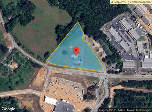
3528 Highway 53, Hoschton, GA 30548
NEARBY LISTINGS FOR SALE OR LEASE
Property Detail
3528 Highway 53
120-030
5.30 AC TRACT 1 PLAT BK 25 PG 219
Commercialacreage
Jackson
X
Georgia
13013C0050D
5.30 AC
2024
Braselton/W Jackson
2023
Atlanta
010106
Jefferson, GA
3,285 SF
DEMOGRAPHICS near 3528 Highway 53
1 Mile
3 Mile
5 Mile
2024 Total Population
2,290
11,373
41,317
2029 Population
2,920
14,360
50,551
Pop Growth 2024-2029
+ 27.51%
+ 26.26%
+ 22.35%
Average Age
38
39
39
2024 Total Households
808
3,865
13,854
HH Growth 2024-2029
+ 26.11%
+ 25.07%
+ 21.50%
Median Household Inc
$80,952
$89,531
$98,550
Avg Household Size
2.80
2.90
2.90
2024 Avg HH Vehicles
2.00
2.00
2.00
Median Home Value
$329,929
$331,438
$327,245
Median Year Built
2003
2005
2004
Nearby Places
- Restaurants
- Banks
- Shops
- Fitness
- Groceries
SALE & LEASE HISTORY
LISTING DATE
SALE/LEASE

May 01, 2020
For Lease
Nearby Properties
Address
Land Use
TOTAL SIZE
Lot Size
Zoning
Address
Land Use
TOTAL SIZE
Lot Size
Zoning
979,317 SF
107.36 AC
001
Address
Land Use
TOTAL SIZE
Lot Size
Zoning
613,440 SF
50 AC
003
Address
Land Use
TOTAL SIZE
Lot Size
Zoning
510,720 SF
48.46 AC
M1
Address
Land Use
TOTAL SIZE
Lot Size
Zoning
521,290 SF
23.60 AC
MD
Address
Land Use
TOTAL SIZE
Lot Size
Zoning
502,088 SF
36.80 AC
MD
Address
Land Use
TOTAL SIZE
Lot Size
Zoning
348,990 SF
86.93 AC
M
Address
Land Use
TOTAL SIZE
Lot Size
Zoning
422,920 SF
24.70 AC
MD
Address
Land Use
TOTAL SIZE
Lot Size
Zoning
446,439 SF
30.47 AC
003
Address
Land Use
TOTAL SIZE
Lot Size
Zoning
500,500 SF
53.92 AC
MI
Address
Land Use
TOTAL SIZE
Lot Size
Zoning
438,375 SF
32.69 AC
Address
Land Use
TOTAL SIZE
Lot Size
Zoning
805,954 SF
52.41 AC
003
Address
Land Use
TOTAL SIZE
Lot Size
Zoning
547,250 SF
47.51 AC
M1
Address
Land Use
TOTAL SIZE
Lot Size
Zoning
554,285 SF
70.18 AC
Address
Land Use
TOTAL SIZE
Lot Size
Zoning
222,000 SF
20.59 AC
003
Address
Land Use
TOTAL SIZE
Lot Size
Zoning
131,875 SF
18.93 AC
C
Address
Land Use
TOTAL SIZE
Lot Size
Zoning
8,752 SF
11.40 AC
OI
Address
Land Use
TOTAL SIZE
Lot Size
Zoning
25,194 SF
6.36 AC
C2-GENERAL
Address
Land Use
TOTAL SIZE
Lot Size
Zoning
378.65 AC
004
Address
Land Use
TOTAL SIZE
Lot Size
Zoning
146,571 SF
21.60 AC
E2
Address
Land Use
TOTAL SIZE
Lot Size
Zoning
110,034 SF
11.57 AC
001
Address
Land Use
TOTAL SIZE
Lot Size
Zoning
224.76 AC
004
Address
Land Use
TOTAL SIZE
Lot Size
Zoning
60,128 SF
2.48 AC
001
Address
Land Use
TOTAL SIZE
Lot Size
Zoning
65,501 SF
2.20 AC
GC
Address
Land Use
TOTAL SIZE
Lot Size
Zoning
173.05 AC
004
Address
Land Use
TOTAL SIZE
Lot Size
Zoning
81,900 SF
8.61 AC
001
Address
Land Use
TOTAL SIZE
Lot Size
Zoning
20,634 SF
9.80 AC
003
Address
Land Use
TOTAL SIZE
Lot Size
Zoning
35.12 AC
001
Address
Land Use
TOTAL SIZE
Lot Size
Zoning
21,268 SF
7 AC
MI
Address
Land Use
TOTAL SIZE
Lot Size
Zoning
11.17 AC
PCD
Address
Land Use
TOTAL SIZE
Lot Size
Zoning
46,350 SF
4.30 AC
MD
The World's #1 Commercial Real Estate Marketplace
Connect with us
© 2025 CoStar Group
The information above has been obtained from sources believed reliable. While we do not doubt its accuracy we have not verified it and make no guarantee, warranty or representation about it. It is your responsibility to independently confirm its accuracy and completeness. Any projections, opinions, assumptions, or estimates used are for example only and do not represent the current or future performance of the property. The value of this transaction to you depends on tax and other factors which should be evaluated by your tax, financial, and legal advisors. You and your advisors should conduct a careful, independent investigation of the property to determine to your satisfaction the suitability of the property for your needs.