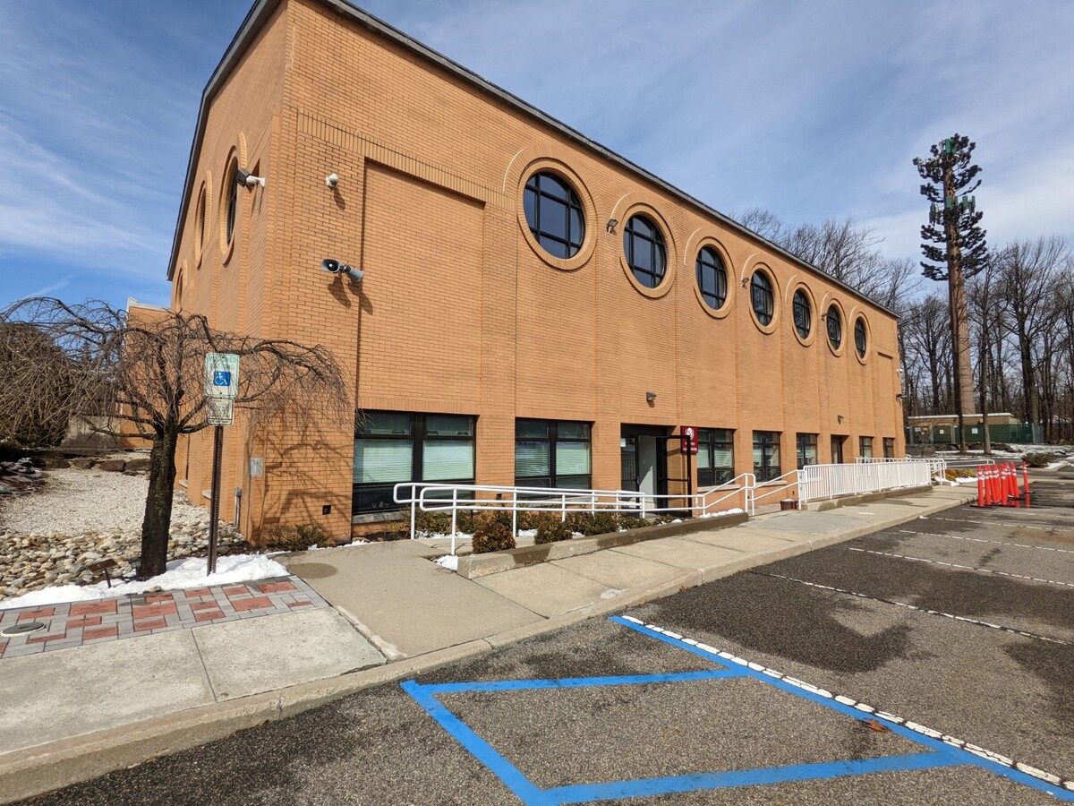
Property Record
353 E Clinton Ave, Tenafly, NJ 07670
NEARBY LISTINGS FOR SALE OR LEASE
-
-
View all Tenafly listings for lease on LoopNet.com
Property Detail
353 E Clinton Ave
61-02902-0000-00013
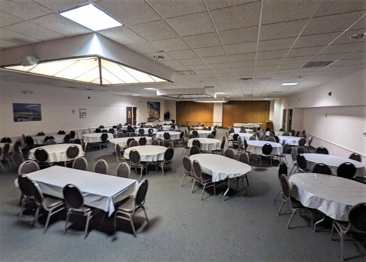
10.2 AC CHURCH
Religious
Bergen
X
New Jersey
34003C0212H
13
0
10.20 AC
2024
Palisades
055100
Northern New Jersey
51,818 SF
New York-Jersey City-White Plains, NY-NJ
DEMOGRAPHICS near 353 E Clinton Ave
1 Mile
3 Mile
5 Mile
2024 Total Population
6,077
187,521
962,658
2029 Population
6,099
183,905
922,037
Pop Growth 2024-2029
+ 0.36%
(1.93%)
(4.22%)
Average Age
40
41
40
2024 Total Households
1,919
70,029
351,058
HH Growth 2024-2029
+ 0.26%
(2.34%)
(4.58%)
Median Household Inc
$232,635
$91,145
$62,021
Avg Household Size
3.10
2.50
2.60
2024 Avg HH Vehicles
2.00
1.00
1.00
Median Home Value
$1,061,807
$544,714
$488,406
Median Year Built
1959
1957
1950
Nearby Places
- Restaurants
- Banks
- Shops
- Fitness
- Groceries
PUBLIC TRANSPORTATION
AIRPORT
Laguardia
DRIVE
WALK
Distance
Laguardia
29 min
16.3 mi
Newark Liberty International
DRIVE
WALK
Distance
Newark Liberty International
28 min
23.4 mi
Westchester County
DRIVE
WALK
Distance
Westchester County
46 min
31.0 mi
Freight Ports
NY - Red Hook Container Terminal
DRIVE
WALK
Distance
NY - Red Hook Container Terminal
41 min
22.6 mi
SALE & LEASE HISTORY
LISTING DATE
SALE/LEASE

May 04, 2023
For Lease
Apr 28, 2022
For Lease
Nearby Properties
Address
Land Use
TOTAL SIZE
Lot Size
Zoning
Address
Land Use
TOTAL SIZE
Lot Size
Zoning
689 SF
423.72 AC
P
Address
Land Use
TOTAL SIZE
Lot Size
Zoning
572,137 SF
14.11 AC
R-D
Address
Land Use
TOTAL SIZE
Lot Size
Zoning
74,550 SF
11.28 AC
OI
Address
Land Use
TOTAL SIZE
Lot Size
Zoning
219.71 AC
O
Address
Land Use
TOTAL SIZE
Lot Size
Zoning
166.61 AC
P
Address
Land Use
TOTAL SIZE
Lot Size
Zoning
100,151 SF
22.13 AC
B2
Address
Land Use
TOTAL SIZE
Lot Size
Zoning
5.22 AC
APT
Address
Land Use
TOTAL SIZE
Lot Size
Zoning
4.54 AC
R-M3
Address
Land Use
TOTAL SIZE
Lot Size
Zoning
134.16 AC
RA
Address
Land Use
TOTAL SIZE
Lot Size
Zoning
15.76 AC
B2
Address
Land Use
TOTAL SIZE
Lot Size
Zoning
259.87 AC
PARK
Address
Land Use
TOTAL SIZE
Lot Size
Zoning
12.68 AC
P1
Address
Land Use
TOTAL SIZE
Lot Size
Zoning
Address
Land Use
TOTAL SIZE
Lot Size
Zoning
2.63 AC
OI
Address
Land Use
TOTAL SIZE
Lot Size
Zoning
225.36 AC
O
Address
Land Use
TOTAL SIZE
Lot Size
Zoning
87,000 SF
455.70 AC
PARK
Address
Land Use
TOTAL SIZE
Lot Size
Zoning
9.48 AC
RA
Address
Land Use
TOTAL SIZE
Lot Size
Zoning
1.12 AC
Address
Land Use
TOTAL SIZE
Lot Size
Zoning
450,784 SF
42.36 AC
R4
Address
Land Use
TOTAL SIZE
Lot Size
Zoning
251,884 SF
21.53 AC
R6
Address
Land Use
TOTAL SIZE
Lot Size
Zoning
68,824 SF
34.75 AC
R-D
Address
Land Use
TOTAL SIZE
Lot Size
Zoning
173,890 SF
23.80 AC
O
Address
Land Use
TOTAL SIZE
Lot Size
Zoning
7.91 AC
RB
Address
Land Use
TOTAL SIZE
Lot Size
Zoning
7.34 AC
Address
Land Use
TOTAL SIZE
Lot Size
Zoning
36.90 AC
MU
Address
Land Use
TOTAL SIZE
Lot Size
Zoning
650 SF
74.61 AC
OS
Address
Land Use
TOTAL SIZE
Lot Size
Zoning
28.78 AC
B2
Address
Land Use
TOTAL SIZE
Lot Size
Zoning
844,578 SF
4.91 AC
R6
Address
Land Use
TOTAL SIZE
Lot Size
Zoning
Address
Land Use
TOTAL SIZE
Lot Size
Zoning
6.28 AC
B2
The World's #1 Commercial Real Estate Marketplace
Connect with us
© 2025 CoStar Group
The information above has been obtained from sources believed reliable. While we do not doubt its accuracy we have not verified it and make no guarantee, warranty or representation about it. It is your responsibility to independently confirm its accuracy and completeness. Any projections, opinions, assumptions, or estimates used are for example only and do not represent the current or future performance of the property. The value of this transaction to you depends on tax and other factors which should be evaluated by your tax, financial, and legal advisors. You and your advisors should conduct a careful, independent investigation of the property to determine to your satisfaction the suitability of the property for your needs.