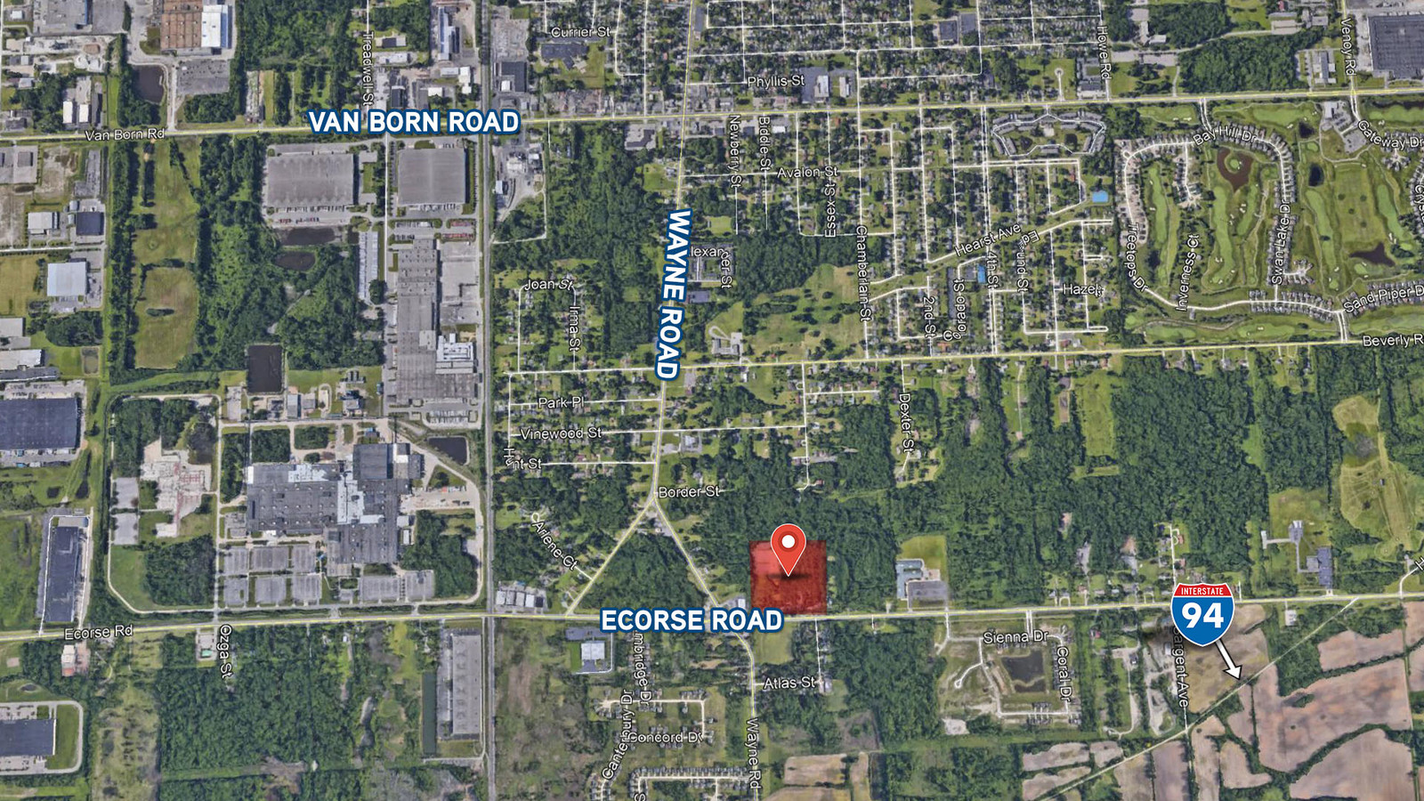
Property Record
35344 Ecorse Rd, Romulus, MI 48174
This Property Is For Sale
NEARBY LISTINGS FOR SALE OR LEASE
Property Detail
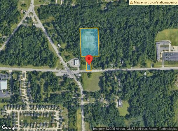
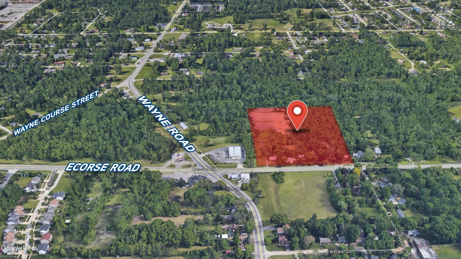
35344 Ecorse Rd
Detroit-Warren-Dearborn, MI
River Meadow Condominium
80-015-99-0059-000
Wayne
Sfr
Michigan
X
5.20 AC
26163C0220F
Airport District
1,322 SF
Detroit
DEMOGRAPHICS near 35344 Ecorse Rd
1 Mile
3 Mile
5 Mile
2024 Total Population
3,896
39,221
130,907
2029 Population
3,748
37,834
126,074
Pop Growth 2024-2029
(3.80%)
(3.54%)
(3.69%)
Average Age
37
40
39
2024 Total Households
1,504
15,981
52,433
HH Growth 2024-2029
(3.79%)
(3.62%)
(3.76%)
Median Household Inc
$60,264
$55,619
$60,202
Avg Household Size
2.60
2.40
2.40
2024 Avg HH Vehicles
2.00
2.00
2.00
Median Home Value
$200,144
$145,100
$158,099
Median Year Built
1974
1964
1967
Nearby Places
- Restaurants
- Banks
- Shops
- Fitness
- Groceries
PUBLIC TRANSPORTATION
AIRPORT
Detroit Metro Wayne County
DRIVE
WALK
Distance
Detroit Metro Wayne County
11 min
7.0 mi
Windsor International
DRIVE
WALK
Distance
Windsor International
50 min
31.1 mi
Freight Ports
Port of Toledo
DRIVE
WALK
Distance
Port of Toledo
64 min
49.9 mi
Nearby Properties
Address
Land Use
TOTAL SIZE
Lot Size
Zoning
Address
Land Use
TOTAL SIZE
Lot Size
Zoning
238.69 AC
AG
Address
Land Use
TOTAL SIZE
Lot Size
Zoning
855,000 SF
84.70 AC
M-1/COND
Address
Land Use
TOTAL SIZE
Lot Size
Zoning
108,809 SF
AP-AIRPORT
Address
Land Use
TOTAL SIZE
Lot Size
Zoning
43.43 AC
Address
Land Use
TOTAL SIZE
Lot Size
Zoning
435,648 SF
27.84 AC
M2-GEN
Address
Land Use
TOTAL SIZE
Lot Size
Zoning
366,820 SF
20.83 AC
Address
Land Use
TOTAL SIZE
Lot Size
Zoning
366,820 SF
20.72 AC
Address
Land Use
TOTAL SIZE
Lot Size
Zoning
354,968 SF
25.72 AC
Address
Land Use
TOTAL SIZE
Lot Size
Zoning
268,272 SF
22.70 AC
Address
Land Use
TOTAL SIZE
Lot Size
Zoning
685,506 SF
44.25 AC
M1 LIG
Address
Land Use
TOTAL SIZE
Lot Size
Zoning
138.32 AC
IND-2 HVY
Address
Land Use
TOTAL SIZE
Lot Size
Zoning
250,263 SF
18.81 AC
RM-MLTI
Address
Land Use
TOTAL SIZE
Lot Size
Zoning
907,180 SF
56.56 AC
M2-GEN
Address
Land Use
TOTAL SIZE
Lot Size
Zoning
5,382 SF
109.33 AC
RMH-MOB
Address
Land Use
TOTAL SIZE
Lot Size
Zoning
285,080 SF
21.89 AC
M2-GEN
Address
Land Use
TOTAL SIZE
Lot Size
Zoning
195,388 SF
15.89 AC
RM-MLTI
Address
Land Use
TOTAL SIZE
Lot Size
Zoning
489,500 SF
58.51 AC
M2GEN
Address
Land Use
TOTAL SIZE
Lot Size
Zoning
26.05 AC
Address
Land Use
TOTAL SIZE
Lot Size
Zoning
4,839 SF
50.14 AC
RC-REG
Address
Land Use
TOTAL SIZE
Lot Size
Zoning
150.49 AC
M2-GEN
Address
Land Use
TOTAL SIZE
Lot Size
Zoning
2,590 SF
62.42 AC
RC-REG
Address
Land Use
TOTAL SIZE
Lot Size
Zoning
249,090 SF
27.15 AC
M1-LIG
Address
Land Use
TOTAL SIZE
Lot Size
Zoning
197,548 SF
13.06 AC
Address
Land Use
TOTAL SIZE
Lot Size
Zoning
165,200 SF
14.85 AC
Address
Land Use
TOTAL SIZE
Lot Size
Zoning
71.38 AC
IND-2 HVY
Address
Land Use
TOTAL SIZE
Lot Size
Zoning
151,250 SF
23.05 AC
IND-2 HVY
Address
Land Use
TOTAL SIZE
Lot Size
Zoning
129,260 SF
5.25 AC
AP-AIRPORT
Address
Land Use
TOTAL SIZE
Lot Size
Zoning
405,592 SF
28.40 AC
M1 LIG
Address
Land Use
TOTAL SIZE
Lot Size
Zoning
423,808 SF
25 AC
M2-GEN
Address
Land Use
TOTAL SIZE
Lot Size
Zoning
150,000 SF
21.80 AC
M2-GEN
The World's #1 Commercial Real Estate Marketplace
Connect with us
© 2025 CoStar Group
The information above has been obtained from sources believed reliable. While we do not doubt its accuracy we have not verified it and make no guarantee, warranty or representation about it. It is your responsibility to independently confirm its accuracy and completeness. Any projections, opinions, assumptions, or estimates used are for example only and do not represent the current or future performance of the property. The value of this transaction to you depends on tax and other factors which should be evaluated by your tax, financial, and legal advisors. You and your advisors should conduct a careful, independent investigation of the property to determine to your satisfaction the suitability of the property for your needs.