Property Record
3540 75Th St E, Inver Grove Heights, MN 55076
NEARBY LISTINGS FOR SALE OR LEASE
-
-
View all Inver Grove Heights listings for sale on LoopNet.com
Property Detail
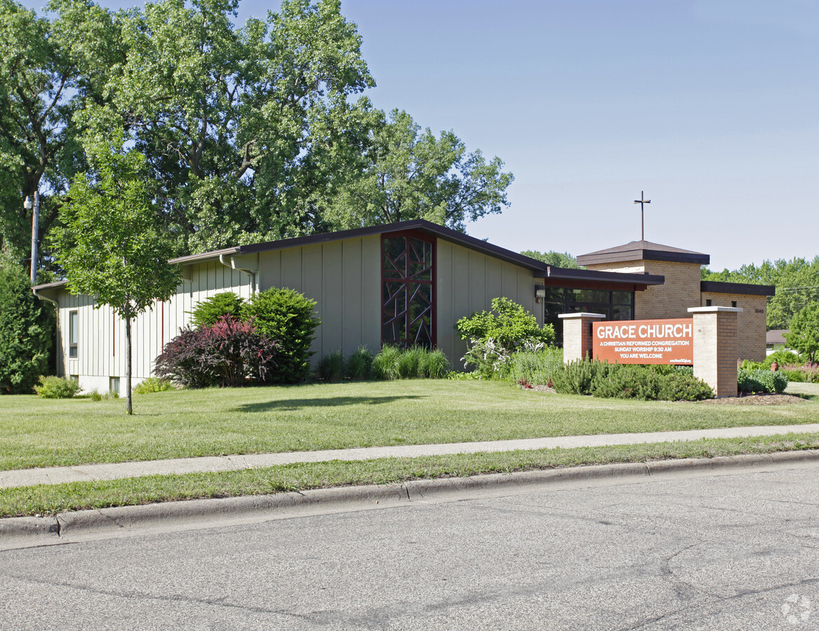
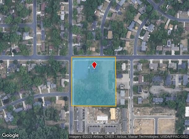
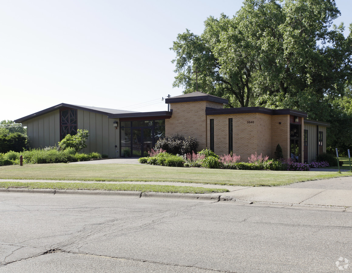
3540 75Th St E
20-01000-75-010
SECTION 10 TWN 27 RANGE 22 10 27 22 W 396 FT OF N 1/3 OF N 1/2 OF SE 1/4
Religious
Dakota
X
Minnesota
27037C0110E
10
2023
3.98 AC
2023
Dakota County Outlying
060503
Minneapolis/St Paul
3,996 SF
Minneapolis-St. Paul-Bloomington, MN-WI
DEMOGRAPHICS near 3540 75Th St E
1 Mile
3 Mile
5 Mile
2024 Total Population
10,067
43,809
112,623
2029 Population
10,222
45,162
117,616
Pop Growth 2024-2029
+ 1.54%
+ 3.09%
+ 4.43%
Average Age
42
40
40
2024 Total Households
3,982
17,396
43,776
HH Growth 2024-2029
+ 1.53%
+ 2.96%
+ 4.31%
Median Household Inc
$82,773
$82,553
$87,311
Avg Household Size
2.50
2.50
2.50
2024 Avg HH Vehicles
2.00
2.00
2.00
Median Home Value
$282,771
$284,619
$304,193
Median Year Built
1980
1982
1982
Nearby Places
- Restaurants
- Banks
- Shops
- Fitness
- Groceries
PUBLIC TRANSPORTATION
COMMUTER RAIL
St. Paul-Minneapolis (Empire Builder - Amtrak)
DRIVE
WALK
Distance
St. Paul-Minneapolis (Empire Builder - Amtrak)
16 min
9.7 mi
AIRPORT
Minneapolis-St Paul International/Wold-Chamberlain
DRIVE
WALK
Distance
Minneapolis-St Paul International/Wold-Chamberlain
22 min
12.4 mi
Freight Ports
Port Milwaukee
DRIVE
WALK
Distance
Port Milwaukee
367 min
332.0 mi
Nearby Properties
Address
Land Use
TOTAL SIZE
Lot Size
Zoning
Address
Land Use
TOTAL SIZE
Lot Size
Zoning
196,078 SF
31.29 AC
Address
Land Use
TOTAL SIZE
Lot Size
Zoning
284,876 SF
29.54 AC
Address
Land Use
TOTAL SIZE
Lot Size
Zoning
169,237 SF
23.38 AC
Address
Land Use
TOTAL SIZE
Lot Size
Zoning
227,382 SF
13.14 AC
Address
Land Use
TOTAL SIZE
Lot Size
Zoning
128,798 SF
4.22 AC
Address
Land Use
TOTAL SIZE
Lot Size
Zoning
147,944 SF
5.17 AC
Address
Land Use
TOTAL SIZE
Lot Size
Zoning
219,438 SF
90.20 AC
Address
Land Use
TOTAL SIZE
Lot Size
Zoning
106,040 SF
5.70 AC
Address
Land Use
TOTAL SIZE
Lot Size
Zoning
143,712 SF
9.57 AC
Address
Land Use
TOTAL SIZE
Lot Size
Zoning
64,860 SF
2.65 AC
Address
Land Use
TOTAL SIZE
Lot Size
Zoning
87,080 SF
2.16 AC
Address
Land Use
TOTAL SIZE
Lot Size
Zoning
95,693 SF
3.64 AC
Address
Land Use
TOTAL SIZE
Lot Size
Zoning
185,715 SF
11.50 AC
Address
Land Use
TOTAL SIZE
Lot Size
Zoning
108,000 SF
6.44 AC
Address
Land Use
TOTAL SIZE
Lot Size
Zoning
161,676 SF
13.90 AC
Address
Land Use
TOTAL SIZE
Lot Size
Zoning
141,090 SF
16.79 AC
Address
Land Use
TOTAL SIZE
Lot Size
Zoning
72,350 SF
1.86 AC
Address
Land Use
TOTAL SIZE
Lot Size
Zoning
83,000 SF
6.45 AC
Address
Land Use
TOTAL SIZE
Lot Size
Zoning
96,000 SF
6.41 AC
Address
Land Use
TOTAL SIZE
Lot Size
Zoning
61,138 SF
7.67 AC
Address
Land Use
TOTAL SIZE
Lot Size
Zoning
134,918 SF
15.18 AC
Address
Land Use
TOTAL SIZE
Lot Size
Zoning
71,296 SF
4.99 AC
Address
Land Use
TOTAL SIZE
Lot Size
Zoning
85,104 SF
11.75 AC
Address
Land Use
TOTAL SIZE
Lot Size
Zoning
48,987 SF
5.04 AC
Address
Land Use
TOTAL SIZE
Lot Size
Zoning
40,515 SF
9.36 AC
Address
Land Use
TOTAL SIZE
Lot Size
Zoning
74,980 SF
13.14 AC
Address
Land Use
TOTAL SIZE
Lot Size
Zoning
86,363 SF
22.51 AC
Address
Land Use
TOTAL SIZE
Lot Size
Zoning
68,824 SF
2.14 AC
Address
Land Use
TOTAL SIZE
Lot Size
Zoning
47,122 SF
2.44 AC
Address
Land Use
TOTAL SIZE
Lot Size
Zoning
70,432 SF
11.12 AC
The World's #1 Commercial Real Estate Marketplace
Connect with us
© 2025 CoStar Group
The information above has been obtained from sources believed reliable. While we do not doubt its accuracy we have not verified it and make no guarantee, warranty or representation about it. It is your responsibility to independently confirm its accuracy and completeness. Any projections, opinions, assumptions, or estimates used are for example only and do not represent the current or future performance of the property. The value of this transaction to you depends on tax and other factors which should be evaluated by your tax, financial, and legal advisors. You and your advisors should conduct a careful, independent investigation of the property to determine to your satisfaction the suitability of the property for your needs.