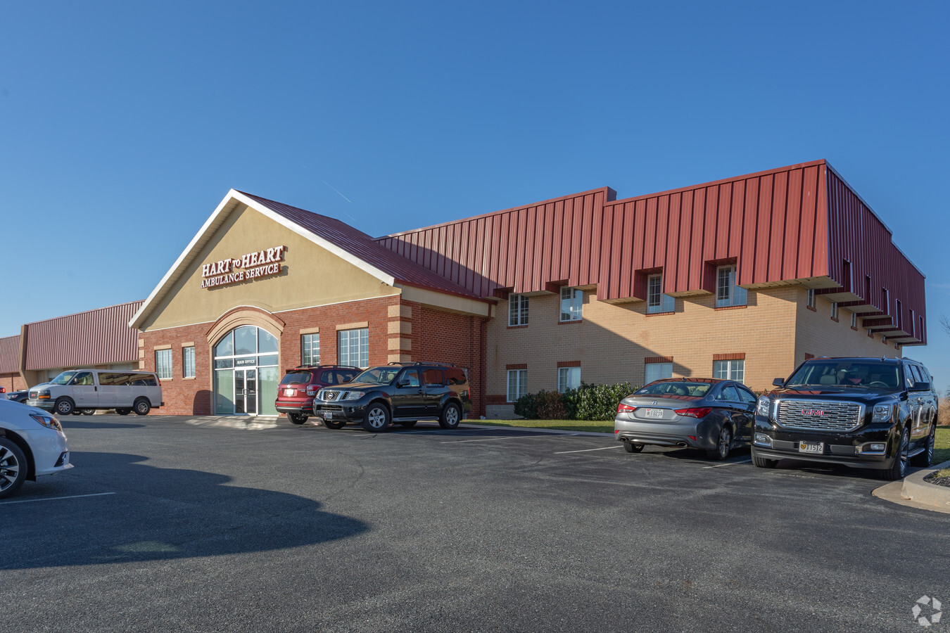
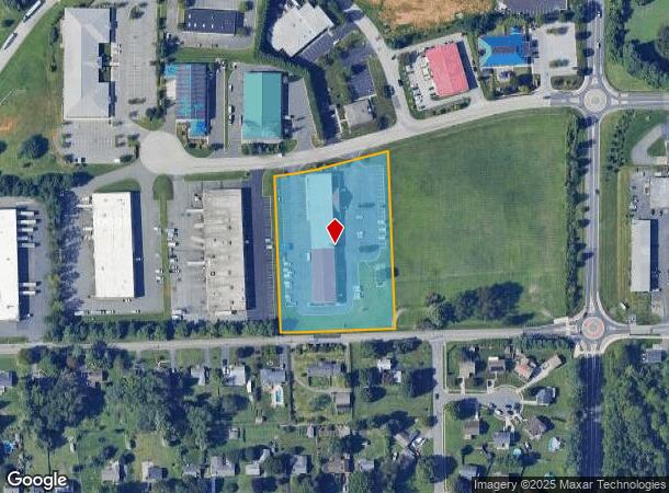
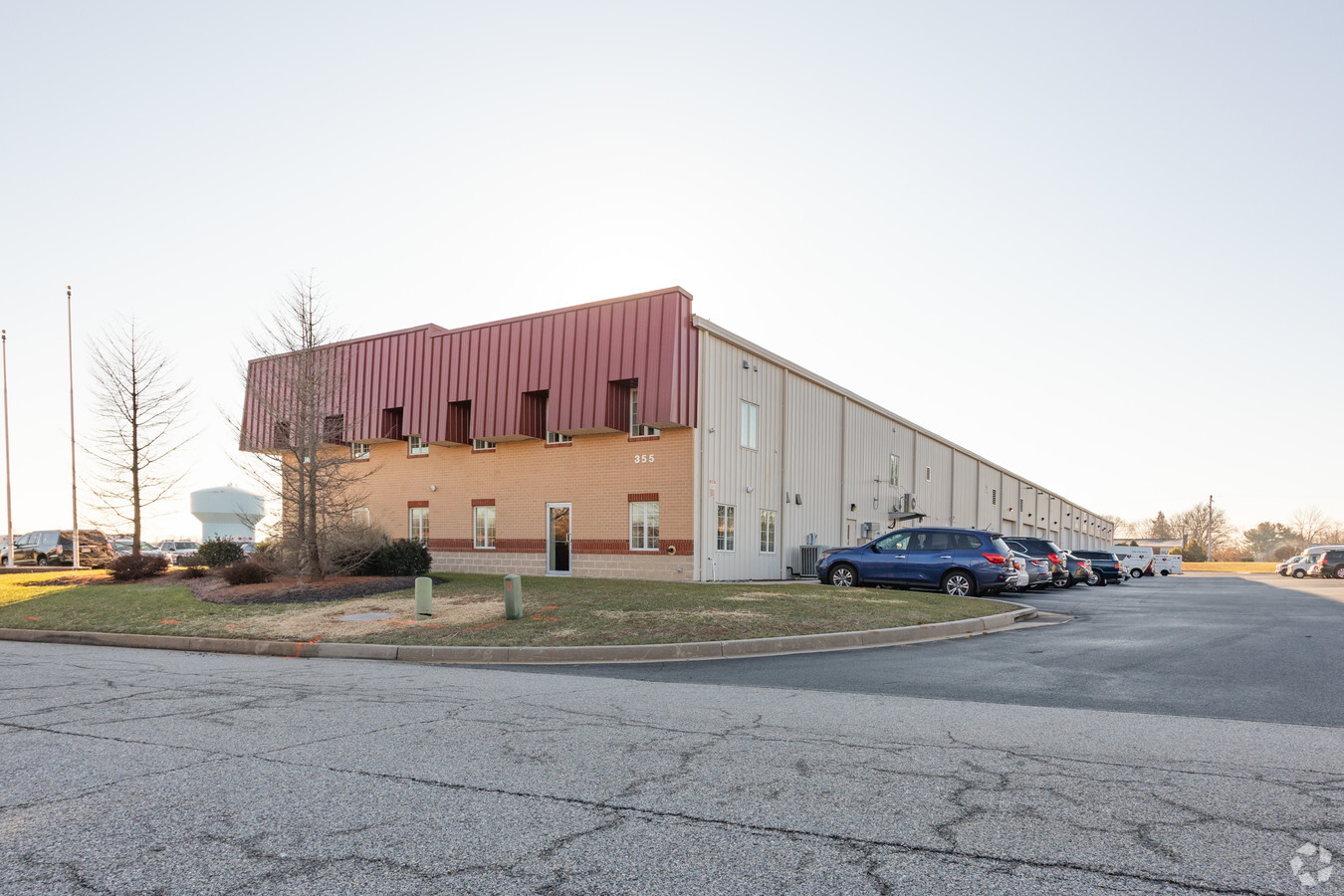
Property Record
355 Granary Rd, Forest Hill, MD 21050
NEARBY LISTINGS FOR SALE OR LEASE
Property Detail
355 Granary Rd
Baltimore-Columbia-Towson, MD
Granary Road Bynum Run
03-366243
LOT 2 3.29 ACRES 355 GRANARY ROAD BYNUM RUN BUS P 111/23
Autorepair
Harford
X
Maryland
24025C0153E
2
2023
2.95 AC
2024
Outlying Harford Cnty
3032033008
Baltimore
13,740 SF
DEMOGRAPHICS near 355 Granary Rd
1 Mile
3 Mile
5 Mile
2024 Total Population
9,015
48,503
85,322
2029 Population
9,271
49,771
87,516
Pop Growth 2024-2029
+ 2.84%
+ 2.61%
+ 2.57%
Average Age
41
41
42
2024 Total Households
3,218
18,227
31,683
HH Growth 2024-2029
+ 2.89%
+ 2.69%
+ 2.66%
Median Household Inc
$110,441
$103,343
$110,118
Avg Household Size
2.70
2.60
2.60
2024 Avg HH Vehicles
2.00
2.00
2.00
Median Home Value
$372,564
$362,669
$381,882
Median Year Built
1996
1988
1986
Nearby Places
- Restaurants
- Banks
- Shops
- Fitness
- Groceries
SALE & LEASE HISTORY
LISTING DATE
SALE/LEASE

Nov 20, 2023
For Lease
Nearby Properties
Address
Land Use
TOTAL SIZE
Lot Size
Zoning
Address
Land Use
TOTAL SIZE
Lot Size
Zoning
270,700 SF
31.09 AC
B3 R3
Address
Land Use
TOTAL SIZE
Lot Size
Zoning
5,674 SF
288 AC
R4
Address
Land Use
TOTAL SIZE
Lot Size
Zoning
49,611 SF
49.52 AC
AG
Address
Land Use
TOTAL SIZE
Lot Size
Zoning
223,629 SF
29.38 AC
M1
Address
Land Use
TOTAL SIZE
Lot Size
Zoning
161,723 SF
72.26 AC
R1
Address
Land Use
TOTAL SIZE
Lot Size
Zoning
228 AC
COS
Address
Land Use
TOTAL SIZE
Lot Size
Zoning
55,164 SF
16.22 AC
B2
Address
Land Use
TOTAL SIZE
Lot Size
Zoning
13.02 AC
R3
Address
Land Use
TOTAL SIZE
Lot Size
Zoning
12.38 AC
R2
Address
Land Use
TOTAL SIZE
Lot Size
Zoning
101,236 SF
23.52 AC
R1
Address
Land Use
TOTAL SIZE
Lot Size
Zoning
6,084 SF
6.03 AC
B2
Address
Land Use
TOTAL SIZE
Lot Size
Zoning
113,276 SF
2.19 AC
B2A
Address
Land Use
TOTAL SIZE
Lot Size
Zoning
1,496 SF
11.55 AC
M1
Address
Land Use
TOTAL SIZE
Lot Size
Zoning
78,264 SF
16.71 AC
AG
Address
Land Use
TOTAL SIZE
Lot Size
Zoning
10.73 AC
B2
Address
Land Use
TOTAL SIZE
Lot Size
Zoning
5.87 AC
R2
Address
Land Use
TOTAL SIZE
Lot Size
Zoning
229,355 SF
59.83 AC
R2
Address
Land Use
TOTAL SIZE
Lot Size
Zoning
74,842 SF
0.77 AC
B2 B3
Address
Land Use
TOTAL SIZE
Lot Size
Zoning
132,779 SF
10.20 AC
B3
Address
Land Use
TOTAL SIZE
Lot Size
Zoning
46,247 SF
10.45 AC
R2 B2
Address
Land Use
TOTAL SIZE
Lot Size
Zoning
70,172 SF
6.88 AC
B3
Address
Land Use
TOTAL SIZE
Lot Size
Zoning
52,245 SF
2.43 AC
R3/B1
Address
Land Use
TOTAL SIZE
Lot Size
Zoning
35.99 AC
R2
Address
Land Use
TOTAL SIZE
Lot Size
Zoning
45,454 SF
11.65 AC
B3
Address
Land Use
TOTAL SIZE
Lot Size
Zoning
78,394 SF
24.56 AC
CI
Address
Land Use
TOTAL SIZE
Lot Size
Zoning
23,130 SF
11.47 AC
B3
Address
Land Use
TOTAL SIZE
Lot Size
Zoning
62,219 SF
4.43 AC
M1
Address
Land Use
TOTAL SIZE
Lot Size
Zoning
7,104 SF
10.95 AC
R2 R3
Address
Land Use
TOTAL SIZE
Lot Size
Zoning
77,649 SF
10.42 AC
GI
Address
Land Use
TOTAL SIZE
Lot Size
Zoning
10,033 SF
7.60 AC
R3
The World's #1 Commercial Real Estate Marketplace
Connect with us
© 2025 CoStar Group
The information above has been obtained from sources believed reliable. While we do not doubt its accuracy we have not verified it and make no guarantee, warranty or representation about it. It is your responsibility to independently confirm its accuracy and completeness. Any projections, opinions, assumptions, or estimates used are for example only and do not represent the current or future performance of the property. The value of this transaction to you depends on tax and other factors which should be evaluated by your tax, financial, and legal advisors. You and your advisors should conduct a careful, independent investigation of the property to determine to your satisfaction the suitability of the property for your needs.