Property Record
355 Rattlesnake Bridge Rd, Bedminster, NJ 07921
NEARBY LISTINGS FOR SALE OR LEASE
Property Detail
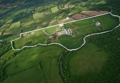
355 Rattlesnake Bridge Rd
Newark, NJ-PA
Somerset
01-00044-0000-00002-01
New Jersey
Farms
16.50 AC
AE
Route 22 West
34019C0164F
Northern New Jersey
12,986 SF
DEMOGRAPHICS near 355 Rattlesnake Bridge Rd
1 Mile
3 Mile
5 Mile
2024 Total Population
403
10,440
56,643
2029 Population
408
10,483
56,859
Pop Growth 2024-2029
+ 1.24%
+ 0.41%
+ 0.38%
Average Age
44
44
44
2024 Total Households
157
4,019
21,922
HH Growth 2024-2029
+ 1.27%
+ 0.42%
+ 0.32%
Median Household Inc
$155,263
$142,009
$143,021
Avg Household Size
2.50
2.60
2.50
2024 Avg HH Vehicles
2.00
2.00
2.00
Median Home Value
$704,225
$535,948
$499,704
Median Year Built
1967
1981
1985
Nearby Places
- Restaurants
- Banks
- Shops
- Fitness
- Groceries
PUBLIC TRANSPORTATION
COMMUTER RAIL
North Branch (Raritan Valley Line - NJ Transit Commuter Rail (NJ Transit))
DRIVE
WALK
Distance
North Branch (Raritan Valley Line - NJ Transit Commuter Rail (NJ Transit))
8 min
3.4 mi
White House (Raritan Valley Line - NJ Transit Commuter Rail (NJ Transit))
DRIVE
WALK
Distance
White House (Raritan Valley Line - NJ Transit Commuter Rail (NJ Transit))
11 min
6.4 mi
AIRPORT
Newark Liberty International
DRIVE
WALK
Distance
Newark Liberty International
40 min
34.1 mi
Trenton Mercer
DRIVE
WALK
Distance
Trenton Mercer
60 min
35.4 mi
Freight Ports
New York Container Terminal
DRIVE
WALK
Distance
New York Container Terminal
50 min
37.1 mi
Nearby Properties
Address
Land Use
TOTAL SIZE
Lot Size
Zoning
Address
Land Use
TOTAL SIZE
Lot Size
Zoning
236.88 AC
CF
Address
Land Use
TOTAL SIZE
Lot Size
Zoning
4,397 SF
26.86 AC
I-1
Address
Land Use
TOTAL SIZE
Lot Size
Zoning
18.46 AC
I
Address
Land Use
TOTAL SIZE
Lot Size
Zoning
243.82 AC
R10
Address
Land Use
TOTAL SIZE
Lot Size
Zoning
61,757 SF
8.75 AC
TC
Address
Land Use
TOTAL SIZE
Lot Size
Zoning
20 AC
I-1
Address
Land Use
TOTAL SIZE
Lot Size
Zoning
23.64 AC
I,IP
Address
Land Use
TOTAL SIZE
Lot Size
Zoning
13.48 AC
I2
Address
Land Use
TOTAL SIZE
Lot Size
Zoning
38.79 AC
I-1
Address
Land Use
TOTAL SIZE
Lot Size
Zoning
118.92 AC
R10
Address
Land Use
TOTAL SIZE
Lot Size
Zoning
10.34 AC
RS-1
Address
Land Use
TOTAL SIZE
Lot Size
Zoning
20.18 AC
I-1
Address
Land Use
TOTAL SIZE
Lot Size
Zoning
25.08 AC
I-1
Address
Land Use
TOTAL SIZE
Lot Size
Zoning
18.81 AC
O
Address
Land Use
TOTAL SIZE
Lot Size
Zoning
13.99 AC
I-2
Address
Land Use
TOTAL SIZE
Lot Size
Zoning
5.98 AC
I-IP
Address
Land Use
TOTAL SIZE
Lot Size
Zoning
23.11 AC
I-1
Address
Land Use
TOTAL SIZE
Lot Size
Zoning
12.05 AC
I-IP
Address
Land Use
TOTAL SIZE
Lot Size
Zoning
22.84 AC
I-1
Address
Land Use
TOTAL SIZE
Lot Size
Zoning
12.18 AC
I-IP
Address
Land Use
TOTAL SIZE
Lot Size
Zoning
18,288 SF
3.78 AC
I-IP
Address
Land Use
TOTAL SIZE
Lot Size
Zoning
12.83 AC
I-1
Address
Land Use
TOTAL SIZE
Lot Size
Zoning
720 SF
5.17 AC
I-IP
Address
Land Use
TOTAL SIZE
Lot Size
Zoning
6.32 AC
I-IP
Address
Land Use
TOTAL SIZE
Lot Size
Zoning
8.30 AC
I
Address
Land Use
TOTAL SIZE
Lot Size
Zoning
20,048 SF
3 AC
AR
Address
Land Use
TOTAL SIZE
Lot Size
Zoning
6.56 AC
I-1
Address
Land Use
TOTAL SIZE
Lot Size
Zoning
4.90 AC
IP
Address
Land Use
TOTAL SIZE
Lot Size
Zoning
4.28 AC
I-IP
Address
Land Use
TOTAL SIZE
Lot Size
Zoning
4.88 AC
I-1
The World's #1 Commercial Real Estate Marketplace
Connect with us
© 2025 CoStar Group
The information above has been obtained from sources believed reliable. While we do not doubt its accuracy we have not verified it and make no guarantee, warranty or representation about it. It is your responsibility to independently confirm its accuracy and completeness. Any projections, opinions, assumptions, or estimates used are for example only and do not represent the current or future performance of the property. The value of this transaction to you depends on tax and other factors which should be evaluated by your tax, financial, and legal advisors. You and your advisors should conduct a careful, independent investigation of the property to determine to your satisfaction the suitability of the property for your needs.