Property Record
3564 Lawrenceville Hwy, Lawrenceville, GA 30044
NEARBY LISTINGS FOR SALE OR LEASE
-
-
View all Lawrenceville listings for sale on LoopNet.com
Property Detail
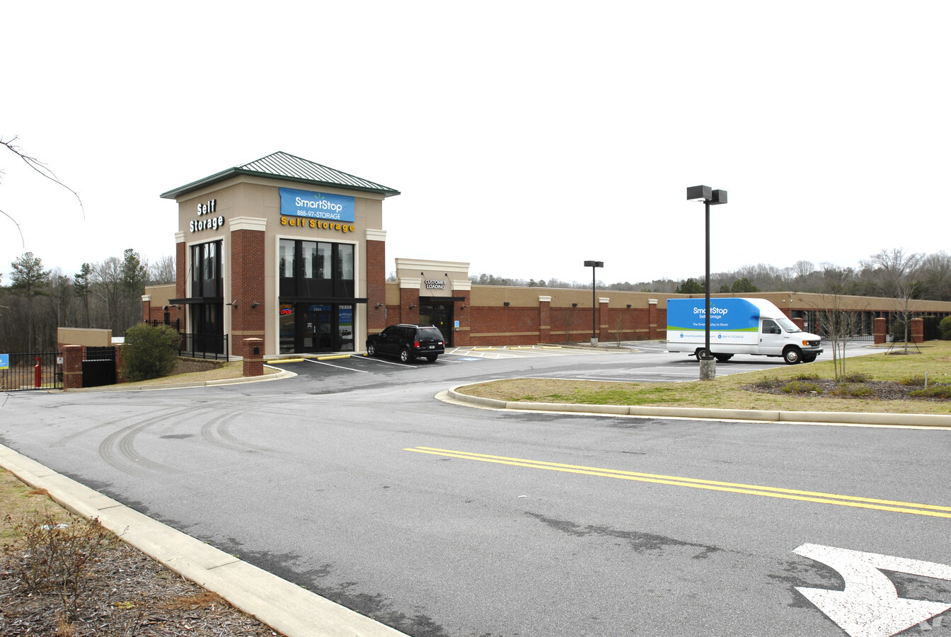
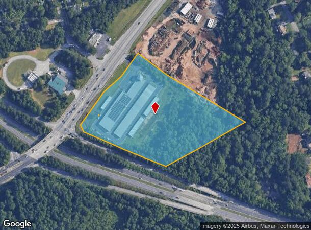
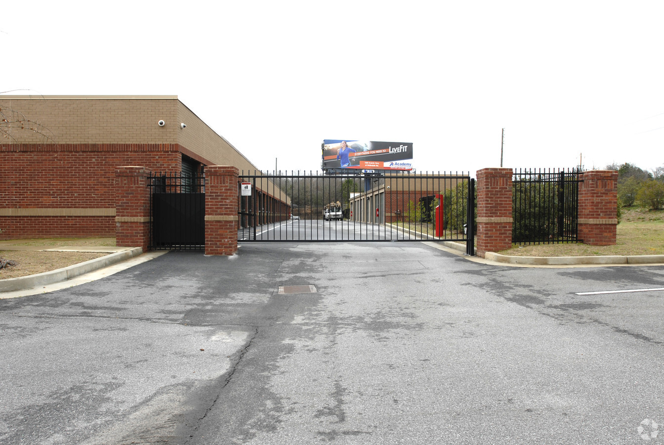
3564 Lawrenceville Hwy
6-152-084
HWY 29
Publicstorage
Gwinnett
AE
Georgia
13135C0100F
8.72 AC
2023
Lawrenceville/Lilburn
2023
Atlanta
050441
Atlanta-Sandy Springs-Roswell, GA
97,856 SF
DEMOGRAPHICS near 3564 Lawrenceville Hwy
1 Mile
3 Mile
5 Mile
2024 Total Population
9,197
103,087
253,365
2029 Population
9,565
107,273
263,849
Pop Growth 2024-2029
+ 4.00%
+ 4.06%
+ 4.14%
Average Age
35
36
36
2024 Total Households
2,904
33,877
83,811
HH Growth 2024-2029
+ 3.65%
+ 4.11%
+ 4.21%
Median Household Inc
$62,187
$59,635
$63,712
Avg Household Size
3.00
2.90
2.90
2024 Avg HH Vehicles
2.00
2.00
2.00
Median Home Value
$240,482
$264,078
$278,182
Median Year Built
1992
1990
1990
Nearby Places
- Restaurants
- Banks
- Shops
- Fitness
- Groceries
PUBLIC TRANSPORTATION
AIRPORT
Hartsfield - Jackson Atlanta International
DRIVE
WALK
Distance
Hartsfield - Jackson Atlanta International
48 min
33.2 mi
Freight Ports
Georgia Ports - Savannah
DRIVE
WALK
Distance
Georgia Ports - Savannah
301 min
265.1 mi
Nearby Properties
Address
Land Use
TOTAL SIZE
Lot Size
Zoning
Address
Land Use
TOTAL SIZE
Lot Size
Zoning
491,944 SF
38.60 AC
RM13
Address
Land Use
TOTAL SIZE
Lot Size
Zoning
30,492 SF
34.99 AC
RM13-MULTI
Address
Land Use
TOTAL SIZE
Lot Size
Zoning
448,880 SF
33.96 AC
RM13
Address
Land Use
TOTAL SIZE
Lot Size
Zoning
438,488 SF
35.04 AC
RM
Address
Land Use
TOTAL SIZE
Lot Size
Zoning
478,862 SF
43.10 AC
OI
Address
Land Use
TOTAL SIZE
Lot Size
Zoning
419,855 SF
29.83 AC
RM13
Address
Land Use
TOTAL SIZE
Lot Size
Zoning
403,119 SF
37.43 AC
RM
Address
Land Use
TOTAL SIZE
Lot Size
Zoning
43,680 SF
20.98 AC
RM10-MULTI
Address
Land Use
TOTAL SIZE
Lot Size
Zoning
220,552 SF
35.67 AC
RM8
Address
Land Use
TOTAL SIZE
Lot Size
Zoning
328,078 SF
34.06 AC
RM13
Address
Land Use
TOTAL SIZE
Lot Size
Zoning
251,214 SF
24.91 AC
RM13
Address
Land Use
TOTAL SIZE
Lot Size
Zoning
348,681 SF
35.52 AC
RM10
Address
Land Use
TOTAL SIZE
Lot Size
Zoning
305,795 SF
29.40 AC
RM
Address
Land Use
TOTAL SIZE
Lot Size
Zoning
299,768 SF
17.15 AC
RM13
Address
Land Use
TOTAL SIZE
Lot Size
Zoning
301,407 SF
8.80 AC
OI
Address
Land Use
TOTAL SIZE
Lot Size
Zoning
300,402 SF
24.55 AC
RM13
Address
Land Use
TOTAL SIZE
Lot Size
Zoning
249,680 SF
18.05 AC
RM
Address
Land Use
TOTAL SIZE
Lot Size
Zoning
242,082 SF
43.15 AC
R1
Address
Land Use
TOTAL SIZE
Lot Size
Zoning
304,445 SF
35.49 AC
RM8
Address
Land Use
TOTAL SIZE
Lot Size
Zoning
346,107 SF
29.56 AC
RM13
Address
Land Use
TOTAL SIZE
Lot Size
Zoning
14,200 SF
23.33 AC
RM-MULTI-F
Address
Land Use
TOTAL SIZE
Lot Size
Zoning
392,364 SF
23.17 AC
RM
Address
Land Use
TOTAL SIZE
Lot Size
Zoning
280,313 SF
20.36 AC
RM13
Address
Land Use
TOTAL SIZE
Lot Size
Zoning
239,816 SF
18.37 AC
RM13
Address
Land Use
TOTAL SIZE
Lot Size
Zoning
285,240 SF
26.20 AC
RM
Address
Land Use
TOTAL SIZE
Lot Size
Zoning
33.62 AC
RM13-MULTI
Address
Land Use
TOTAL SIZE
Lot Size
Zoning
3.68 AC
M1
Address
Land Use
TOTAL SIZE
Lot Size
Zoning
455,471 SF
48.23 AC
R75
Address
Land Use
TOTAL SIZE
Lot Size
Zoning
418,867 SF
31.39 AC
M1
Address
Land Use
TOTAL SIZE
Lot Size
Zoning
366,008 SF
39.23 AC
AA012
The World's #1 Commercial Real Estate Marketplace
Connect with us
© 2025 CoStar Group
The information above has been obtained from sources believed reliable. While we do not doubt its accuracy we have not verified it and make no guarantee, warranty or representation about it. It is your responsibility to independently confirm its accuracy and completeness. Any projections, opinions, assumptions, or estimates used are for example only and do not represent the current or future performance of the property. The value of this transaction to you depends on tax and other factors which should be evaluated by your tax, financial, and legal advisors. You and your advisors should conduct a careful, independent investigation of the property to determine to your satisfaction the suitability of the property for your needs.