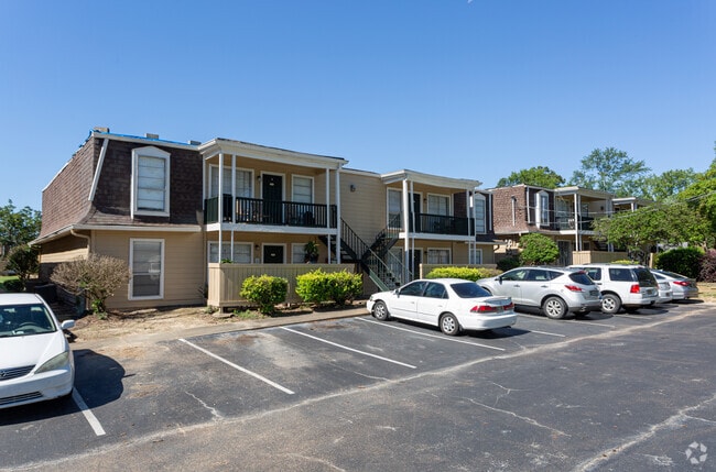
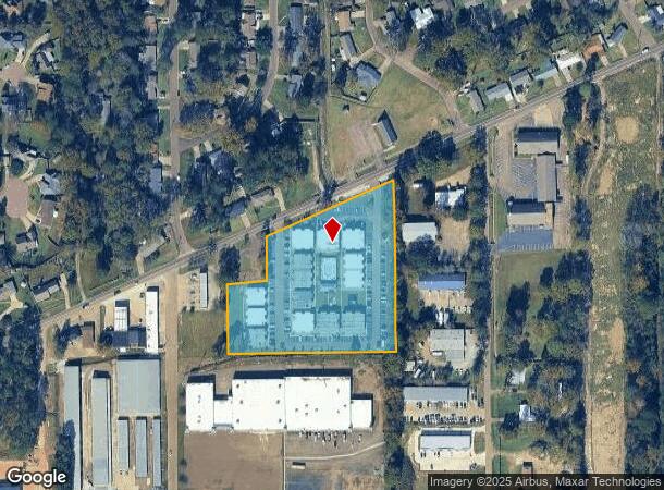
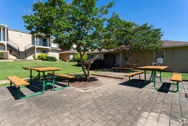
Property Record
3569 Old Brandon Rd, Pearl, MS 39208

NEARBY LISTINGS FOR SALE OR LEASE
-
-
View all Pearl listings for sale on LoopNet.com
Property Detail
3569 Old Brandon Rd
F09A-000023-00000
Eastern Highland Sub
Officebuilding
LOT 513.45 X 527.13 X 416.9 X 157.39 X 129.0 X 193.63 APPROX 4.5A EASTERN HIGHLAND SUB--RANKIN SQUARE APTS DB 317 PG 806 0121
A
Rankin
28121C0186G
Mississippi
2024
4.50 AC
2024
Close-In Rankin County
020217
Jackson
714 SF
Jackson, MS
DEMOGRAPHICS near 3569 Old Brandon Rd
1 Mile
3 Mile
5 Mile
2024 Total Population
5,788
21,456
52,569
2029 Population
5,930
22,001
53,116
Pop Growth 2024-2029
+ 2.45%
+ 2.54%
+ 1.04%
Average Age
38
39
40
2024 Total Households
2,270
8,259
20,560
HH Growth 2024-2029
+ 2.56%
+ 2.69%
+ 0.83%
Median Household Inc
$53,823
$50,876
$58,631
Avg Household Size
2.50
2.40
2.30
2024 Avg HH Vehicles
2.00
2.00
2.00
Median Home Value
$132,248
$141,154
$169,599
Median Year Built
1972
1977
1979
Nearby Places
Map Layers
Map Styles
 Street
 Aerial
- Restaurants
- Banks
- Shops
- Fitness
- Groceries
PUBLIC TRANSPORTATION
COMMUTER RAIL
Jackson (City of New Orleans - Amtrak)
DRIVE
WALK
Distance
Jackson (City of New Orleans - Amtrak)
12 min
7.0 mi
AIRPORT
Jackson-Medgar Wiley Evers International
DRIVE
WALK
Distance
Jackson-Medgar Wiley Evers International
9 min
3.3 mi
Freight Ports
Port of Greater Baton Rouge
DRIVE
WALK
Distance
Port of Greater Baton Rouge
203 min
180.2 mi
Nearby Properties
Address
Land Use
TOTAL SIZE
Lot Size
Zoning
Address
Land Use
TOTAL SIZE
Lot Size
Zoning
14,236 SF
7.38 AC
Address
Land Use
TOTAL SIZE
Lot Size
Zoning
48,134 SF
6.62 AC
Address
Land Use
TOTAL SIZE
Lot Size
Zoning
117,983 SF
7.01 AC
Address
Land Use
TOTAL SIZE
Lot Size
Zoning
373.20 AC
Address
Land Use
TOTAL SIZE
Lot Size
Zoning
249,342 SF
29.79 AC
Address
Land Use
TOTAL SIZE
Lot Size
Zoning
30,925 SF
38.73 AC
Address
Land Use
TOTAL SIZE
Lot Size
Zoning
20,566 SF
5.73 AC
Address
Land Use
TOTAL SIZE
Lot Size
Zoning
4,008 SF
8.30 AC
Address
Land Use
TOTAL SIZE
Lot Size
Zoning
1,787 SF
16.82 AC
Address
Land Use
TOTAL SIZE
Lot Size
Zoning
40.72 AC
Address
Land Use
TOTAL SIZE
Lot Size
Zoning
5,354 SF
0.68 AC
Address
Land Use
TOTAL SIZE
Lot Size
Zoning
30,800 SF
5.66 AC
Address
Land Use
TOTAL SIZE
Lot Size
Zoning
2,348 SF
16.45 AC
Address
Land Use
TOTAL SIZE
Lot Size
Zoning
1,257 SF
2.65 AC
Address
Land Use
TOTAL SIZE
Lot Size
Zoning
90,610 SF
Address
Land Use
TOTAL SIZE
Lot Size
Zoning
15,645 SF
1.10 AC
Address
Land Use
TOTAL SIZE
Lot Size
Zoning
11,578 SF
0.89 AC
Address
Land Use
TOTAL SIZE
Lot Size
Zoning
73,795 SF
5.02 AC
Address
Land Use
TOTAL SIZE
Lot Size
Zoning
52,343 SF
3.39 AC
Address
Land Use
TOTAL SIZE
Lot Size
Zoning
31,427 SF
40.65 AC
Address
Land Use
TOTAL SIZE
Lot Size
Zoning
9,632 SF
32.54 AC
Address
Land Use
TOTAL SIZE
Lot Size
Zoning
48,048 SF
5 AC
Address
Land Use
TOTAL SIZE
Lot Size
Zoning
10,086 SF
2.41 AC
Address
Land Use
TOTAL SIZE
Lot Size
Zoning
67,788 SF
7.84 AC
Address
Land Use
TOTAL SIZE
Lot Size
Zoning
65,915 SF
5.71 AC
Address
Land Use
TOTAL SIZE
Lot Size
Zoning
87,948 SF
21.19 AC
Address
Land Use
TOTAL SIZE
Lot Size
Zoning
70,433 SF
2.53 AC
Address
Land Use
TOTAL SIZE
Lot Size
Zoning
6,538 SF
35.76 AC
Address
Land Use
TOTAL SIZE
Lot Size
Zoning
87,907 SF
14.71 AC
The World's #1 Commercial Real Estate Marketplace
Connect with us
© 2026 CoStar Group
The information above has been obtained from sources believed reliable. While we do not doubt its accuracy we have not verified it and make no guarantee, warranty or representation about it. It is your responsibility to independently confirm its accuracy and completeness. Any projections, opinions, assumptions, or estimates used are for example only and do not represent the current or future performance of the property. The value of this transaction to you depends on tax and other factors which should be evaluated by your tax, financial, and legal advisors. You and your advisors should conduct a careful, independent investigation of the property to determine to your satisfaction the suitability of the property for your needs.