Property Record
36 N Main St, Kilmarnock, VA 22482
NEARBY LISTINGS FOR SALE OR LEASE
Property Detail
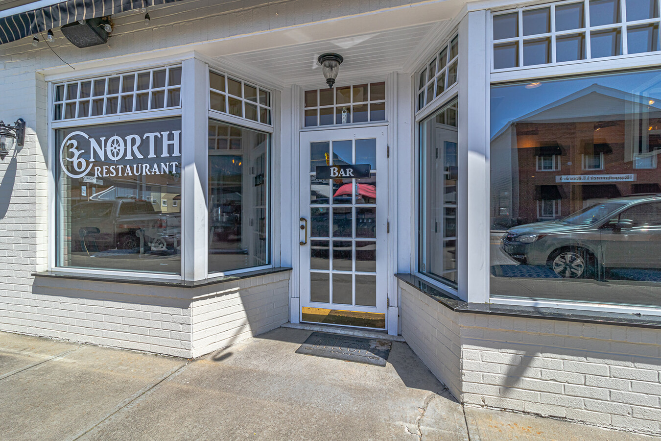
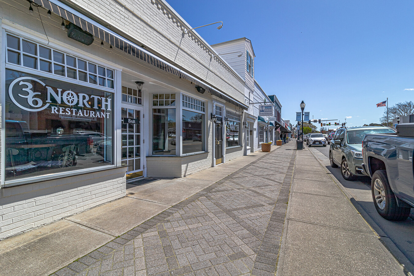
36 N Main St
23A-23-18C
Town Of Kilmarnock
Restaurantbuilding
MAIN ST .06 AC LR06/2009
X
Lancaster
51119C0150D
Virginia
2024
0.06 AC
2024
Virginia Regional
020302
Other Market Areas
2,400 SF
DEMOGRAPHICS near 36 N Main St
1 Mile
3 Mile
5 Mile
2024 Total Population
1,109
3,240
6,902
2029 Population
1,080
3,201
6,867
Pop Growth 2024-2029
(2.61%)
(1.20%)
(0.51%)
Average Age
53
54
54
2024 Total Households
540
1,607
3,362
HH Growth 2024-2029
(2.78%)
(1.43%)
(0.65%)
Median Household Inc
$57,592
$64,280
$67,405
Avg Household Size
1.90
1.90
1.90
2024 Avg HH Vehicles
2.00
2.00
2.00
Median Home Value
$291,953
$348,188
$391,928
Median Year Built
1983
1981
1980
Nearby Places
- Restaurants
- Banks
- Shops
- Fitness
- Groceries
SALE & LEASE HISTORY
LISTING DATE
SALE/LEASE

Apr 18, 2024
For Sale
Nearby Properties
Address
Land Use
TOTAL SIZE
Lot Size
Zoning
Address
Land Use
TOTAL SIZE
Lot Size
Zoning
143,980 SF
31.64 AC
C1
Address
Land Use
TOTAL SIZE
Lot Size
Zoning
70,979 SF
26.61 AC
C2
Address
Land Use
TOTAL SIZE
Lot Size
Zoning
39,800 SF
2.50 AC
R2
Address
Land Use
TOTAL SIZE
Lot Size
Zoning
9,600 SF
18.65 AC
C2
Address
Land Use
TOTAL SIZE
Lot Size
Zoning
26,216 SF
0.87 AC
C1
Address
Land Use
TOTAL SIZE
Lot Size
Zoning
31,670 SF
4.21 AC
C1
Address
Land Use
TOTAL SIZE
Lot Size
Zoning
39,107 SF
4.29 AC
C1
Address
Land Use
TOTAL SIZE
Lot Size
Zoning
1,422 SF
5.80 AC
A1
Address
Land Use
TOTAL SIZE
Lot Size
Zoning
62,500 SF
6.85 AC
C1
Address
Land Use
TOTAL SIZE
Lot Size
Zoning
26,656 SF
3.49 AC
C1
Address
Land Use
TOTAL SIZE
Lot Size
Zoning
54,275 SF
6.20 AC
C1
Address
Land Use
TOTAL SIZE
Lot Size
Zoning
14,040 SF
3.42 AC
C1
Address
Land Use
TOTAL SIZE
Lot Size
Zoning
28,728 SF
2.63 AC
C1
Address
Land Use
TOTAL SIZE
Lot Size
Zoning
29,523 SF
4.12 AC
C1
Address
Land Use
TOTAL SIZE
Lot Size
Zoning
95 AC
R1
Address
Land Use
TOTAL SIZE
Lot Size
Zoning
19,372 SF
3.85 AC
C1
Address
Land Use
TOTAL SIZE
Lot Size
Zoning
88.39 AC
Address
Land Use
TOTAL SIZE
Lot Size
Zoning
7,155 SF
16.50 AC
R1
Address
Land Use
TOTAL SIZE
Lot Size
Zoning
13,182 SF
3.54 AC
C1
Address
Land Use
TOTAL SIZE
Lot Size
Zoning
14,286 SF
2.69 AC
C1
Address
Land Use
TOTAL SIZE
Lot Size
Zoning
264 SF
4 AC
C1
Address
Land Use
TOTAL SIZE
Lot Size
Zoning
16,759 SF
1.01 AC
R1
Address
Land Use
TOTAL SIZE
Lot Size
Zoning
11,284 SF
1.61 AC
R1
Address
Land Use
TOTAL SIZE
Lot Size
Zoning
7.59 AC
C1
Address
Land Use
TOTAL SIZE
Lot Size
Zoning
209.73 AC
Address
Land Use
TOTAL SIZE
Lot Size
Zoning
9,902 SF
1.09 AC
C1
Address
Land Use
TOTAL SIZE
Lot Size
Zoning
9,168 SF
1.66 AC
C2
Address
Land Use
TOTAL SIZE
Lot Size
Zoning
7,396 SF
4.13 AC
C1
Address
Land Use
TOTAL SIZE
Lot Size
Zoning
15,812 SF
2.84 AC
C1
Address
Land Use
TOTAL SIZE
Lot Size
Zoning
21,665 SF
1.49 AC
C1
The World's #1 Commercial Real Estate Marketplace
Connect with us
© 2025 CoStar Group
The information above has been obtained from sources believed reliable. While we do not doubt its accuracy we have not verified it and make no guarantee, warranty or representation about it. It is your responsibility to independently confirm its accuracy and completeness. Any projections, opinions, assumptions, or estimates used are for example only and do not represent the current or future performance of the property. The value of this transaction to you depends on tax and other factors which should be evaluated by your tax, financial, and legal advisors. You and your advisors should conduct a careful, independent investigation of the property to determine to your satisfaction the suitability of the property for your needs.