Property Record
350 Church Rd, Albany, NY 12203

NEARBY LISTINGS FOR SALE OR LEASE
Property Detail
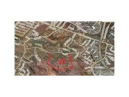
350 Church Rd
Albany-Schenectady-Troy, NY
6350 CHURCH RD
013089-063-000-0001-007-001-0000
Albany
Residentialacreage
New York
AE
7.001
36001C0186D
89.63 AC
2025
W Outer Albany County
2024
Albany/Schenectady/Troy
014609
DEMOGRAPHICS near 350 Church Rd
1 Mile
3 Mile
5 Mile
2024 Total Population
5,878
44,438
145,518
2029 Population
5,932
44,329
144,049
Pop Growth 2024-2029
+ 0.92%
(0.25%)
(1.01%)
Average Age
41
40
40
2024 Total Households
2,861
17,171
59,596
HH Growth 2024-2029
+ 1.01%
(0.10%)
(1.05%)
Median Household Inc
$78,887
$81,695
$78,421
Avg Household Size
2.00
2.10
2.20
2024 Avg HH Vehicles
2.00
2.00
2.00
Median Home Value
$277,041
$255,050
$258,259
Median Year Built
1978
1974
1962
Nearby Places
Map Layers
Map Styles
 Street
 Aerial
- Restaurants
- Banks
- Shops
- Fitness
- Groceries
PUBLIC TRANSPORTATION
AIRPORT
Albany International
DRIVE
WALK
Distance
Albany International
16 min
8.8 mi
Freight Ports
Albany, NY Port
DRIVE
WALK
Distance
Albany, NY Port
19 min
11.5 mi
Nearby Properties
Address
Land Use
TOTAL SIZE
Lot Size
Zoning
Address
Land Use
TOTAL SIZE
Lot Size
Zoning
111,628 SF
303.87 AC
CO
Address
Land Use
TOTAL SIZE
Lot Size
Zoning
72,000 SF
279.23 AC
CO
Address
Land Use
TOTAL SIZE
Lot Size
Zoning
5.04 AC
CM
Address
Land Use
TOTAL SIZE
Lot Size
Zoning
Address
Land Use
TOTAL SIZE
Lot Size
Zoning
812,458 SF
38.74 AC
F
Address
Land Use
TOTAL SIZE
Lot Size
Zoning
561,128 SF
33.58 AC
GB
Address
Land Use
TOTAL SIZE
Lot Size
Zoning
9,208 SF
290.80 AC
LC
Address
Land Use
TOTAL SIZE
Lot Size
Zoning
190 AC
LC
Address
Land Use
TOTAL SIZE
Lot Size
Zoning
595,472 SF
6.06 AC
CO
Address
Land Use
TOTAL SIZE
Lot Size
Zoning
47,424 SF
37.60 AC
MR
Address
Land Use
TOTAL SIZE
Lot Size
Zoning
12,096 SF
73.12 AC
CM
Address
Land Use
TOTAL SIZE
Lot Size
Zoning
175,587 SF
20.14 AC
LB
Address
Land Use
TOTAL SIZE
Lot Size
Zoning
3,760 SF
28.30 AC
MR
Address
Land Use
TOTAL SIZE
Lot Size
Zoning
98.20 AC
LC
Address
Land Use
TOTAL SIZE
Lot Size
Zoning
213,860 SF
28.20 AC
C2
Address
Land Use
TOTAL SIZE
Lot Size
Zoning
349,516 SF
22.61 AC
MED
Address
Land Use
TOTAL SIZE
Lot Size
Zoning
65,219 SF
35 AC
R1B
Address
Land Use
TOTAL SIZE
Lot Size
Zoning
135,000 SF
14.64 AC
R1B
Address
Land Use
TOTAL SIZE
Lot Size
Zoning
59,442 SF
69.20 AC
R1LL
Address
Land Use
TOTAL SIZE
Lot Size
Zoning
80.10 AC
LC
Address
Land Use
TOTAL SIZE
Lot Size
Zoning
279,150 SF
21.10 AC
CO
Address
Land Use
TOTAL SIZE
Lot Size
Zoning
31,080 SF
13.60 AC
LB
Address
Land Use
TOTAL SIZE
Lot Size
Zoning
8,600 SF
14.80 AC
MR
Address
Land Use
TOTAL SIZE
Lot Size
Zoning
66,419 SF
2 AC
CPB
Address
Land Use
TOTAL SIZE
Lot Size
Zoning
10,500 SF
40.10 AC
CO
Address
Land Use
TOTAL SIZE
Lot Size
Zoning
18,240 SF
26.70 AC
MR
Address
Land Use
TOTAL SIZE
Lot Size
Zoning
10,368 SF
17 AC
MR
Address
Land Use
TOTAL SIZE
Lot Size
Zoning
119,112 SF
4.13 AC
LB
Address
Land Use
TOTAL SIZE
Lot Size
Zoning
150,000 SF
1 AC
CM
Address
Land Use
TOTAL SIZE
Lot Size
Zoning
137,784 SF
2.30 AC
C2
The World's #1 Commercial Real Estate Marketplace
Connect with us
© 2025 CoStar Group
The information above has been obtained from sources believed reliable. While we do not doubt its accuracy we have not verified it and make no guarantee, warranty or representation about it. It is your responsibility to independently confirm its accuracy and completeness. Any projections, opinions, assumptions, or estimates used are for example only and do not represent the current or future performance of the property. The value of this transaction to you depends on tax and other factors which should be evaluated by your tax, financial, and legal advisors. You and your advisors should conduct a careful, independent investigation of the property to determine to your satisfaction the suitability of the property for your needs.