Property Record
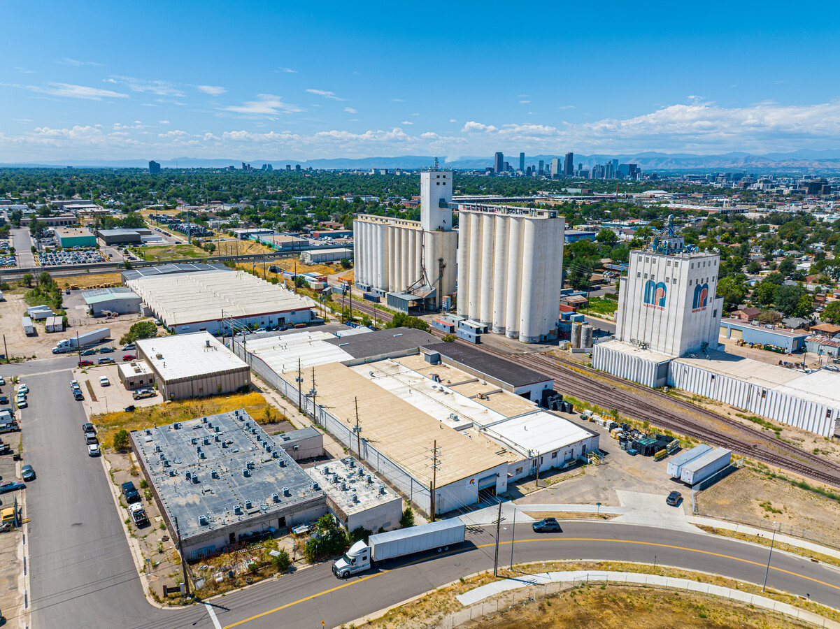
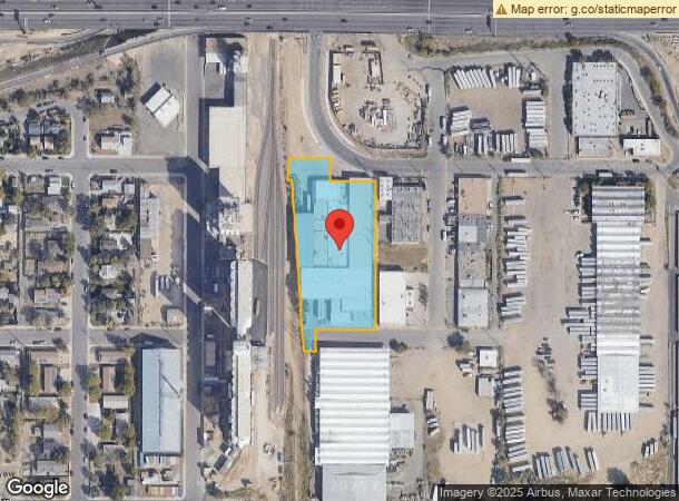
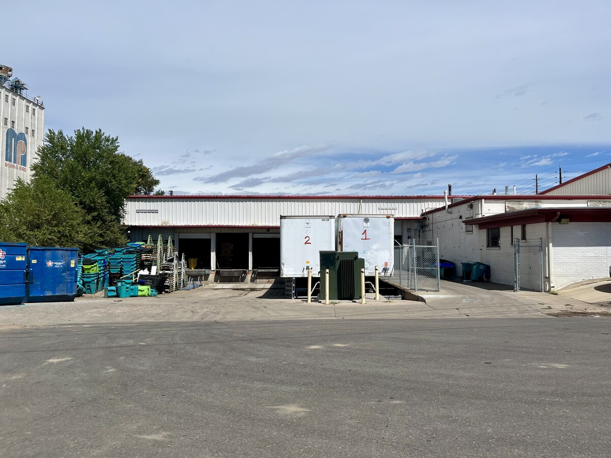
3600 E 45Th Ave, Denver, CO 80216

This Property Is For Sale
Current Lease Availabilities
NEARBY LISTINGS FOR SALE OR LEASE
Property Detail
3600 E 45Th Ave
Denver-Aurora-Lakewood, CO
Town Of Swansea
2241-13-032
RAMONA B8 & TOWN OF SWANSEA B35 & VAC STS & ALYS ADJ BEG SW COR B8 TH W 40FT S 62FT W 36.11FT NWLY 461.18FT W 10FT N 62FT E 114.04FT S 62FT E 125.05FT S 400FT W TO POB
Warehouse
Denver
X
Colorado
08005C0025K
17
2023
2.21 AC
2023
Lower North Central
003501
Denver
66,260 SF
DEMOGRAPHICS near 3600 E 45Th Ave
1 Mile
3 Mile
5 Mile
2024 Total Population
8,995
112,478
393,141
2029 Population
9,019
114,113
401,402
Pop Growth 2024-2029
+ 0.27%
+ 1.45%
+ 2.10%
Average Age
35
37
37
2024 Total Households
3,008
50,023
182,862
HH Growth 2024-2029
+ 0.03%
+ 1.42%
+ 2.05%
Median Household Inc
$64,046
$83,537
$86,863
Avg Household Size
2.80
2.10
2.10
2024 Avg HH Vehicles
2.00
2.00
2.00
Median Home Value
$381,366
$615,133
$636,059
Median Year Built
1954
1964
1972
Nearby Places
- Restaurants
- Banks
- Shops
- Fitness
- Groceries
PUBLIC TRANSPORTATION
COMMUTER RAIL
40Th & Colorado Station Track 1 (Union Station to Denver Airport Station - Regional Transportation District)
DRIVE
WALK
Distance
40Th & Colorado Station Track 1 (Union Station to Denver Airport Station - Regional Transportation District)
3 min
1.2 mi
40Th & Colorado Station Track 2 (Union Station to Denver Airport Station - Regional Transportation District)
DRIVE
WALK
Distance
40Th & Colorado Station Track 2 (Union Station to Denver Airport Station - Regional Transportation District)
3 min
1.2 mi
AIRPORT
Denver International
DRIVE
WALK
Distance
Denver International
26 min
20.1 mi
Freight Ports
Tulsa Port Of Catoosa
DRIVE
WALK
Distance
Tulsa Port Of Catoosa
723 min
705.6 mi
Nearby Properties
Address
Land Use
TOTAL SIZE
Lot Size
Zoning
Address
Land Use
TOTAL SIZE
Lot Size
Zoning
396,741 SF
8.12 AC
A1
Address
Land Use
TOTAL SIZE
Lot Size
Zoning
1,323,471 SF
10.26 AC
CMP-H
Address
Land Use
TOTAL SIZE
Lot Size
Zoning
573,985 SF
21.47 AC
M-MX-5
Address
Land Use
TOTAL SIZE
Lot Size
Zoning
1,507,456 SF
10.93 AC
H-1-A
Address
Land Use
TOTAL SIZE
Lot Size
Zoning
449,651 SF
1.66 AC
C-MX-8
Address
Land Use
TOTAL SIZE
Lot Size
Zoning
579,102 SF
7.47 AC
H-1-A
Address
Land Use
TOTAL SIZE
Lot Size
Zoning
631,980 SF
77.96 AC
I-B
Address
Land Use
TOTAL SIZE
Lot Size
Zoning
314,075 SF
2.15 AC
CMP-H
Address
Land Use
TOTAL SIZE
Lot Size
Zoning
25,000 SF
40.42 AC
I-A
Address
Land Use
TOTAL SIZE
Lot Size
Zoning
3,188 SF
81.17 AC
I-B
Address
Land Use
TOTAL SIZE
Lot Size
Zoning
237,753 SF
18.94 AC
U-SU-B1
Address
Land Use
TOTAL SIZE
Lot Size
Zoning
386,089 SF
0.79 AC
I-MX-8
Address
Land Use
TOTAL SIZE
Lot Size
Zoning
254,509 SF
16.29 AC
E-SU-DX
Address
Land Use
TOTAL SIZE
Lot Size
Zoning
301,115 SF
3.85 AC
C-MX-8
Address
Land Use
TOTAL SIZE
Lot Size
Zoning
551,915 SF
25.76 AC
Address
Land Use
TOTAL SIZE
Lot Size
Zoning
884,849 SF
7.23 AC
CMP-H
Address
Land Use
TOTAL SIZE
Lot Size
Zoning
698,527 SF
79.66 AC
OS-A
Address
Land Use
TOTAL SIZE
Lot Size
Zoning
172,690 SF
0.62 AC
C-MX-12
Address
Land Use
TOTAL SIZE
Lot Size
Zoning
176,795 SF
0.81 AC
I-MX-8
Address
Land Use
TOTAL SIZE
Lot Size
Zoning
302,231 SF
9.94 AC
C-MU-20
Address
Land Use
TOTAL SIZE
Lot Size
Zoning
352,600 SF
18.21 AC
I-B
Address
Land Use
TOTAL SIZE
Lot Size
Zoning
552,279 SF
2.22 AC
C-RX
Address
Land Use
TOTAL SIZE
Lot Size
Zoning
299,498 SF
35.75 AC
C-MX-12
Address
Land Use
TOTAL SIZE
Lot Size
Zoning
140,437 SF
1.76 AC
C-MX-12
Address
Land Use
TOTAL SIZE
Lot Size
Zoning
727,307 SF
38.44 AC
I-B
Address
Land Use
TOTAL SIZE
Lot Size
Zoning
595,017 SF
11.62 AC
I-B
Address
Land Use
TOTAL SIZE
Lot Size
Zoning
344,689 SF
11.77 AC
I-B
Address
Land Use
TOTAL SIZE
Lot Size
Zoning
305,722 SF
11.48 AC
G-MU-5
Address
Land Use
TOTAL SIZE
Lot Size
Zoning
173,295 SF
3.59 AC
H-1-A
Address
Land Use
TOTAL SIZE
Lot Size
Zoning
228,564 SF
11.06 AC
U-SU-A1
The World's #1 Commercial Real Estate Marketplace
Connect with us
© 2025 CoStar Group
The information above has been obtained from sources believed reliable. While we do not doubt its accuracy we have not verified it and make no guarantee, warranty or representation about it. It is your responsibility to independently confirm its accuracy and completeness. Any projections, opinions, assumptions, or estimates used are for example only and do not represent the current or future performance of the property. The value of this transaction to you depends on tax and other factors which should be evaluated by your tax, financial, and legal advisors. You and your advisors should conduct a careful, independent investigation of the property to determine to your satisfaction the suitability of the property for your needs.