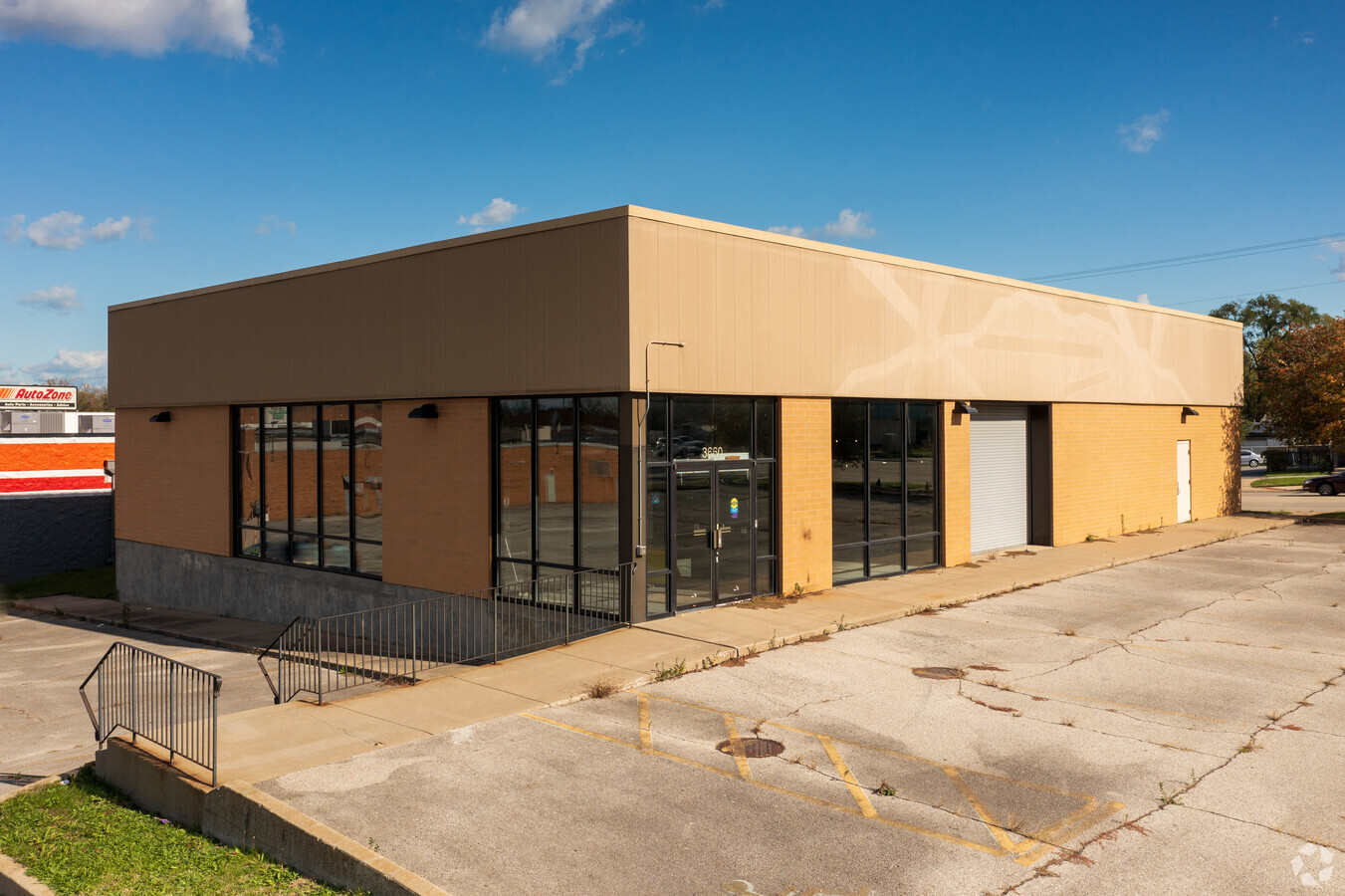
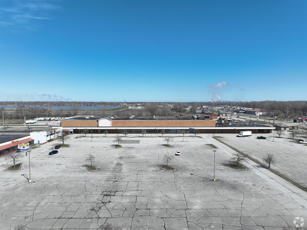
Property Record
3600 Grant St, Gary, IN 46408
NEARBY LISTINGS FOR SALE OR LEASE
Property Detail
3600 Grant St
Chicago-Naperville-Elgin, IL-IN-WI
Madison Avenue Commons Sub Secondary Pla
45-08-20-476-004.000-003
Lake
Regionalshoppingcenterormallwithanchorstore
Indiana
X
37.48 AC
18089C0161F
Indiana
383,191 SF
Chicago
DEMOGRAPHICS near 3600 Grant St
1 Mile
3 Mile
5 Mile
2024 Total Population
5,637
67,168
149,437
2029 Population
5,857
69,767
152,650
Pop Growth 2024-2029
+ 3.90%
+ 3.87%
+ 2.15%
Average Age
40
39
39
2024 Total Households
2,262
27,135
59,498
HH Growth 2024-2029
+ 3.71%
+ 3.83%
+ 2.14%
Median Household Inc
$35,164
$35,639
$44,215
Avg Household Size
2.30
2.40
2.40
2024 Avg HH Vehicles
1.00
1.00
2.00
Median Home Value
$74,967
$94,444
$135,910
Median Year Built
1952
1958
1960
Nearby Places
- Restaurants
- Banks
- Shops
- Fitness
- Groceries
PUBLIC TRANSPORTATION
COMMUTER RAIL
Clark Road (Gary) Station (South Shore Line - Northern Indiana Commuter Transportation District (South Shore Line))
DRIVE
WALK
Distance
Clark Road (Gary) Station (South Shore Line - Northern Indiana Commuter Transportation District (South Shore Line))
14 min
6.0 mi
Gary Metro Center Station (South Shore Line - Northern Indiana Commuter Transportation District (South Shore Line))
DRIVE
WALK
Distance
Gary Metro Center Station (South Shore Line - Northern Indiana Commuter Transportation District (South Shore Line))
15 min
6.6 mi
AIRPORT
Chicago Midway International
DRIVE
WALK
Distance
Chicago Midway International
55 min
34.8 mi
Freight Ports
Port Milwaukee
DRIVE
WALK
Distance
Port Milwaukee
155 min
118.9 mi
Nearby Properties
Address
Land Use
TOTAL SIZE
Lot Size
Zoning
Address
Land Use
TOTAL SIZE
Lot Size
Zoning
233,023 SF
37.73 AC
Address
Land Use
TOTAL SIZE
Lot Size
Zoning
233,767 SF
37.03 AC
Address
Land Use
TOTAL SIZE
Lot Size
Zoning
105,600 SF
2.90 AC
Address
Land Use
TOTAL SIZE
Lot Size
Zoning
159,134 SF
22 AC
Address
Land Use
TOTAL SIZE
Lot Size
Zoning
33,920 SF
83.34 AC
Address
Land Use
TOTAL SIZE
Lot Size
Zoning
53,502 SF
7.77 AC
Address
Land Use
TOTAL SIZE
Lot Size
Zoning
149,808 SF
15.07 AC
Address
Land Use
TOTAL SIZE
Lot Size
Zoning
140,080 SF
12.83 AC
Address
Land Use
TOTAL SIZE
Lot Size
Zoning
125,034 SF
8.22 AC
Address
Land Use
TOTAL SIZE
Lot Size
Zoning
232,672 SF
28.18 AC
Address
Land Use
TOTAL SIZE
Lot Size
Zoning
46,380 SF
14.94 AC
Address
Land Use
TOTAL SIZE
Lot Size
Zoning
247,640 SF
22.88 AC
Address
Land Use
TOTAL SIZE
Lot Size
Zoning
79,216 SF
4.59 AC
Address
Land Use
TOTAL SIZE
Lot Size
Zoning
44,960 SF
4.80 AC
Address
Land Use
TOTAL SIZE
Lot Size
Zoning
239,769 SF
20.94 AC
Address
Land Use
TOTAL SIZE
Lot Size
Zoning
92,259 SF
6.41 AC
Address
Land Use
TOTAL SIZE
Lot Size
Zoning
65,552 SF
4.36 AC
Address
Land Use
TOTAL SIZE
Lot Size
Zoning
77,328 SF
2.36 AC
Address
Land Use
TOTAL SIZE
Lot Size
Zoning
72,981 SF
4.28 AC
Address
Land Use
TOTAL SIZE
Lot Size
Zoning
185,480 SF
23.32 AC
81
Address
Land Use
TOTAL SIZE
Lot Size
Zoning
88,434 SF
5 AC
Address
Land Use
TOTAL SIZE
Lot Size
Zoning
55,620 SF
6.14 AC
R3
Address
Land Use
TOTAL SIZE
Lot Size
Zoning
86,292 SF
3.84 AC
Address
Land Use
TOTAL SIZE
Lot Size
Zoning
45,022 SF
6.02 AC
Address
Land Use
TOTAL SIZE
Lot Size
Zoning
28,884 SF
20 AC
Address
Land Use
TOTAL SIZE
Lot Size
Zoning
63,648 SF
2.86 AC
Address
Land Use
TOTAL SIZE
Lot Size
Zoning
137,970 SF
5.11 AC
Address
Land Use
TOTAL SIZE
Lot Size
Zoning
16,844 SF
23.46 AC
Address
Land Use
TOTAL SIZE
Lot Size
Zoning
4,750 SF
4.64 AC
Address
Land Use
TOTAL SIZE
Lot Size
Zoning
68,853 SF
5.31 AC
The World's #1 Commercial Real Estate Marketplace
Connect with us
© 2025 CoStar Group
The information above has been obtained from sources believed reliable. While we do not doubt its accuracy we have not verified it and make no guarantee, warranty or representation about it. It is your responsibility to independently confirm its accuracy and completeness. Any projections, opinions, assumptions, or estimates used are for example only and do not represent the current or future performance of the property. The value of this transaction to you depends on tax and other factors which should be evaluated by your tax, financial, and legal advisors. You and your advisors should conduct a careful, independent investigation of the property to determine to your satisfaction the suitability of the property for your needs.