Property Record
Bellamy St, Charlotte, NC 28208
NEARBY LISTINGS FOR SALE OR LEASE
Property Detail
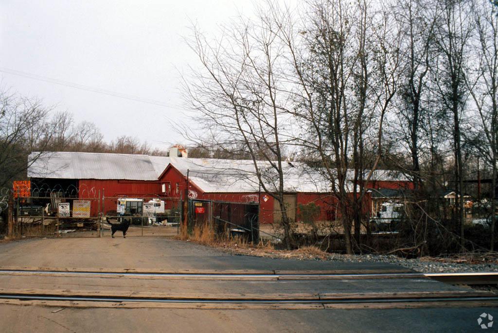
Bellamy St
Charlotte-Concord-Gastonia, NC-SC
EXEMPT G-S 105-275-8-B
117-103-01
Mecklenburg
Industrialgeneral
North Carolina
X
1
3710453400K
6.77 AC
2023
Airport/West
2023
Charlotte
004000
DEMOGRAPHICS near Bellamy St
1 Mile
3 Mile
5 Mile
2024 Total Population
6,015
61,588
186,718
2029 Population
6,455
66,332
199,533
Pop Growth 2024-2029
+ 7.32%
+ 7.70%
+ 6.86%
Average Age
37
35
36
2024 Total Households
2,272
27,868
85,354
HH Growth 2024-2029
+ 7.35%
+ 7.97%
+ 7.08%
Median Household Inc
$38,974
$59,145
$68,514
Avg Household Size
2.50
2.10
2.10
2024 Avg HH Vehicles
1.00
1.00
2.00
Median Home Value
$92,920
$231,099
$317,289
Median Year Built
1972
1999
1996
Nearby Places
- Restaurants
- Banks
- Shops
- Fitness
- Groceries
PUBLIC TRANSPORTATION
COMMUTER RAIL
Charlotte Amtrak Station (Carolinian - Amtrak, Crescent - Amtrak, Piedmont - Amtrak)
DRIVE
WALK
Distance
Charlotte Amtrak Station (Carolinian - Amtrak, Crescent - Amtrak, Piedmont - Amtrak)
10 min
5.6 mi
AIRPORT
Charlotte/Douglas International
DRIVE
WALK
Distance
Charlotte/Douglas International
10 min
4.3 mi
Concord-Padgett Regional
DRIVE
WALK
Distance
Concord-Padgett Regional
30 min
19.8 mi
Freight Ports
North Charleston Terminal
DRIVE
WALK
Distance
North Charleston Terminal
228 min
199.5 mi
Nearby Properties
Address
Land Use
TOTAL SIZE
Lot Size
Zoning
Address
Land Use
TOTAL SIZE
Lot Size
Zoning
5,290,257 SF
502.52 AC
I2
Address
Land Use
TOTAL SIZE
Lot Size
Zoning
309.30 AC
I-2
Address
Land Use
TOTAL SIZE
Lot Size
Zoning
1,250,926 SF
4.89 AC
I2
Address
Land Use
TOTAL SIZE
Lot Size
Zoning
626,053 SF
2.77 AC
I2
Address
Land Use
TOTAL SIZE
Lot Size
Zoning
416,225 SF
0.64 AC
Address
Land Use
TOTAL SIZE
Lot Size
Zoning
1,519,630 SF
235.59 AC
I2
Address
Land Use
TOTAL SIZE
Lot Size
Zoning
743,550 SF
4.69 AC
I2
Address
Land Use
TOTAL SIZE
Lot Size
Zoning
505,747 SF
3.87 AC
Address
Land Use
TOTAL SIZE
Lot Size
Zoning
581,470 SF
2.55 AC
I2
Address
Land Use
TOTAL SIZE
Lot Size
Zoning
689,165 SF
1.30 AC
Address
Land Use
TOTAL SIZE
Lot Size
Zoning
490,957 SF
4.32 AC
I2
Address
Land Use
TOTAL SIZE
Lot Size
Zoning
693,089 SF
1.80 AC
MUDDO
Address
Land Use
TOTAL SIZE
Lot Size
Zoning
565,754 SF
4.96 AC
MUDD
Address
Land Use
TOTAL SIZE
Lot Size
Zoning
447,679 SF
0.37 AC
Address
Land Use
TOTAL SIZE
Lot Size
Zoning
357,769 SF
4.93 AC
Address
Land Use
TOTAL SIZE
Lot Size
Zoning
521,959 SF
2.27 AC
MUDDO
Address
Land Use
TOTAL SIZE
Lot Size
Zoning
409,916 SF
2.90 AC
I2
Address
Land Use
TOTAL SIZE
Lot Size
Zoning
434,803 SF
4.58 AC
I2
Address
Land Use
TOTAL SIZE
Lot Size
Zoning
266,073 SF
4.36 AC
I2
Address
Land Use
TOTAL SIZE
Lot Size
Zoning
399,398 SF
35.02 AC
Address
Land Use
TOTAL SIZE
Lot Size
Zoning
621,107 SF
249.22 AC
I2
Address
Land Use
TOTAL SIZE
Lot Size
Zoning
447,816 SF
3.42 AC
I2
Address
Land Use
TOTAL SIZE
Lot Size
Zoning
500,799 SF
4.48 AC
I2
Address
Land Use
TOTAL SIZE
Lot Size
Zoning
471,178 SF
3.55 AC
B1
Address
Land Use
TOTAL SIZE
Lot Size
Zoning
493,745 SF
4.25 AC
I2
Address
Land Use
TOTAL SIZE
Lot Size
Zoning
100.51 AC
I-2
Address
Land Use
TOTAL SIZE
Lot Size
Zoning
448,599 SF
3.16 AC
B1
Address
Land Use
TOTAL SIZE
Lot Size
Zoning
262,862 SF
3.01 AC
I2
Address
Land Use
TOTAL SIZE
Lot Size
Zoning
607,941 SF
4.19 AC
R17MF
Address
Land Use
TOTAL SIZE
Lot Size
Zoning
661,612 SF
32.38 AC
I1CD
The World's #1 Commercial Real Estate Marketplace
Connect with us
© 2025 CoStar Group
The information above has been obtained from sources believed reliable. While we do not doubt its accuracy we have not verified it and make no guarantee, warranty or representation about it. It is your responsibility to independently confirm its accuracy and completeness. Any projections, opinions, assumptions, or estimates used are for example only and do not represent the current or future performance of the property. The value of this transaction to you depends on tax and other factors which should be evaluated by your tax, financial, and legal advisors. You and your advisors should conduct a careful, independent investigation of the property to determine to your satisfaction the suitability of the property for your needs.