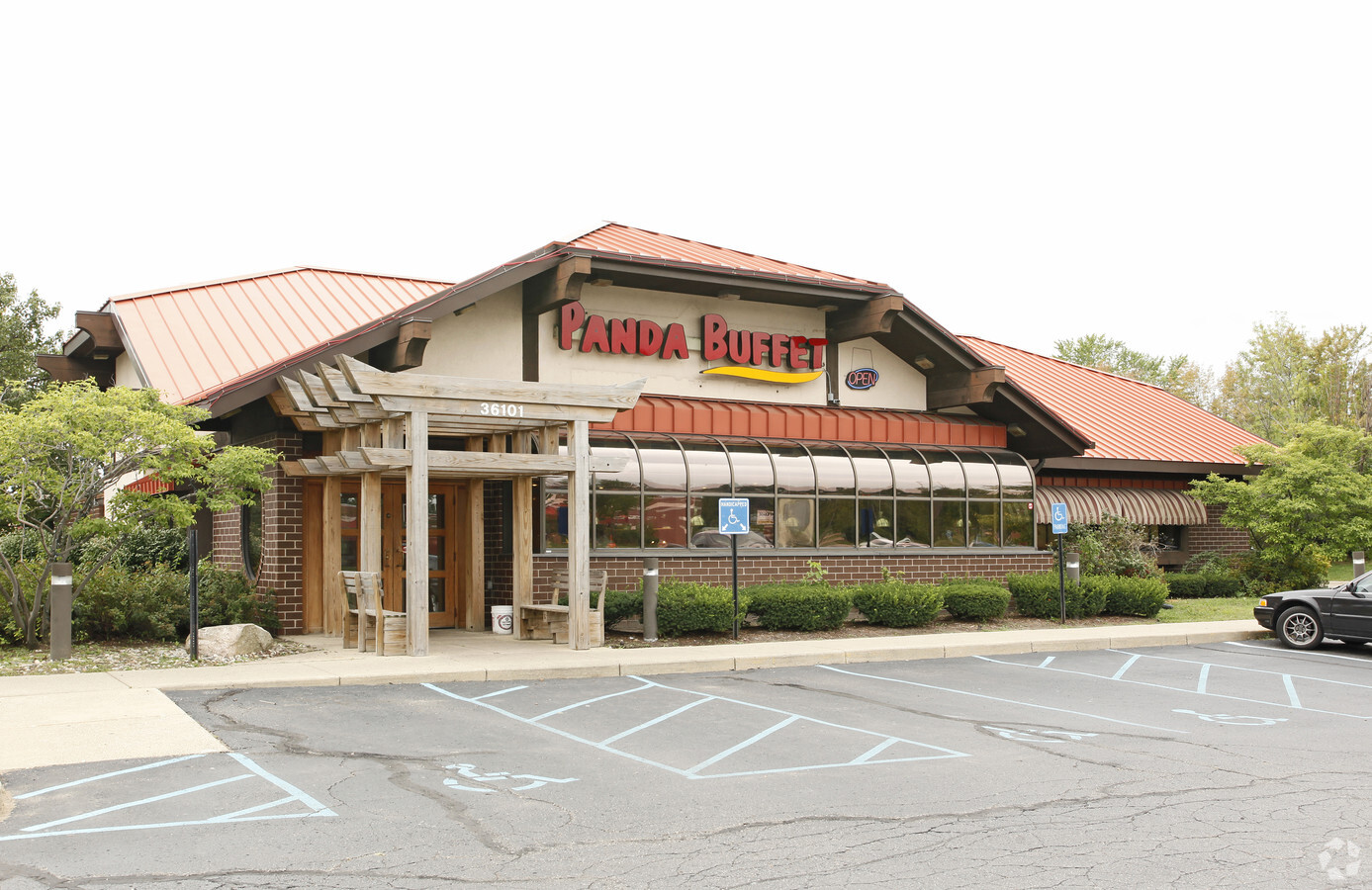
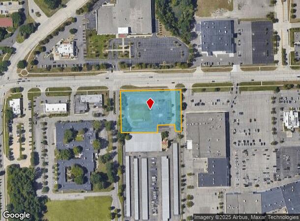
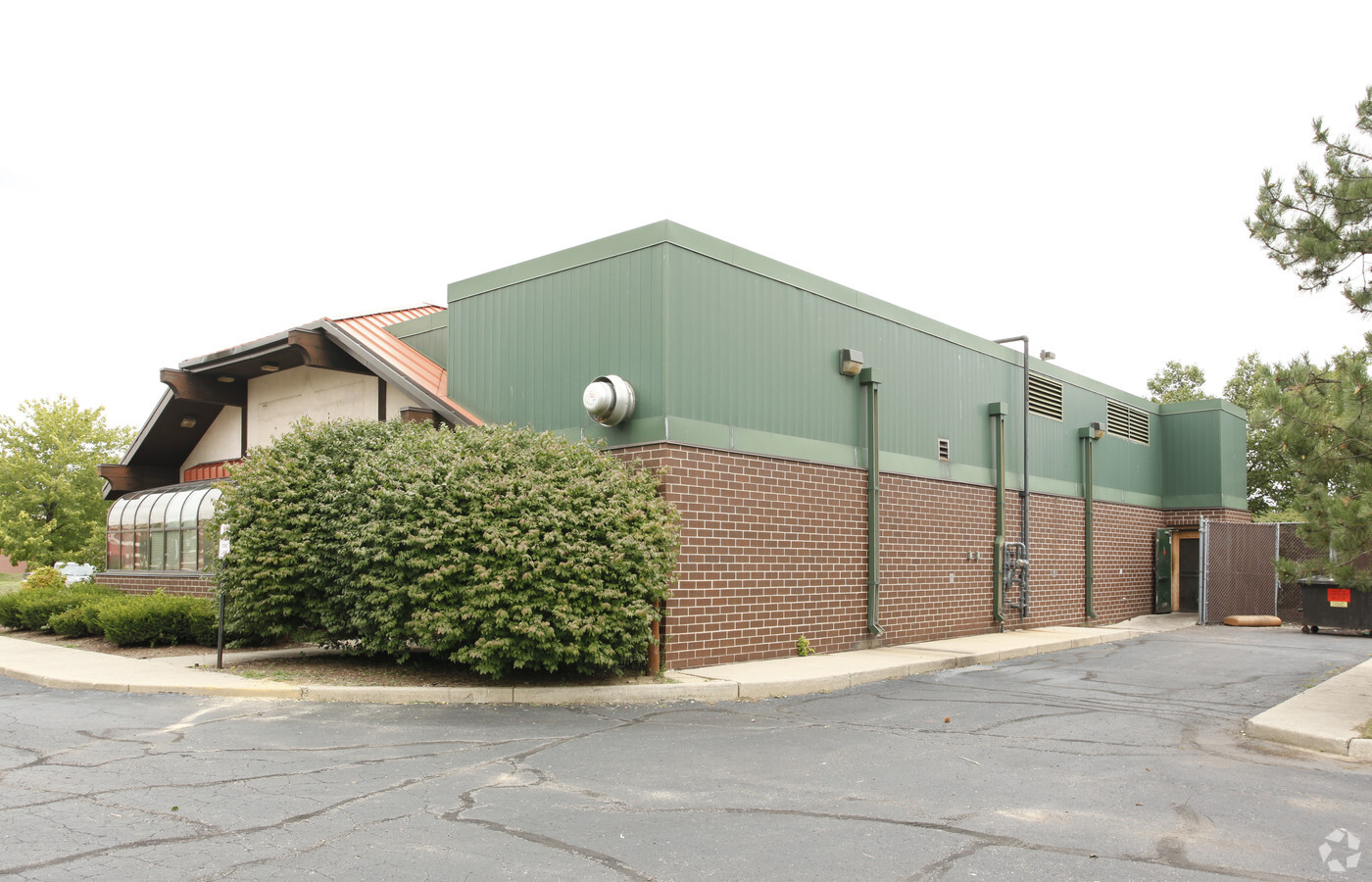
Property Record
36101 Warren Rd, Westland, MI 48185
NEARBY LISTINGS FOR SALE OR LEASE
Property Detail
36101 Warren Rd
Detroit-Warren-Dearborn, MI
Of Wayne County Condo Sub
56-029-99-0008-718
PART OF THE NE 1/4 OF SEC 8 DESCRIBED AS BEGINNING AT A POINT S 89D 54M 15S E 521.60 FT ALONG THE N LINE OF SEC 8 THE CENTERLINE OF WARREN ROAD AND S 00D 41M 37S W 60.00 FT FROM THE N 1/4 CORNER OF SEC 8; TH S 89D 54M 15S E 347.66 FT; TH S 00D 41M 37
Commercialacreage
Wayne
X
Michigan
26163C0210E
0008
2024
1.84 AC
2024
Southern I-275 Corridor
568800
Detroit
DEMOGRAPHICS near 36101 Warren Rd
1 Mile
3 Mile
5 Mile
2024 Total Population
14,861
88,314
253,164
2029 Population
14,380
84,703
242,883
Pop Growth 2024-2029
(3.24%)
(4.09%)
(4.06%)
Average Age
41
42
41
2024 Total Households
7,656
39,576
105,836
HH Growth 2024-2029
(3.29%)
(4.09%)
(4.07%)
Median Household Inc
$42,814
$64,918
$72,579
Avg Household Size
1.90
2.20
2.30
2024 Avg HH Vehicles
1.00
2.00
2.00
Median Home Value
$167,375
$175,455
$201,322
Median Year Built
1979
1968
1966
Nearby Places
- Restaurants
- Banks
- Shops
- Fitness
- Groceries
PUBLIC TRANSPORTATION
AIRPORT
Detroit Metro Wayne County
DRIVE
WALK
Distance
Detroit Metro Wayne County
24 min
17.0 mi
Windsor International
DRIVE
WALK
Distance
Windsor International
52 min
33.1 mi
Freight Ports
Port of Toledo
DRIVE
WALK
Distance
Port of Toledo
73 min
58.7 mi
Nearby Properties
Address
Land Use
TOTAL SIZE
Lot Size
Zoning
Address
Land Use
TOTAL SIZE
Lot Size
Zoning
741,173 SF
63.81 AC
Address
Land Use
TOTAL SIZE
Lot Size
Zoning
Address
Land Use
TOTAL SIZE
Lot Size
Zoning
183.17 AC
Address
Land Use
TOTAL SIZE
Lot Size
Zoning
400,857 SF
27.44 AC
RP
Address
Land Use
TOTAL SIZE
Lot Size
Zoning
37.30 AC
MR
Address
Land Use
TOTAL SIZE
Lot Size
Zoning
72.87 AC
Address
Land Use
TOTAL SIZE
Lot Size
Zoning
408,122 SF
23.31 AC
MR
Address
Land Use
TOTAL SIZE
Lot Size
Zoning
311,556 SF
23.17 AC
C-3
Address
Land Use
TOTAL SIZE
Lot Size
Zoning
114,894 SF
4.94 AC
Address
Land Use
TOTAL SIZE
Lot Size
Zoning
358,290 SF
26.40 AC
Address
Land Use
TOTAL SIZE
Lot Size
Zoning
467,373 SF
26.32 AC
Address
Land Use
TOTAL SIZE
Lot Size
Zoning
361,807 SF
18.77 AC
Address
Land Use
TOTAL SIZE
Lot Size
Zoning
411,864 SF
9.67 AC
Address
Land Use
TOTAL SIZE
Lot Size
Zoning
172,602 SF
14.51 AC
R-6
Address
Land Use
TOTAL SIZE
Lot Size
Zoning
954,882 SF
47.92 AC
LI-2
Address
Land Use
TOTAL SIZE
Lot Size
Zoning
299,257 SF
40.21 AC
Address
Land Use
TOTAL SIZE
Lot Size
Zoning
257,292 SF
21.17 AC
Address
Land Use
TOTAL SIZE
Lot Size
Zoning
265,334 SF
11.76 AC
Address
Land Use
TOTAL SIZE
Lot Size
Zoning
383,099 SF
7.71 AC
Address
Land Use
TOTAL SIZE
Lot Size
Zoning
282,738 SF
15.28 AC
Address
Land Use
TOTAL SIZE
Lot Size
Zoning
76,430 SF
13.61 AC
C-3
Address
Land Use
TOTAL SIZE
Lot Size
Zoning
247,579 SF
14.12 AC
Address
Land Use
TOTAL SIZE
Lot Size
Zoning
16.03 AC
MR
Address
Land Use
TOTAL SIZE
Lot Size
Zoning
229,544 SF
16.04 AC
Address
Land Use
TOTAL SIZE
Lot Size
Zoning
105,250 SF
11.20 AC
C-3
Address
Land Use
TOTAL SIZE
Lot Size
Zoning
172,368 SF
11.84 AC
Address
Land Use
TOTAL SIZE
Lot Size
Zoning
429,037 SF
30.20 AC
IND
Address
Land Use
TOTAL SIZE
Lot Size
Zoning
226,612 SF
39.67 AC
Address
Land Use
TOTAL SIZE
Lot Size
Zoning
189,083 SF
17.11 AC
Address
Land Use
TOTAL SIZE
Lot Size
Zoning
383,099 SF
11.72 AC
The World's #1 Commercial Real Estate Marketplace
Connect with us
© 2025 CoStar Group
The information above has been obtained from sources believed reliable. While we do not doubt its accuracy we have not verified it and make no guarantee, warranty or representation about it. It is your responsibility to independently confirm its accuracy and completeness. Any projections, opinions, assumptions, or estimates used are for example only and do not represent the current or future performance of the property. The value of this transaction to you depends on tax and other factors which should be evaluated by your tax, financial, and legal advisors. You and your advisors should conduct a careful, independent investigation of the property to determine to your satisfaction the suitability of the property for your needs.