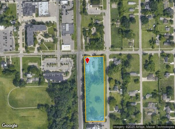
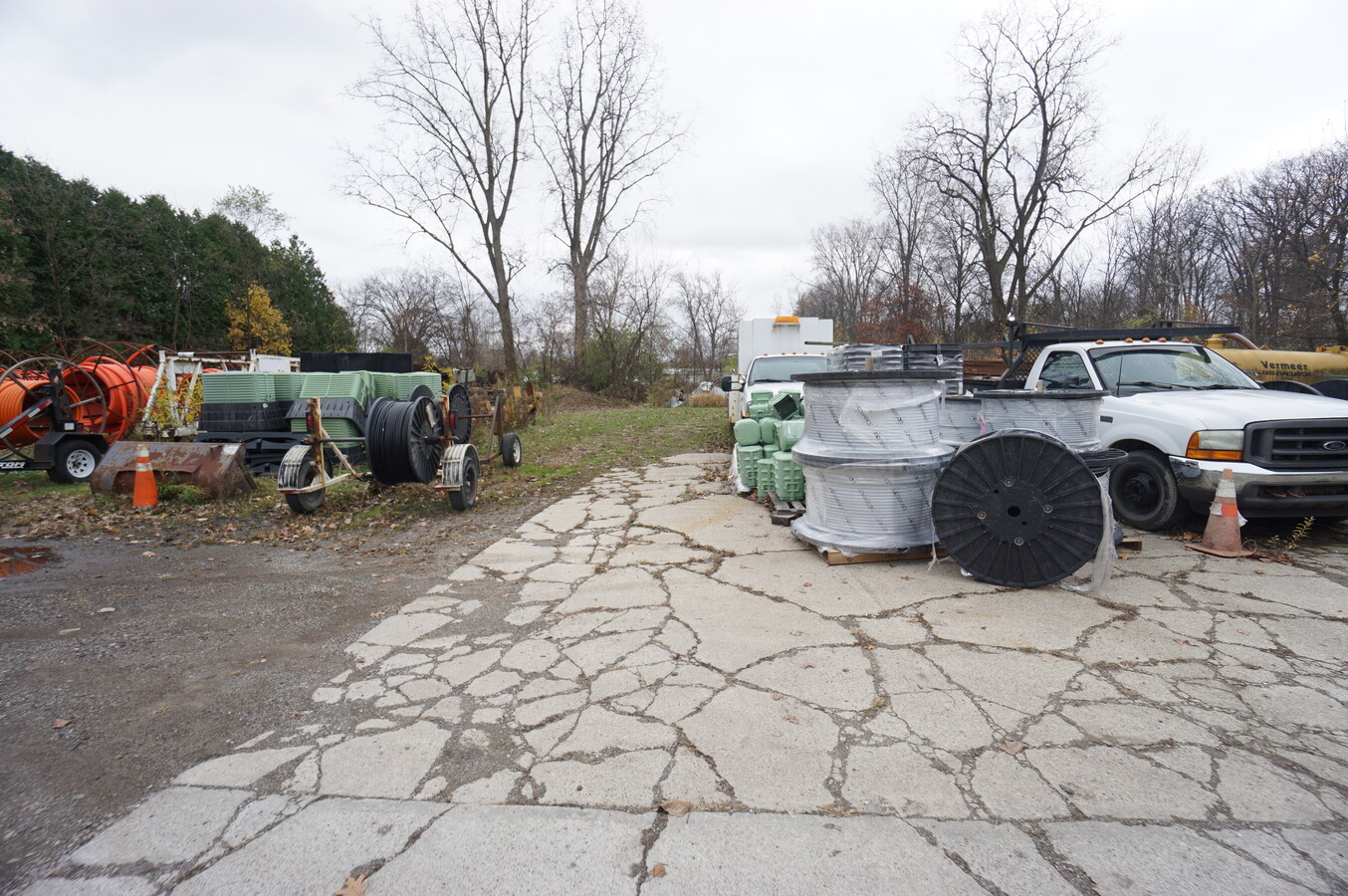
Property Record
36135 Bibbins St, Romulus, MI 48174
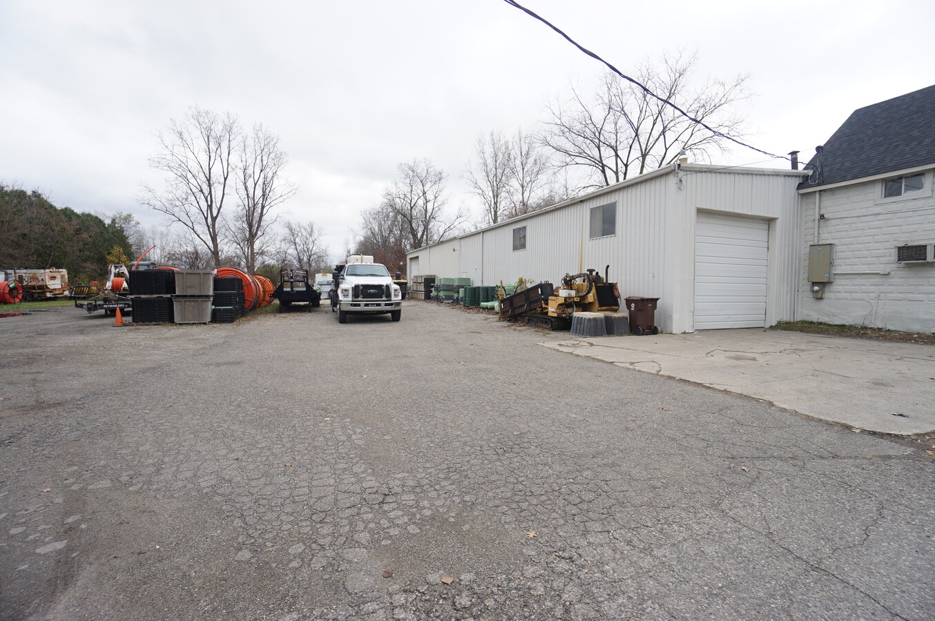
This Property Is For Sale
NEARBY LISTINGS FOR SALE OR LEASE
Property Detail
36135 Bibbins St
Detroit-Warren-Dearborn, MI
The Junction Sub
80-077-17-0017-000
20ABL17 BL18A1 BLOCK 17 THE JUNCTION SUB BLOCK 18 T3S R9E L17 P34 WCR ALSO N 296.30FT OF BLOCK 18 L17 P34 WCR
Industrialgeneral
Wayne
X
Michigan
26163C0357F
0017
2024
2.82 AC
2024
Airport District
585900
Detroit
6,116 SF
DEMOGRAPHICS near 36135 Bibbins St
1 Mile
3 Mile
5 Mile
2024 Total Population
2,758
15,051
72,401
2029 Population
2,673
14,488
69,598
Pop Growth 2024-2029
(3.08%)
(3.74%)
(3.87%)
Average Age
42
40
40
2024 Total Households
1,236
6,095
29,307
HH Growth 2024-2029
(2.99%)
(3.79%)
(3.92%)
Median Household Inc
$53,598
$64,190
$63,754
Avg Household Size
2.20
2.40
2.40
2024 Avg HH Vehicles
2.00
2.00
2.00
Median Home Value
$174,927
$170,842
$173,642
Median Year Built
1963
1969
1972
Nearby Places
- Restaurants
- Banks
- Shops
- Fitness
- Groceries
PUBLIC TRANSPORTATION
AIRPORT
Detroit Metro Wayne County
DRIVE
WALK
Distance
Detroit Metro Wayne County
9 min
5.2 mi
Windsor International
DRIVE
WALK
Distance
Windsor International
50 min
32.4 mi
Freight Ports
Port of Toledo
DRIVE
WALK
Distance
Port of Toledo
62 min
47.7 mi
Nearby Properties
Address
Land Use
TOTAL SIZE
Lot Size
Zoning
Address
Land Use
TOTAL SIZE
Lot Size
Zoning
238.69 AC
AG
Address
Land Use
TOTAL SIZE
Lot Size
Zoning
855,000 SF
84.70 AC
M-1/COND
Address
Land Use
TOTAL SIZE
Lot Size
Zoning
108,809 SF
AP-AIRPORT
Address
Land Use
TOTAL SIZE
Lot Size
Zoning
307,524 SF
63.94 AC
Address
Land Use
TOTAL SIZE
Lot Size
Zoning
Address
Land Use
TOTAL SIZE
Lot Size
Zoning
1,249,073 SF
154.21 AC
M2-GEN
Address
Land Use
TOTAL SIZE
Lot Size
Zoning
500,240 SF
55.95 AC
M2-GEN
Address
Land Use
TOTAL SIZE
Lot Size
Zoning
600,000 SF
M1-LIG
Address
Land Use
TOTAL SIZE
Lot Size
Zoning
43.43 AC
Address
Land Use
TOTAL SIZE
Lot Size
Zoning
500,240 SF
M1-LIG
Address
Land Use
TOTAL SIZE
Lot Size
Zoning
435,648 SF
27.84 AC
M2-GEN
Address
Land Use
TOTAL SIZE
Lot Size
Zoning
366,820 SF
20.83 AC
Address
Land Use
TOTAL SIZE
Lot Size
Zoning
366,820 SF
20.72 AC
Address
Land Use
TOTAL SIZE
Lot Size
Zoning
354,968 SF
25.72 AC
Address
Land Use
TOTAL SIZE
Lot Size
Zoning
268,272 SF
22.70 AC
Address
Land Use
TOTAL SIZE
Lot Size
Zoning
199,722 SF
30.86 AC
M2-GEN
Address
Land Use
TOTAL SIZE
Lot Size
Zoning
250,263 SF
18.81 AC
RM-MLTI
Address
Land Use
TOTAL SIZE
Lot Size
Zoning
907,180 SF
56.56 AC
M2-GEN
Address
Land Use
TOTAL SIZE
Lot Size
Zoning
5,382 SF
109.33 AC
RMH-MOB
Address
Land Use
TOTAL SIZE
Lot Size
Zoning
285,080 SF
21.89 AC
M2-GEN
Address
Land Use
TOTAL SIZE
Lot Size
Zoning
26.05 AC
Address
Land Use
TOTAL SIZE
Lot Size
Zoning
462,840 SF
45.66 AC
Address
Land Use
TOTAL SIZE
Lot Size
Zoning
150.49 AC
M2-GEN
Address
Land Use
TOTAL SIZE
Lot Size
Zoning
161,794 SF
17.73 AC
RM MULT
Address
Land Use
TOTAL SIZE
Lot Size
Zoning
2,590 SF
62.42 AC
RC-REG
Address
Land Use
TOTAL SIZE
Lot Size
Zoning
249,090 SF
27.15 AC
M1-LIG
Address
Land Use
TOTAL SIZE
Lot Size
Zoning
165,200 SF
14.85 AC
Address
Land Use
TOTAL SIZE
Lot Size
Zoning
87,000 SF
18.02 AC
Address
Land Use
TOTAL SIZE
Lot Size
Zoning
129,260 SF
5.25 AC
AP-AIRPORT
Address
Land Use
TOTAL SIZE
Lot Size
Zoning
268,800 SF
17.47 AC
M1-LIG
The World's #1 Commercial Real Estate Marketplace
Connect with us
© 2025 CoStar Group
The information above has been obtained from sources believed reliable. While we do not doubt its accuracy we have not verified it and make no guarantee, warranty or representation about it. It is your responsibility to independently confirm its accuracy and completeness. Any projections, opinions, assumptions, or estimates used are for example only and do not represent the current or future performance of the property. The value of this transaction to you depends on tax and other factors which should be evaluated by your tax, financial, and legal advisors. You and your advisors should conduct a careful, independent investigation of the property to determine to your satisfaction the suitability of the property for your needs.