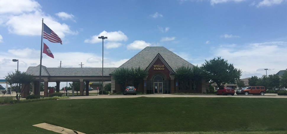
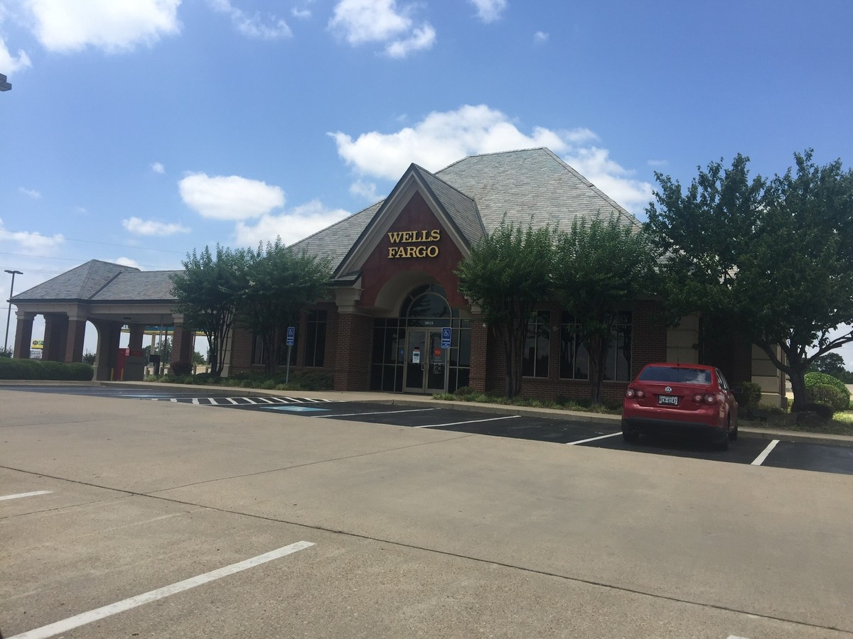
Property Record
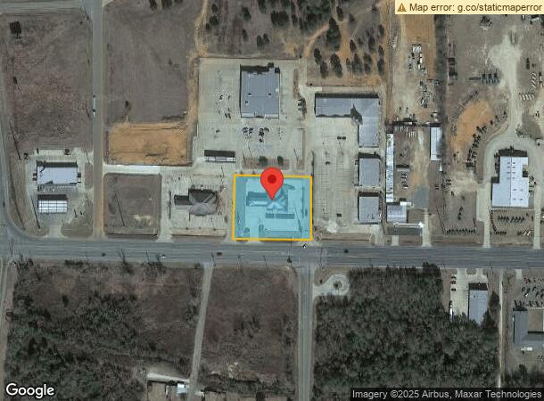
3615 E 9Th St, Texarkana, AR 71854
NEARBY LISTINGS FOR SALE OR LEASE
Property Detail
3615 E 9Th St
00290804
21-15S-28W
Financialbuilding
PT BLK 3 MCLAIN PLAT
X
Miller
48037C0370E
Arkansas
2023
0.96 AC
2024
Other Market Areas
020802
Texarkana, TX-AR
4,186 SF
DEMOGRAPHICS near 3615 E 9Th St
1 Mile
3 Mile
5 Mile
2024 Total Population
2,233
26,640
54,749
2029 Population
2,274
26,850
55,066
Pop Growth 2024-2029
+ 1.84%
+ 0.79%
+ 0.58%
Average Age
36
39
39
2024 Total Households
948
10,371
21,978
HH Growth 2024-2029
+ 1.90%
+ 0.80%
+ 0.58%
Median Household Inc
$24,052
$39,731
$41,281
Avg Household Size
2.30
2.30
2.30
2024 Avg HH Vehicles
1.00
2.00
2.00
Median Home Value
$173,437
$117,927
$133,265
Median Year Built
2001
1973
1977
Nearby Places
- Restaurants
- Banks
- Shops
- Fitness
- Groceries
PUBLIC TRANSPORTATION
COMMUTER RAIL
Texarkana Amtrak Station (Texas Eagle - Amtrak)
DRIVE
WALK
Distance
Texarkana Amtrak Station (Texas Eagle - Amtrak)
5 min
3.1 mi
AIRPORT
Texarkana Regional-Webb Field
DRIVE
WALK
Distance
Texarkana Regional-Webb Field
7 min
2.4 mi
Freight Ports
Port of Shreveport
DRIVE
WALK
Distance
Port of Shreveport
104 min
92.6 mi
SALE & LEASE HISTORY
LISTING DATE
SALE/LEASE

Jun 22, 2017
For Sale
Nearby Properties
Address
Land Use
TOTAL SIZE
Lot Size
Zoning
Address
Land Use
TOTAL SIZE
Lot Size
Zoning
1,896,910 SF
46.18 AC
Address
Land Use
TOTAL SIZE
Lot Size
Zoning
Address
Land Use
TOTAL SIZE
Lot Size
Zoning
1,896,910 SF
Address
Land Use
TOTAL SIZE
Lot Size
Zoning
74,246 SF
1.34 AC
Address
Land Use
TOTAL SIZE
Lot Size
Zoning
4.43 AC
Address
Land Use
TOTAL SIZE
Lot Size
Zoning
102,614 SF
0.89 AC
Address
Land Use
TOTAL SIZE
Lot Size
Zoning
118,371 SF
64.38 AC
Address
Land Use
TOTAL SIZE
Lot Size
Zoning
2.55 AC
Address
Land Use
TOTAL SIZE
Lot Size
Zoning
185,060 SF
Address
Land Use
TOTAL SIZE
Lot Size
Zoning
270,796 SF
33.10 AC
Address
Land Use
TOTAL SIZE
Lot Size
Zoning
26,696 SF
1.29 AC
Address
Land Use
TOTAL SIZE
Lot Size
Zoning
21,296 SF
1.82 AC
Address
Land Use
TOTAL SIZE
Lot Size
Zoning
28,480 SF
0.96 AC
Address
Land Use
TOTAL SIZE
Lot Size
Zoning
2.07 AC
Address
Land Use
TOTAL SIZE
Lot Size
Zoning
179,723 SF
36.84 AC
Address
Land Use
TOTAL SIZE
Lot Size
Zoning
0.48 AC
Address
Land Use
TOTAL SIZE
Lot Size
Zoning
100,000 SF
5.92 AC
Address
Land Use
TOTAL SIZE
Lot Size
Zoning
101,920 SF
17.18 AC
Address
Land Use
TOTAL SIZE
Lot Size
Zoning
47,776 SF
8 AC
Address
Land Use
TOTAL SIZE
Lot Size
Zoning
26,721 SF
0.32 AC
Address
Land Use
TOTAL SIZE
Lot Size
Zoning
15,940 SF
13.43 AC
Address
Land Use
TOTAL SIZE
Lot Size
Zoning
25,250 SF
2.05 AC
Address
Land Use
TOTAL SIZE
Lot Size
Zoning
19,456 SF
0.96 AC
Address
Land Use
TOTAL SIZE
Lot Size
Zoning
24,108 SF
2.07 AC
Address
Land Use
TOTAL SIZE
Lot Size
Zoning
211,666 SF
15.11 AC
Address
Land Use
TOTAL SIZE
Lot Size
Zoning
90,160 SF
1.96 AC
Address
Land Use
TOTAL SIZE
Lot Size
Zoning
15,002 SF
0.96 AC
Address
Land Use
TOTAL SIZE
Lot Size
Zoning
13,050 SF
0.77 AC
Address
Land Use
TOTAL SIZE
Lot Size
Zoning
25,768 SF
1.73 AC
Address
Land Use
TOTAL SIZE
Lot Size
Zoning
10,327 SF
0.48 AC
The World's #1 Commercial Real Estate Marketplace
Connect with us
© 2025 CoStar Group
The information above has been obtained from sources believed reliable. While we do not doubt its accuracy we have not verified it and make no guarantee, warranty or representation about it. It is your responsibility to independently confirm its accuracy and completeness. Any projections, opinions, assumptions, or estimates used are for example only and do not represent the current or future performance of the property. The value of this transaction to you depends on tax and other factors which should be evaluated by your tax, financial, and legal advisors. You and your advisors should conduct a careful, independent investigation of the property to determine to your satisfaction the suitability of the property for your needs.