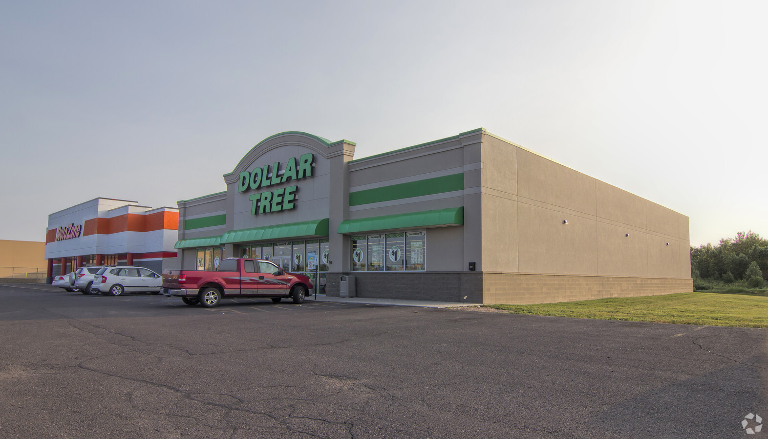
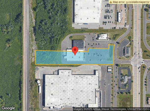
Property Record
3615 Tower Ave, Superior, WI 54880
NEARBY LISTINGS FOR SALE OR LEASE
Property Detail
3615 Tower Ave
Duluth, MN-WI
PARCEL A: LOT 1 OF CERTIFIED SURVEY MAP NO. 722, RECORDED IN VOL. 5 OF CSM S, PAGE 130 TO 131, AS DOC. NO. 719866, DOUGLAS CO
07-807-03010-00
Douglas
Commercialnec
Wisconsin
X
1
55031C0078D
3.39 AC
2023
Superior
2023
Duluth
020800
DEMOGRAPHICS near 3615 Tower Ave
1 Mile
3 Mile
5 Mile
2024 Total Population
2,361
23,318
39,359
2029 Population
2,335
23,033
38,811
Pop Growth 2024-2029
(1.10%)
(1.22%)
(1.39%)
Average Age
42
40
40
2024 Total Households
1,035
10,234
17,358
HH Growth 2024-2029
(1.26%)
(1.27%)
(1.47%)
Median Household Inc
$53,077
$52,150
$52,518
Avg Household Size
2.20
2.10
2.10
2024 Avg HH Vehicles
2.00
2.00
2.00
Median Home Value
$168,863
$151,217
$150,274
Median Year Built
1967
1956
1949
Nearby Places
- Restaurants
- Banks
- Shops
- Fitness
- Groceries
PUBLIC TRANSPORTATION
AIRPORT
Duluth International
DRIVE
WALK
Distance
Duluth International
30 min
15.0 mi
Freight Ports
Port Milwaukee
DRIVE
WALK
Distance
Port Milwaukee
446 min
394.8 mi
Nearby Properties
Address
Land Use
TOTAL SIZE
Lot Size
Zoning
Address
Land Use
TOTAL SIZE
Lot Size
Zoning
175 AC
W1
Address
Land Use
TOTAL SIZE
Lot Size
Zoning
50.82 AC
M2
Address
Land Use
TOTAL SIZE
Lot Size
Zoning
2.81 AC
PDD
Address
Land Use
TOTAL SIZE
Lot Size
Zoning
21.96 AC
Address
Land Use
TOTAL SIZE
Lot Size
Zoning
27.99 AC
C2
Address
Land Use
TOTAL SIZE
Lot Size
Zoning
1.36 AC
C2
Address
Land Use
TOTAL SIZE
Lot Size
Zoning
1.45 AC
C3
Address
Land Use
TOTAL SIZE
Lot Size
Zoning
4.17 AC
C2
Address
Land Use
TOTAL SIZE
Lot Size
Zoning
6.94 AC
Address
Land Use
TOTAL SIZE
Lot Size
Zoning
135.91 AC
M2
Address
Land Use
TOTAL SIZE
Lot Size
Zoning
2 AC
R3
Address
Land Use
TOTAL SIZE
Lot Size
Zoning
52.06 AC
M2
Address
Land Use
TOTAL SIZE
Lot Size
Zoning
9.84 AC
C2
Address
Land Use
TOTAL SIZE
Lot Size
Zoning
0.68 AC
R3
Address
Land Use
TOTAL SIZE
Lot Size
Zoning
2.44 AC
C2
Address
Land Use
TOTAL SIZE
Lot Size
Zoning
4.47 AC
Address
Land Use
TOTAL SIZE
Lot Size
Zoning
1.34 AC
Address
Land Use
TOTAL SIZE
Lot Size
Zoning
7.05 AC
M2
Address
Land Use
TOTAL SIZE
Lot Size
Zoning
3.42 AC
R3
Address
Land Use
TOTAL SIZE
Lot Size
Zoning
1.97 AC
PDD
Address
Land Use
TOTAL SIZE
Lot Size
Zoning
Address
Land Use
TOTAL SIZE
Lot Size
Zoning
6.01 AC
M2
Address
Land Use
TOTAL SIZE
Lot Size
Zoning
3.54 AC
W1
Address
Land Use
TOTAL SIZE
Lot Size
Zoning
6.20 AC
C4
Address
Land Use
TOTAL SIZE
Lot Size
Zoning
11.43 AC
R3
Address
Land Use
TOTAL SIZE
Lot Size
Zoning
2.58 AC
R2A
Address
Land Use
TOTAL SIZE
Lot Size
Zoning
1.41 AC
C4
Address
Land Use
TOTAL SIZE
Lot Size
Zoning
1.70 AC
C2
Address
Land Use
TOTAL SIZE
Lot Size
Zoning
4.80 AC
R3
Address
Land Use
TOTAL SIZE
Lot Size
Zoning
2.41 AC
C1
The World's #1 Commercial Real Estate Marketplace
Connect with us
© 2025 CoStar Group
The information above has been obtained from sources believed reliable. While we do not doubt its accuracy we have not verified it and make no guarantee, warranty or representation about it. It is your responsibility to independently confirm its accuracy and completeness. Any projections, opinions, assumptions, or estimates used are for example only and do not represent the current or future performance of the property. The value of this transaction to you depends on tax and other factors which should be evaluated by your tax, financial, and legal advisors. You and your advisors should conduct a careful, independent investigation of the property to determine to your satisfaction the suitability of the property for your needs.