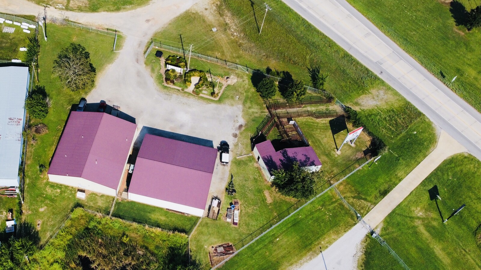
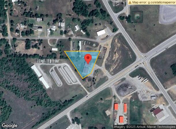
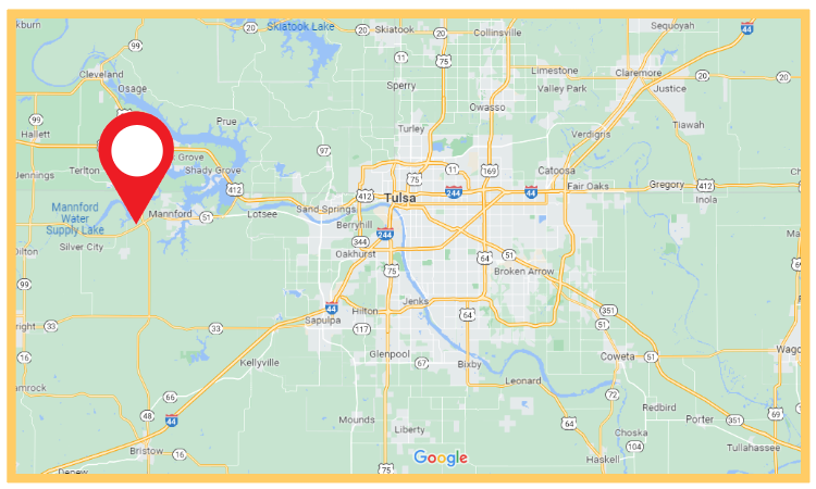
Property Record
36161 W Highway 51, Mannford, OK 74044
NEARBY LISTINGS FOR SALE OR LEASE
-
-
View all Mannford listings for sale on LoopNet.com
Property Detail
36161 W Highway 51
0000-18-019-009-0-064-01
T19n-R09e
Animalhospitalvet
18-19-9 A TR IN S SW BEG N LINE DIST 1893.76 E OF NW COR TH N89'59 E393.52 TO PT ON R W LINE HWY 51 S21'41 W ALG R W 304.41 T
X
Creek
40037C0125D
Oklahoma
2024
1.61 AC
2024
Creek County
020705
Tulsa
3,600 SF
Tulsa, OK
DEMOGRAPHICS near 36161 W Highway 51
1 Mile
3 Mile
5 Mile
2024 Total Population
479
3,401
6,889
2029 Population
482
3,390
6,961
Pop Growth 2024-2029
+ 0.63%
(0.32%)
+ 1.05%
Average Age
42
41
42
2024 Total Households
187
1,312
2,661
HH Growth 2024-2029
+ 1.07%
(0.30%)
+ 1.09%
Median Household Inc
$57,291
$55,519
$58,899
Avg Household Size
2.50
2.50
2.60
2024 Avg HH Vehicles
2.00
2.00
2.00
Median Home Value
$169,999
$199,269
$188,718
Median Year Built
1985
1986
1984
Nearby Places
- Restaurants
- Banks
- Shops
- Fitness
- Groceries
PUBLIC TRANSPORTATION
AIRPORT
Tulsa International
DRIVE
WALK
Distance
Tulsa International
44 min
33.5 mi
Freight Ports
Tulsa Port Of Catoosa
DRIVE
WALK
Distance
Tulsa Port Of Catoosa
54 min
42.8 mi
Nearby Properties
Address
Land Use
TOTAL SIZE
Lot Size
Zoning
Address
Land Use
TOTAL SIZE
Lot Size
Zoning
33,110 SF
4.57 AC
Address
Land Use
TOTAL SIZE
Lot Size
Zoning
31,631 SF
2.18 AC
Address
Land Use
TOTAL SIZE
Lot Size
Zoning
9,156 SF
1.30 AC
Address
Land Use
TOTAL SIZE
Lot Size
Zoning
24.95 AC
NP
Address
Land Use
TOTAL SIZE
Lot Size
Zoning
2,744 SF
2.50 AC
Address
Land Use
TOTAL SIZE
Lot Size
Zoning
9,090 SF
1.15 AC
Address
Land Use
TOTAL SIZE
Lot Size
Zoning
15,840 SF
2.45 AC
Address
Land Use
TOTAL SIZE
Lot Size
Zoning
5,320 SF
2.72 AC
Address
Land Use
TOTAL SIZE
Lot Size
Zoning
3,346 SF
0.43 AC
Address
Land Use
TOTAL SIZE
Lot Size
Zoning
3,120 SF
1.86 AC
Address
Land Use
TOTAL SIZE
Lot Size
Zoning
2,100 SF
0.33 AC
Address
Land Use
TOTAL SIZE
Lot Size
Zoning
3,360 SF
0.33 AC
Address
Land Use
TOTAL SIZE
Lot Size
Zoning
4,800 SF
53.90 AC
IP
Address
Land Use
TOTAL SIZE
Lot Size
Zoning
2,200 SF
1.50 AC
Address
Land Use
TOTAL SIZE
Lot Size
Zoning
6,030 SF
5 AC
Address
Land Use
TOTAL SIZE
Lot Size
Zoning
3,898 SF
0.33 AC
Address
Land Use
TOTAL SIZE
Lot Size
Zoning
8,200 SF
1.13 AC
Address
Land Use
TOTAL SIZE
Lot Size
Zoning
2,806 SF
2.10 AC
Address
Land Use
TOTAL SIZE
Lot Size
Zoning
3,850 SF
9.08 AC
Address
Land Use
TOTAL SIZE
Lot Size
Zoning
5,000 SF
0.79 AC
Address
Land Use
TOTAL SIZE
Lot Size
Zoning
1,216 SF
0.73 AC
Address
Land Use
TOTAL SIZE
Lot Size
Zoning
2,296 SF
0.67 AC
Address
Land Use
TOTAL SIZE
Lot Size
Zoning
2,590 SF
0.48 AC
Address
Land Use
TOTAL SIZE
Lot Size
Zoning
3,000 SF
0.76 AC
Address
Land Use
TOTAL SIZE
Lot Size
Zoning
2,375 SF
0.81 AC
The World's #1 Commercial Real Estate Marketplace
Connect with us
© 2025 CoStar Group
The information above has been obtained from sources believed reliable. While we do not doubt its accuracy we have not verified it and make no guarantee, warranty or representation about it. It is your responsibility to independently confirm its accuracy and completeness. Any projections, opinions, assumptions, or estimates used are for example only and do not represent the current or future performance of the property. The value of this transaction to you depends on tax and other factors which should be evaluated by your tax, financial, and legal advisors. You and your advisors should conduct a careful, independent investigation of the property to determine to your satisfaction the suitability of the property for your needs.