Property Record
3619 W 73Rd St, Anderson, IN 46011

NEARBY LISTINGS FOR SALE OR LEASE
-
-
View all Anderson listings for sale on LoopNet.com
Property Detail
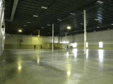
3619 W 73Rd St
48-14-04-400-011.000-039
FLAGSHIP WEST 2ND LOT 2 SE 4-18-2 8.420 AC
Manufacturinglight
Madison
X
Indiana
18095C0261D
2
0
8.42 AC
2024
Madison County
011501
Indianapolis
77,500 SF
Indianapolis-Carmel-Anderson, IN
DEMOGRAPHICS near 3619 W 73Rd St
1 Mile
3 Mile
5 Mile
2024 Total Population
514
10,672
48,159
2029 Population
526
10,886
49,511
Pop Growth 2024-2029
+ 2.33%
+ 2.01%
+ 2.81%
Average Age
42
42
41
2024 Total Households
166
4,293
19,197
HH Growth 2024-2029
+ 2.41%
+ 2.14%
+ 3.04%
Median Household Inc
$60,882
$70,618
$50,135
Avg Household Size
2.40
2.30
2.30
2024 Avg HH Vehicles
2.00
2.00
2.00
Median Home Value
$192,707
$171,898
$135,677
Median Year Built
1981
1977
1964
Nearby Places
- Restaurants
- Banks
- Shops
- Fitness
- Groceries
Nearby Properties
Address
Land Use
TOTAL SIZE
Lot Size
Zoning
Address
Land Use
TOTAL SIZE
Lot Size
Zoning
256,290 SF
77.35 AC
Address
Land Use
TOTAL SIZE
Lot Size
Zoning
399,763 SF
40 AC
Address
Land Use
TOTAL SIZE
Lot Size
Zoning
324,931 SF
25.40 AC
Address
Land Use
TOTAL SIZE
Lot Size
Zoning
325,122 SF
40 AC
Address
Land Use
TOTAL SIZE
Lot Size
Zoning
222,080 SF
25 AC
Address
Land Use
TOTAL SIZE
Lot Size
Zoning
140,000 SF
19.36 AC
Address
Land Use
TOTAL SIZE
Lot Size
Zoning
32,361 SF
2.88 AC
Address
Land Use
TOTAL SIZE
Lot Size
Zoning
18,780 SF
2.59 AC
Address
Land Use
TOTAL SIZE
Lot Size
Zoning
47,370 SF
11.23 AC
Address
Land Use
TOTAL SIZE
Lot Size
Zoning
44,660 SF
10 AC
Address
Land Use
TOTAL SIZE
Lot Size
Zoning
70,000 SF
10.07 AC
Address
Land Use
TOTAL SIZE
Lot Size
Zoning
115,522 SF
20 AC
Address
Land Use
TOTAL SIZE
Lot Size
Zoning
51,047 SF
4.42 AC
Address
Land Use
TOTAL SIZE
Lot Size
Zoning
44,699 SF
4.94 AC
Address
Land Use
TOTAL SIZE
Lot Size
Zoning
19,457 SF
7.30 AC
Address
Land Use
TOTAL SIZE
Lot Size
Zoning
19,278 SF
1.76 AC
Address
Land Use
TOTAL SIZE
Lot Size
Zoning
14,007 SF
3.20 AC
Address
Land Use
TOTAL SIZE
Lot Size
Zoning
71,278 SF
7.59 AC
Address
Land Use
TOTAL SIZE
Lot Size
Zoning
17,118 SF
8.95 AC
Address
Land Use
TOTAL SIZE
Lot Size
Zoning
32,586 SF
3.65 AC
Address
Land Use
TOTAL SIZE
Lot Size
Zoning
7,920 SF
1.07 AC
Address
Land Use
TOTAL SIZE
Lot Size
Zoning
21,641 SF
4.91 AC
Address
Land Use
TOTAL SIZE
Lot Size
Zoning
21,020 SF
1.15 AC
Address
Land Use
TOTAL SIZE
Lot Size
Zoning
6,660 SF
1.39 AC
Address
Land Use
TOTAL SIZE
Lot Size
Zoning
64,512 SF
7.91 AC
Address
Land Use
TOTAL SIZE
Lot Size
Zoning
3,000 SF
5.06 AC
Address
Land Use
TOTAL SIZE
Lot Size
Zoning
1,680 SF
4.69 AC
Address
Land Use
TOTAL SIZE
Lot Size
Zoning
3,116 SF
1.04 AC
Address
Land Use
TOTAL SIZE
Lot Size
Zoning
10,771 SF
1.78 AC
The World's #1 Commercial Real Estate Marketplace
Connect with us
© 2025 CoStar Group
The information above has been obtained from sources believed reliable. While we do not doubt its accuracy we have not verified it and make no guarantee, warranty or representation about it. It is your responsibility to independently confirm its accuracy and completeness. Any projections, opinions, assumptions, or estimates used are for example only and do not represent the current or future performance of the property. The value of this transaction to you depends on tax and other factors which should be evaluated by your tax, financial, and legal advisors. You and your advisors should conduct a careful, independent investigation of the property to determine to your satisfaction the suitability of the property for your needs.