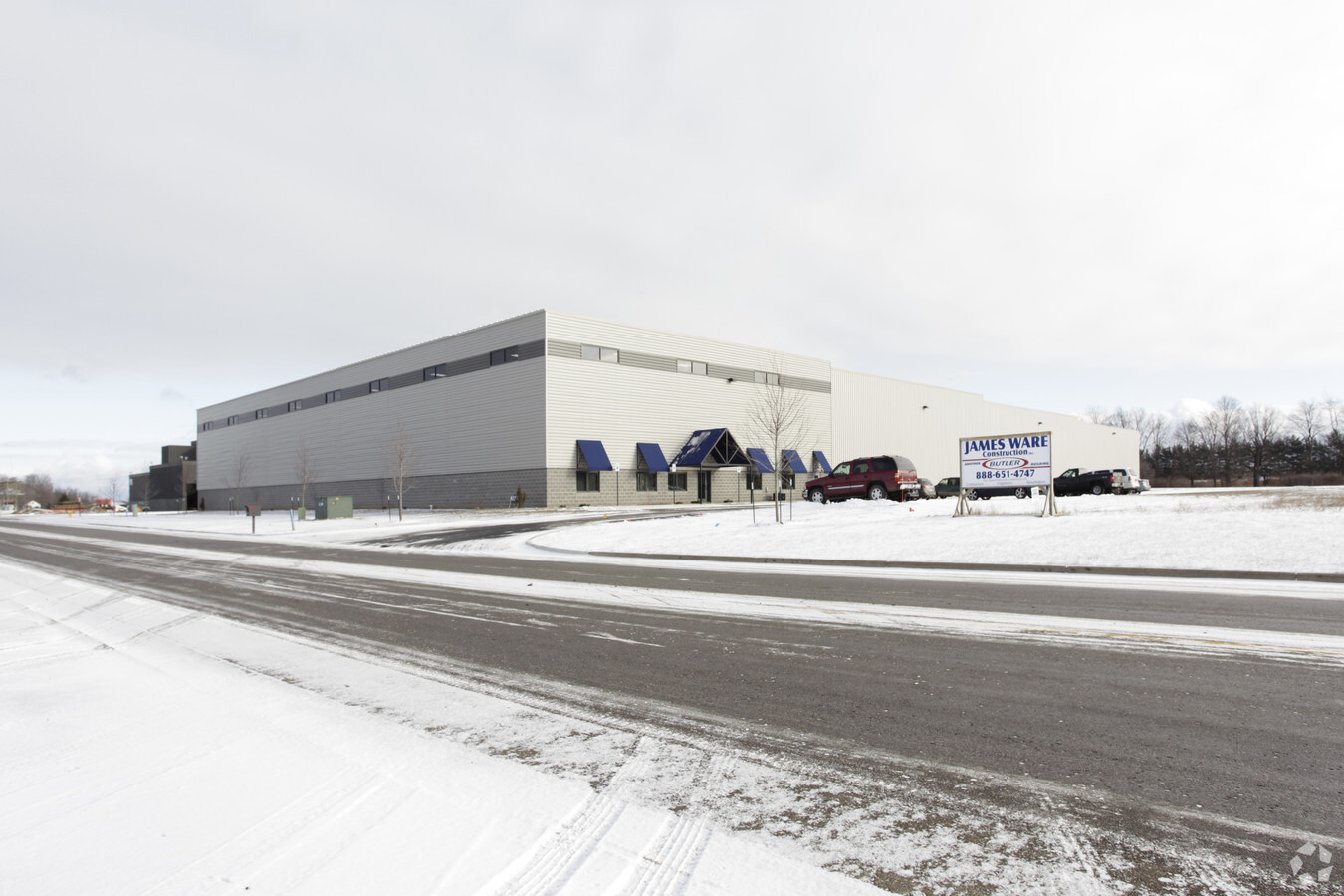
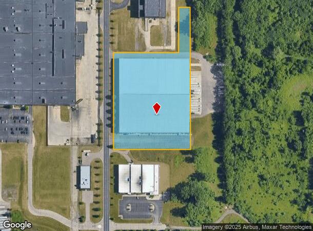
Property Record
3625 Park Circle Dr, Kalamazoo, MI 49048
NEARBY LISTINGS FOR SALE OR LEASE
-
-
-
-
-
-
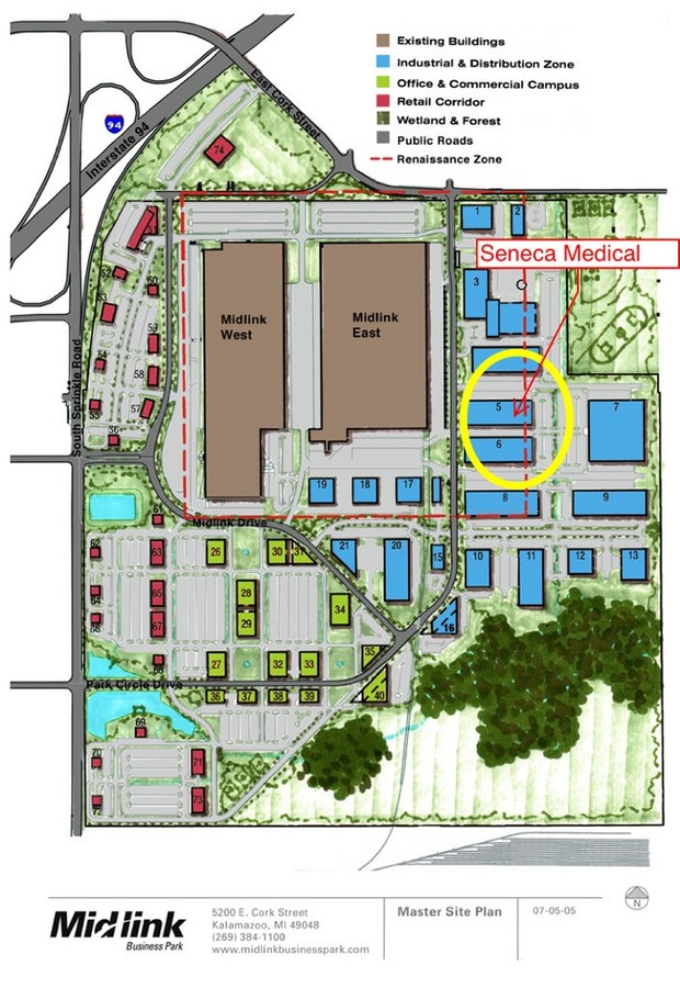
5200 E Cork St- Midlink Business Park Pre-Construction
Kalamazoo, MI 49048
$6.95 SF/YR
41,250 - 165,000 SF
Industrial
-
-
View all Kalamazoo listings for sale on LoopNet.com
Property Detail
3625 Park Circle Dr
07-31-104-041
Midlink Industrial Site Condominiums
Commercialnec
31-2-10 MIDLINK INDUSTRIAL SITE CONDO UNIT 4A (REPLAT #1) RENAISSANCE ZONE AREA SPLIT ON 12/26/05 FROM 31-102-043 INTO 31-104-001,002,003,004,005,006,& 008 COMBINE ON 05/06/2010 FROM; PART FROM 31-104-004, ALL OF -005,PART OF -006
X
Kalamazoo
26077C0195E
Michigan
2023
5.90 AC
2024
Southern Kalamazoo County
006702
West Michigan
164,320 SF
Kalamazoo-Portage, MI
DEMOGRAPHICS near 3625 Park Circle Dr
1 Mile
3 Mile
5 Mile
2024 Total Population
322
23,496
86,313
2029 Population
318
23,448
86,251
Pop Growth 2024-2029
(1.24%)
(0.20%)
(0.07%)
Average Age
43
37
37
2024 Total Households
125
9,520
36,211
HH Growth 2024-2029
(1.60%)
(0.26%)
(0.10%)
Median Household Inc
$65,869
$52,108
$51,942
Avg Household Size
2.40
2.40
2.20
2024 Avg HH Vehicles
2.00
2.00
2.00
Median Home Value
$225,000
$127,186
$151,818
Median Year Built
1966
1956
1957
Nearby Places
- Restaurants
- Banks
- Shops
- Fitness
- Groceries
PUBLIC TRANSPORTATION
COMMUTER RAIL
Kalamazoo (Blue Water - Amtrak, Wolverine - Amtrak)
DRIVE
WALK
Distance
Kalamazoo (Blue Water - Amtrak, Wolverine - Amtrak)
11 min
5.9 mi
AIRPORT
Kalamazoo/Battle Creek International
DRIVE
WALK
Distance
Kalamazoo/Battle Creek International
10 min
2.8 mi
Freight Ports
Port of Toledo
DRIVE
WALK
Distance
Port of Toledo
172 min
142.4 mi
Nearby Properties
Address
Land Use
TOTAL SIZE
Lot Size
Zoning
Address
Land Use
TOTAL SIZE
Lot Size
Zoning
82,520 SF
39.35 AC
Address
Land Use
TOTAL SIZE
Lot Size
Zoning
37.40 AC
Address
Land Use
TOTAL SIZE
Lot Size
Zoning
33.60 AC
Address
Land Use
TOTAL SIZE
Lot Size
Zoning
Address
Land Use
TOTAL SIZE
Lot Size
Zoning
17,858 SF
15.27 AC
Address
Land Use
TOTAL SIZE
Lot Size
Zoning
61.61 AC
Address
Land Use
TOTAL SIZE
Lot Size
Zoning
134,876 SF
16.45 AC
RM-15
Address
Land Use
TOTAL SIZE
Lot Size
Zoning
498,424 SF
41.72 AC
M-2
Address
Land Use
TOTAL SIZE
Lot Size
Zoning
606,439 SF
34.61 AC
M-2
Address
Land Use
TOTAL SIZE
Lot Size
Zoning
298,908 SF
40.33 AC
Address
Land Use
TOTAL SIZE
Lot Size
Zoning
157,123 SF
M
Address
Land Use
TOTAL SIZE
Lot Size
Zoning
Address
Land Use
TOTAL SIZE
Lot Size
Zoning
793,429 SF
36.48 AC
M
Address
Land Use
TOTAL SIZE
Lot Size
Zoning
80,064 SF
6.13 AC
M-1
Address
Land Use
TOTAL SIZE
Lot Size
Zoning
104,366 SF
9.76 AC
B-3
Address
Land Use
TOTAL SIZE
Lot Size
Zoning
33.31 AC
M-2
Address
Land Use
TOTAL SIZE
Lot Size
Zoning
202,798 SF
17.67 AC
I-1
Address
Land Use
TOTAL SIZE
Lot Size
Zoning
291,184 SF
26.35 AC
Address
Land Use
TOTAL SIZE
Lot Size
Zoning
98,401 SF
2.94 AC
RM-15
Address
Land Use
TOTAL SIZE
Lot Size
Zoning
129,350 SF
42.30 AC
Address
Land Use
TOTAL SIZE
Lot Size
Zoning
10.04 AC
I-1
Address
Land Use
TOTAL SIZE
Lot Size
Zoning
478,944 SF
18.41 AC
M
Address
Land Use
TOTAL SIZE
Lot Size
Zoning
79,947 SF
12.13 AC
M
Address
Land Use
TOTAL SIZE
Lot Size
Zoning
178,748 SF
5.61 AC
LM
Address
Land Use
TOTAL SIZE
Lot Size
Zoning
2,286 SF
74.31 AC
Address
Land Use
TOTAL SIZE
Lot Size
Zoning
42,386 SF
1.55 AC
RM-15
Address
Land Use
TOTAL SIZE
Lot Size
Zoning
49,894 SF
7.09 AC
RM-15
Address
Land Use
TOTAL SIZE
Lot Size
Zoning
80,640 SF
14.04 AC
Address
Land Use
TOTAL SIZE
Lot Size
Zoning
37.66 AC
RM-36
Address
Land Use
TOTAL SIZE
Lot Size
Zoning
142,107 SF
14.97 AC
M-1
The World's #1 Commercial Real Estate Marketplace
Connect with us
© 2025 CoStar Group
The information above has been obtained from sources believed reliable. While we do not doubt its accuracy we have not verified it and make no guarantee, warranty or representation about it. It is your responsibility to independently confirm its accuracy and completeness. Any projections, opinions, assumptions, or estimates used are for example only and do not represent the current or future performance of the property. The value of this transaction to you depends on tax and other factors which should be evaluated by your tax, financial, and legal advisors. You and your advisors should conduct a careful, independent investigation of the property to determine to your satisfaction the suitability of the property for your needs.