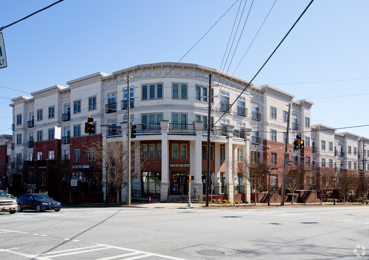
Property Record
3645 Habersham Rd Ne, Atlanta, GA 30305

NEARBY LISTINGS FOR SALE OR LEASE
Property Detail
3645 Habersham Rd Ne
Atlanta-Sandy Springs-Roswell, GA
Habersham Park
17-0098-LL-048-7
KA TREMONT APTS, OFFICES, RETAIL,
Apartment
Fulton
X
Georgia
13121C0232F
4
2023
1.68 AC
2023
Buckhead Forest
009601
Atlanta
178,264 SF
DEMOGRAPHICS near 3645 Habersham Rd Ne
1 Mile
3 Mile
5 Mile
2024 Total Population
18,385
118,995
306,661
2029 Population
19,508
122,813
313,251
Pop Growth 2024-2029
+ 6.11%
+ 3.21%
+ 2.15%
Average Age
39
39
38
2024 Total Households
10,792
61,372
151,295
HH Growth 2024-2029
+ 6.18%
+ 3.52%
+ 2.40%
Median Household Inc
$125,419
$111,645
$106,566
Avg Household Size
1.70
1.90
1.90
2024 Avg HH Vehicles
1.00
2.00
2.00
Median Home Value
$727,557
$750,478
$673,256
Median Year Built
2003
1995
1993
Nearby Places
- Restaurants
- Banks
- Shops
- Fitness
- Groceries
PUBLIC TRANSPORTATION
COMMUTER RAIL
Atlanta (Crescent - Amtrak)
DRIVE
WALK
Distance
Atlanta (Crescent - Amtrak)
6 min
4.1 mi
AIRPORT
Hartsfield - Jackson Atlanta International
DRIVE
WALK
Distance
Hartsfield - Jackson Atlanta International
27 min
17.2 mi
Freight Ports
Georgia Ports - Savannah
DRIVE
WALK
Distance
Georgia Ports - Savannah
290 min
256.5 mi
SALE & LEASE HISTORY
LISTING DATE
SALE/LEASE

Oct 19, 2018
For Lease
Feb 07, 2024
For Lease
Nearby Properties
Address
Land Use
TOTAL SIZE
Lot Size
Zoning
Address
Land Use
TOTAL SIZE
Lot Size
Zoning
2,225,385 SF
43.33 AC
C3
Address
Land Use
TOTAL SIZE
Lot Size
Zoning
1,572,131 SF
25.12 AC
RG3
Address
Land Use
TOTAL SIZE
Lot Size
Zoning
619,288 SF
3.51 AC
OI
Address
Land Use
TOTAL SIZE
Lot Size
Zoning
844,000 SF
2.33 AC
PDMU
Address
Land Use
TOTAL SIZE
Lot Size
Zoning
702,901 SF
3.72 AC
PDOC
Address
Land Use
TOTAL SIZE
Lot Size
Zoning
1,233,815 SF
2.18 AC
PDMU
Address
Land Use
TOTAL SIZE
Lot Size
Zoning
1,092,973 SF
4.11 AC
C1C
Address
Land Use
TOTAL SIZE
Lot Size
Zoning
1,006,124 SF
2.96 AC
RG4C
Address
Land Use
TOTAL SIZE
Lot Size
Zoning
1,242,520 SF
3.38 AC
PDMU
Address
Land Use
TOTAL SIZE
Lot Size
Zoning
835,636 SF
5.63 AC
PDOC
Address
Land Use
TOTAL SIZE
Lot Size
Zoning
1,021,058 SF
2.89 AC
C3
Address
Land Use
TOTAL SIZE
Lot Size
Zoning
458,822 SF
2.86 AC
RG2
Address
Land Use
TOTAL SIZE
Lot Size
Zoning
1,678,082 SF
14.72 AC
C3
Address
Land Use
TOTAL SIZE
Lot Size
Zoning
703,243 SF
1.17 AC
PDOC
Address
Land Use
TOTAL SIZE
Lot Size
Zoning
899,673 SF
2.15 AC
PDMU
Address
Land Use
TOTAL SIZE
Lot Size
Zoning
598,962 SF
4.50 AC
PDOC
Address
Land Use
TOTAL SIZE
Lot Size
Zoning
672,661 SF
1.56 AC
C3
Address
Land Use
TOTAL SIZE
Lot Size
Zoning
1,410,148 SF
9.58 AC
RG5
Address
Land Use
TOTAL SIZE
Lot Size
Zoning
188,648 SF
5.10 AC
X
Address
Land Use
TOTAL SIZE
Lot Size
Zoning
490,090 SF
2.27 AC
C3
Address
Land Use
TOTAL SIZE
Lot Size
Zoning
863,826 SF
3.79 AC
C4
Address
Land Use
TOTAL SIZE
Lot Size
Zoning
32.79 AC
R3
Address
Land Use
TOTAL SIZE
Lot Size
Zoning
386,058 SF
C3
Address
Land Use
TOTAL SIZE
Lot Size
Zoning
574,125 SF
1.96 AC
C3
Address
Land Use
TOTAL SIZE
Lot Size
Zoning
634,223 SF
4 AC
RG3
Address
Land Use
TOTAL SIZE
Lot Size
Zoning
790,055 SF
2.95 AC
C3
Address
Land Use
TOTAL SIZE
Lot Size
Zoning
469,880 SF
8.90 AC
OI
Address
Land Use
TOTAL SIZE
Lot Size
Zoning
475,848 SF
1.20 AC
C3
Address
Land Use
TOTAL SIZE
Lot Size
Zoning
1,060,239 SF
0.06 AC
C3
Address
Land Use
TOTAL SIZE
Lot Size
Zoning
632,526 SF
1.92 AC
C1
The World's #1 Commercial Real Estate Marketplace
Connect with us
© 2025 CoStar Group
The information above has been obtained from sources believed reliable. While we do not doubt its accuracy we have not verified it and make no guarantee, warranty or representation about it. It is your responsibility to independently confirm its accuracy and completeness. Any projections, opinions, assumptions, or estimates used are for example only and do not represent the current or future performance of the property. The value of this transaction to you depends on tax and other factors which should be evaluated by your tax, financial, and legal advisors. You and your advisors should conduct a careful, independent investigation of the property to determine to your satisfaction the suitability of the property for your needs.