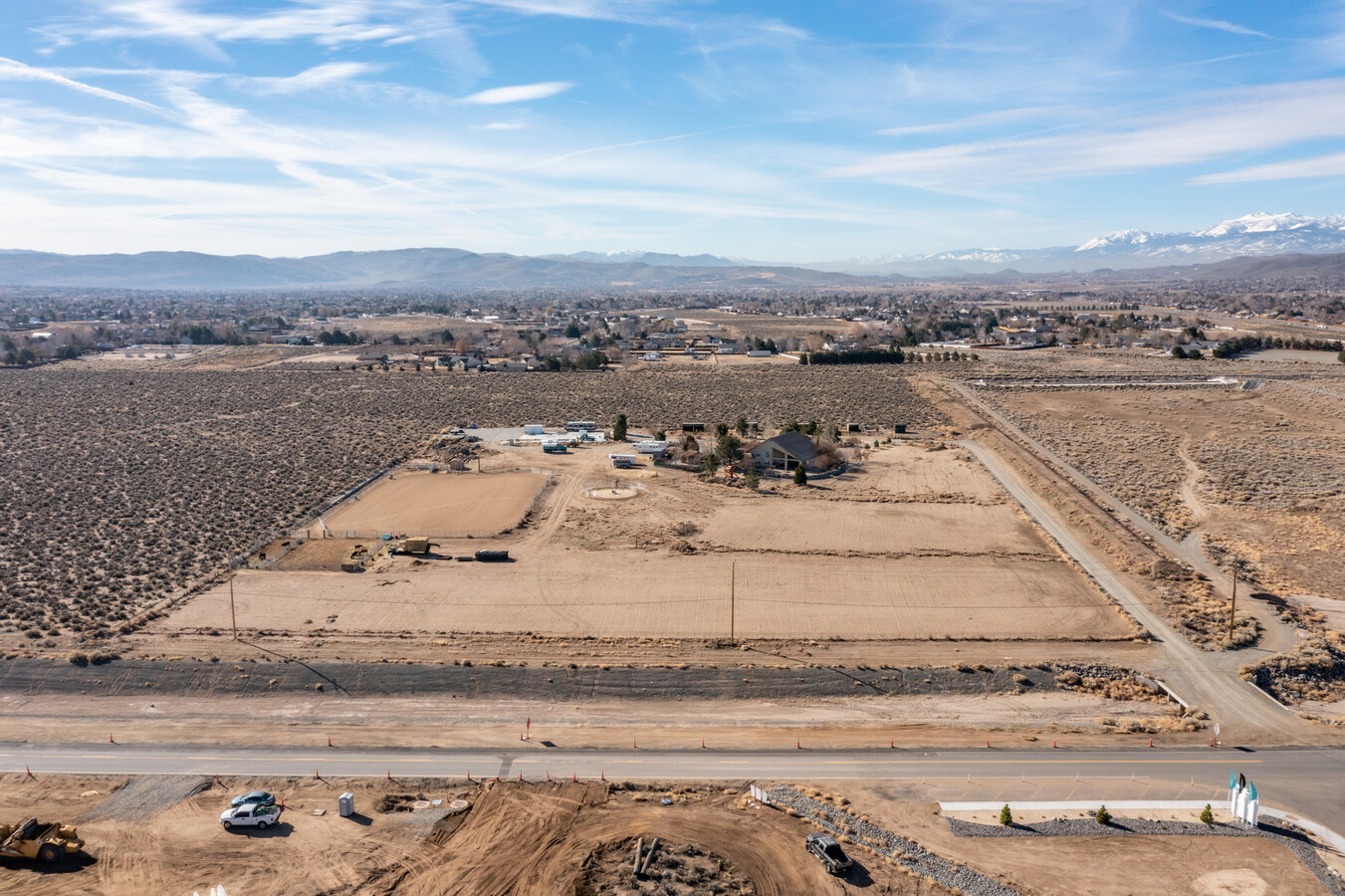
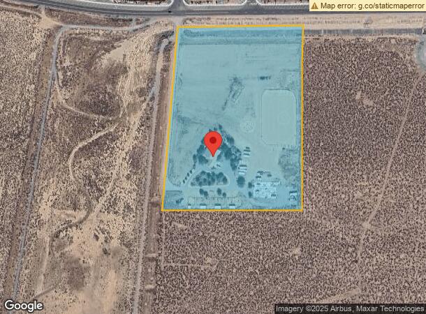
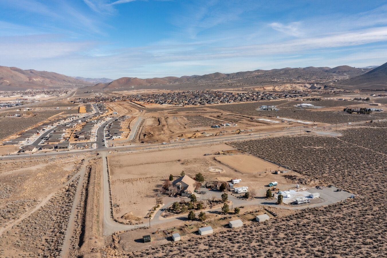
Property Record
365 Calle De La Plata, Sparks, NV 89441
NEARBY LISTINGS FOR SALE OR LEASE
Property Detail
365 Calle De La Plata
Reno, NV
_Unspecified
534-561-09
Washoe
Sfr
Nevada
AE
10.45 AC
32031C2865G
N Outlying Washoe County
2,402 SF
Reno/Sparks
DEMOGRAPHICS near 365 Calle De La Plata
1 Mile
3 Mile
5 Mile
2024 Total Population
4,157
23,657
46,663
2029 Population
4,485
25,183
49,503
Pop Growth 2024-2029
+ 7.89%
+ 6.45%
+ 6.09%
Average Age
43
43
41
2024 Total Households
1,471
8,543
16,779
HH Growth 2024-2029
+ 8.02%
+ 6.54%
+ 6.22%
Median Household Inc
$133,908
$110,993
$108,597
Avg Household Size
2.80
2.70
2.70
2024 Avg HH Vehicles
3.00
3.00
2.00
Median Home Value
$521,367
$483,531
$477,342
Median Year Built
2005
2002
2004
Nearby Places
- Restaurants
- Banks
- Shops
- Fitness
- Groceries
PUBLIC TRANSPORTATION
AIRPORT
Reno/Tahoe International
DRIVE
WALK
Distance
Reno/Tahoe International
40 min
17.5 mi
Freight Ports
Port of Stockton
DRIVE
WALK
Distance
Port of Stockton
225 min
191.8 mi
SALE & LEASE HISTORY
LISTING DATE
SALE/LEASE

Mar 10, 2022
For Sale
Apr 18, 2022
For Sale
Nearby Properties
Address
Land Use
TOTAL SIZE
Lot Size
Zoning
Address
Land Use
TOTAL SIZE
Lot Size
Zoning
349,926 SF
76.09 AC
I
Address
Land Use
TOTAL SIZE
Lot Size
Zoning
602,186 SF
66 AC
I
Address
Land Use
TOTAL SIZE
Lot Size
Zoning
289,637 SF
53.48 AC
PSP
Address
Land Use
TOTAL SIZE
Lot Size
Zoning
238,764 SF
7 AC
NC
Address
Land Use
TOTAL SIZE
Lot Size
Zoning
160,562 SF
17.10 AC
I
Address
Land Use
TOTAL SIZE
Lot Size
Zoning
464,360 SF
36.05 AC
I
Address
Land Use
TOTAL SIZE
Lot Size
Zoning
419,040 SF
20.67 AC
I
Address
Land Use
TOTAL SIZE
Lot Size
Zoning
408,965 SF
20.44 AC
I
Address
Land Use
TOTAL SIZE
Lot Size
Zoning
412,614 SF
25.93 AC
I
Address
Land Use
TOTAL SIZE
Lot Size
Zoning
195,000 SF
11.18 AC
I
Address
Land Use
TOTAL SIZE
Lot Size
Zoning
411,100 SF
19.44 AC
I
Address
Land Use
TOTAL SIZE
Lot Size
Zoning
230,897 SF
11.52 AC
NUD
Address
Land Use
TOTAL SIZE
Lot Size
Zoning
408,660 SF
20.15 AC
I
Address
Land Use
TOTAL SIZE
Lot Size
Zoning
144,669 SF
20 AC
I
Address
Land Use
TOTAL SIZE
Lot Size
Zoning
122,223 SF
20 AC
PSP
Address
Land Use
TOTAL SIZE
Lot Size
Zoning
185,000 SF
10 AC
I
Address
Land Use
TOTAL SIZE
Lot Size
Zoning
55,704 SF
14.03 AC
MDS 1% / O
Address
Land Use
TOTAL SIZE
Lot Size
Zoning
146,900 SF
10 AC
I
Address
Land Use
TOTAL SIZE
Lot Size
Zoning
106,387 SF
10.45 AC
I
Address
Land Use
TOTAL SIZE
Lot Size
Zoning
209,527 SF
5.28 AC
NC
Address
Land Use
TOTAL SIZE
Lot Size
Zoning
152,640 SF
24.48 AC
I
Address
Land Use
TOTAL SIZE
Lot Size
Zoning
144,000 SF
9.90 AC
I
Address
Land Use
TOTAL SIZE
Lot Size
Zoning
81,122 SF
8.44 AC
NUD
Address
Land Use
TOTAL SIZE
Lot Size
Zoning
173,680 SF
11.23 AC
I
Address
Land Use
TOTAL SIZE
Lot Size
Zoning
61,048 SF
13.10 AC
PSP
Address
Land Use
TOTAL SIZE
Lot Size
Zoning
54,237 SF
8 AC
PD
Address
Land Use
TOTAL SIZE
Lot Size
Zoning
13,372.63 AC
OS 45% / G
Address
Land Use
TOTAL SIZE
Lot Size
Zoning
102,137 SF
8.46 AC
NC
Address
Land Use
TOTAL SIZE
Lot Size
Zoning
55,889 SF
9.87 AC
PSP
Address
Land Use
TOTAL SIZE
Lot Size
Zoning
52,128 SF
6.70 AC
GC
The World's #1 Commercial Real Estate Marketplace
Connect with us
© 2025 CoStar Group
The information above has been obtained from sources believed reliable. While we do not doubt its accuracy we have not verified it and make no guarantee, warranty or representation about it. It is your responsibility to independently confirm its accuracy and completeness. Any projections, opinions, assumptions, or estimates used are for example only and do not represent the current or future performance of the property. The value of this transaction to you depends on tax and other factors which should be evaluated by your tax, financial, and legal advisors. You and your advisors should conduct a careful, independent investigation of the property to determine to your satisfaction the suitability of the property for your needs.