Property Record
3650 Nm Hwy 528 Ne, Rio Rancho, NM 87144
NEARBY LISTINGS FOR SALE OR LEASE
-
-
View all Rio Rancho listings for sale on LoopNet.com
Property Detail
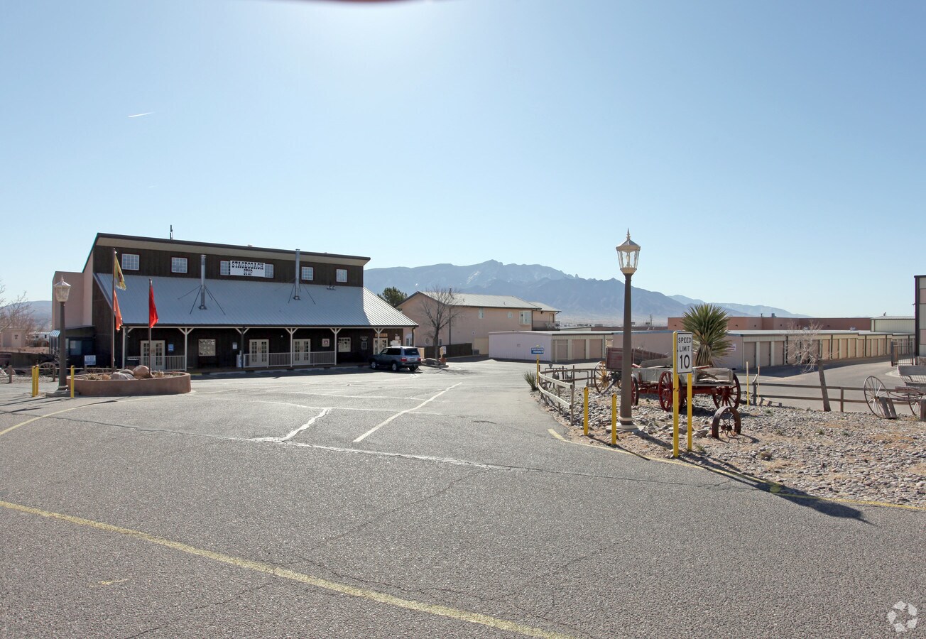
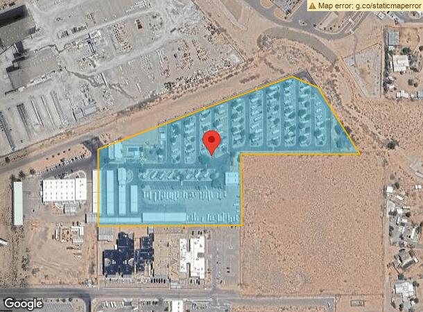
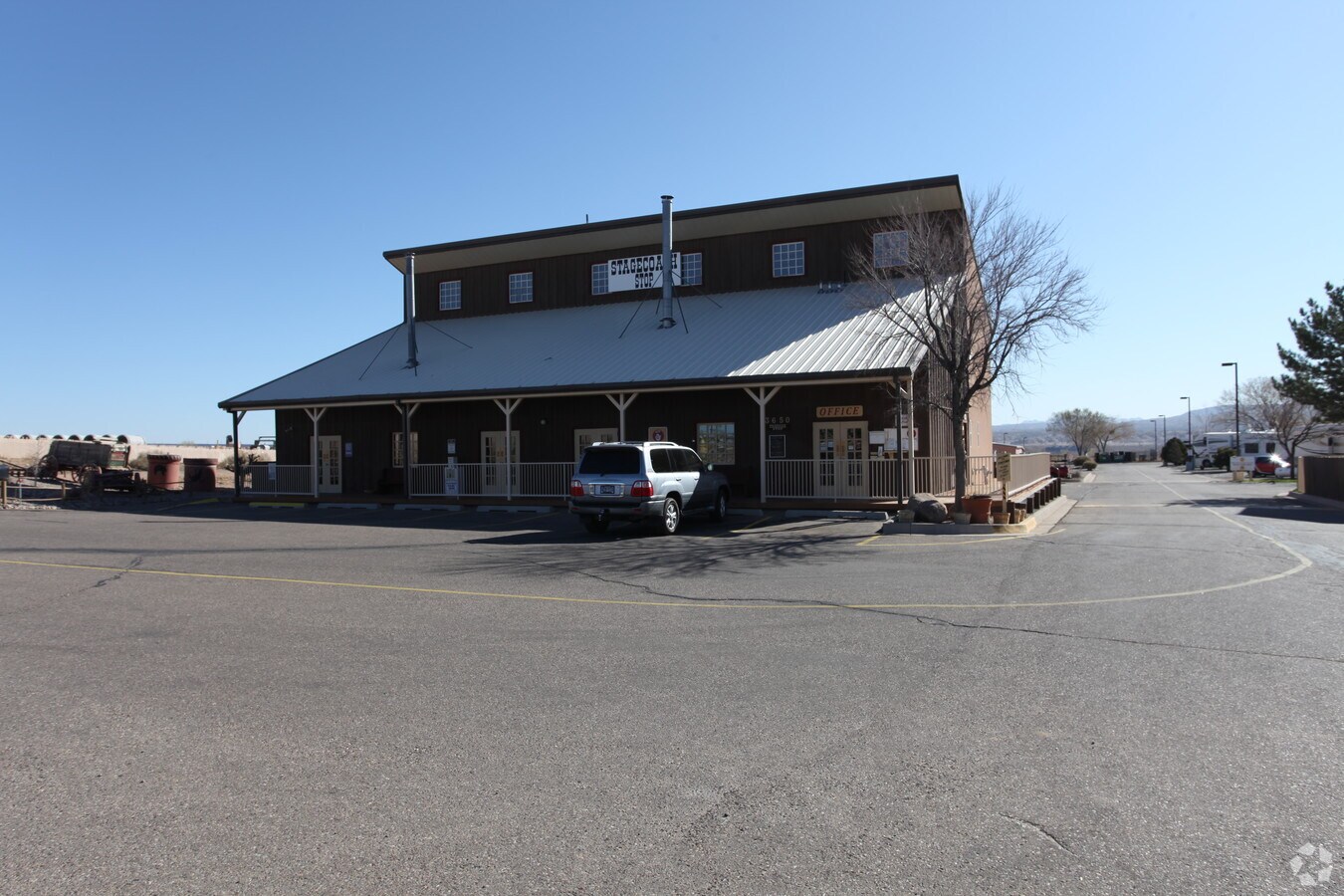
3650 Nm Hwy 528 Ne
Albuquerque, NM
Industrial Park
1-018-074-448-148
LEGAL: S: 25 T: 13N R: 3E SUBD: INDUSTRIAL PARK BLOCK: A LOT: 7A1 UNIT: 20
Recreationalacreage
Sandoval
X
New Mexico
35043C1904D
7a1
2023
10.43 AC
2023
Rio Rancho
010718
Albuquerque
31,027 SF
DEMOGRAPHICS near 3650 Nm Hwy 528 Ne
1 Mile
3 Mile
5 Mile
2024 Total Population
4,504
28,731
39,679
2029 Population
4,893
31,287
43,183
Pop Growth 2024-2029
+ 8.64%
+ 8.90%
+ 8.83%
Average Age
46
42
43
2024 Total Households
1,864
10,763
14,976
HH Growth 2024-2029
+ 8.42%
+ 8.87%
+ 8.81%
Median Household Inc
$100,628
$81,459
$86,285
Avg Household Size
2.40
2.60
2.60
2024 Avg HH Vehicles
2.00
2.00
2.00
Median Home Value
$340,707
$278,111
$293,817
Median Year Built
2009
2000
2000
Nearby Places
- Restaurants
- Banks
- Shops
- Fitness
- Groceries
PUBLIC TRANSPORTATION
COMMUTER RAIL
Sandoval County-Us 550 (Rail Runner Express - New Mexico Rail Runner Express)
DRIVE
WALK
Distance
Sandoval County-Us 550 (Rail Runner Express - New Mexico Rail Runner Express)
7 min
3.3 mi
Downtown Bernalillo (Rail Runner Express - New Mexico Rail Runner Express)
DRIVE
WALK
Distance
Downtown Bernalillo (Rail Runner Express - New Mexico Rail Runner Express)
9 min
3.7 mi
AIRPORT
Albuquerque International Sunport
DRIVE
WALK
Distance
Albuquerque International Sunport
47 min
26.0 mi
Freight Ports
Tulsa Port Of Catoosa
DRIVE
WALK
Distance
Tulsa Port Of Catoosa
711 min
677.3 mi
Nearby Properties
Address
Land Use
TOTAL SIZE
Lot Size
Zoning
Address
Land Use
TOTAL SIZE
Lot Size
Zoning
146,718 SF
55.81 AC
Address
Land Use
TOTAL SIZE
Lot Size
Zoning
Address
Land Use
TOTAL SIZE
Lot Size
Zoning
222,104 SF
20.71 AC
Address
Land Use
TOTAL SIZE
Lot Size
Zoning
94,863 SF
12.12 AC
Address
Land Use
TOTAL SIZE
Lot Size
Zoning
126,581 SF
10.98 AC
Address
Land Use
TOTAL SIZE
Lot Size
Zoning
106,010 SF
9.78 AC
Address
Land Use
TOTAL SIZE
Lot Size
Zoning
151,857 SF
8.49 AC
Address
Land Use
TOTAL SIZE
Lot Size
Zoning
130,230 SF
21.34 AC
Address
Land Use
TOTAL SIZE
Lot Size
Zoning
77,044 SF
14.02 AC
Address
Land Use
TOTAL SIZE
Lot Size
Zoning
85,513 SF
24.88 AC
Address
Land Use
TOTAL SIZE
Lot Size
Zoning
86,089 SF
14.29 AC
Address
Land Use
TOTAL SIZE
Lot Size
Zoning
59,329 SF
5.40 AC
Address
Land Use
TOTAL SIZE
Lot Size
Zoning
151,857 SF
9.19 AC
Address
Land Use
TOTAL SIZE
Lot Size
Zoning
58,121 SF
4.35 AC
Address
Land Use
TOTAL SIZE
Lot Size
Zoning
153,238 SF
11.30 AC
Address
Land Use
TOTAL SIZE
Lot Size
Zoning
55,439 SF
5.28 AC
Address
Land Use
TOTAL SIZE
Lot Size
Zoning
265,897 SF
62.04 AC
Address
Land Use
TOTAL SIZE
Lot Size
Zoning
2,238 SF
76.37 AC
Address
Land Use
TOTAL SIZE
Lot Size
Zoning
118,218 SF
4.52 AC
Address
Land Use
TOTAL SIZE
Lot Size
Zoning
102,963 SF
12.99 AC
Address
Land Use
TOTAL SIZE
Lot Size
Zoning
15,141 SF
1.72 AC
Address
Land Use
TOTAL SIZE
Lot Size
Zoning
14,476 SF
1.58 AC
Address
Land Use
TOTAL SIZE
Lot Size
Zoning
36,830 SF
3.94 AC
Address
Land Use
TOTAL SIZE
Lot Size
Zoning
17,198 SF
6.05 AC
Address
Land Use
TOTAL SIZE
Lot Size
Zoning
24,298 SF
3.01 AC
Address
Land Use
TOTAL SIZE
Lot Size
Zoning
960 SF
25.82 AC
Address
Land Use
TOTAL SIZE
Lot Size
Zoning
62,274 SF
11.28 AC
Address
Land Use
TOTAL SIZE
Lot Size
Zoning
63,444 SF
6.82 AC
Address
Land Use
TOTAL SIZE
Lot Size
Zoning
70,736 SF
3.79 AC
The World's #1 Commercial Real Estate Marketplace
Connect with us
© 2025 CoStar Group
The information above has been obtained from sources believed reliable. While we do not doubt its accuracy we have not verified it and make no guarantee, warranty or representation about it. It is your responsibility to independently confirm its accuracy and completeness. Any projections, opinions, assumptions, or estimates used are for example only and do not represent the current or future performance of the property. The value of this transaction to you depends on tax and other factors which should be evaluated by your tax, financial, and legal advisors. You and your advisors should conduct a careful, independent investigation of the property to determine to your satisfaction the suitability of the property for your needs.