Property Record
3678 N 700 W, Greenfield, IN 46140
NEARBY LISTINGS FOR SALE OR LEASE
Property Detail
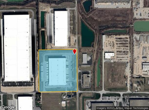
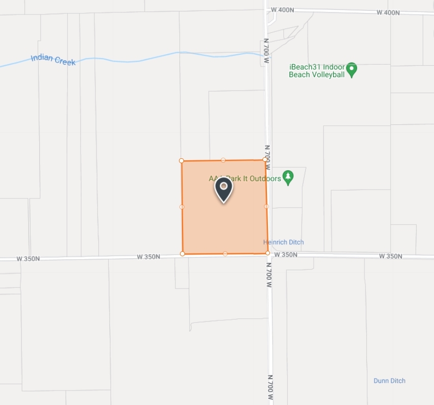
3678 N 700 W
30-05-14-100-007.000-006
Alta Nsps Land Title Survey 70 Connect I
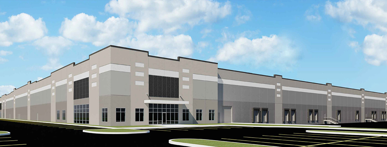
Warehouse
ED NE 14-16-5 22.882AC
X
Hancock
18059C0108E
Indiana
2023
22.88 AC
2023
Hancock County
410901
Indianapolis
2,232 SF
Indianapolis-Carmel-Anderson, IN
DEMOGRAPHICS near 3678 N 700 W
1 Mile
3 Mile
5 Mile
2024 Total Population
299
32,395
110,740
2029 Population
327
32,752
111,422
Pop Growth 2024-2029
+ 9.36%
+ 1.10%
+ 0.62%
Average Age
40
35
36
2024 Total Households
106
11,442
41,410
HH Growth 2024-2029
+ 10.38%
+ 1.14%
+ 0.64%
Median Household Inc
$85,833
$67,899
$62,814
Avg Household Size
2.80
2.80
2.60
2024 Avg HH Vehicles
3.00
2.00
2.00
Median Home Value
$208,889
$171,867
$175,217
Median Year Built
1989
1995
1987
Nearby Places
- Restaurants
- Banks
- Shops
- Fitness
- Groceries
PUBLIC TRANSPORTATION
AIRPORT
Indianapolis International
DRIVE
WALK
Distance
Indianapolis International
50 min
30.7 mi
Freight Ports
Port of Toledo
DRIVE
WALK
Distance
Port of Toledo
259 min
213.4 mi
SALE & LEASE HISTORY
LISTING DATE
SALE/LEASE

Jan 13, 2020
For Lease
Nearby Properties
Address
Land Use
TOTAL SIZE
Lot Size
Zoning
Address
Land Use
TOTAL SIZE
Lot Size
Zoning
2,896,370 SF
54.48 AC
Address
Land Use
TOTAL SIZE
Lot Size
Zoning
659,178 SF
84.62 AC
Address
Land Use
TOTAL SIZE
Lot Size
Zoning
1,720 SF
87.91 AC
Address
Land Use
TOTAL SIZE
Lot Size
Zoning
75.21 AC
Address
Land Use
TOTAL SIZE
Lot Size
Zoning
986,112 SF
41.42 AC
Address
Land Use
TOTAL SIZE
Lot Size
Zoning
47.49 AC
Address
Land Use
TOTAL SIZE
Lot Size
Zoning
41.23 AC
Address
Land Use
TOTAL SIZE
Lot Size
Zoning
13.89 AC
Address
Land Use
TOTAL SIZE
Lot Size
Zoning
2,056 SF
76.90 AC
Address
Land Use
TOTAL SIZE
Lot Size
Zoning
2,398 SF
64.58 AC
Address
Land Use
TOTAL SIZE
Lot Size
Zoning
416,714 SF
47.60 AC
Address
Land Use
TOTAL SIZE
Lot Size
Zoning
540,000 SF
33.78 AC
Address
Land Use
TOTAL SIZE
Lot Size
Zoning
630,000 SF
30.03 AC
Address
Land Use
TOTAL SIZE
Lot Size
Zoning
499,913 SF
38.88 AC
Address
Land Use
TOTAL SIZE
Lot Size
Zoning
439,040 SF
31.70 AC
Address
Land Use
TOTAL SIZE
Lot Size
Zoning
2,620 SF
32.36 AC
Address
Land Use
TOTAL SIZE
Lot Size
Zoning
93,745 SF
70 AC
Address
Land Use
TOTAL SIZE
Lot Size
Zoning
29.76 AC
Address
Land Use
TOTAL SIZE
Lot Size
Zoning
455,424 SF
33.96 AC
Address
Land Use
TOTAL SIZE
Lot Size
Zoning
97.06 AC
Address
Land Use
TOTAL SIZE
Lot Size
Zoning
200,806 SF
26.29 AC
Address
Land Use
TOTAL SIZE
Lot Size
Zoning
423,000 SF
30.62 AC
Address
Land Use
TOTAL SIZE
Lot Size
Zoning
74,311 SF
67.69 AC
Address
Land Use
TOTAL SIZE
Lot Size
Zoning
368,075 SF
25.49 AC
Address
Land Use
TOTAL SIZE
Lot Size
Zoning
27.17 AC
Address
Land Use
TOTAL SIZE
Lot Size
Zoning
250,000 SF
20.86 AC
Address
Land Use
TOTAL SIZE
Lot Size
Zoning
216,427 SF
19.62 AC
Address
Land Use
TOTAL SIZE
Lot Size
Zoning
19.12 AC
Address
Land Use
TOTAL SIZE
Lot Size
Zoning
245,200 SF
12.08 AC
The World's #1 Commercial Real Estate Marketplace
Connect with us
© 2025 CoStar Group
The information above has been obtained from sources believed reliable. While we do not doubt its accuracy we have not verified it and make no guarantee, warranty or representation about it. It is your responsibility to independently confirm its accuracy and completeness. Any projections, opinions, assumptions, or estimates used are for example only and do not represent the current or future performance of the property. The value of this transaction to you depends on tax and other factors which should be evaluated by your tax, financial, and legal advisors. You and your advisors should conduct a careful, independent investigation of the property to determine to your satisfaction the suitability of the property for your needs.