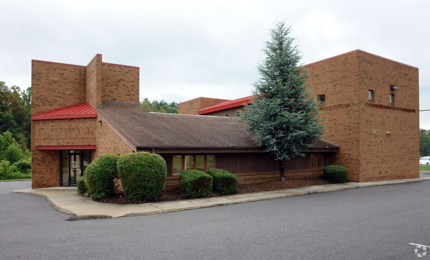
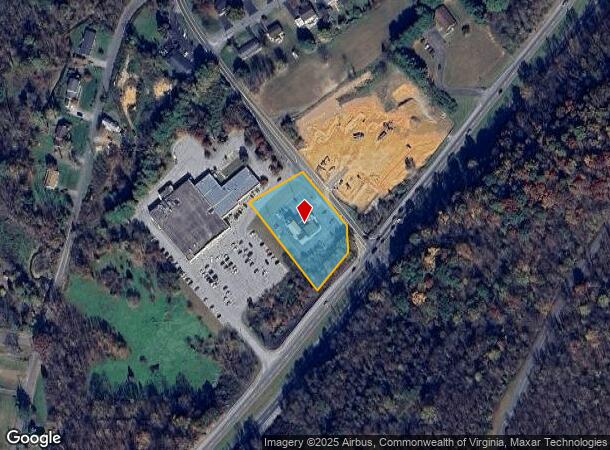
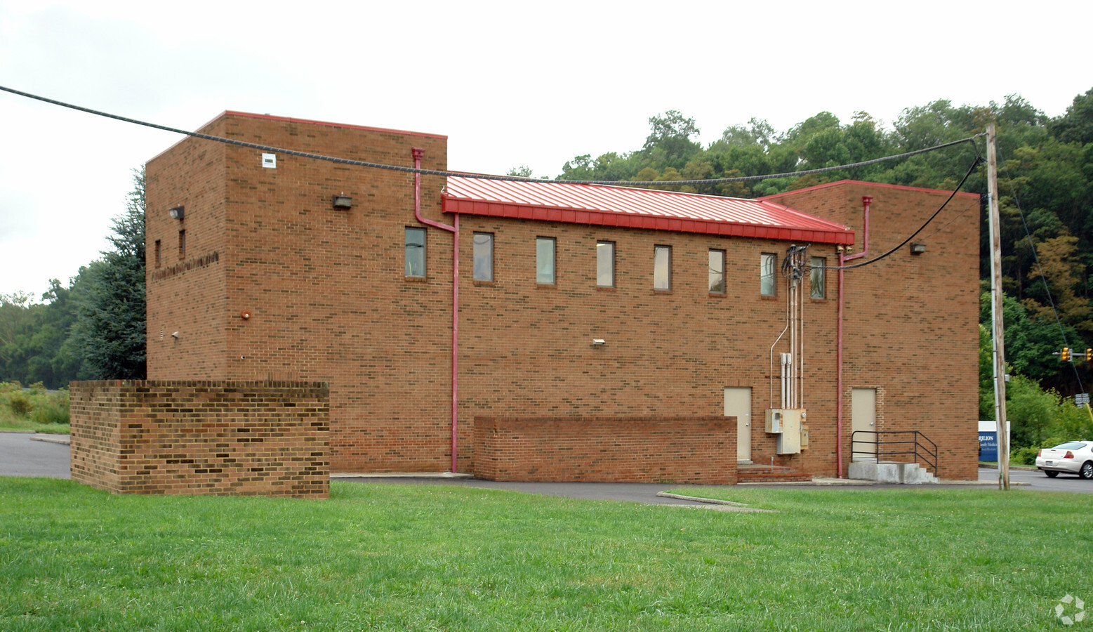
Property Record
37 Laymantown Rd, Troutville, VA 24175
NEARBY LISTINGS FOR SALE OR LEASE
-
-
View all Troutville listings for sale on LoopNet.com
Property Detail
37 Laymantown Rd
108-101A
GLADE CR
Commercialnec
Botetourt
X
Virginia
51023C0480C
1.09 AC
2024
Botetourt County
2024
Roanoke
040501
Roanoke, VA
DEMOGRAPHICS near 37 Laymantown Rd
1 Mile
3 Mile
5 Mile
2024 Total Population
1,691
11,577
32,475
2029 Population
1,743
11,852
32,858
Pop Growth 2024-2029
+ 3.08%
+ 2.38%
+ 1.18%
Average Age
44
44
43
2024 Total Households
654
4,576
13,153
HH Growth 2024-2029
+ 3.06%
+ 2.27%
+ 1.06%
Median Household Inc
$82,857
$85,375
$78,058
Avg Household Size
2.50
2.50
2.40
2024 Avg HH Vehicles
2.00
2.00
2.00
Median Home Value
$274,999
$277,893
$256,601
Median Year Built
1984
1989
1984
Nearby Places
- Restaurants
- Banks
- Shops
- Fitness
- Groceries
PUBLIC TRANSPORTATION
COMMUTER RAIL
Roanoke (Northeast Regional - Amtrak)
DRIVE
WALK
Distance
Roanoke (Northeast Regional - Amtrak)
15 min
8.1 mi
AIRPORT
Roanoke/Blacksburg Regional (Woodrum Field)
DRIVE
WALK
Distance
Roanoke/Blacksburg Regional (Woodrum Field)
21 min
11.2 mi
Freight Ports
Virginia Port Authority - Richmond
DRIVE
WALK
Distance
Virginia Port Authority - Richmond
204 min
153.9 mi
Nearby Properties
Address
Land Use
TOTAL SIZE
Lot Size
Zoning
Address
Land Use
TOTAL SIZE
Lot Size
Zoning
1,991 SF
26.77 AC
R-1
Address
Land Use
TOTAL SIZE
Lot Size
Zoning
24,126 SF
20.11 AC
R3
Address
Land Use
TOTAL SIZE
Lot Size
Zoning
40.12 AC
M-1
Address
Land Use
TOTAL SIZE
Lot Size
Zoning
57,985 SF
12.66 AC
R1
Address
Land Use
TOTAL SIZE
Lot Size
Zoning
391,945 SF
25 AC
I1C
Address
Land Use
TOTAL SIZE
Lot Size
Zoning
183,960 SF
27.63 AC
C2
Address
Land Use
TOTAL SIZE
Lot Size
Zoning
69,212 SF
19.65 AC
R3S
Address
Land Use
TOTAL SIZE
Lot Size
Zoning
134,019 SF
14.84 AC
C2
Address
Land Use
TOTAL SIZE
Lot Size
Zoning
9.14 AC
M-2
Address
Land Use
TOTAL SIZE
Lot Size
Zoning
4 AC
B-2
Address
Land Use
TOTAL SIZE
Lot Size
Zoning
8.50 AC
A1
Address
Land Use
TOTAL SIZE
Lot Size
Zoning
5.44 AC
R-1
Address
Land Use
TOTAL SIZE
Lot Size
Zoning
13.39 AC
M-2
Address
Land Use
TOTAL SIZE
Lot Size
Zoning
75,080 SF
16.96 AC
M-2
Address
Land Use
TOTAL SIZE
Lot Size
Zoning
12.87 AC
SCD
Address
Land Use
TOTAL SIZE
Lot Size
Zoning
4,600 SF
83.17 AC
4
Address
Land Use
TOTAL SIZE
Lot Size
Zoning
6.66 AC
M-1
Address
Land Use
TOTAL SIZE
Lot Size
Zoning
13.50 AC
M-2
Address
Land Use
TOTAL SIZE
Lot Size
Zoning
26,386 SF
4.28 AC
R2
Address
Land Use
TOTAL SIZE
Lot Size
Zoning
9.95 AC
A1
Address
Land Use
TOTAL SIZE
Lot Size
Zoning
11,348 SF
5.28 AC
C1
Address
Land Use
TOTAL SIZE
Lot Size
Zoning
30.08 AC
1
Address
Land Use
TOTAL SIZE
Lot Size
Zoning
3.24 AC
B-1
Address
Land Use
TOTAL SIZE
Lot Size
Zoning
1.96 AC
B-2
Address
Land Use
TOTAL SIZE
Lot Size
Zoning
5,046 SF
1.44 AC
C2
Address
Land Use
TOTAL SIZE
Lot Size
Zoning
1.54 AC
B-2
Address
Land Use
TOTAL SIZE
Lot Size
Zoning
0.80 AC
B-2
Address
Land Use
TOTAL SIZE
Lot Size
Zoning
8,112 SF
1.49 AC
B-2
Address
Land Use
TOTAL SIZE
Lot Size
Zoning
14,962 SF
2.53 AC
Address
Land Use
TOTAL SIZE
Lot Size
Zoning
6,264 SF
1.26 AC
C2
The World's #1 Commercial Real Estate Marketplace
Connect with us
© 2025 CoStar Group
The information above has been obtained from sources believed reliable. While we do not doubt its accuracy we have not verified it and make no guarantee, warranty or representation about it. It is your responsibility to independently confirm its accuracy and completeness. Any projections, opinions, assumptions, or estimates used are for example only and do not represent the current or future performance of the property. The value of this transaction to you depends on tax and other factors which should be evaluated by your tax, financial, and legal advisors. You and your advisors should conduct a careful, independent investigation of the property to determine to your satisfaction the suitability of the property for your needs.