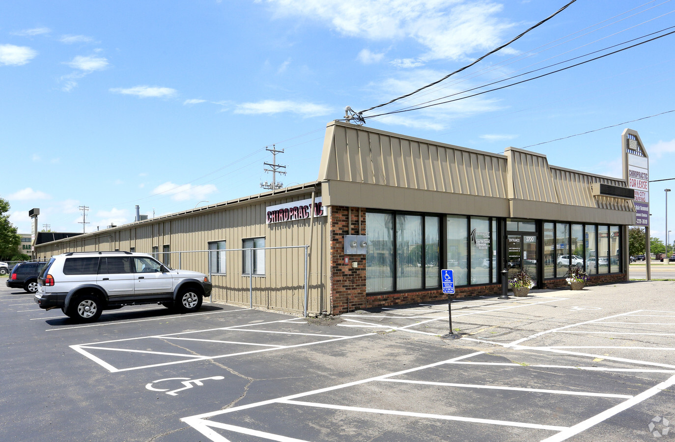
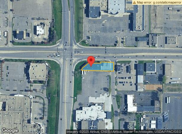
Property Record
3700 W Division St, Saint Cloud, MN 56301
Current Lease Availabilities
NEARBY LISTINGS FOR SALE OR LEASE
Property Detail
3700 W Division St
82.44014.0000
Metes And Bounds Desc.
Multifamilydwelling
.64 A E344' OF N4S2SW4NE4 LESS S28' AND LESS PART FOR HWY SECTION 16 TOWNSHIP 124 RANGE 028 SECTION 16 TOWNSHIP 124 RANGE 028
X
Stearns
27145C0640E
Minnesota
2024
0.46 AC
2024
Stearns County
000601
Minneapolis/St Paul
9,420 SF
St. Cloud, MN
DEMOGRAPHICS near 3700 W Division St
1 Mile
3 Mile
5 Mile
2024 Total Population
9,611
63,716
108,141
2029 Population
10,001
65,927
111,789
Pop Growth 2024-2029
+ 4.06%
+ 3.47%
+ 3.37%
Average Age
38
37
37
2024 Total Households
3,994
25,267
43,213
HH Growth 2024-2029
+ 4.16%
+ 3.64%
+ 3.42%
Median Household Inc
$48,378
$53,393
$55,290
Avg Household Size
2.30
2.30
2.30
2024 Avg HH Vehicles
2.00
2.00
2.00
Median Home Value
$165,349
$183,067
$194,495
Median Year Built
1981
1981
1985
Nearby Places
- Restaurants
- Banks
- Shops
- Fitness
- Groceries
PUBLIC TRANSPORTATION
COMMUTER RAIL
St. Cloud Amtrak Station (Empire Builder - Amtrak)
DRIVE
WALK
Distance
St. Cloud Amtrak Station (Empire Builder - Amtrak)
8 min
3.4 mi
Freight Ports
Port Milwaukee
DRIVE
WALK
Distance
Port Milwaukee
449 min
404.8 mi
Nearby Properties
Address
Land Use
TOTAL SIZE
Lot Size
Zoning
Address
Land Use
TOTAL SIZE
Lot Size
Zoning
16.60 AC
MD
Address
Land Use
TOTAL SIZE
Lot Size
Zoning
38.98 AC
Address
Land Use
TOTAL SIZE
Lot Size
Zoning
113,316 SF
31.99 AC
Address
Land Use
TOTAL SIZE
Lot Size
Zoning
52,983 SF
22 AC
Address
Land Use
TOTAL SIZE
Lot Size
Zoning
281,127 SF
135,381 AC
PUD95
Address
Land Use
TOTAL SIZE
Lot Size
Zoning
70,971 SF
11.40 AC
PUD57
Address
Land Use
TOTAL SIZE
Lot Size
Zoning
125,278 SF
11.01 AC
C5
Address
Land Use
TOTAL SIZE
Lot Size
Zoning
184,285 SF
26.79 AC
Address
Land Use
TOTAL SIZE
Lot Size
Zoning
115,298 SF
8.50 AC
R5
Address
Land Use
TOTAL SIZE
Lot Size
Zoning
233,354 SF
7.30 AC
R5
Address
Land Use
TOTAL SIZE
Lot Size
Zoning
113,268 SF
12 AC
PUD32
Address
Land Use
TOTAL SIZE
Lot Size
Zoning
5.34 AC
Address
Land Use
TOTAL SIZE
Lot Size
Zoning
146,285 SF
38.20 AC
Address
Land Use
TOTAL SIZE
Lot Size
Zoning
183,627 SF
3 AC
R3
Address
Land Use
TOTAL SIZE
Lot Size
Zoning
25,608 SF
6.96 AC
R5
Address
Land Use
TOTAL SIZE
Lot Size
Zoning
0.28 AC
I2
Address
Land Use
TOTAL SIZE
Lot Size
Zoning
36,393 SF
6.28 AC
Address
Land Use
TOTAL SIZE
Lot Size
Zoning
100,024 SF
0.47 AC
Address
Land Use
TOTAL SIZE
Lot Size
Zoning
83,317 SF
6.43 AC
C5
Address
Land Use
TOTAL SIZE
Lot Size
Zoning
44,223 SF
12.32 AC
Address
Land Use
TOTAL SIZE
Lot Size
Zoning
112,300 SF
2.27 AC
R3
Address
Land Use
TOTAL SIZE
Lot Size
Zoning
197,115 SF
18.27 AC
Address
Land Use
TOTAL SIZE
Lot Size
Zoning
165,878 SF
11.16 AC
PUD56
Address
Land Use
TOTAL SIZE
Lot Size
Zoning
43,302 SF
11.34 AC
Address
Land Use
TOTAL SIZE
Lot Size
Zoning
11,700 SF
143.98 AC
Address
Land Use
TOTAL SIZE
Lot Size
Zoning
18,554 SF
8.41 AC
Address
Land Use
TOTAL SIZE
Lot Size
Zoning
7.70 AC
Address
Land Use
TOTAL SIZE
Lot Size
Zoning
32,074 SF
7.20 AC
PUD50
Address
Land Use
TOTAL SIZE
Lot Size
Zoning
22,425 SF
11.08 AC
Address
Land Use
TOTAL SIZE
Lot Size
Zoning
9,448 SF
5.10 AC
The World's #1 Commercial Real Estate Marketplace
Connect with us
© 2025 CoStar Group
The information above has been obtained from sources believed reliable. While we do not doubt its accuracy we have not verified it and make no guarantee, warranty or representation about it. It is your responsibility to independently confirm its accuracy and completeness. Any projections, opinions, assumptions, or estimates used are for example only and do not represent the current or future performance of the property. The value of this transaction to you depends on tax and other factors which should be evaluated by your tax, financial, and legal advisors. You and your advisors should conduct a careful, independent investigation of the property to determine to your satisfaction the suitability of the property for your needs.