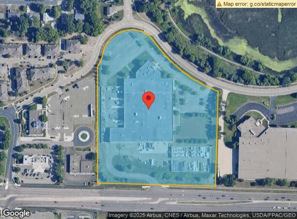
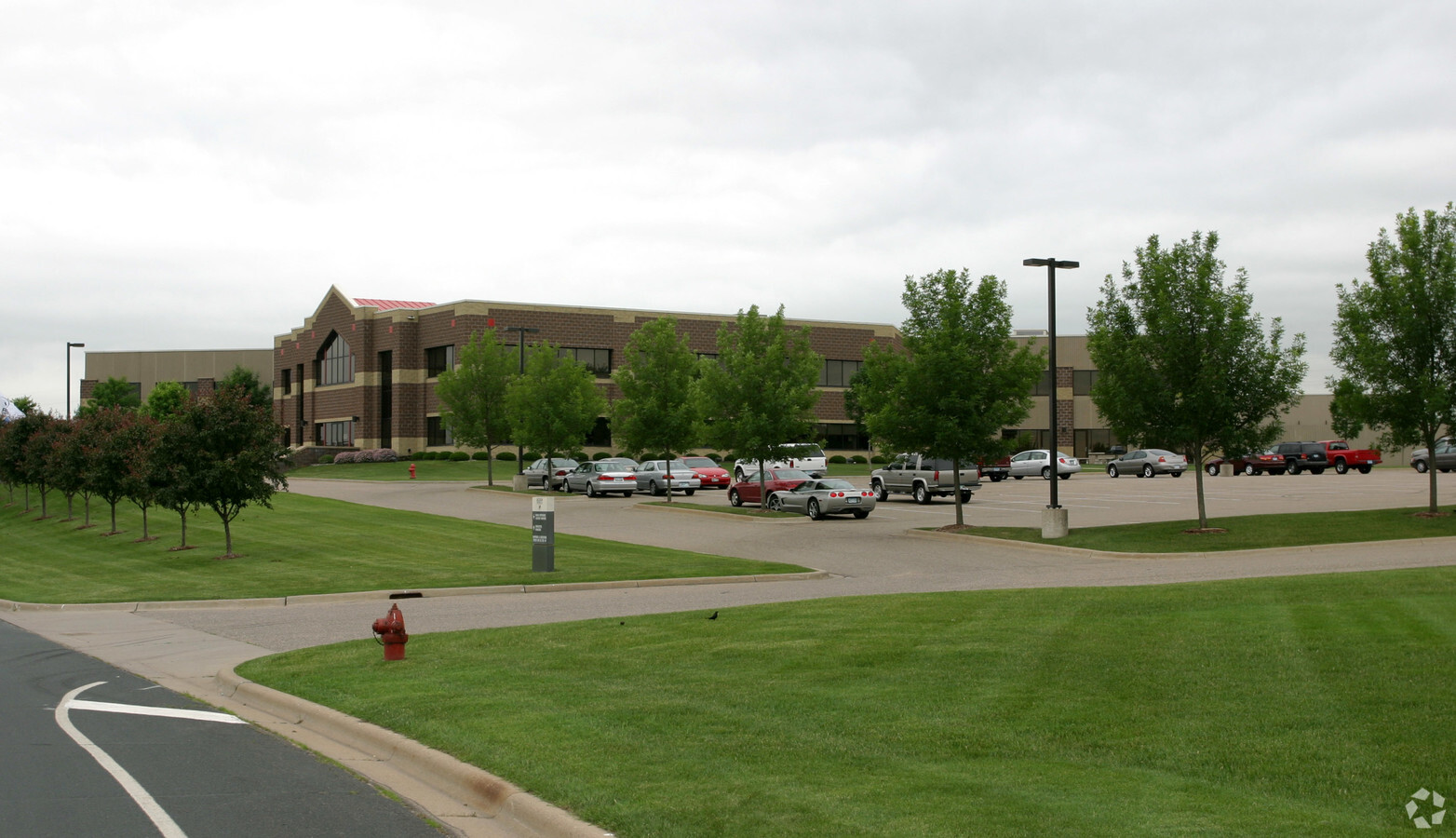
Property Record
3700 W Preserve Blvd, Burnsville, MN 55337

NEARBY LISTINGS FOR SALE OR LEASE
Property Detail
3700 W Preserve Blvd
Minneapolis-St. Paul-Bloomington, MN-WI
Drd Rupp Plaza 2Nd Addition
02-20451-02-010
DRD RUPP PLAZA 2ND ADDITION 1 2
Industrialgeneral
Dakota
X
Minnesota
27037C0177E
10
2023
11.63 AC
2023
South Central
060709
Minneapolis/St Paul
141,600 SF
DEMOGRAPHICS near 3700 W Preserve Blvd
1 Mile
3 Mile
5 Mile
2024 Total Population
10,257
61,871
151,057
2029 Population
10,651
64,211
155,428
Pop Growth 2024-2029
+ 3.84%
+ 3.78%
+ 2.89%
Average Age
37
38
40
2024 Total Households
3,339
22,988
56,822
HH Growth 2024-2029
+ 3.98%
+ 3.78%
+ 2.84%
Median Household Inc
$99,358
$93,433
$98,790
Avg Household Size
3.00
2.60
2.60
2024 Avg HH Vehicles
2.00
2.00
2.00
Median Home Value
$325,158
$333,096
$346,724
Median Year Built
1987
1988
1985
Nearby Places
- Restaurants
- Banks
- Shops
- Fitness
- Groceries
PUBLIC TRANSPORTATION
AIRPORT
Minneapolis-St Paul International/Wold-Chamberlain
DRIVE
WALK
Distance
Minneapolis-St Paul International/Wold-Chamberlain
24 min
15.8 mi
Freight Ports
Port Milwaukee
DRIVE
WALK
Distance
Port Milwaukee
386 min
348.3 mi
Nearby Properties
Address
Land Use
TOTAL SIZE
Lot Size
Zoning
Address
Land Use
TOTAL SIZE
Lot Size
Zoning
378,396 SF
20.25 AC
Address
Land Use
TOTAL SIZE
Lot Size
Zoning
454,738 SF
106.74 AC
Address
Land Use
TOTAL SIZE
Lot Size
Zoning
184,747 SF
8.44 AC
Address
Land Use
TOTAL SIZE
Lot Size
Zoning
419,750 SF
13.83 AC
Address
Land Use
TOTAL SIZE
Lot Size
Zoning
276,290 SF
7.44 AC
Address
Land Use
TOTAL SIZE
Lot Size
Zoning
10.57 AC
Address
Land Use
TOTAL SIZE
Lot Size
Zoning
265,406 SF
26.78 AC
Address
Land Use
TOTAL SIZE
Lot Size
Zoning
239,047 SF
9.14 AC
Address
Land Use
TOTAL SIZE
Lot Size
Zoning
216,700 SF
43.17 AC
Address
Land Use
TOTAL SIZE
Lot Size
Zoning
Address
Land Use
TOTAL SIZE
Lot Size
Zoning
136,535 SF
4.99 AC
Address
Land Use
TOTAL SIZE
Lot Size
Zoning
120,090 SF
3.16 AC
Address
Land Use
TOTAL SIZE
Lot Size
Zoning
276,392 SF
6.55 AC
Address
Land Use
TOTAL SIZE
Lot Size
Zoning
419,750 SF
10.86 AC
Address
Land Use
TOTAL SIZE
Lot Size
Zoning
150,867 SF
100.29 AC
Address
Land Use
TOTAL SIZE
Lot Size
Zoning
245,291 SF
12.64 AC
Address
Land Use
TOTAL SIZE
Lot Size
Zoning
Address
Land Use
TOTAL SIZE
Lot Size
Zoning
75,339 SF
3.99 AC
Address
Land Use
TOTAL SIZE
Lot Size
Zoning
340,588 SF
16.54 AC
Address
Land Use
TOTAL SIZE
Lot Size
Zoning
211,187 SF
5.75 AC
Address
Land Use
TOTAL SIZE
Lot Size
Zoning
85,602 SF
5.66 AC
Address
Land Use
TOTAL SIZE
Lot Size
Zoning
13.99 AC
Address
Land Use
TOTAL SIZE
Lot Size
Zoning
231,928 SF
16.63 AC
Address
Land Use
TOTAL SIZE
Lot Size
Zoning
89,306 SF
25.06 AC
Address
Land Use
TOTAL SIZE
Lot Size
Zoning
139,852 SF
13.16 AC
Address
Land Use
TOTAL SIZE
Lot Size
Zoning
129,048 SF
11.06 AC
Address
Land Use
TOTAL SIZE
Lot Size
Zoning
102,797 SF
11.95 AC
Address
Land Use
TOTAL SIZE
Lot Size
Zoning
169,984 SF
6.03 AC
Address
Land Use
TOTAL SIZE
Lot Size
Zoning
173,996 SF
16.31 AC
Address
Land Use
TOTAL SIZE
Lot Size
Zoning
178,449 SF
7.44 AC
The World's #1 Commercial Real Estate Marketplace
Connect with us
© 2025 CoStar Group
The information above has been obtained from sources believed reliable. While we do not doubt its accuracy we have not verified it and make no guarantee, warranty or representation about it. It is your responsibility to independently confirm its accuracy and completeness. Any projections, opinions, assumptions, or estimates used are for example only and do not represent the current or future performance of the property. The value of this transaction to you depends on tax and other factors which should be evaluated by your tax, financial, and legal advisors. You and your advisors should conduct a careful, independent investigation of the property to determine to your satisfaction the suitability of the property for your needs.