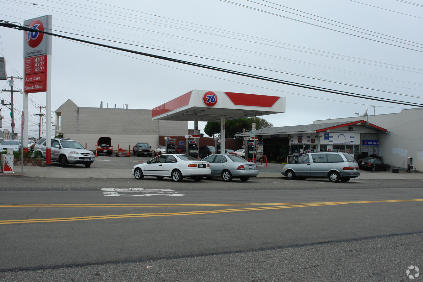
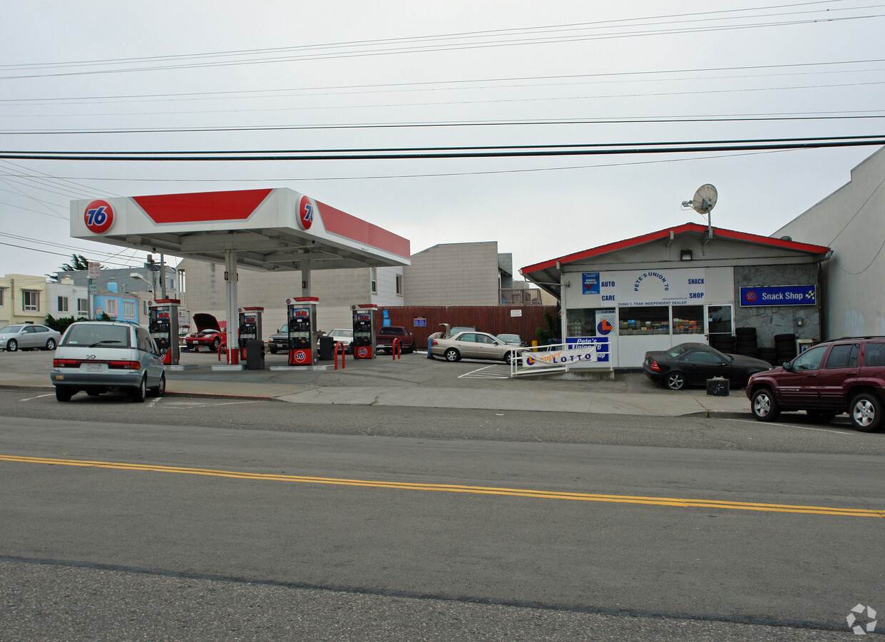
Property Record
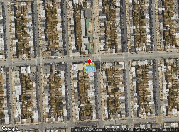
3701 Noriega St, San Francisco, CA 94122

NEARBY LISTINGS FOR SALE OR LEASE
Property Detail
3701 Noriega St
San Francisco-Redwood City-South San Francisco, CA
Outside Land Bl 913
2081-001
San Francisco
Retailwithmorethanonenonretailuse
California
2023
1
2023
0.22 AC
035201
Southern City
27,117 SF
San Francisco
DEMOGRAPHICS near 3701 Noriega St
1 Mile
3 Mile
5 Mile
2024 Total Population
34,445
185,777
555,855
2029 Population
31,307
171,335
513,745
Pop Growth 2024-2029
(9.11%)
(7.77%)
(7.58%)
Average Age
45
44
43
2024 Total Households
12,162
71,834
222,439
HH Growth 2024-2029
(9.64%)
(8.20%)
(7.95%)
Median Household Inc
$125,556
$128,396
$134,134
Avg Household Size
2.70
2.50
2.40
2024 Avg HH Vehicles
2.00
1.00
1.00
Median Home Value
$1,107,280
$1,121,583
$1,102,611
Median Year Built
1947
1947
1948
Nearby Places
- Restaurants
- Banks
- Shops
- Fitness
- Groceries
PUBLIC TRANSPORTATION
TRANSIT/SUBWAY
Judah And 43Rd Avenue (N Judah - San Francisco Municipal Railway (MUNI Metro))
DRIVE
WALK
Distance
Judah And 43Rd Avenue (N Judah - San Francisco Municipal Railway (MUNI Metro))
2 min
11 min
0.6 mi
Judah And 46Th Avenue (N Judah - San Francisco Municipal Railway (MUNI Metro))
DRIVE
WALK
Distance
Judah And 46Th Avenue (N Judah - San Francisco Municipal Railway (MUNI Metro))
2 min
11 min
0.6 mi
Judah And 48Th Avenue (N Judah - San Francisco Municipal Railway (MUNI Metro))
DRIVE
WALK
Distance
Judah And 48Th Avenue (N Judah - San Francisco Municipal Railway (MUNI Metro))
2 min
14 min
0.7 mi
Judah And 40Th Avenue (N Judah - San Francisco Municipal Railway (MUNI Metro))
DRIVE
WALK
Distance
Judah And 40Th Avenue (N Judah - San Francisco Municipal Railway (MUNI Metro))
2 min
14 min
0.8 mi
Ocean Beach (N Judah - San Francisco Municipal Railway (MUNI Metro))
DRIVE
WALK
Distance
Ocean Beach (N Judah - San Francisco Municipal Railway (MUNI Metro))
2 min
14 min
0.8 mi
COMMUTER RAIL
San Francisco 4Th & King (Caltrain - Caltrain (Caltrain))
DRIVE
WALK
Distance
San Francisco 4Th & King (Caltrain - Caltrain (Caltrain))
18 min
7.3 mi
22Nd Street (Caltrain - Caltrain (Caltrain))
DRIVE
WALK
Distance
22Nd Street (Caltrain - Caltrain (Caltrain))
18 min
7.9 mi
AIRPORT
San Francisco International
DRIVE
WALK
Distance
San Francisco International
26 min
15.0 mi
Metro Oakland International
DRIVE
WALK
Distance
Metro Oakland International
45 min
26.2 mi
Freight Ports
Port of San Francisco
DRIVE
WALK
Distance
Port of San Francisco
21 min
8.2 mi
Nearby Properties
Address
Land Use
TOTAL SIZE
Lot Size
Zoning
Address
Land Use
TOTAL SIZE
Lot Size
Zoning
411,904 SF
21.74 AC
C2
Address
Land Use
TOTAL SIZE
Lot Size
Zoning
419,790 SF
3 AC
M1
Address
Land Use
TOTAL SIZE
Lot Size
Zoning
2.03 AC
C2
Address
Land Use
TOTAL SIZE
Lot Size
Zoning
88,900 SF
5.37 AC
NCS
Address
Land Use
TOTAL SIZE
Lot Size
Zoning
11.31 AC
RM2
Address
Land Use
TOTAL SIZE
Lot Size
Zoning
90,539 SF
2.28 AC
RH2
Address
Land Use
TOTAL SIZE
Lot Size
Zoning
Address
Land Use
TOTAL SIZE
Lot Size
Zoning
176,000 SF
1.64 AC
C2
Address
Land Use
TOTAL SIZE
Lot Size
Zoning
73,491 SF
4.48 AC
C2
Address
Land Use
TOTAL SIZE
Lot Size
Zoning
146,036 SF
0.49 AC
RH3
Address
Land Use
TOTAL SIZE
Lot Size
Zoning
76,000 SF
1.48 AC
RM4
Address
Land Use
TOTAL SIZE
Lot Size
Zoning
54,131 SF
1.75 AC
C2
Address
Land Use
TOTAL SIZE
Lot Size
Zoning
70,120 SF
6.35 AC
RM2
Address
Land Use
TOTAL SIZE
Lot Size
Zoning
194,477 SF
11.37 AC
RH1
Address
Land Use
TOTAL SIZE
Lot Size
Zoning
205,770 SF
3.37 AC
RM4
Address
Land Use
TOTAL SIZE
Lot Size
Zoning
6.80 AC
RM1
Address
Land Use
TOTAL SIZE
Lot Size
Zoning
81,756 SF
5.39 AC
RH1D
Address
Land Use
TOTAL SIZE
Lot Size
Zoning
6.18 AC
RM1
Address
Land Use
TOTAL SIZE
Lot Size
Zoning
6.43 AC
RM1
Address
Land Use
TOTAL SIZE
Lot Size
Zoning
6.06 AC
RM1
Address
Land Use
TOTAL SIZE
Lot Size
Zoning
13,300 SF
6.38 AC
C2
Address
Land Use
TOTAL SIZE
Lot Size
Zoning
52,000 SF
2.32 AC
NCS
Address
Land Use
TOTAL SIZE
Lot Size
Zoning
34,253 SF
1.65 AC
NCS
Address
Land Use
TOTAL SIZE
Lot Size
Zoning
96,000 SF
0.62 AC
NC3
Address
Land Use
TOTAL SIZE
Lot Size
Zoning
4.24 AC
RM1
Address
Land Use
TOTAL SIZE
Lot Size
Zoning
4.24 AC
RM1
Address
Land Use
TOTAL SIZE
Lot Size
Zoning
3.74 AC
RM1
Address
Land Use
TOTAL SIZE
Lot Size
Zoning
2.60 AC
RM1
Address
Land Use
TOTAL SIZE
Lot Size
Zoning
32,692 SF
1.65 AC
RH1D
Address
Land Use
TOTAL SIZE
Lot Size
Zoning
209,884 SF
1.07 AC
The World's #1 Commercial Real Estate Marketplace
Connect with us
© 2025 CoStar Group
The information above has been obtained from sources believed reliable. While we do not doubt its accuracy we have not verified it and make no guarantee, warranty or representation about it. It is your responsibility to independently confirm its accuracy and completeness. Any projections, opinions, assumptions, or estimates used are for example only and do not represent the current or future performance of the property. The value of this transaction to you depends on tax and other factors which should be evaluated by your tax, financial, and legal advisors. You and your advisors should conduct a careful, independent investigation of the property to determine to your satisfaction the suitability of the property for your needs.