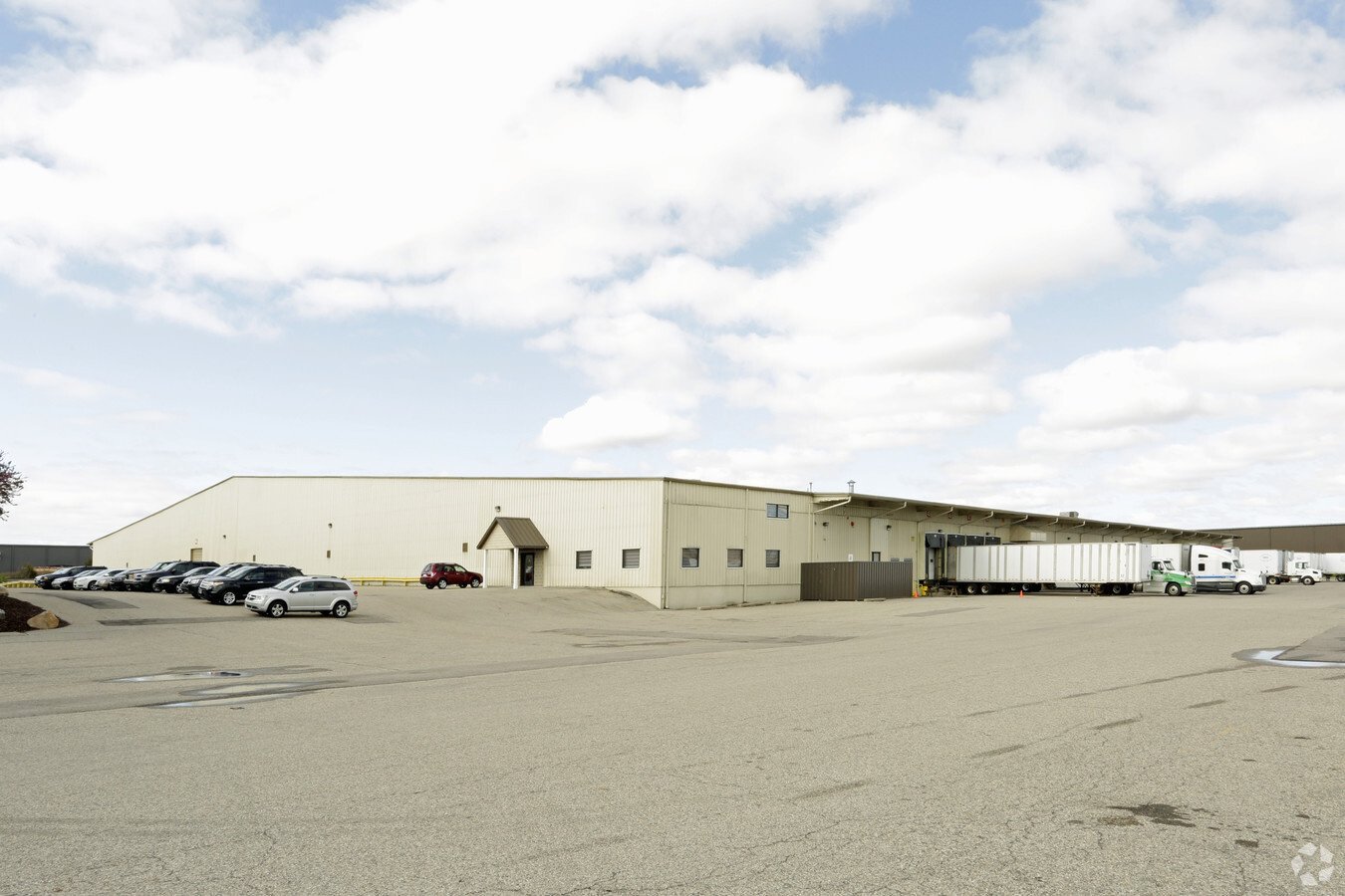
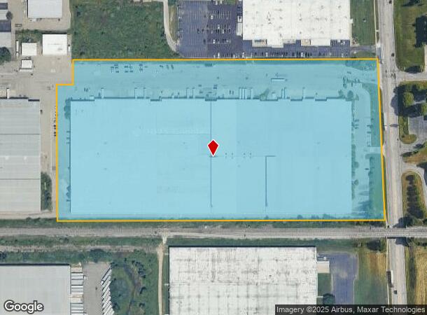
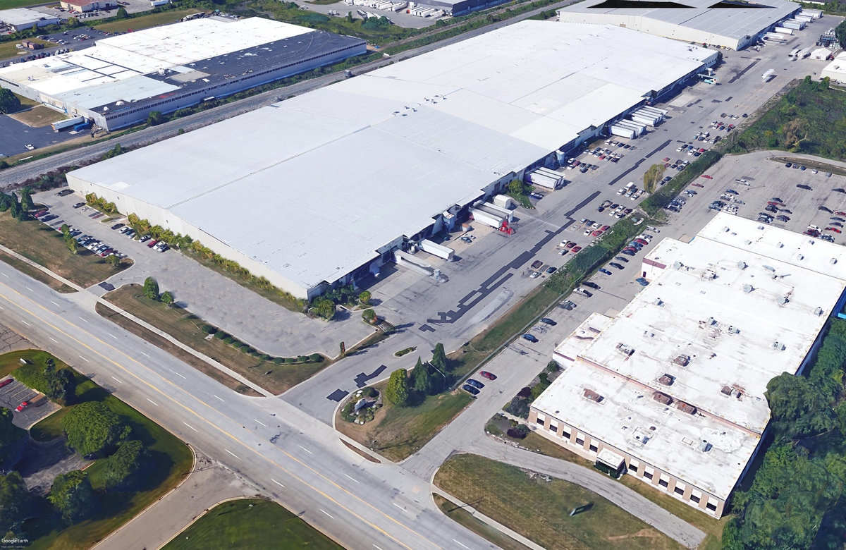
Property Record
3701 Patterson Ave Se, Grand Rapids, MI 49512
NEARBY LISTINGS FOR SALE OR LEASE
Property Detail
3701 Patterson Ave Se
Grand Rapids-Wyoming, MI
411824200104 PART OF NE 1/4 COM AT N 1/4 COR TH N 89D 56M 17S E 700.0 FT ALONG N SEC LINE TH S 0D 03M 17S E PERP TO N SEC
41-18-24-200-104
Kent
Commercialnec
Michigan
2023
20.04 AC
2024
SE Grand Rapids/Cascade
012608
West Michigan
529,904 SF
DEMOGRAPHICS near 3701 Patterson Ave Se
1 Mile
3 Mile
5 Mile
2024 Total Population
2,951
40,603
131,767
2029 Population
2,987
40,967
132,922
Pop Growth 2024-2029
+ 1.22%
+ 0.90%
+ 0.88%
Average Age
35
39
39
2024 Total Households
1,608
17,279
50,046
HH Growth 2024-2029
+ 1.31%
+ 0.96%
+ 0.88%
Median Household Inc
$41,185
$63,319
$80,454
Avg Household Size
1.80
2.20
2.50
2024 Avg HH Vehicles
1.00
2.00
2.00
Median Home Value
$164,687
$274,805
$274,655
Median Year Built
1987
1986
1979
Nearby Places
- Restaurants
- Banks
- Shops
- Fitness
- Groceries
PUBLIC TRANSPORTATION
AIRPORT
Gerald R Ford International
DRIVE
WALK
Distance
Gerald R Ford International
9 min
3.6 mi
Freight Ports
Port Milwaukee
DRIVE
WALK
Distance
Port Milwaukee
313 min
268.8 mi
SALE & LEASE HISTORY
LISTING DATE
SALE/LEASE

Sep 24, 2016
For Lease
Nov 21, 2016
For Lease
Feb 23, 2017
For Lease
Nearby Properties
Address
Land Use
TOTAL SIZE
Lot Size
Zoning
Address
Land Use
TOTAL SIZE
Lot Size
Zoning
563,998 SF
31.75 AC
C3
Address
Land Use
TOTAL SIZE
Lot Size
Zoning
385,631 SF
45.27 AC
R-PUD-1
Address
Land Use
TOTAL SIZE
Lot Size
Zoning
521,735 SF
52.16 AC
MON-C
Address
Land Use
TOTAL SIZE
Lot Size
Zoning
476,572 SF
51.60 AC
R4
Address
Land Use
TOTAL SIZE
Lot Size
Zoning
446,986 SF
72.57 AC
R4
Address
Land Use
TOTAL SIZE
Lot Size
Zoning
341,808 SF
27.73 AC
HC-PUD
Address
Land Use
TOTAL SIZE
Lot Size
Zoning
23.99 AC
PUD
Address
Land Use
TOTAL SIZE
Lot Size
Zoning
874,605 SF
87.68 AC
I-PUD
Address
Land Use
TOTAL SIZE
Lot Size
Zoning
155.84 AC
Address
Land Use
TOTAL SIZE
Lot Size
Zoning
223,931 SF
18 AC
R-PUD-1
Address
Land Use
TOTAL SIZE
Lot Size
Zoning
208.39 AC
I-PUD
Address
Land Use
TOTAL SIZE
Lot Size
Zoning
22.46 AC
MON-MDR
Address
Land Use
TOTAL SIZE
Lot Size
Zoning
685,902 SF
38.89 AC
I1
Address
Land Use
TOTAL SIZE
Lot Size
Zoning
19.40 AC
MON-MDR
Address
Land Use
TOTAL SIZE
Lot Size
Zoning
47.13 AC
PUD
Address
Land Use
TOTAL SIZE
Lot Size
Zoning
285,875 SF
37.86 AC
TI
Address
Land Use
TOTAL SIZE
Lot Size
Zoning
292,825 SF
15.01 AC
R-PUD-1
Address
Land Use
TOTAL SIZE
Lot Size
Zoning
15.94 AC
MON-MDR
Address
Land Use
TOTAL SIZE
Lot Size
Zoning
455,880 SF
24.91 AC
I1
Address
Land Use
TOTAL SIZE
Lot Size
Zoning
97,263 SF
19.37 AC
MON-MDR
Address
Land Use
TOTAL SIZE
Lot Size
Zoning
267,336 SF
13.99 AC
R-PUD-1
Address
Land Use
TOTAL SIZE
Lot Size
Zoning
16.90 AC
MON-MDR
Address
Land Use
TOTAL SIZE
Lot Size
Zoning
400,646 SF
23.78 AC
I1
Address
Land Use
TOTAL SIZE
Lot Size
Zoning
304,200 SF
R1
Address
Land Use
TOTAL SIZE
Lot Size
Zoning
119.44 AC
I-PUD
Address
Land Use
TOTAL SIZE
Lot Size
Zoning
17,671 SF
15.18 AC
MON-MDR
Address
Land Use
TOTAL SIZE
Lot Size
Zoning
51,148 SF
26.38 AC
R-PUD-1
Address
Land Use
TOTAL SIZE
Lot Size
Zoning
619,165 SF
37 AC
I1
Address
Land Use
TOTAL SIZE
Lot Size
Zoning
18.86 AC
MON-MDR
Address
Land Use
TOTAL SIZE
Lot Size
Zoning
258,128 SF
20.41 AC
R4
The World's #1 Commercial Real Estate Marketplace
Connect with us
© 2025 CoStar Group
The information above has been obtained from sources believed reliable. While we do not doubt its accuracy we have not verified it and make no guarantee, warranty or representation about it. It is your responsibility to independently confirm its accuracy and completeness. Any projections, opinions, assumptions, or estimates used are for example only and do not represent the current or future performance of the property. The value of this transaction to you depends on tax and other factors which should be evaluated by your tax, financial, and legal advisors. You and your advisors should conduct a careful, independent investigation of the property to determine to your satisfaction the suitability of the property for your needs.