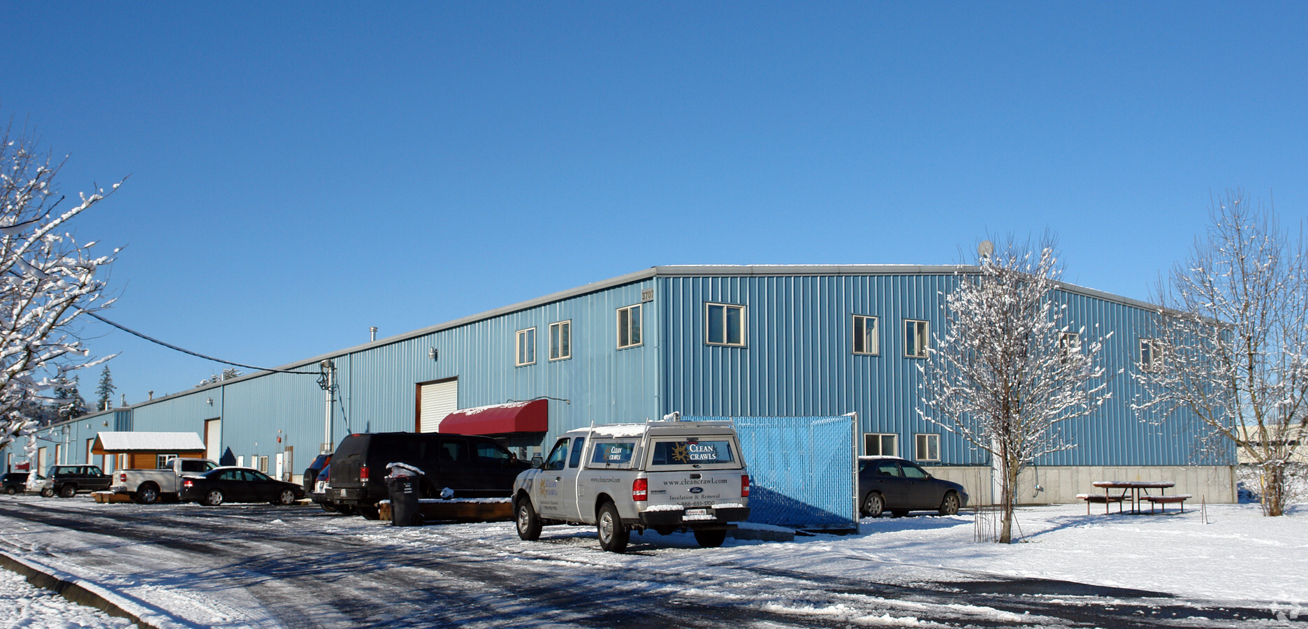
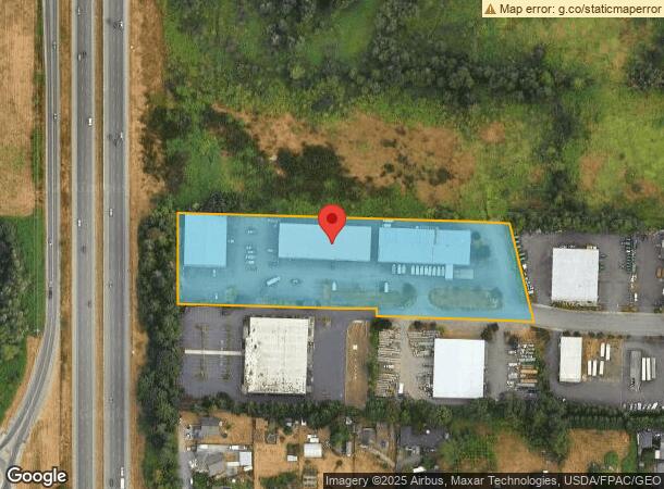
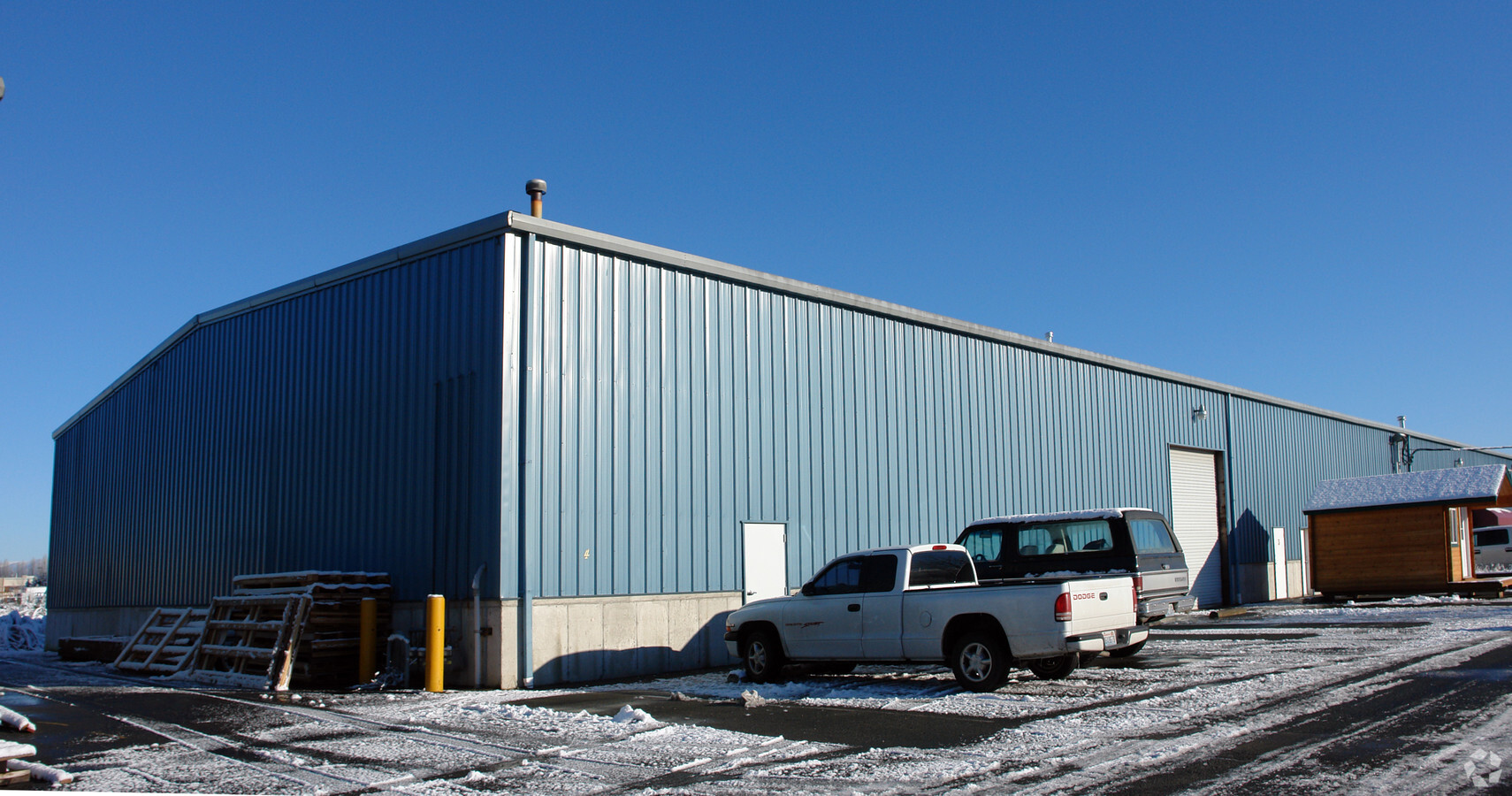
Property Record
3707 124Th St Ne, Marysville, WA 98271

NEARBY LISTINGS FOR SALE OR LEASE
Property Detail
3707 124Th St Ne
Seattle-Tacoma-Bellevue, WA
3 Of Sp 131 -4-80 Af No 8006240154 Daf -
300504-003-033-00
SEC 04 TWP 30 RGE 05 LOT 3 OF SP 131 (4-80) AF NO 8006240154 DAF - BEG SW COR SEC 4 TH N02*02 24W ALG W LN SEC 4 FOR 98.17 FT TPB TH CONT N02*02 24W 216.19FT TH S88*37 12E 808.99FT TH S13*59 27E 240.43 FT TH N88*31 57W 372.22FT TH N01*34 59E 16.04FT
Commercialnec
Snohomish
X
Washington
53061C0710F
3
2024
3.93 AC
2024
N Snohomish County
052807
Seattle/Puget Sound
50,974 SF
DEMOGRAPHICS near 3707 124Th St Ne
1 Mile
3 Mile
5 Mile
2024 Total Population
5,425
36,484
89,502
2029 Population
5,657
38,090
93,488
Pop Growth 2024-2029
+ 4.28%
+ 4.40%
+ 4.45%
Average Age
39
40
39
2024 Total Households
1,896
13,052
31,837
HH Growth 2024-2029
+ 4.43%
+ 4.54%
+ 4.56%
Median Household Inc
$90,445
$92,594
$93,554
Avg Household Size
2.70
2.70
2.70
2024 Avg HH Vehicles
2.00
2.00
2.00
Median Home Value
$457,097
$467,113
$482,576
Median Year Built
1981
1988
1991
Nearby Places
- Restaurants
- Banks
- Shops
- Fitness
- Groceries
PUBLIC TRANSPORTATION
AIRPORT
Seattle Paine Field International
DRIVE
WALK
Distance
Seattle Paine Field International
27 min
18.8 mi
Freight Ports
Port of Everett
DRIVE
WALK
Distance
Port of Everett
18 min
11.3 mi
Nearby Properties
Address
Land Use
TOTAL SIZE
Lot Size
Zoning
Address
Land Use
TOTAL SIZE
Lot Size
Zoning
113,927 SF
576.83 AC
TRIBES
Address
Land Use
TOTAL SIZE
Lot Size
Zoning
229,606 SF
9.28 AC
R18 MFM
Address
Land Use
TOTAL SIZE
Lot Size
Zoning
201,141 SF
7.37 AC
MU
Address
Land Use
TOTAL SIZE
Lot Size
Zoning
1,664 SF
20 AC
LI
Address
Land Use
TOTAL SIZE
Lot Size
Zoning
231,030 SF
18.48 AC
LI
Address
Land Use
TOTAL SIZE
Lot Size
Zoning
186,723 SF
5.36 AC
HC
Address
Land Use
TOTAL SIZE
Lot Size
Zoning
82.67 AC
R4.5 SFM
Address
Land Use
TOTAL SIZE
Lot Size
Zoning
9.87 AC
R4.5 SFM
Address
Land Use
TOTAL SIZE
Lot Size
Zoning
117,532 SF
4.72 AC
R18 MFM
Address
Land Use
TOTAL SIZE
Lot Size
Zoning
182,316 SF
15.03 AC
HC
Address
Land Use
TOTAL SIZE
Lot Size
Zoning
174,661 SF
12.98 AC
CB
Address
Land Use
TOTAL SIZE
Lot Size
Zoning
155,543 SF
20.20 AC
HC
Address
Land Use
TOTAL SIZE
Lot Size
Zoning
152,543 SF
15.32 AC
GC
Address
Land Use
TOTAL SIZE
Lot Size
Zoning
70,712 SF
4 AC
GC
Address
Land Use
TOTAL SIZE
Lot Size
Zoning
176,030 SF
18.67 AC
LI
Address
Land Use
TOTAL SIZE
Lot Size
Zoning
336,508 SF
23.32 AC
LI
Address
Land Use
TOTAL SIZE
Lot Size
Zoning
224,324 SF
30.49 AC
LI
Address
Land Use
TOTAL SIZE
Lot Size
Zoning
110,890 SF
7.44 AC
R28 MFH
Address
Land Use
TOTAL SIZE
Lot Size
Zoning
95,461 SF
12.39 AC
CB
Address
Land Use
TOTAL SIZE
Lot Size
Zoning
126,905 SF
10.55 AC
GC
Address
Land Use
TOTAL SIZE
Lot Size
Zoning
119,510 SF
2.16 AC
GC
Address
Land Use
TOTAL SIZE
Lot Size
Zoning
102,520 SF
2.56 AC
CC
Address
Land Use
TOTAL SIZE
Lot Size
Zoning
51,698 SF
7.57 AC
GC
Address
Land Use
TOTAL SIZE
Lot Size
Zoning
1,372 SF
95 AC
LI
Address
Land Use
TOTAL SIZE
Lot Size
Zoning
52,312 SF
14.53 AC
GC
Address
Land Use
TOTAL SIZE
Lot Size
Zoning
54,309 SF
1.47 AC
CB
Address
Land Use
TOTAL SIZE
Lot Size
Zoning
120,176 SF
4.99 AC
HC
Address
Land Use
TOTAL SIZE
Lot Size
Zoning
93,106 SF
7.24 AC
GC
Address
Land Use
TOTAL SIZE
Lot Size
Zoning
115,966 SF
7.74 AC
LI
The World's #1 Commercial Real Estate Marketplace
Connect with us
© 2025 CoStar Group
The information above has been obtained from sources believed reliable. While we do not doubt its accuracy we have not verified it and make no guarantee, warranty or representation about it. It is your responsibility to independently confirm its accuracy and completeness. Any projections, opinions, assumptions, or estimates used are for example only and do not represent the current or future performance of the property. The value of this transaction to you depends on tax and other factors which should be evaluated by your tax, financial, and legal advisors. You and your advisors should conduct a careful, independent investigation of the property to determine to your satisfaction the suitability of the property for your needs.