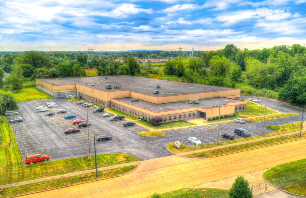
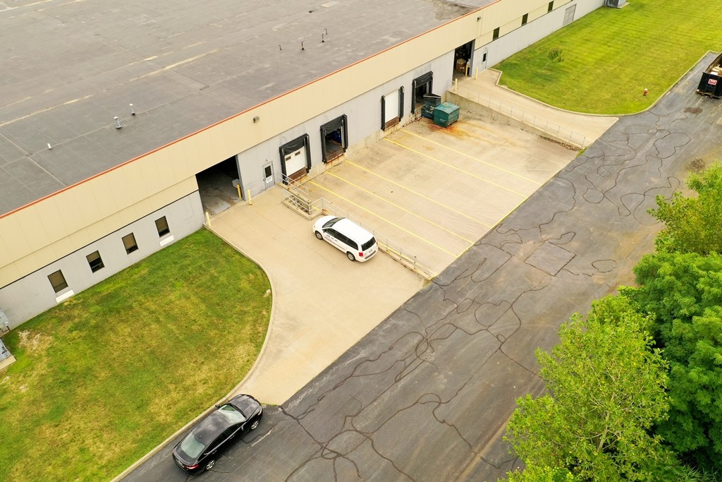
Property Record
37200 Research Dr, Eastlake, OH 44095

NEARBY LISTINGS FOR SALE OR LEASE
Property Detail
37200 Research Dr
Cleveland-Elyria, OH
Eastlake Industrial Park
34-A-012-0-00-006
LOT 7 CARD TRACT
Industrialgeneral
Lake
X
Ohio
39035C0025E
7
2024
11.33 AC
2023
Eastlake/S Willoughby
202000
Cleveland
111,212 SF
DEMOGRAPHICS near 37200 Research Dr
1 Mile
3 Mile
5 Mile
2024 Total Population
4,916
55,712
112,252
2029 Population
4,895
55,694
111,892
Pop Growth 2024-2029
(0.43%)
(0.03%)
(0.32%)
Average Age
44
44
44
2024 Total Households
2,285
25,879
51,050
HH Growth 2024-2029
(0.44%)
+ 0.03%
(0.28%)
Median Household Inc
$68,354
$68,595
$69,738
Avg Household Size
2.10
2.10
2.20
2024 Avg HH Vehicles
2.00
2.00
2.00
Median Home Value
$170,404
$165,025
$167,928
Median Year Built
1964
1967
1966
Nearby Places
- Restaurants
- Banks
- Shops
- Fitness
- Groceries
PUBLIC TRANSPORTATION
AIRPORT
Cleveland-Hopkins International
DRIVE
WALK
Distance
Cleveland-Hopkins International
48 min
32.7 mi
Freight Ports
Port of Toledo
DRIVE
WALK
Distance
Port of Toledo
162 min
133.1 mi
SALE & LEASE HISTORY
LISTING DATE
SALE/LEASE

Aug 20, 2019
For Sale
Apr 24, 2020
For Lease
Nearby Properties
Address
Land Use
TOTAL SIZE
Lot Size
Zoning
Address
Land Use
TOTAL SIZE
Lot Size
Zoning
455,945 SF
78.40 AC
B-1
Address
Land Use
TOTAL SIZE
Lot Size
Zoning
120.34 AC
Address
Land Use
TOTAL SIZE
Lot Size
Zoning
488,790 SF
11.54 AC
R-MFL
Address
Land Use
TOTAL SIZE
Lot Size
Zoning
327,593 SF
103.27 AC
Address
Land Use
TOTAL SIZE
Lot Size
Zoning
372,776 SF
27.68 AC
Address
Land Use
TOTAL SIZE
Lot Size
Zoning
307,867 SF
31.16 AC
S-CMF
Address
Land Use
TOTAL SIZE
Lot Size
Zoning
308,298 SF
15.93 AC
Address
Land Use
TOTAL SIZE
Lot Size
Zoning
45,768 SF
13.53 AC
Address
Land Use
TOTAL SIZE
Lot Size
Zoning
212,280 SF
17.96 AC
B-2
Address
Land Use
TOTAL SIZE
Lot Size
Zoning
120,352 SF
15.05 AC
1FM60
Address
Land Use
TOTAL SIZE
Lot Size
Zoning
214,881 SF
47.98 AC
S-5
Address
Land Use
TOTAL SIZE
Lot Size
Zoning
53,637 SF
13.44 AC
G-BUS
Address
Land Use
TOTAL SIZE
Lot Size
Zoning
117,333 SF
16.17 AC
L-1
Address
Land Use
TOTAL SIZE
Lot Size
Zoning
272,400 SF
1.07 AC
U2D
Address
Land Use
TOTAL SIZE
Lot Size
Zoning
81,965 SF
10.65 AC
R
Address
Land Use
TOTAL SIZE
Lot Size
Zoning
174,098 SF
20.51 AC
U-1
Address
Land Use
TOTAL SIZE
Lot Size
Zoning
187,332 SF
10 AC
R-100
Address
Land Use
TOTAL SIZE
Lot Size
Zoning
136,722 SF
10.25 AC
GB
Address
Land Use
TOTAL SIZE
Lot Size
Zoning
164,666 SF
8 AC
R-100
Address
Land Use
TOTAL SIZE
Lot Size
Zoning
159,188 SF
12.43 AC
R-BUS
Address
Land Use
TOTAL SIZE
Lot Size
Zoning
133,526 SF
4 AC
Address
Land Use
TOTAL SIZE
Lot Size
Zoning
124,170 SF
35.77 AC
1FM60
Address
Land Use
TOTAL SIZE
Lot Size
Zoning
120,676 SF
9.07 AC
R-MFL
Address
Land Use
TOTAL SIZE
Lot Size
Zoning
70,325 SF
9.16 AC
Address
Land Use
TOTAL SIZE
Lot Size
Zoning
159,043 SF
11.61 AC
B2
Address
Land Use
TOTAL SIZE
Lot Size
Zoning
122,130 SF
9.51 AC
Address
Land Use
TOTAL SIZE
Lot Size
Zoning
95,798 SF
222.29 AC
R-1
Address
Land Use
TOTAL SIZE
Lot Size
Zoning
142,504 SF
15.41 AC
R-MFL
Address
Land Use
TOTAL SIZE
Lot Size
Zoning
109,803 SF
9.77 AC
Address
Land Use
TOTAL SIZE
Lot Size
Zoning
145,899 SF
8 AC
R-BUS
The World's #1 Commercial Real Estate Marketplace
Connect with us
© 2025 CoStar Group
The information above has been obtained from sources believed reliable. While we do not doubt its accuracy we have not verified it and make no guarantee, warranty or representation about it. It is your responsibility to independently confirm its accuracy and completeness. Any projections, opinions, assumptions, or estimates used are for example only and do not represent the current or future performance of the property. The value of this transaction to you depends on tax and other factors which should be evaluated by your tax, financial, and legal advisors. You and your advisors should conduct a careful, independent investigation of the property to determine to your satisfaction the suitability of the property for your needs.