Property Record
3721 Alpine Ave Nw, Comstock Park, MI 49321
Current Lease Availabilities
NEARBY LISTINGS FOR SALE OR LEASE
Property Detail
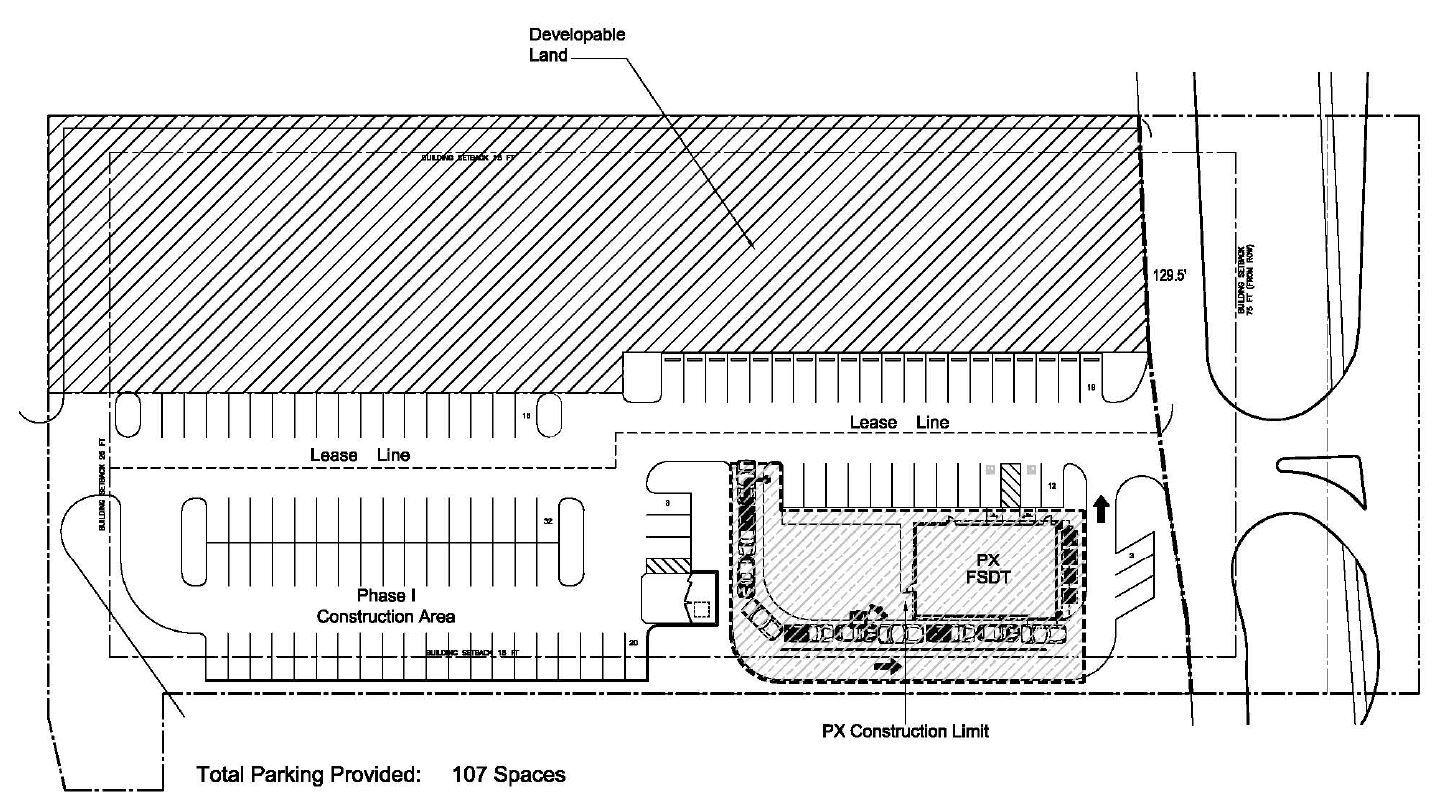
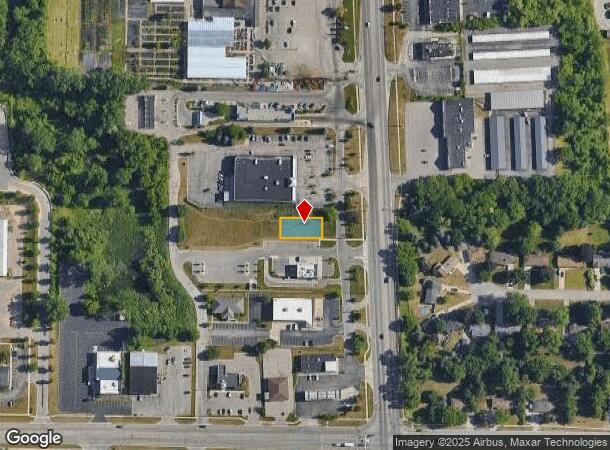
3721 Alpine Ave Nw
West Michigan
Comstock Park Mi Cft Plaza Kent County
Grand Rapids-Wyoming, MI
410935491002 UNIT 2 * COMSTOCK PARK, MI, CFT PLAZA KENT COUNTY CONDOMINIUM SUBDIVISION PLAN NO.1056 INSTRUMENT
41-09-35-491-002
Kent
Commercialacreage
Michigan
2023
2.30 AC
2024
Comstock/Alpine
0114032024
DEMOGRAPHICS near 3721 Alpine Ave Nw
1 Mile
3 Mile
5 Mile
2024 Total Population
8,718
41,500
138,915
2029 Population
8,796
41,590
139,419
Pop Growth 2024-2029
+ 0.89%
+ 0.22%
+ 0.36%
Average Age
35
38
38
2024 Total Households
4,091
17,599
59,249
HH Growth 2024-2029
+ 0.88%
+ 0.24%
+ 0.45%
Median Household Inc
$45,417
$62,642
$64,467
Avg Household Size
2.10
2.30
2.30
2024 Avg HH Vehicles
1.00
2.00
2.00
Median Home Value
$226,867
$215,229
$221,821
Median Year Built
1990
1966
1964
Nearby Places
- Restaurants
- Banks
- Shops
- Fitness
- Groceries
PUBLIC TRANSPORTATION
COMMUTER RAIL
Grand Rapids Vernon J. Ehlers Station (Pere Marquette - Amtrak)
DRIVE
WALK
Distance
Grand Rapids Vernon J. Ehlers Station (Pere Marquette - Amtrak)
9 min
6.3 mi
AIRPORT
Gerald R Ford International
DRIVE
WALK
Distance
Gerald R Ford International
27 min
18.8 mi
Freight Ports
Port Milwaukee
DRIVE
WALK
Distance
Port Milwaukee
311 min
267.4 mi
Nearby Properties
Address
Land Use
TOTAL SIZE
Lot Size
Zoning
Address
Land Use
TOTAL SIZE
Lot Size
Zoning
352,362 SF
61.33 AC
IPUD
Address
Land Use
TOTAL SIZE
Lot Size
Zoning
546,366 SF
28.40 AC
MH
Address
Land Use
TOTAL SIZE
Lot Size
Zoning
537,080 SF
46.61 AC
RPUD - 2
Address
Land Use
TOTAL SIZE
Lot Size
Zoning
451,792 SF
32.60 AC
ARM - MULT
Address
Land Use
TOTAL SIZE
Lot Size
Zoning
455,639 SF
42.06 AC
MH
Address
Land Use
TOTAL SIZE
Lot Size
Zoning
340,744 SF
69.50 AC
RPUD - 2
Address
Land Use
TOTAL SIZE
Lot Size
Zoning
Address
Land Use
TOTAL SIZE
Lot Size
Zoning
337,324 SF
10.15 AC
C-3
Address
Land Use
TOTAL SIZE
Lot Size
Zoning
169,898 SF
Address
Land Use
TOTAL SIZE
Lot Size
Zoning
33.06 AC
R-3
Address
Land Use
TOTAL SIZE
Lot Size
Zoning
183,517 SF
44.93 AC
ML
Address
Land Use
TOTAL SIZE
Lot Size
Zoning
190,882 SF
30.17 AC
MP
Address
Land Use
TOTAL SIZE
Lot Size
Zoning
670,966 SF
40.67 AC
C-3
Address
Land Use
TOTAL SIZE
Lot Size
Zoning
Address
Land Use
TOTAL SIZE
Lot Size
Zoning
136,468 SF
13.34 AC
CPUD
Address
Land Use
TOTAL SIZE
Lot Size
Zoning
165,184 SF
14.85 AC
CPUD
Address
Land Use
TOTAL SIZE
Lot Size
Zoning
32.63 AC
R-3
Address
Land Use
TOTAL SIZE
Lot Size
Zoning
214,046 SF
31.31 AC
C-2
Address
Land Use
TOTAL SIZE
Lot Size
Zoning
267,000 SF
15.63 AC
IPUD
Address
Land Use
TOTAL SIZE
Lot Size
Zoning
239,172 SF
25.79 AC
C-2
Address
Land Use
TOTAL SIZE
Lot Size
Zoning
118,085 SF
10.94 AC
CPUD
Address
Land Use
TOTAL SIZE
Lot Size
Zoning
Address
Land Use
TOTAL SIZE
Lot Size
Zoning
268,146 SF
13.31 AC
ML
Address
Land Use
TOTAL SIZE
Lot Size
Zoning
332,315 SF
17.71 AC
MP
Address
Land Use
TOTAL SIZE
Lot Size
Zoning
Address
Land Use
TOTAL SIZE
Lot Size
Zoning
14.36 AC
MON-MDR
Address
Land Use
TOTAL SIZE
Lot Size
Zoning
250,469 SF
14.11 AC
ML
Address
Land Use
TOTAL SIZE
Lot Size
Zoning
9.11 AC
R-3
Address
Land Use
TOTAL SIZE
Lot Size
Zoning
97,894 SF
5.90 AC
MCN-LDR
Address
Land Use
TOTAL SIZE
Lot Size
Zoning
8.77 AC
R-3
The World's #1 Commercial Real Estate Marketplace
Connect with us
© 2025 CoStar Group
The information above has been obtained from sources believed reliable. While we do not doubt its accuracy we have not verified it and make no guarantee, warranty or representation about it. It is your responsibility to independently confirm its accuracy and completeness. Any projections, opinions, assumptions, or estimates used are for example only and do not represent the current or future performance of the property. The value of this transaction to you depends on tax and other factors which should be evaluated by your tax, financial, and legal advisors. You and your advisors should conduct a careful, independent investigation of the property to determine to your satisfaction the suitability of the property for your needs.