Property Record
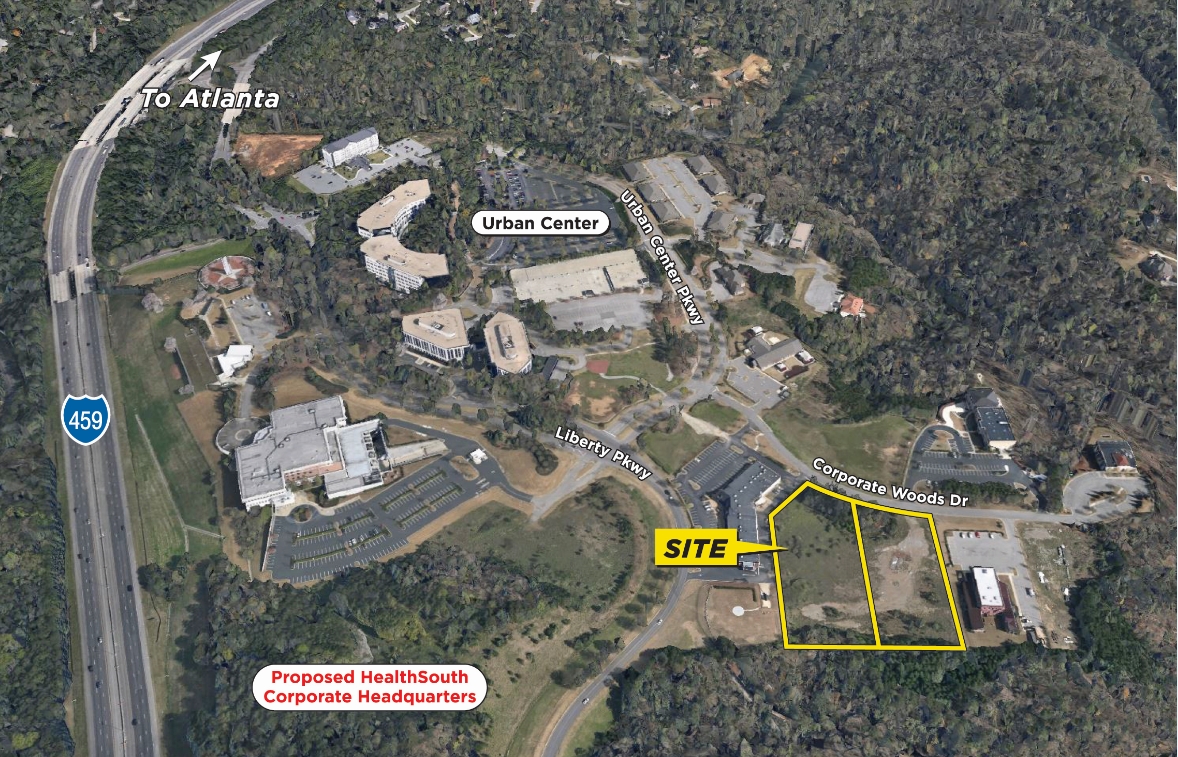
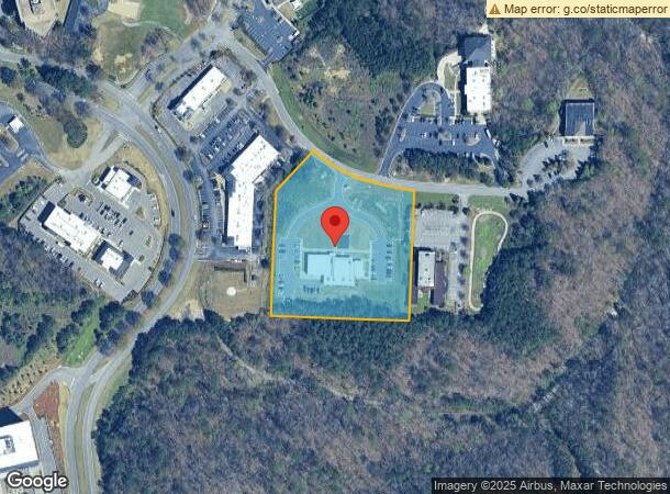
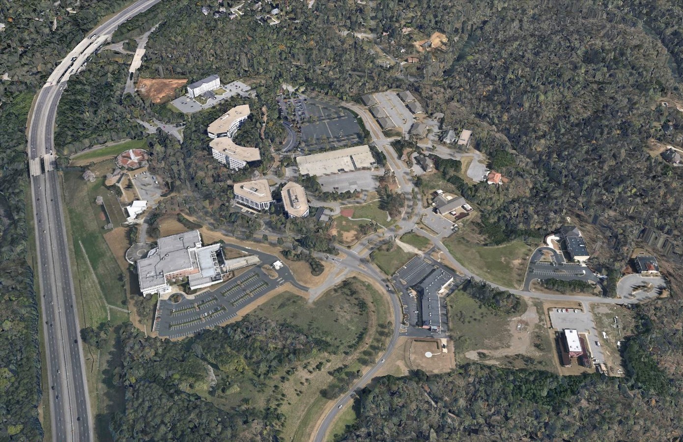
3745 Corporate Woods Dr, Vestavia, AL 35242

NEARBY LISTINGS FOR SALE OR LEASE
Property Detail
3745 Corporate Woods Dr
Birmingham-Hoover, AL
Corp Woods Add To Liberty Park
28-00-12-3-000-001.023
LOT 1K CORPORATE WOODS ADDITION TO LIBERTY PARK RESUR NO 6 PB 248 PG 46
Medicalbuilding
Jefferson
X
Alabama
01117C0080F
1k
2023
4.03 AC
2024
Hwy 280/Jefferson County
0127031026
Birmingham
11,036 SF
DEMOGRAPHICS near 3745 Corporate Woods Dr
1 Mile
3 Mile
5 Mile
2024 Total Population
1,937
27,594
99,345
2029 Population
1,858
26,642
98,617
Pop Growth 2024-2029
(4.08%)
(3.45%)
(0.73%)
Average Age
42
39
40
2024 Total Households
748
11,084
42,640
HH Growth 2024-2029
(4.28%)
(3.53%)
(0.71%)
Median Household Inc
$134,698
$123,184
$91,983
Avg Household Size
2.50
2.50
2.20
2024 Avg HH Vehicles
2.00
2.00
2.00
Median Home Value
$454,639
$479,562
$427,574
Median Year Built
1995
1979
1979
Nearby Places
- Restaurants
- Banks
- Shops
- Fitness
- Groceries
PUBLIC TRANSPORTATION
AIRPORT
Birmingham-Shuttlesworth International
DRIVE
WALK
Distance
Birmingham-Shuttlesworth International
21 min
12.3 mi
Freight Ports
Port of Mobile
DRIVE
WALK
Distance
Port of Mobile
280 min
255.5 mi
SALE & LEASE HISTORY
LISTING DATE
SALE/LEASE

Sep 24, 2016
For Sale
Jun 18, 2018
For Sale
Nearby Properties
Address
Land Use
TOTAL SIZE
Lot Size
Zoning
Address
Land Use
TOTAL SIZE
Lot Size
Zoning
45,868 SF
6.80 AC
CP Y
Address
Land Use
TOTAL SIZE
Lot Size
Zoning
500,279 SF
52.57 AC
B2
Address
Land Use
TOTAL SIZE
Lot Size
Zoning
153,413 SF
6.35 AC
C1
Address
Land Use
TOTAL SIZE
Lot Size
Zoning
136,498 SF
11 AC
C1
Address
Land Use
TOTAL SIZE
Lot Size
Zoning
239,213 SF
17 AC
C1
Address
Land Use
TOTAL SIZE
Lot Size
Zoning
259,316 SF
30 AC
PUD
Address
Land Use
TOTAL SIZE
Lot Size
Zoning
321,157 SF
33 AC
C
Address
Land Use
TOTAL SIZE
Lot Size
Zoning
361,937 SF
22 AC
R4
Address
Land Use
TOTAL SIZE
Lot Size
Zoning
423,995 SF
25 AC
R3
Address
Land Use
TOTAL SIZE
Lot Size
Zoning
68,778 SF
3.40 AC
CP
Address
Land Use
TOTAL SIZE
Lot Size
Zoning
83,792 SF
9.94 AC
Address
Land Use
TOTAL SIZE
Lot Size
Zoning
68,803 SF
3.93 AC
CP
Address
Land Use
TOTAL SIZE
Lot Size
Zoning
198,270 SF
11.21 AC
CP
Address
Land Use
TOTAL SIZE
Lot Size
Zoning
92,913 SF
15 AC
I3
Address
Land Use
TOTAL SIZE
Lot Size
Zoning
77,857 SF
11.54 AC
B2
Address
Land Use
TOTAL SIZE
Lot Size
Zoning
129,702 SF
8.20 AC
C-1
Address
Land Use
TOTAL SIZE
Lot Size
Zoning
235,552 SF
10.13 AC
R3
Address
Land Use
TOTAL SIZE
Lot Size
Zoning
57,938 SF
6.85 AC
CP
Address
Land Use
TOTAL SIZE
Lot Size
Zoning
59,108 SF
1.72 AC
CP&C
Address
Land Use
TOTAL SIZE
Lot Size
Zoning
64,390 SF
7.10 AC
Address
Land Use
TOTAL SIZE
Lot Size
Zoning
47,099 SF
2.03 AC
CP
Address
Land Use
TOTAL SIZE
Lot Size
Zoning
98,696 SF
8.45 AC
B2
Address
Land Use
TOTAL SIZE
Lot Size
Zoning
30,050 SF
3.17 AC
CP
Address
Land Use
TOTAL SIZE
Lot Size
Zoning
28,034 SF
5.77 AC
C1
Address
Land Use
TOTAL SIZE
Lot Size
Zoning
66,698 SF
7.38 AC
B2
Address
Land Use
TOTAL SIZE
Lot Size
Zoning
28,709 SF
3.47 AC
C1
Address
Land Use
TOTAL SIZE
Lot Size
Zoning
137,270 SF
11.70 AC
C1/R
Address
Land Use
TOTAL SIZE
Lot Size
Zoning
129,706 SF
120 AC
INST
Address
Land Use
TOTAL SIZE
Lot Size
Zoning
101,984 SF
5.95 AC
R4
The World's #1 Commercial Real Estate Marketplace
Connect with us
© 2025 CoStar Group
The information above has been obtained from sources believed reliable. While we do not doubt its accuracy we have not verified it and make no guarantee, warranty or representation about it. It is your responsibility to independently confirm its accuracy and completeness. Any projections, opinions, assumptions, or estimates used are for example only and do not represent the current or future performance of the property. The value of this transaction to you depends on tax and other factors which should be evaluated by your tax, financial, and legal advisors. You and your advisors should conduct a careful, independent investigation of the property to determine to your satisfaction the suitability of the property for your needs.