Property Record
375 Morgan Ln, West Haven, CT 06516
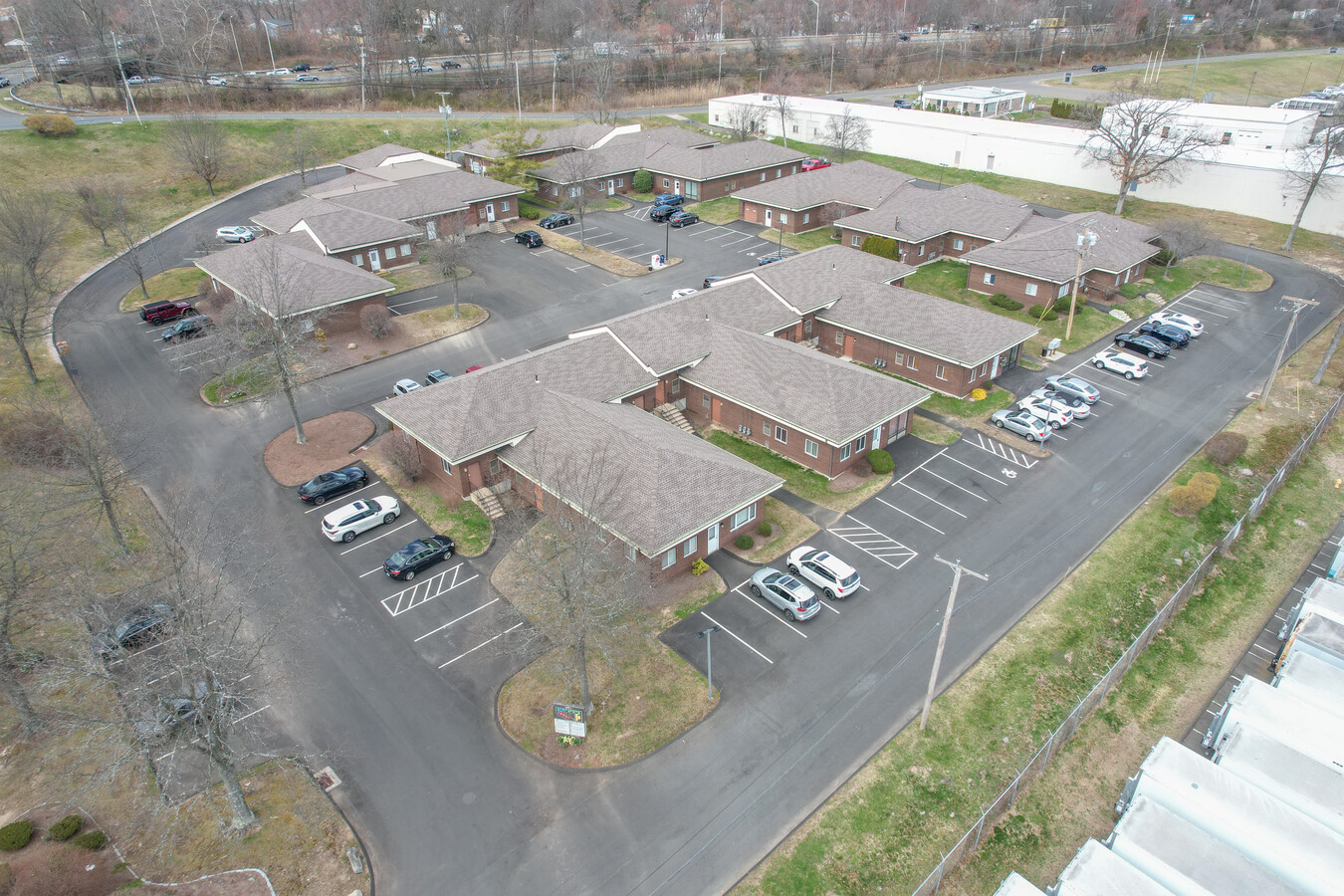
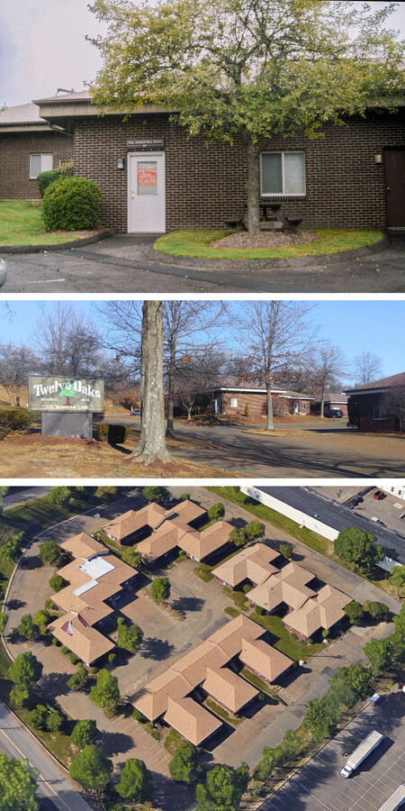
This Property Is For Sale
Current Lease Availabilities
NEARBY LISTINGS FOR SALE OR LEASE
Property Detail
375 Morgan Ln
Industrialcondominium
New Haven
X
Connecticut
09009C0438H
101
2024
West Haven
2024
Westchester/So Connecticut
154700
New Haven-Milford, CT
896 SF
WHAV-000018-000008-000101
DEMOGRAPHICS near 375 Morgan Ln
1 Mile
3 Mile
5 Mile
2024 Total Population
6,949
69,736
169,858
2029 Population
6,967
69,106
168,879
Pop Growth 2024-2029
+ 0.26%
(0.90%)
(0.58%)
Average Age
43
41
39
2024 Total Households
2,788
27,203
66,991
HH Growth 2024-2029
+ 0.47%
(0.99%)
(0.57%)
Median Household Inc
$85,546
$77,111
$71,650
Avg Household Size
2.40
2.40
2.30
2024 Avg HH Vehicles
2.00
2.00
2.00
Median Home Value
$250,678
$265,604
$294,565
Median Year Built
1973
1962
1958
Nearby Places
- Restaurants
- Banks
- Shops
- Fitness
- Groceries
PUBLIC TRANSPORTATION
COMMUTER RAIL
West Haven (New Haven - Metro-North Railroad)
DRIVE
WALK
Distance
West Haven (New Haven - Metro-North Railroad)
4 min
1.6 mi
New Haven (New Haven - Metro-North Railroad)
DRIVE
WALK
Distance
New Haven (New Haven - Metro-North Railroad)
10 min
4.9 mi
AIRPORT
Tweed/New Haven
DRIVE
WALK
Distance
Tweed/New Haven
19 min
9.5 mi
Freight Ports
Port of New Haven
DRIVE
WALK
Distance
Port of New Haven
14 min
6.7 mi
Nearby Properties
Address
Land Use
TOTAL SIZE
Lot Size
Zoning
Address
Land Use
TOTAL SIZE
Lot Size
Zoning
56,359 SF
17.09 AC
RCPD
Address
Land Use
TOTAL SIZE
Lot Size
Zoning
50.14 AC
PRD
Address
Land Use
TOTAL SIZE
Lot Size
Zoning
42.52 AC
PF
Address
Land Use
TOTAL SIZE
Lot Size
Zoning
29.78 AC
PRD
Address
Land Use
TOTAL SIZE
Lot Size
Zoning
35.05 AC
LI-2
Address
Land Use
TOTAL SIZE
Lot Size
Zoning
1,628 SF
22.65 AC
OSAH
Address
Land Use
TOTAL SIZE
Lot Size
Zoning
214,516 SF
35.88 AC
RA
Address
Land Use
TOTAL SIZE
Lot Size
Zoning
287.63 AC
OS
Address
Land Use
TOTAL SIZE
Lot Size
Zoning
125,676 SF
22.12 AC
BOP
Address
Land Use
TOTAL SIZE
Lot Size
Zoning
161,426 SF
4.79 AC
EFD
Address
Land Use
TOTAL SIZE
Lot Size
Zoning
63,304 SF
4.62 AC
RCPD
Address
Land Use
TOTAL SIZE
Lot Size
Zoning
9 AC
LI-4
Address
Land Use
TOTAL SIZE
Lot Size
Zoning
162,464 SF
7.51 AC
SLD
Address
Land Use
TOTAL SIZE
Lot Size
Zoning
181,277 SF
4.58 AC
CDD5
Address
Land Use
TOTAL SIZE
Lot Size
Zoning
140,962 SF
72.93 AC
IPD
Address
Land Use
TOTAL SIZE
Lot Size
Zoning
20.33 AC
LI-3
Address
Land Use
TOTAL SIZE
Lot Size
Zoning
6.01 AC
LI-2
Address
Land Use
TOTAL SIZE
Lot Size
Zoning
Address
Land Use
TOTAL SIZE
Lot Size
Zoning
55,894 SF
8.25 AC
LI-2
Address
Land Use
TOTAL SIZE
Lot Size
Zoning
15.51 AC
C-2
Address
Land Use
TOTAL SIZE
Lot Size
Zoning
138,970 SF
14.34 AC
CDD5
Address
Land Use
TOTAL SIZE
Lot Size
Zoning
75,670 SF
34.18 AC
R2
Address
Land Use
TOTAL SIZE
Lot Size
Zoning
14,183 SF
16.40 AC
R18
Address
Land Use
TOTAL SIZE
Lot Size
Zoning
47,225 SF
41.33 AC
LI-2
Address
Land Use
TOTAL SIZE
Lot Size
Zoning
97,527 SF
3.70 AC
LI-2
Address
Land Use
TOTAL SIZE
Lot Size
Zoning
154,315 SF
4.29 AC
SCR
Address
Land Use
TOTAL SIZE
Lot Size
Zoning
168,910 SF
12 AC
LI-2
Address
Land Use
TOTAL SIZE
Lot Size
Zoning
Address
Land Use
TOTAL SIZE
Lot Size
Zoning
6,941 SF
8.02 AC
TOD
Address
Land Use
TOTAL SIZE
Lot Size
Zoning
133,764 SF
15.20 AC
CD
The World's #1 Commercial Real Estate Marketplace
Connect with us
© 2025 CoStar Group
The information above has been obtained from sources believed reliable. While we do not doubt its accuracy we have not verified it and make no guarantee, warranty or representation about it. It is your responsibility to independently confirm its accuracy and completeness. Any projections, opinions, assumptions, or estimates used are for example only and do not represent the current or future performance of the property. The value of this transaction to you depends on tax and other factors which should be evaluated by your tax, financial, and legal advisors. You and your advisors should conduct a careful, independent investigation of the property to determine to your satisfaction the suitability of the property for your needs.