Property Record
3755 S Royal Palm Rd, Apache Junction, AZ 85119
NEARBY LISTINGS FOR SALE OR LEASE
-
-
-
-
Old West Highway & Tomahawk Rd
Apache Junction, AZ 85119
$431,244 - $5,227,200
0.99 - 11.01 AC Lot
Land
-
-
-
-
View all Apache Junction listings for sale on LoopNet.com
Property Detail
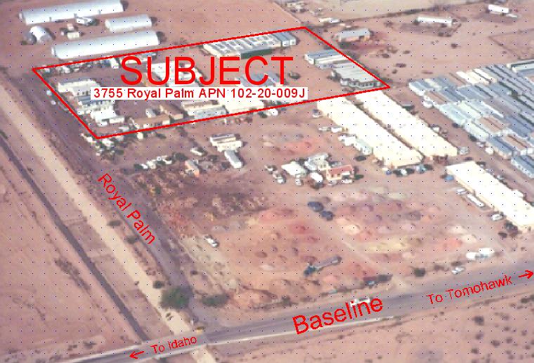
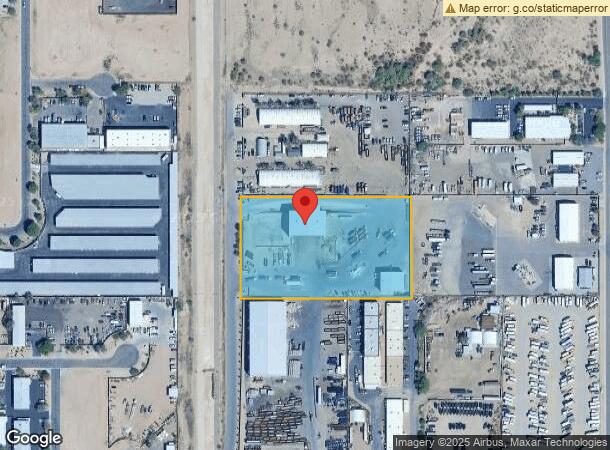
3755 S Royal Palm Rd
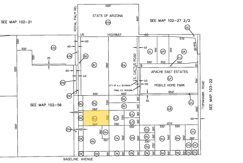
102-20-009J
S1/2 NW SW SE OF SEC 33-1N-8E EXC W-100 THEREOF AS CONVEYED IN D KT 1758/PG 757 SEC 33-1N-8E 4.24 AC
Commercialnec
Pinal
X
Arizona
04013C2320L
4.24 AC
2024
Superstition Corridor
2025
Phoenix
000325
Phoenix-Mesa-Scottsdale, AZ
15,200 SF
DEMOGRAPHICS near 3755 S Royal Palm Rd
1 Mile
3 Mile
5 Mile
2024 Total Population
6,499
38,211
110,384
2029 Population
8,274
48,007
129,890
Pop Growth 2024-2029
+ 27.31%
+ 25.64%
+ 17.67%
Average Age
44
50
46
2024 Total Households
2,724
17,158
45,185
HH Growth 2024-2029
+ 27.06%
+ 25.23%
+ 18.67%
Median Household Inc
$67,617
$57,987
$67,763
Avg Household Size
2.40
2.20
2.40
2024 Avg HH Vehicles
2.00
2.00
2.00
Median Home Value
$305,089
$209,476
$313,048
Median Year Built
2000
1993
1997
Nearby Places
- Restaurants
- Banks
- Shops
- Fitness
- Groceries
PUBLIC TRANSPORTATION
AIRPORT
Phoenix-Mesa Gateway
DRIVE
WALK
Distance
Phoenix-Mesa Gateway
25 min
15.7 mi
Phoenix Sky Harbor International
DRIVE
WALK
Distance
Phoenix Sky Harbor International
42 min
31.5 mi
Freight Ports
Port of San Diego
DRIVE
WALK
Distance
Port of San Diego
429 min
388.2 mi
Nearby Properties
Address
Land Use
TOTAL SIZE
Lot Size
Zoning
Address
Land Use
TOTAL SIZE
Lot Size
Zoning
117,169 SF
13.27 AC
Address
Land Use
TOTAL SIZE
Lot Size
Zoning
Address
Land Use
TOTAL SIZE
Lot Size
Zoning
128,905 SF
7.14 AC
UNDESIGNAT
Address
Land Use
TOTAL SIZE
Lot Size
Zoning
Address
Land Use
TOTAL SIZE
Lot Size
Zoning
Address
Land Use
TOTAL SIZE
Lot Size
Zoning
126,549 SF
9.75 AC
Address
Land Use
TOTAL SIZE
Lot Size
Zoning
52,961 SF
7.94 AC
Address
Land Use
TOTAL SIZE
Lot Size
Zoning
108,644 SF
10.12 AC
UNDESIGNAT
Address
Land Use
TOTAL SIZE
Lot Size
Zoning
62,290 SF
7.53 AC
UNDESIGNAT
Address
Land Use
TOTAL SIZE
Lot Size
Zoning
54,706 SF
16.20 AC
UNDESIGNAT
Address
Land Use
TOTAL SIZE
Lot Size
Zoning
Address
Land Use
TOTAL SIZE
Lot Size
Zoning
69,692 SF
7.26 AC
Address
Land Use
TOTAL SIZE
Lot Size
Zoning
11,686 SF
40 AC
Address
Land Use
TOTAL SIZE
Lot Size
Zoning
38,353 SF
5 AC
Address
Land Use
TOTAL SIZE
Lot Size
Zoning
30,775 SF
7.60 AC
UNDESIGNAT
Address
Land Use
TOTAL SIZE
Lot Size
Zoning
102,430 SF
5 AC
UNDESIGNAT
Address
Land Use
TOTAL SIZE
Lot Size
Zoning
26,022 SF
11.03 AC
UNDESIGNAT
Address
Land Use
TOTAL SIZE
Lot Size
Zoning
27,121 SF
4.05 AC
Address
Land Use
TOTAL SIZE
Lot Size
Zoning
196,400 SF
15.67 AC
Address
Land Use
TOTAL SIZE
Lot Size
Zoning
54,300 SF
4.57 AC
UNDESIGNAT
Address
Land Use
TOTAL SIZE
Lot Size
Zoning
683 SF
36.74 AC
UNDESIGNAT
Address
Land Use
TOTAL SIZE
Lot Size
Zoning
24,158 SF
5.19 AC
Address
Land Use
TOTAL SIZE
Lot Size
Zoning
62,758 SF
5 AC
UNDESIGNAT
Address
Land Use
TOTAL SIZE
Lot Size
Zoning
4,000 SF
20 AC
CI2
Address
Land Use
TOTAL SIZE
Lot Size
Zoning
8,710 SF
14.93 AC
Address
Land Use
TOTAL SIZE
Lot Size
Zoning
28,800 SF
4.59 AC
Address
Land Use
TOTAL SIZE
Lot Size
Zoning
Address
Land Use
TOTAL SIZE
Lot Size
Zoning
20,967 SF
3.60 AC
UNDESIGNAT
Address
Land Use
TOTAL SIZE
Lot Size
Zoning
54,784 SF
5.36 AC
The World's #1 Commercial Real Estate Marketplace
Connect with us
© 2025 CoStar Group
The information above has been obtained from sources believed reliable. While we do not doubt its accuracy we have not verified it and make no guarantee, warranty or representation about it. It is your responsibility to independently confirm its accuracy and completeness. Any projections, opinions, assumptions, or estimates used are for example only and do not represent the current or future performance of the property. The value of this transaction to you depends on tax and other factors which should be evaluated by your tax, financial, and legal advisors. You and your advisors should conduct a careful, independent investigation of the property to determine to your satisfaction the suitability of the property for your needs.