Property Record
377 Raleigh Rd, Henderson, NC 27536

NEARBY LISTINGS FOR SALE OR LEASE
Property Detail
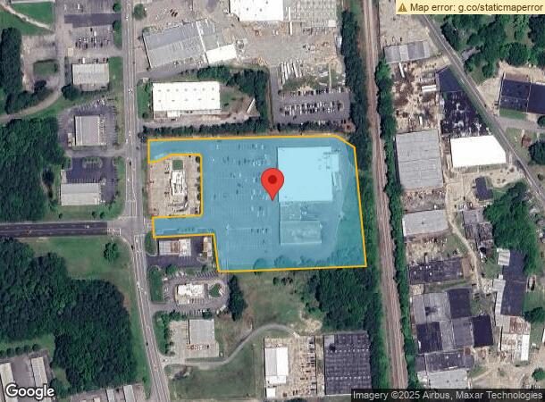
377 Raleigh Rd
0062-01008C
Property Owned By Owen B Moore Jr As Sur
Stripcommercialcenter
377-389 RALEIGH RD 6.14
X
Vance
3720196200K
North Carolina
2024
6.14 AC
2024
North Carolina Northeast Area
9608003017
Other Market Areas
48,490 SF
Henderson, NC
DEMOGRAPHICS near 377 Raleigh Rd
1 Mile
3 Mile
5 Mile
2024 Total Population
6,502
20,342
27,482
2029 Population
6,544
20,214
27,222
Pop Growth 2024-2029
+ 0.65%
(0.63%)
(0.95%)
Average Age
40
40
41
2024 Total Households
2,432
8,207
11,000
HH Growth 2024-2029
+ 0.74%
(0.61%)
(0.91%)
Median Household Inc
$37,008
$35,783
$40,264
Avg Household Size
2.50
2.40
2.40
2024 Avg HH Vehicles
2.00
2.00
2.00
Median Home Value
$83,921
$97,300
$121,078
Median Year Built
1961
1971
1975
Nearby Places
- Restaurants
- Banks
- Shops
- Fitness
- Groceries
SALE & LEASE HISTORY
LISTING DATE
SALE/LEASE

Nov 08, 2021
For Sale
Nov 05, 2020
For Lease
Mar 28, 2023
For Lease
Aug 16, 2018
For Lease
Nearby Properties
Address
Land Use
TOTAL SIZE
Lot Size
Zoning
Address
Land Use
TOTAL SIZE
Lot Size
Zoning
82,663 SF
33 AC
HOI
Address
Land Use
TOTAL SIZE
Lot Size
Zoning
125,900 SF
38.64 AC
HI2
Address
Land Use
TOTAL SIZE
Lot Size
Zoning
149,688 SF
131.64 AC
HI2
Address
Land Use
TOTAL SIZE
Lot Size
Zoning
603,204 SF
45.50 AC
HI2
Address
Land Use
TOTAL SIZE
Lot Size
Zoning
230,400 SF
69.68 AC
HI2
Address
Land Use
TOTAL SIZE
Lot Size
Zoning
106,510 SF
45.28 AC
HI2
Address
Land Use
TOTAL SIZE
Lot Size
Zoning
201,508 SF
19.91 AC
HB2
Address
Land Use
TOTAL SIZE
Lot Size
Zoning
95,555 SF
13.80 AC
HB4
Address
Land Use
TOTAL SIZE
Lot Size
Zoning
96,081 SF
1.33 AC
HB1
Address
Land Use
TOTAL SIZE
Lot Size
Zoning
51,768 SF
40.75 AC
HR8M
Address
Land Use
TOTAL SIZE
Lot Size
Zoning
164,283 SF
20.33 AC
HB2
Address
Land Use
TOTAL SIZE
Lot Size
Zoning
104,496 SF
14.95 AC
HR6
Address
Land Use
TOTAL SIZE
Lot Size
Zoning
64,208 SF
1.90 AC
HB1
Address
Land Use
TOTAL SIZE
Lot Size
Zoning
58,025 SF
12.06 AC
HB4
Address
Land Use
TOTAL SIZE
Lot Size
Zoning
257,656 SF
31.28 AC
HI2
Address
Land Use
TOTAL SIZE
Lot Size
Zoning
167,900 SF
70.82 AC
HR15
Address
Land Use
TOTAL SIZE
Lot Size
Zoning
150,320 SF
9.51 AC
HB3
Address
Land Use
TOTAL SIZE
Lot Size
Zoning
81,065 SF
6.62 AC
HB4
Address
Land Use
TOTAL SIZE
Lot Size
Zoning
117,068 SF
31.86 AC
HI2
Address
Land Use
TOTAL SIZE
Lot Size
Zoning
22,572 SF
88.80 AC
HR15M
Address
Land Use
TOTAL SIZE
Lot Size
Zoning
214,900 SF
25.24 AC
HI2
Address
Land Use
TOTAL SIZE
Lot Size
Zoning
24,888 SF
33.39 AC
HR20
Address
Land Use
TOTAL SIZE
Lot Size
Zoning
54,793 SF
47.70 AC
HR15
Address
Land Use
TOTAL SIZE
Lot Size
Zoning
27,784 SF
2.06 AC
HB1
Address
Land Use
TOTAL SIZE
Lot Size
Zoning
87,830 SF
14.96 AC
HI2
Address
Land Use
TOTAL SIZE
Lot Size
Zoning
78,661 SF
4.84 AC
HOI
Address
Land Use
TOTAL SIZE
Lot Size
Zoning
38,331 SF
13.62 AC
HB2A
Address
Land Use
TOTAL SIZE
Lot Size
Zoning
36,173 SF
1.56 AC
HOI
Address
Land Use
TOTAL SIZE
Lot Size
Zoning
19,596 SF
7.60 AC
HR15M
Address
Land Use
TOTAL SIZE
Lot Size
Zoning
28,326 SF
7.63 AC
HB2
The World's #1 Commercial Real Estate Marketplace
Connect with us
© 2025 CoStar Group
The information above has been obtained from sources believed reliable. While we do not doubt its accuracy we have not verified it and make no guarantee, warranty or representation about it. It is your responsibility to independently confirm its accuracy and completeness. Any projections, opinions, assumptions, or estimates used are for example only and do not represent the current or future performance of the property. The value of this transaction to you depends on tax and other factors which should be evaluated by your tax, financial, and legal advisors. You and your advisors should conduct a careful, independent investigation of the property to determine to your satisfaction the suitability of the property for your needs.