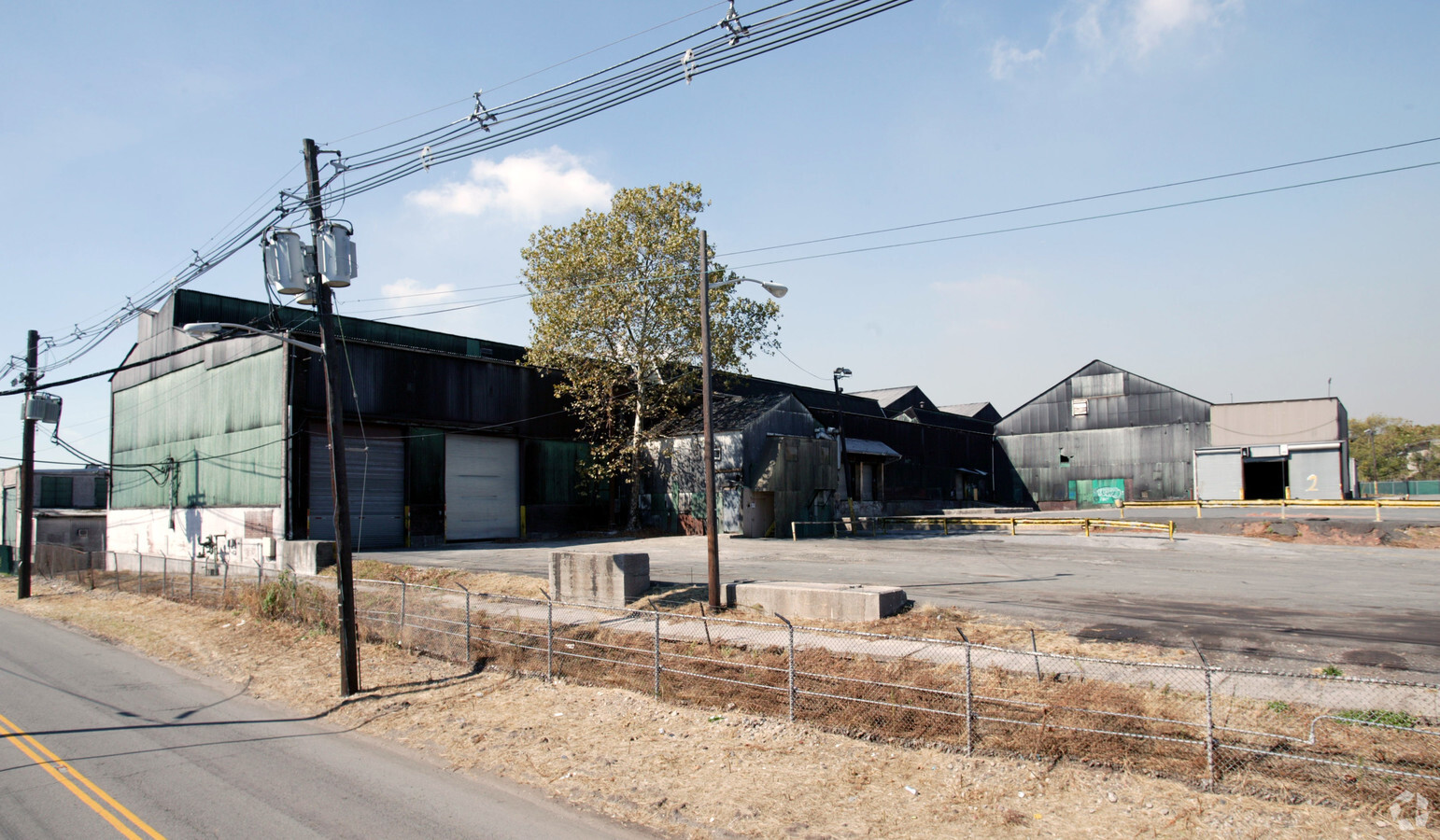
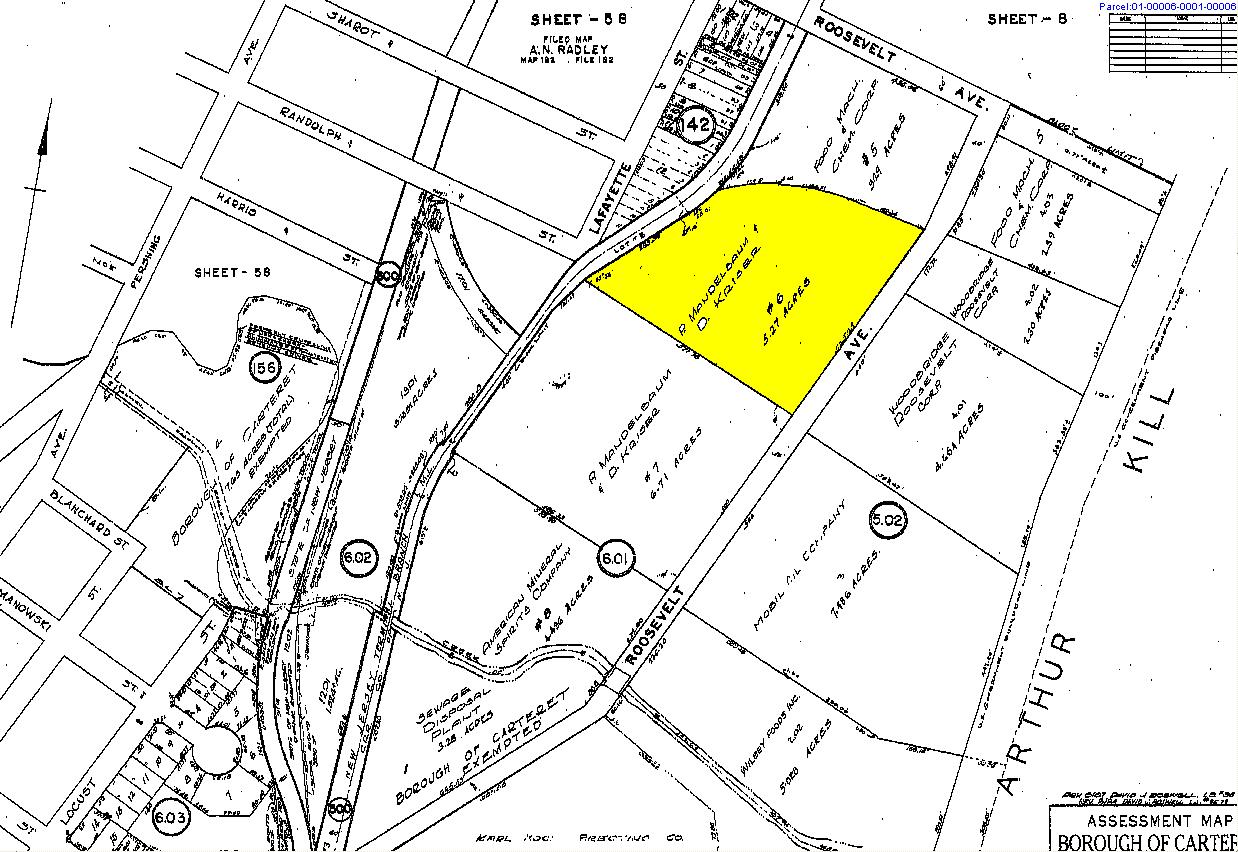
Property Record
377 Roosevelt Ave, Carteret, NJ 07008

NEARBY LISTINGS FOR SALE OR LEASE
Property Detail
377 Roosevelt Ave
01-00404-0000-00003
11.98AC 263925SF
Autorepair
Middlesex
X
New Jersey
34023C0079F
3
2023
11.98 AC
2024
Carteret/Avenel
980000
Northern New Jersey
263,925 SF
New York-Jersey City-White Plains, NY-NJ
DEMOGRAPHICS near 377 Roosevelt Ave
1 Mile
3 Mile
5 Mile
2024 Total Population
13,707
100,739
422,094
2029 Population
13,298
99,010
414,552
Pop Growth 2024-2029
(2.98%)
(1.72%)
(1.79%)
Average Age
37
41
41
2024 Total Households
4,620
34,954
148,172
HH Growth 2024-2029
(3.12%)
(1.80%)
(1.84%)
Median Household Inc
$75,448
$91,783
$90,079
Avg Household Size
2.90
2.80
2.80
2024 Avg HH Vehicles
2.00
2.00
2.00
Median Home Value
$303,353
$490,178
$516,165
Median Year Built
1964
1981
1973
Nearby Places
- Restaurants
- Banks
- Shops
- Fitness
- Groceries
PUBLIC TRANSPORTATION
COMMUTER RAIL
Avenel (North Jersey Coast Line - NJ Transit Commuter Rail (NJ Transit))
DRIVE
WALK
Distance
Avenel (North Jersey Coast Line - NJ Transit Commuter Rail (NJ Transit))
11 min
5.8 mi
AIRPORT
Newark Liberty International
DRIVE
WALK
Distance
Newark Liberty International
21 min
13.7 mi
Laguardia
DRIVE
WALK
Distance
Laguardia
51 min
31.0 mi
John F Kennedy International
DRIVE
WALK
Distance
John F Kennedy International
52 min
36.1 mi
Freight Ports
New York Container Terminal
DRIVE
WALK
Distance
New York Container Terminal
14 min
8.8 mi
Nearby Properties
Address
Land Use
TOTAL SIZE
Lot Size
Zoning
Address
Land Use
TOTAL SIZE
Lot Size
Zoning
196.03 AC
HIA
Address
Land Use
TOTAL SIZE
Lot Size
Zoning
237 AC
M1-1
Address
Land Use
TOTAL SIZE
Lot Size
Zoning
118 AC
M3-1
Address
Land Use
TOTAL SIZE
Lot Size
Zoning
1,258,042 SF
14.46 AC
C4-1
Address
Land Use
TOTAL SIZE
Lot Size
Zoning
20.10 AC
Address
Land Use
TOTAL SIZE
Lot Size
Zoning
794,430 SF
36.09 AC
R50
Address
Land Use
TOTAL SIZE
Lot Size
Zoning
Address
Land Use
TOTAL SIZE
Lot Size
Zoning
102.29 AC
Address
Land Use
TOTAL SIZE
Lot Size
Zoning
131.25 AC
PARK
Address
Land Use
TOTAL SIZE
Lot Size
Zoning
5,214 SF
93 AC
M3-1
Address
Land Use
TOTAL SIZE
Lot Size
Zoning
329,350 SF
15.99 AC
Address
Land Use
TOTAL SIZE
Lot Size
Zoning
195,395 SF
12.04 AC
R3-2
Address
Land Use
TOTAL SIZE
Lot Size
Zoning
970,000 SF
55.25 AC
M3-1
Address
Land Use
TOTAL SIZE
Lot Size
Zoning
365,784 SF
12.73 AC
HIA
Address
Land Use
TOTAL SIZE
Lot Size
Zoning
196,382 SF
25.95 AC
Address
Land Use
TOTAL SIZE
Lot Size
Zoning
360,082 SF
22.45 AC
R50
Address
Land Use
TOTAL SIZE
Lot Size
Zoning
232,134 SF
12.24 AC
LI
Address
Land Use
TOTAL SIZE
Lot Size
Zoning
11,140 SF
170.60 AC
PARK
Address
Land Use
TOTAL SIZE
Lot Size
Zoning
91.96 AC
Address
Land Use
TOTAL SIZE
Lot Size
Zoning
450,000 SF
33.26 AC
M3-1
Address
Land Use
TOTAL SIZE
Lot Size
Zoning
7.24 AC
Address
Land Use
TOTAL SIZE
Lot Size
Zoning
Address
Land Use
TOTAL SIZE
Lot Size
Zoning
286,290 SF
21.24 AC
R50
Address
Land Use
TOTAL SIZE
Lot Size
Zoning
404,985 SF
15.32 AC
R25
Address
Land Use
TOTAL SIZE
Lot Size
Zoning
298,080 SF
13.79 AC
LI
Address
Land Use
TOTAL SIZE
Lot Size
Zoning
9.90 AC
LI
Address
Land Use
TOTAL SIZE
Lot Size
Zoning
Address
Land Use
TOTAL SIZE
Lot Size
Zoning
84,160 SF
81.12 AC
M1-1
Address
Land Use
TOTAL SIZE
Lot Size
Zoning
39.50 AC
HI-A
The World's #1 Commercial Real Estate Marketplace
Connect with us
© 2025 CoStar Group
The information above has been obtained from sources believed reliable. While we do not doubt its accuracy we have not verified it and make no guarantee, warranty or representation about it. It is your responsibility to independently confirm its accuracy and completeness. Any projections, opinions, assumptions, or estimates used are for example only and do not represent the current or future performance of the property. The value of this transaction to you depends on tax and other factors which should be evaluated by your tax, financial, and legal advisors. You and your advisors should conduct a careful, independent investigation of the property to determine to your satisfaction the suitability of the property for your needs.