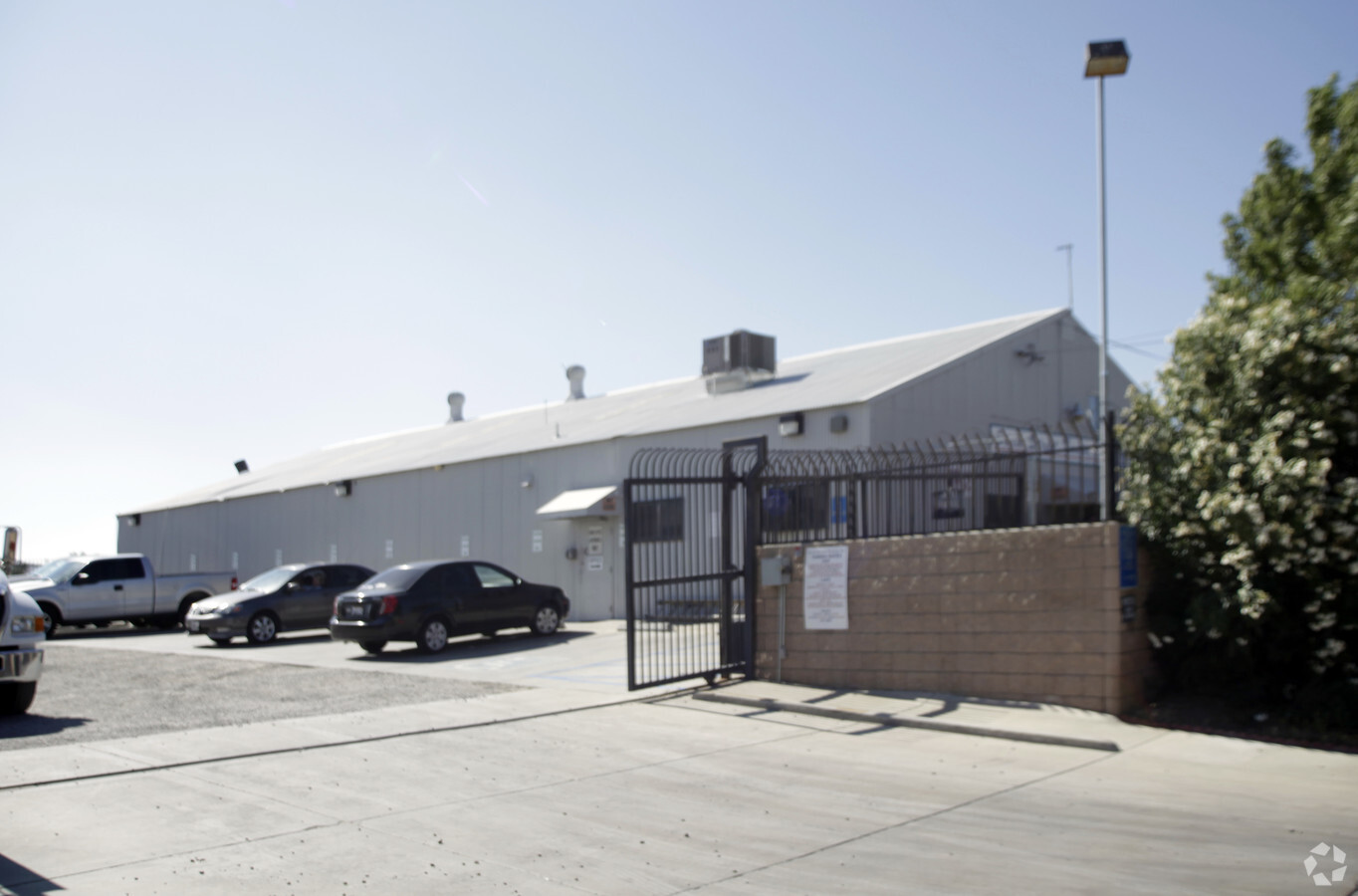
Property Record
37803 6Th St E, Palmdale, CA 93550

NEARBY LISTINGS FOR SALE OR LEASE
Property Detail
37803 6Th St E
Los Angeles-Long Beach-Glendale, CA
Parcel Map 6072
3010-020-023
SUB OF N 1/2 OF SEC 35 T 6N R 12W LOT COM AT SW COR OF LAND DESC IN PAR 1 OR42463-188 TO EDWARD E DEBS AND J CLIFFORD JOHNSTON TH N 0 1538 W 196.78 FT TH S 89 53 W 100 FT TH S 0 1538 E LOT/SEC 3
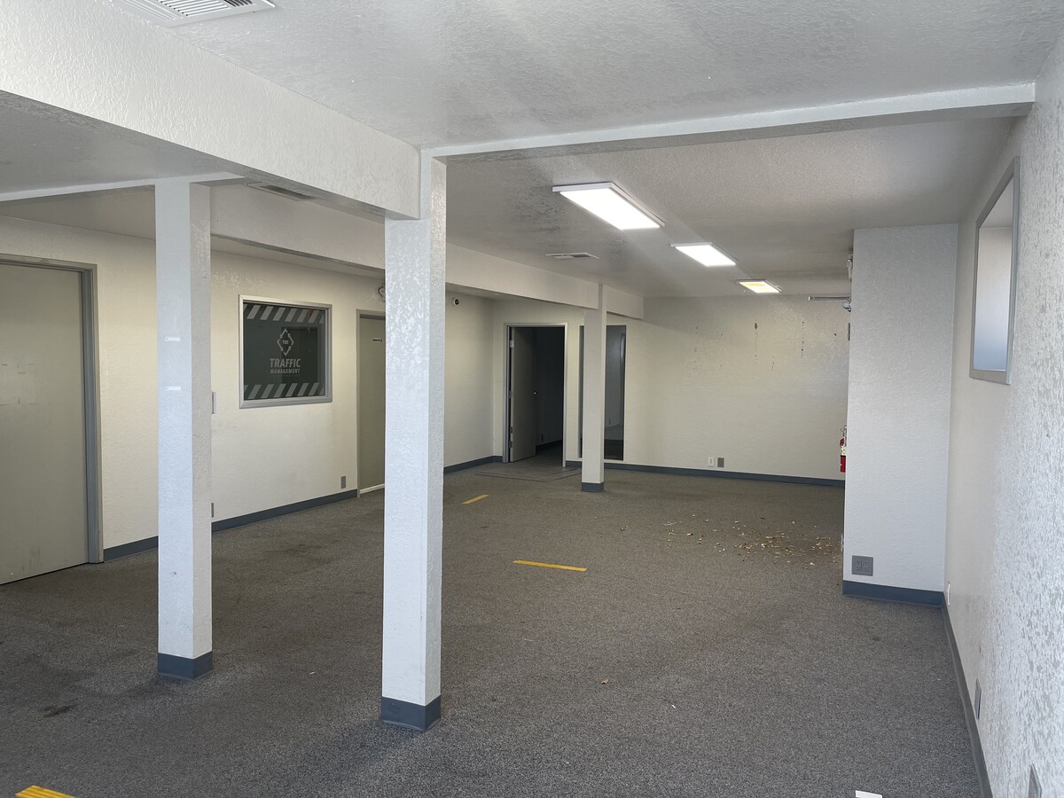
Lightindustrial
Los Angeles
X
California
06037C0700F
3
2024
0.76 AC
2024
Antelope Valley
910504
Los Angeles
5,000 SF
DEMOGRAPHICS near 37803 6Th St E
1 Mile
3 Mile
5 Mile
2024 Total Population
18,258
83,226
137,884
2029 Population
18,022
80,869
133,551
Pop Growth 2024-2029
(1.29%)
(2.83%)
(3.14%)
Average Age
34
35
36
2024 Total Households
5,586
24,689
39,492
HH Growth 2024-2029
(1.22%)
(2.91%)
(3.26%)
Median Household Inc
$43,032
$55,536
$65,851
Avg Household Size
3.20
3.30
3.40
2024 Avg HH Vehicles
2.00
2.00
2.00
Median Home Value
$248,588
$287,953
$329,482
Median Year Built
1983
1984
1986
Nearby Places
- Restaurants
- Banks
- Shops
- Fitness
- Groceries
PUBLIC TRANSPORTATION
COMMUTER RAIL
Palmdale (Antelope Valley Line - Southern California Regional Rail Authority (Metrolink))
DRIVE
WALK
Distance
Palmdale (Antelope Valley Line - Southern California Regional Rail Authority (Metrolink))
4 min
1.6 mi
Vincent Grade/Acton (Antelope Valley Line - Southern California Regional Rail Authority (Metrolink))
DRIVE
WALK
Distance
Vincent Grade/Acton (Antelope Valley Line - Southern California Regional Rail Authority (Metrolink))
11 min
6.3 mi
AIRPORT
Bob Hope
DRIVE
WALK
Distance
Bob Hope
57 min
48.4 mi
Freight Ports
Port of Long Beach
DRIVE
WALK
Distance
Port of Long Beach
100 min
84.9 mi
SALE & LEASE HISTORY
LISTING DATE
SALE/LEASE

Sep 25, 2016
For Lease
Sep 23, 2021
For Sale
Nearby Properties
Address
Land Use
TOTAL SIZE
Lot Size
Zoning
Address
Land Use
TOTAL SIZE
Lot Size
Zoning
358,828 SF
26.23 AC
PDR17000
Address
Land Use
TOTAL SIZE
Lot Size
Zoning
130,392 SF
26.91 AC
PDCPD*
Address
Land Use
TOTAL SIZE
Lot Size
Zoning
167,366 SF
15.36 AC
PDC3
Address
Land Use
TOTAL SIZE
Lot Size
Zoning
88,750 SF
9.28 AC
PDM1 1/2*
Address
Land Use
TOTAL SIZE
Lot Size
Zoning
128,353 SF
9.49 AC
PDCPD-R1*
Address
Land Use
TOTAL SIZE
Lot Size
Zoning
50,735 SF
PDCPD
Address
Land Use
TOTAL SIZE
Lot Size
Zoning
78,492 SF
3.25 AC
PDCPD
Address
Land Use
TOTAL SIZE
Lot Size
Zoning
139,513 SF
4.07 AC
PDCPD
Address
Land Use
TOTAL SIZE
Lot Size
Zoning
60,644 SF
3.89 AC
PDMX*
Address
Land Use
TOTAL SIZE
Lot Size
Zoning
103,503 SF
3.61 AC
PDC2
Address
Land Use
TOTAL SIZE
Lot Size
Zoning
64,818 SF
2.30 AC
PDCP
Address
Land Use
TOTAL SIZE
Lot Size
Zoning
221,827 SF
14.90 AC
PDRPD10U-R
Address
Land Use
TOTAL SIZE
Lot Size
Zoning
PDRN4
Address
Land Use
TOTAL SIZE
Lot Size
Zoning
59,577 SF
0.58 AC
PDR17000
Address
Land Use
TOTAL SIZE
Lot Size
Zoning
209,328 SF
6.35 AC
PDC3-RPD15
Address
Land Use
TOTAL SIZE
Lot Size
Zoning
69,555 SF
7.55 AC
PDMPD*
Address
Land Use
TOTAL SIZE
Lot Size
Zoning
71,394 SF
2.93 AC
PDCPD*
Address
Land Use
TOTAL SIZE
Lot Size
Zoning
76,609 SF
3.61 AC
PDM2
Address
Land Use
TOTAL SIZE
Lot Size
Zoning
36,033 SF
3.81 AC
PDMPD*
Address
Land Use
TOTAL SIZE
Lot Size
Zoning
144,471 SF
12.96 AC
PDCPD-MPD*
Address
Land Use
TOTAL SIZE
Lot Size
Zoning
106,048 SF
9.82 AC
PDR3*
Address
Land Use
TOTAL SIZE
Lot Size
Zoning
80,981 SF
7.11 AC
PDC3
Address
Land Use
TOTAL SIZE
Lot Size
Zoning
55,079 SF
1.98 AC
PDCPD*
Address
Land Use
TOTAL SIZE
Lot Size
Zoning
71,974 SF
3.83 AC
PDCPD*
Address
Land Use
TOTAL SIZE
Lot Size
Zoning
377,382 SF
8.99 AC
PDMP
Address
Land Use
TOTAL SIZE
Lot Size
Zoning
207,582 SF
18.74 AC
PDR1*
Address
Land Use
TOTAL SIZE
Lot Size
Zoning
61,883 SF
4.10 AC
PDMPD*
Address
Land Use
TOTAL SIZE
Lot Size
Zoning
57,588 SF
6.06 AC
PDMPD*
Address
Land Use
TOTAL SIZE
Lot Size
Zoning
133,410 SF
12.66 AC
PDMPD*
Address
Land Use
TOTAL SIZE
Lot Size
Zoning
115,800 SF
11.51 AC
PDCPD-MPD*
The World's #1 Commercial Real Estate Marketplace
Connect with us
© 2025 CoStar Group
The information above has been obtained from sources believed reliable. While we do not doubt its accuracy we have not verified it and make no guarantee, warranty or representation about it. It is your responsibility to independently confirm its accuracy and completeness. Any projections, opinions, assumptions, or estimates used are for example only and do not represent the current or future performance of the property. The value of this transaction to you depends on tax and other factors which should be evaluated by your tax, financial, and legal advisors. You and your advisors should conduct a careful, independent investigation of the property to determine to your satisfaction the suitability of the property for your needs.