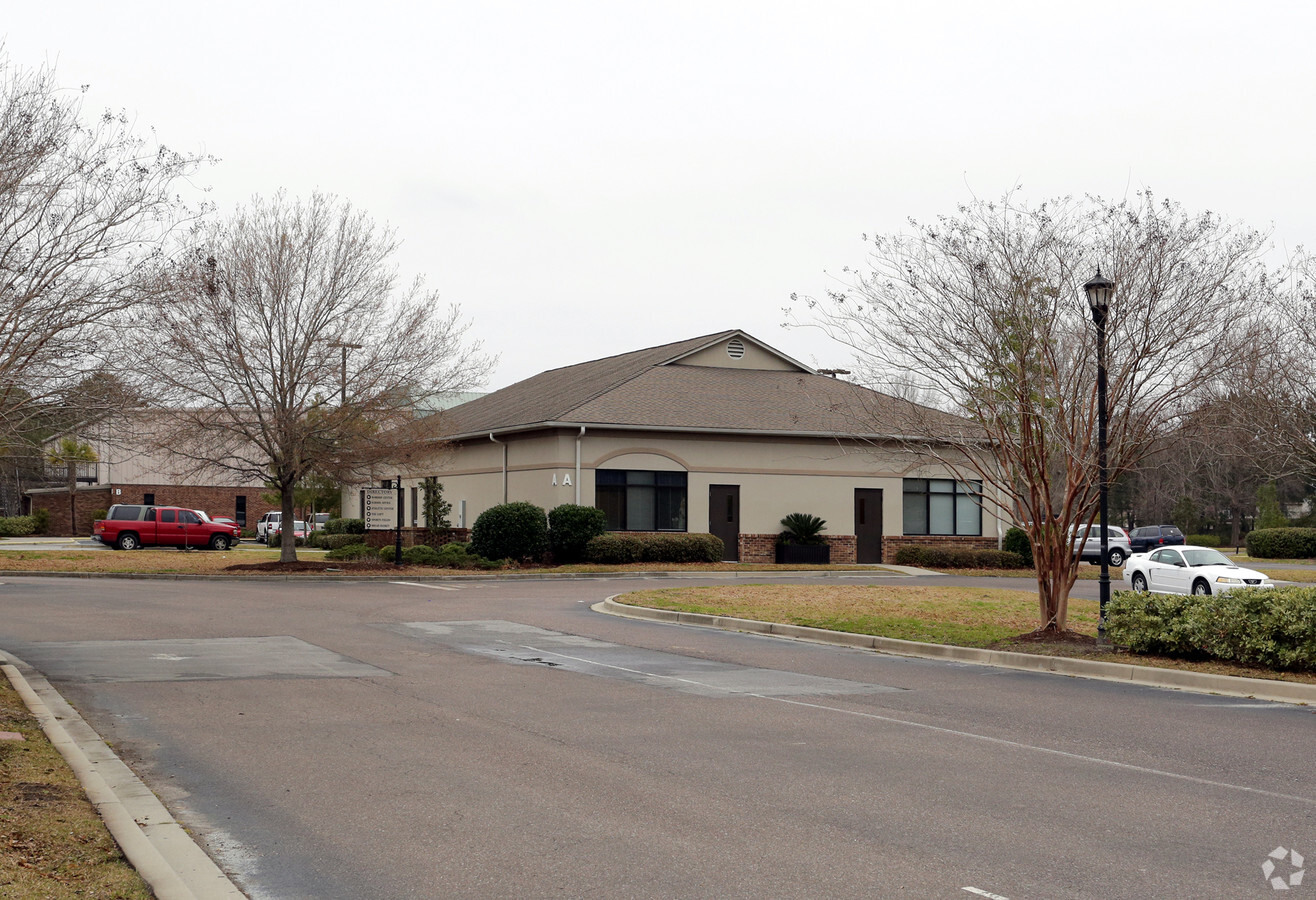
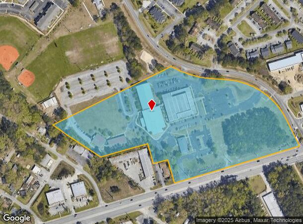
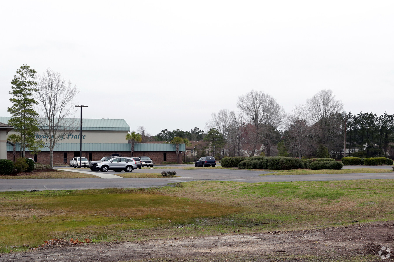
Property Record
3790 Ashley Phosphate Rd, North Charleston, SC 29418
NEARBY LISTINGS FOR SALE OR LEASE
Property Detail
3790 Ashley Phosphate Rd
172-00-00-031
Plat Of Tracts 1 Through 6 A Portion Of
Religious
TRACT 4A
X
Dorchester
45019C0290K
South Carolina
2024
16.05 AC
2024
Dorchester County
010818
Charleston/N Charleston
75,889 SF
Charleston-North Charleston, SC
DEMOGRAPHICS near 3790 Ashley Phosphate Rd
1 Mile
3 Mile
5 Mile
2024 Total Population
9,261
55,469
123,253
2029 Population
9,989
59,377
133,234
Pop Growth 2024-2029
+ 7.86%
+ 7.05%
+ 8.10%
Average Age
35
37
36
2024 Total Households
3,260
21,230
48,042
HH Growth 2024-2029
+ 7.67%
+ 6.94%
+ 7.94%
Median Household Inc
$51,821
$65,236
$63,126
Avg Household Size
2.70
2.50
2.50
2024 Avg HH Vehicles
2.00
2.00
2.00
Median Home Value
$190,668
$250,786
$244,510
Median Year Built
1988
1998
1998
Nearby Places
- Restaurants
- Banks
- Shops
- Fitness
- Groceries
PUBLIC TRANSPORTATION
COMMUTER RAIL
Charleston Amtrak Station (Palmetto - Amtrak, Silver Meteor - Amtrak)
DRIVE
WALK
Distance
Charleston Amtrak Station (Palmetto - Amtrak, Silver Meteor - Amtrak)
14 min
8.6 mi
AIRPORT
Charleston AFB/International
DRIVE
WALK
Distance
Charleston AFB/International
10 min
5.6 mi
Freight Ports
North Charleston Terminal
DRIVE
WALK
Distance
North Charleston Terminal
14 min
8.2 mi
Nearby Properties
Address
Land Use
TOTAL SIZE
Lot Size
Zoning
Address
Land Use
TOTAL SIZE
Lot Size
Zoning
Address
Land Use
TOTAL SIZE
Lot Size
Zoning
48.89 AC
Address
Land Use
TOTAL SIZE
Lot Size
Zoning
1,430 SF
28.27 AC
Address
Land Use
TOTAL SIZE
Lot Size
Zoning
Address
Land Use
TOTAL SIZE
Lot Size
Zoning
14.75 AC
Address
Land Use
TOTAL SIZE
Lot Size
Zoning
16.40 AC
Address
Land Use
TOTAL SIZE
Lot Size
Zoning
1,272 SF
18.46 AC
Address
Land Use
TOTAL SIZE
Lot Size
Zoning
199,300 SF
13.28 AC
Address
Land Use
TOTAL SIZE
Lot Size
Zoning
126,385 SF
13.45 AC
Address
Land Use
TOTAL SIZE
Lot Size
Zoning
67,082 SF
12.07 AC
Address
Land Use
TOTAL SIZE
Lot Size
Zoning
48,400 SF
5.76 AC
Address
Land Use
TOTAL SIZE
Lot Size
Zoning
33.88 AC
Address
Land Use
TOTAL SIZE
Lot Size
Zoning
Address
Land Use
TOTAL SIZE
Lot Size
Zoning
44,300 SF
2.34 AC
Address
Land Use
TOTAL SIZE
Lot Size
Zoning
332,013 SF
74.26 AC
R3_NC
Address
Land Use
TOTAL SIZE
Lot Size
Zoning
384,000 SF
23.95 AC
PDD_NC
Address
Land Use
TOTAL SIZE
Lot Size
Zoning
17,272 SF
3.02 AC
Address
Land Use
TOTAL SIZE
Lot Size
Zoning
105,600 SF
7.22 AC
Address
Land Use
TOTAL SIZE
Lot Size
Zoning
Address
Land Use
TOTAL SIZE
Lot Size
Zoning
339,744 SF
17.75 AC
R1_NC
Address
Land Use
TOTAL SIZE
Lot Size
Zoning
14.33 AC
Address
Land Use
TOTAL SIZE
Lot Size
Zoning
189,648 SF
40.49 AC
R1_NC
Address
Land Use
TOTAL SIZE
Lot Size
Zoning
185,000 SF
28.36 AC
R2_NC
Address
Land Use
TOTAL SIZE
Lot Size
Zoning
99.87 AC
Address
Land Use
TOTAL SIZE
Lot Size
Zoning
194,994 SF
21.28 AC
R4_DC
Address
Land Use
TOTAL SIZE
Lot Size
Zoning
256,996 SF
22.18 AC
R2_NC
Address
Land Use
TOTAL SIZE
Lot Size
Zoning
1,842 SF
17.11 AC
Address
Land Use
TOTAL SIZE
Lot Size
Zoning
102,297 SF
20.14 AC
PDD_NC
Address
Land Use
TOTAL SIZE
Lot Size
Zoning
256,996 SF
29.96 AC
PDD_NC
Address
Land Use
TOTAL SIZE
Lot Size
Zoning
228,432 SF
12.96 AC
B2_NC
The World's #1 Commercial Real Estate Marketplace
Connect with us
© 2025 CoStar Group
The information above has been obtained from sources believed reliable. While we do not doubt its accuracy we have not verified it and make no guarantee, warranty or representation about it. It is your responsibility to independently confirm its accuracy and completeness. Any projections, opinions, assumptions, or estimates used are for example only and do not represent the current or future performance of the property. The value of this transaction to you depends on tax and other factors which should be evaluated by your tax, financial, and legal advisors. You and your advisors should conduct a careful, independent investigation of the property to determine to your satisfaction the suitability of the property for your needs.