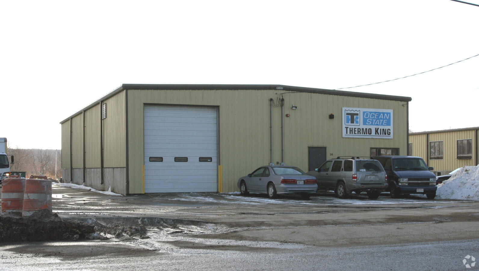
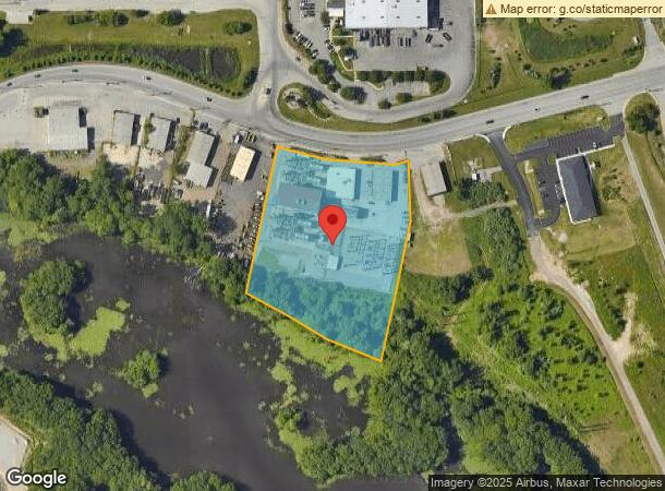
Property Record
38 Shun Pike, Johnston, RI 02919
NEARBY LISTINGS FOR SALE OR LEASE
Property Detail
38 Shun Pike
JOHN-000031-000000-000046
Providence
Taxexempt
Rhode Island
X
46
44007C0292H
1.50 AC
0
Johnston
2024
Providence
0125003010
Providence-Warwick, RI-MA
3,200 SF
DEMOGRAPHICS near 38 Shun Pike
1 Mile
3 Mile
5 Mile
2024 Total Population
893
35,324
190,463
2029 Population
901
35,455
188,911
Pop Growth 2024-2029
+ 0.90%
+ 0.37%
(0.81%)
Average Age
45
44
40
2024 Total Households
348
14,109
74,351
HH Growth 2024-2029
+ 0.57%
+ 0.30%
(0.85%)
Median Household Inc
$88,690
$84,521
$69,311
Avg Household Size
2.40
2.40
2.50
2024 Avg HH Vehicles
2.00
2.00
2.00
Median Home Value
$314,189
$333,321
$305,248
Median Year Built
1979
1978
1958
Nearby Places
- Restaurants
- Banks
- Shops
- Fitness
- Groceries
PUBLIC TRANSPORTATION
COMMUTER RAIL
Providence (Providence/Stoughton Line - Massachusetts Bay Transportation Authority Commuter Rail (Purple Line))
DRIVE
WALK
Distance
Providence (Providence/Stoughton Line - Massachusetts Bay Transportation Authority Commuter Rail (Purple Line))
12 min
7.9 mi
Tf Green Airport (Providence/Stoughton Line - MBTA)
DRIVE
WALK
Distance
Tf Green Airport (Providence/Stoughton Line - MBTA)
15 min
9.5 mi
AIRPORT
Rhode Island Tf Green International
DRIVE
WALK
Distance
Rhode Island Tf Green International
18 min
10.4 mi
Freight Ports
Port of Davisville, RI
DRIVE
WALK
Distance
Port of Davisville, RI
29 min
19.6 mi
Nearby Properties
Address
Land Use
TOTAL SIZE
Lot Size
Zoning
Address
Land Use
TOTAL SIZE
Lot Size
Zoning
93.51 AC
PUD
Address
Land Use
TOTAL SIZE
Lot Size
Zoning
4,954 SF
11.22 AC
C5
Address
Land Use
TOTAL SIZE
Lot Size
Zoning
333,161 SF
25.85 AC
B1
Address
Land Use
TOTAL SIZE
Lot Size
Zoning
32.30 AC
I
Address
Land Use
TOTAL SIZE
Lot Size
Zoning
13,542 SF
95.26 AC
R10
Address
Land Use
TOTAL SIZE
Lot Size
Zoning
15.35 AC
MPD
Address
Land Use
TOTAL SIZE
Lot Size
Zoning
30.14 AC
R40
Address
Land Use
TOTAL SIZE
Lot Size
Zoning
11.16 AC
A20
Address
Land Use
TOTAL SIZE
Lot Size
Zoning
0.97 AC
A12
Address
Land Use
TOTAL SIZE
Lot Size
Zoning
38.09 AC
CD
Address
Land Use
TOTAL SIZE
Lot Size
Zoning
1 AC
R40
Address
Land Use
TOTAL SIZE
Lot Size
Zoning
7.06 AC
R20
Address
Land Use
TOTAL SIZE
Lot Size
Zoning
96.12 AC
I
Address
Land Use
TOTAL SIZE
Lot Size
Zoning
122,836 SF
15.10 AC
R40
Address
Land Use
TOTAL SIZE
Lot Size
Zoning
8.33 AC
R10
Address
Land Use
TOTAL SIZE
Lot Size
Zoning
98,793 SF
10.34 AC
B1
Address
Land Use
TOTAL SIZE
Lot Size
Zoning
60,039 SF
18.41 AC
A80
Address
Land Use
TOTAL SIZE
Lot Size
Zoning
8,742 SF
16.26 AC
R40
Address
Land Use
TOTAL SIZE
Lot Size
Zoning
21.86 AC
I
Address
Land Use
TOTAL SIZE
Lot Size
Zoning
80,602 SF
20.30 AC
B2
Address
Land Use
TOTAL SIZE
Lot Size
Zoning
133,311 SF
3.21 AC
R7
Address
Land Use
TOTAL SIZE
Lot Size
Zoning
133.14 AC
R10
Address
Land Use
TOTAL SIZE
Lot Size
Zoning
93,878 SF
14.15 AC
B2
Address
Land Use
TOTAL SIZE
Lot Size
Zoning
153,214 SF
14.37 AC
C4
Address
Land Use
TOTAL SIZE
Lot Size
Zoning
10.50 AC
B2
Address
Land Use
TOTAL SIZE
Lot Size
Zoning
13.89 AC
B2
Address
Land Use
TOTAL SIZE
Lot Size
Zoning
9.92 AC
C2
Address
Land Use
TOTAL SIZE
Lot Size
Zoning
61,199 SF
8.83 AC
A12
Address
Land Use
TOTAL SIZE
Lot Size
Zoning
87.80 AC
A6
Address
Land Use
TOTAL SIZE
Lot Size
Zoning
11.40 AC
R10
The World's #1 Commercial Real Estate Marketplace
Connect with us
© 2025 CoStar Group
The information above has been obtained from sources believed reliable. While we do not doubt its accuracy we have not verified it and make no guarantee, warranty or representation about it. It is your responsibility to independently confirm its accuracy and completeness. Any projections, opinions, assumptions, or estimates used are for example only and do not represent the current or future performance of the property. The value of this transaction to you depends on tax and other factors which should be evaluated by your tax, financial, and legal advisors. You and your advisors should conduct a careful, independent investigation of the property to determine to your satisfaction the suitability of the property for your needs.