Property Record
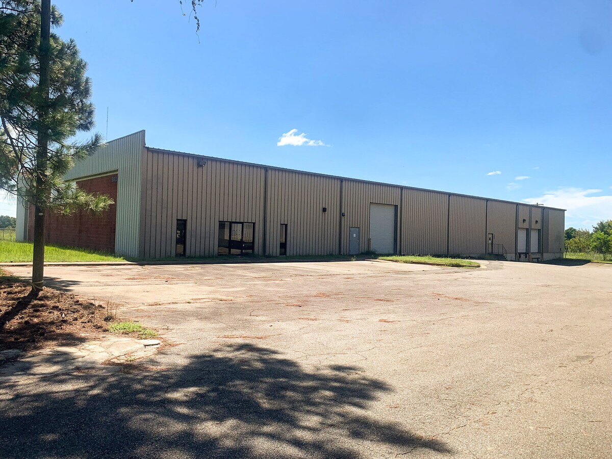
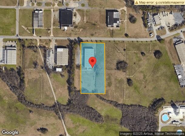
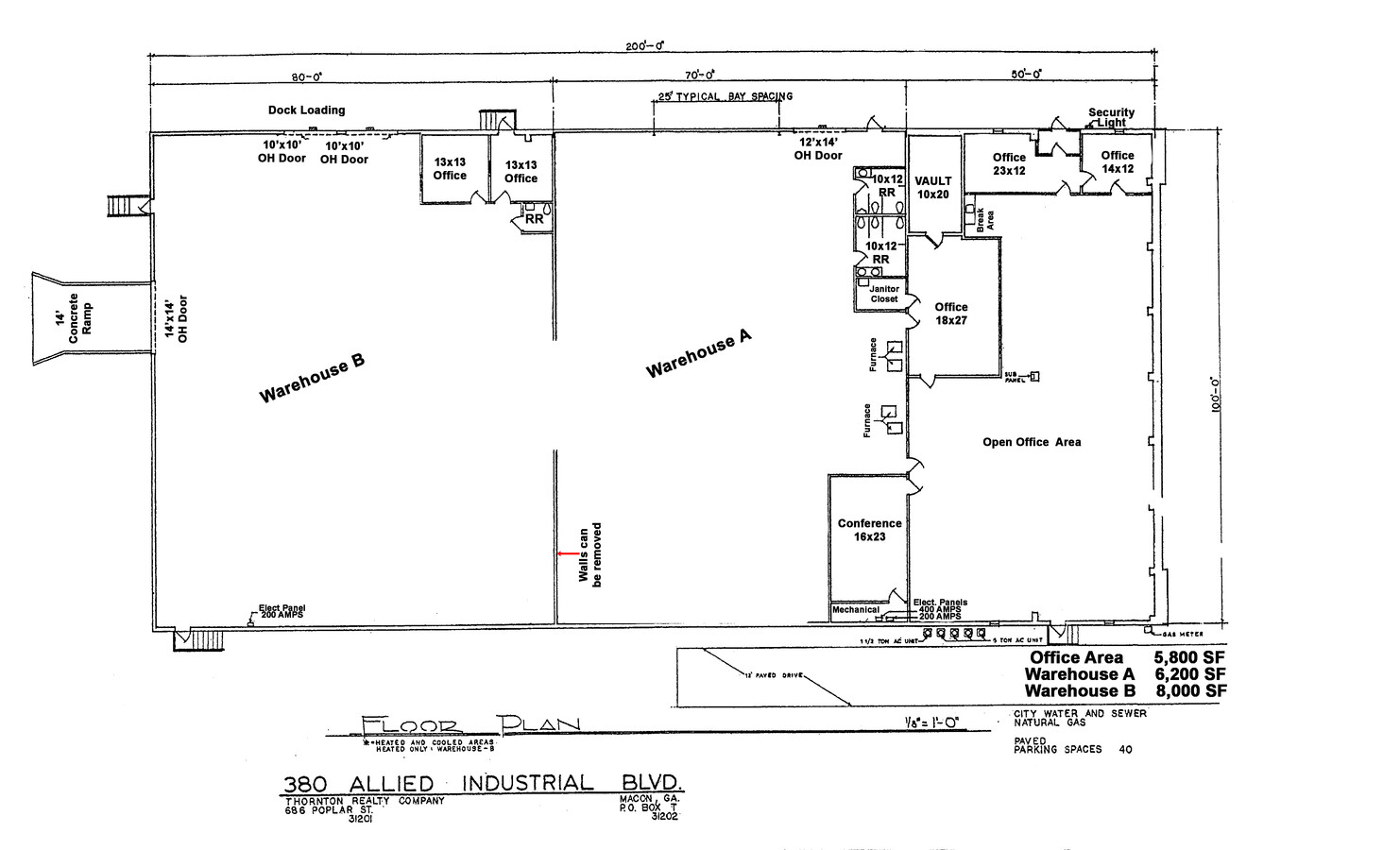
380 Allied Industrial Blvd, Macon, GA 31206
NEARBY LISTINGS FOR SALE OR LEASE
Property Detail
380 Allied Industrial Blvd
Q110-0016
Bibb
Warehouse
Georgia
X
138
13021C0144G
3 AC
2024
Macon
2024
Atlanta
013900
Macon-Bibb County, GA
20,000 SF
DEMOGRAPHICS near 380 Allied Industrial Blvd
1 Mile
3 Mile
5 Mile
2024 Total Population
850
16,287
59,647
2029 Population
903
16,651
60,329
Pop Growth 2024-2029
+ 6.24%
+ 2.23%
+ 1.14%
Average Age
37
37
37
2024 Total Households
298
6,151
23,049
HH Growth 2024-2029
+ 6.71%
+ 2.44%
+ 1.38%
Median Household Inc
$32,142
$30,946
$34,487
Avg Household Size
2.50
2.50
2.40
2024 Avg HH Vehicles
1.00
1.00
1.00
Median Home Value
$165,116
$82,302
$100,160
Median Year Built
1960
1964
1966
Nearby Places
- Restaurants
- Banks
- Shops
- Fitness
- Groceries
SALE & LEASE HISTORY
LISTING DATE
SALE/LEASE

Aug 20, 2024
For Lease
Aug 20, 2024
For Sale
Nearby Properties
Address
Land Use
TOTAL SIZE
Lot Size
Zoning
Address
Land Use
TOTAL SIZE
Lot Size
Zoning
616,986 SF
130.58 AC
M-2
Address
Land Use
TOTAL SIZE
Lot Size
Zoning
983,943 SF
136.41 AC
M-2
Address
Land Use
TOTAL SIZE
Lot Size
Zoning
181,396 SF
44.77 AC
R-1A
Address
Land Use
TOTAL SIZE
Lot Size
Zoning
12,817 SF
357.49 AC
M-2
Address
Land Use
TOTAL SIZE
Lot Size
Zoning
204,144 SF
95 AC
M-2
Address
Land Use
TOTAL SIZE
Lot Size
Zoning
108,418 SF
24.45 AC
R-1A
Address
Land Use
TOTAL SIZE
Lot Size
Zoning
13,596 SF
9.04 AC
R-3
Address
Land Use
TOTAL SIZE
Lot Size
Zoning
1,590 SF
10.52 AC
R-3
Address
Land Use
TOTAL SIZE
Lot Size
Zoning
32,300 SF
24.40 AC
R-2
Address
Land Use
TOTAL SIZE
Lot Size
Zoning
100,192 SF
30.29 AC
C-2
Address
Land Use
TOTAL SIZE
Lot Size
Zoning
54,810 SF
2.17 AC
C-4
Address
Land Use
TOTAL SIZE
Lot Size
Zoning
3,196 SF
12.94 AC
R-3
Address
Land Use
TOTAL SIZE
Lot Size
Zoning
201,615 SF
20.36 AC
M-1
Address
Land Use
TOTAL SIZE
Lot Size
Zoning
64,723 SF
6.12 AC
R-1
Address
Land Use
TOTAL SIZE
Lot Size
Zoning
214,303 SF
5.91 AC
M-2
Address
Land Use
TOTAL SIZE
Lot Size
Zoning
159,556 SF
10.82 AC
C-2
Address
Land Use
TOTAL SIZE
Lot Size
Zoning
41,949 SF
10 AC
R-1
Address
Land Use
TOTAL SIZE
Lot Size
Zoning
6,480 SF
102.17 AC
M-2
Address
Land Use
TOTAL SIZE
Lot Size
Zoning
121,868 SF
12.31 AC
C-2
Address
Land Use
TOTAL SIZE
Lot Size
Zoning
43,659 SF
21.29 AC
C-2
Address
Land Use
TOTAL SIZE
Lot Size
Zoning
100,170 SF
12.31 AC
C-2
Address
Land Use
TOTAL SIZE
Lot Size
Zoning
48,108 SF
6.58 AC
C-2
Address
Land Use
TOTAL SIZE
Lot Size
Zoning
10,000 SF
10.59 AC
PDC
Address
Land Use
TOTAL SIZE
Lot Size
Zoning
6,776 SF
7.89 AC
C-2
Address
Land Use
TOTAL SIZE
Lot Size
Zoning
4,904 SF
19.77 AC
M-2
Address
Land Use
TOTAL SIZE
Lot Size
Zoning
7,140 SF
11.02 AC
M-1
Address
Land Use
TOTAL SIZE
Lot Size
Zoning
15,800 SF
9.52 AC
M-1
Address
Land Use
TOTAL SIZE
Lot Size
Zoning
120,960 SF
6.31 AC
M-1
Address
Land Use
TOTAL SIZE
Lot Size
Zoning
56,800 SF
32.60 AC
R-3
Address
Land Use
TOTAL SIZE
Lot Size
Zoning
42,718 SF
4.82 AC
M-1
The World's #1 Commercial Real Estate Marketplace
Connect with us
© 2025 CoStar Group
The information above has been obtained from sources believed reliable. While we do not doubt its accuracy we have not verified it and make no guarantee, warranty or representation about it. It is your responsibility to independently confirm its accuracy and completeness. Any projections, opinions, assumptions, or estimates used are for example only and do not represent the current or future performance of the property. The value of this transaction to you depends on tax and other factors which should be evaluated by your tax, financial, and legal advisors. You and your advisors should conduct a careful, independent investigation of the property to determine to your satisfaction the suitability of the property for your needs.