Property Record
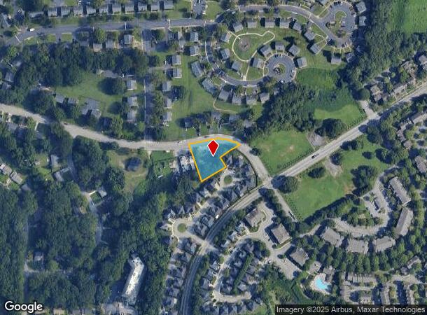
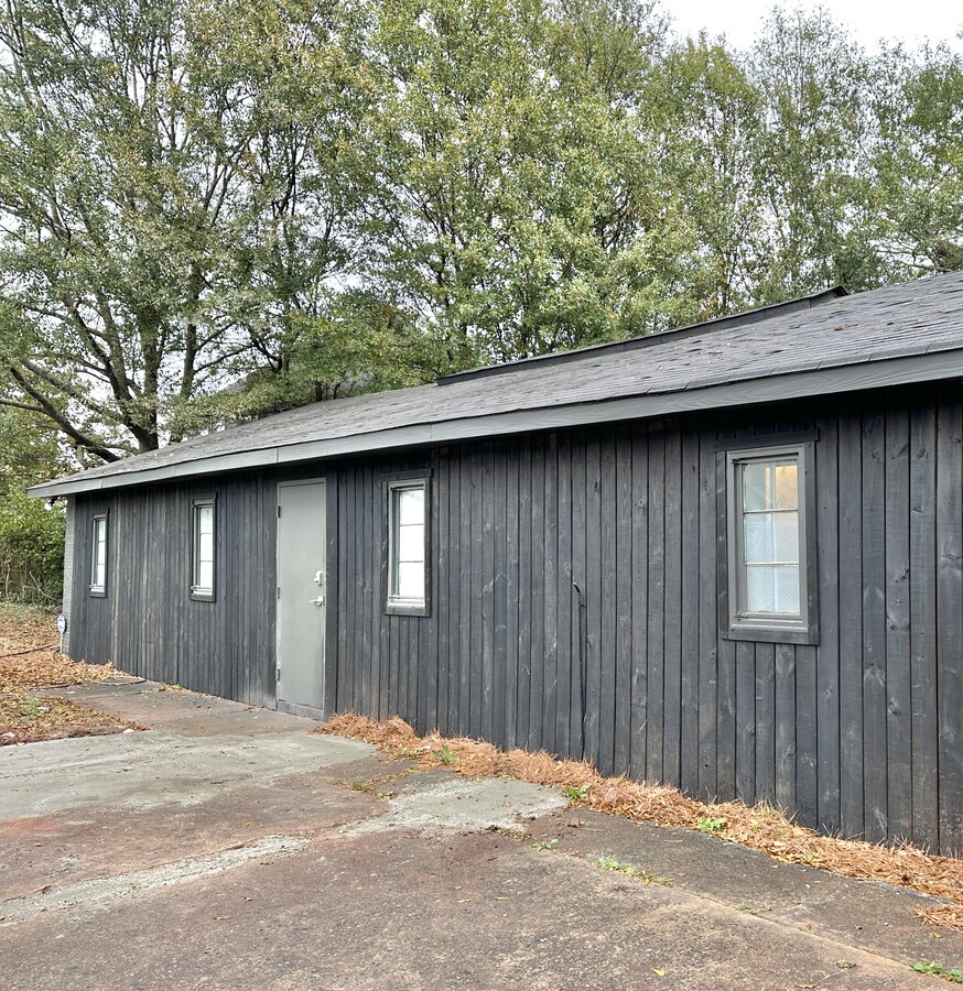
380 Amal Dr Sw, Atlanta, GA 30315

NEARBY LISTINGS FOR SALE OR LEASE
Property Detail
380 Amal Dr Sw
14-0072-LL-018-7
KA: BEEHIVE AN: BLDGS USED FOR HONEYBEE STORAGE 9/19
Commercialnec
Fulton
X
Georgia
13121C0359F
0.61 AC
2023
SE Atlanta
2023
Atlanta
006701
Atlanta-Sandy Springs-Roswell, GA
1,787 SF
DEMOGRAPHICS near 380 Amal Dr Sw
1 Mile
3 Mile
5 Mile
2024 Total Population
9,272
106,482
284,054
2029 Population
9,606
111,426
295,757
Pop Growth 2024-2029
+ 3.60%
+ 4.64%
+ 4.12%
Average Age
37
37
37
2024 Total Households
3,979
43,137
123,025
HH Growth 2024-2029
+ 3.74%
+ 4.88%
+ 4.40%
Median Household Inc
$40,192
$45,165
$58,044
Avg Household Size
2.30
2.30
2.10
2024 Avg HH Vehicles
1.00
1.00
1.00
Median Home Value
$233,654
$280,618
$318,823
Median Year Built
1981
1971
1976
Nearby Places
- Restaurants
- Banks
- Shops
- Fitness
- Groceries
PUBLIC TRANSPORTATION
COMMUTER RAIL
Atlanta (Crescent - Amtrak)
DRIVE
WALK
Distance
Atlanta (Crescent - Amtrak)
12 min
7.6 mi
AIRPORT
Hartsfield - Jackson Atlanta International
DRIVE
WALK
Distance
Hartsfield - Jackson Atlanta International
13 min
6.9 mi
Freight Ports
Georgia Ports - Savannah
DRIVE
WALK
Distance
Georgia Ports - Savannah
276 min
246.2 mi
SALE & LEASE HISTORY
LISTING DATE
SALE/LEASE

Nov 21, 2020
For Sale
Nov 13, 2022
For Lease
Nearby Properties
Address
Land Use
TOTAL SIZE
Lot Size
Zoning
Address
Land Use
TOTAL SIZE
Lot Size
Zoning
11.74 AC
I1
Address
Land Use
TOTAL SIZE
Lot Size
Zoning
7 AC
C3
Address
Land Use
TOTAL SIZE
Lot Size
Zoning
498,515 SF
3.41 AC
C1
Address
Land Use
TOTAL SIZE
Lot Size
Zoning
469,344 SF
3.62 AC
C3
Address
Land Use
TOTAL SIZE
Lot Size
Zoning
425,270 SF
201.84 AC
I1
Address
Land Use
TOTAL SIZE
Lot Size
Zoning
94.93 AC
R5
Address
Land Use
TOTAL SIZE
Lot Size
Zoning
54 AC
I2
Address
Land Use
TOTAL SIZE
Lot Size
Zoning
330,125 SF
7.16 AC
I1
Address
Land Use
TOTAL SIZE
Lot Size
Zoning
283,235 SF
5 AC
RG4
Address
Land Use
TOTAL SIZE
Lot Size
Zoning
416,206 SF
2.60 AC
I1
Address
Land Use
TOTAL SIZE
Lot Size
Zoning
541,508 SF
110.88 AC
I1
Address
Land Use
TOTAL SIZE
Lot Size
Zoning
318,300 SF
4.60 AC
I1
Address
Land Use
TOTAL SIZE
Lot Size
Zoning
376,254 SF
10.39 AC
I2
Address
Land Use
TOTAL SIZE
Lot Size
Zoning
5.34 AC
SPI1
Address
Land Use
TOTAL SIZE
Lot Size
Zoning
479,441 SF
0.36 AC
SPI1
Address
Land Use
TOTAL SIZE
Lot Size
Zoning
0.49 AC
SPI1
Address
Land Use
TOTAL SIZE
Lot Size
Zoning
4.09 AC
C5
Address
Land Use
TOTAL SIZE
Lot Size
Zoning
191,217 SF
1.63 AC
RG3
Address
Land Use
TOTAL SIZE
Lot Size
Zoning
418,159 SF
11.11 AC
RG3
Address
Land Use
TOTAL SIZE
Lot Size
Zoning
848,544 SF
101.10 AC
I1
Address
Land Use
TOTAL SIZE
Lot Size
Zoning
1,170,962 SF
38.32 AC
C3
Address
Land Use
TOTAL SIZE
Lot Size
Zoning
5.51 AC
OI
Address
Land Use
TOTAL SIZE
Lot Size
Zoning
0.18 AC
SPI1
Address
Land Use
TOTAL SIZE
Lot Size
Zoning
224,117 SF
1.44 AC
I1
Address
Land Use
TOTAL SIZE
Lot Size
Zoning
225,375 SF
3.18 AC
C2
Address
Land Use
TOTAL SIZE
Lot Size
Zoning
7.65 AC
R5
Address
Land Use
TOTAL SIZE
Lot Size
Zoning
4.73 AC
SPI1
Address
Land Use
TOTAL SIZE
Lot Size
Zoning
32.90 AC
R5
Address
Land Use
TOTAL SIZE
Lot Size
Zoning
563,256 SF
22.69 AC
I1
Address
Land Use
TOTAL SIZE
Lot Size
Zoning
77,982 SF
55.87 AC
I1
The World's #1 Commercial Real Estate Marketplace
Connect with us
© 2025 CoStar Group
The information above has been obtained from sources believed reliable. While we do not doubt its accuracy we have not verified it and make no guarantee, warranty or representation about it. It is your responsibility to independently confirm its accuracy and completeness. Any projections, opinions, assumptions, or estimates used are for example only and do not represent the current or future performance of the property. The value of this transaction to you depends on tax and other factors which should be evaluated by your tax, financial, and legal advisors. You and your advisors should conduct a careful, independent investigation of the property to determine to your satisfaction the suitability of the property for your needs.