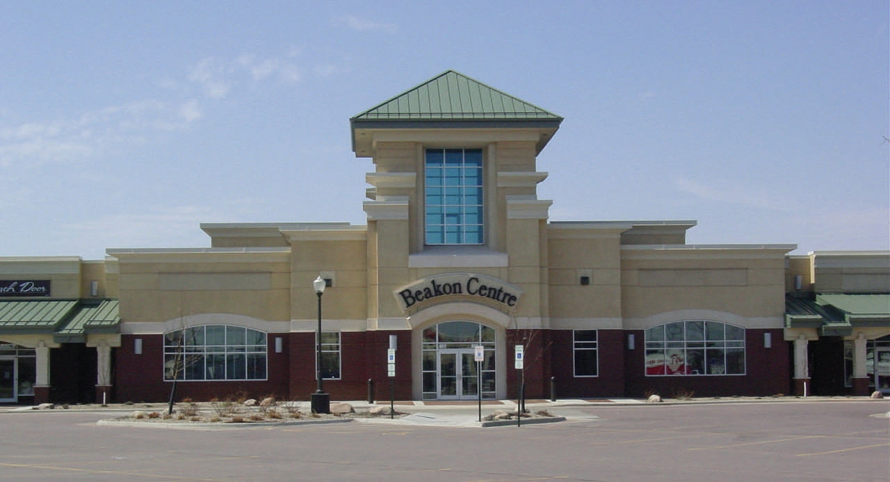
Property Record
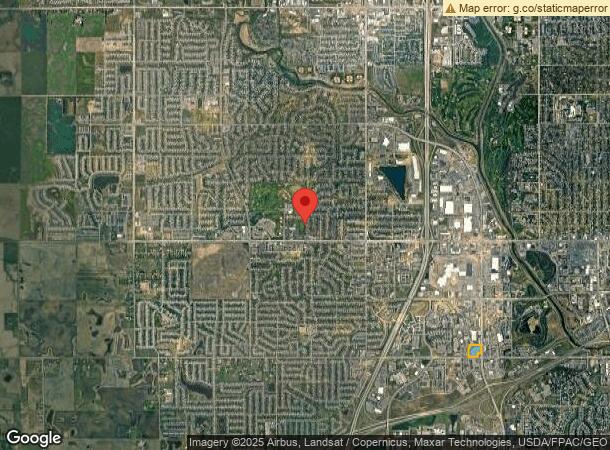
3800 W 57Th St, Sioux Falls, SD 57106
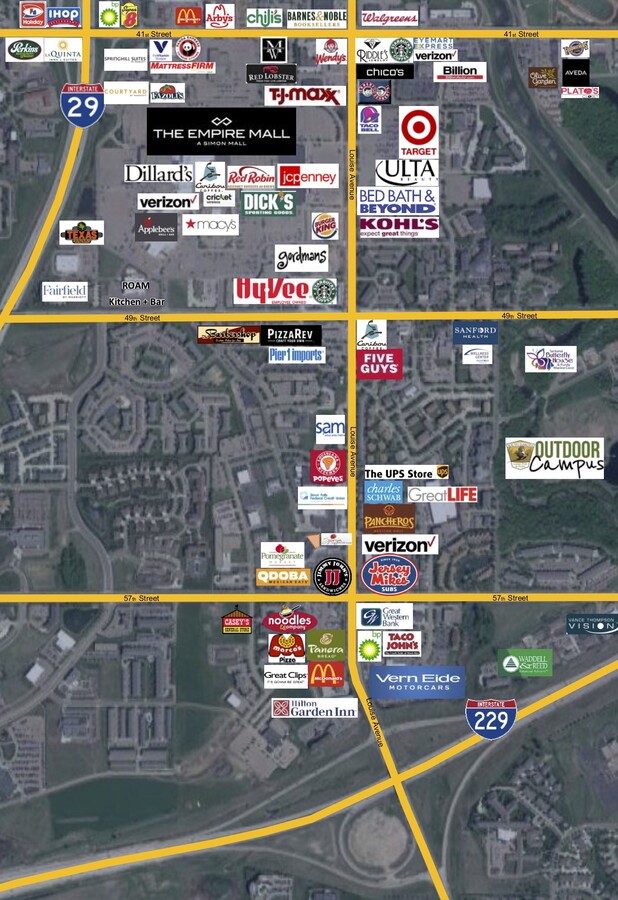
NEARBY LISTINGS FOR SALE OR LEASE
Property Detail
3800 W 57Th St
Sioux Falls, SD
Valhalla Addn
70533
TRACT J3 LOT 1 BLK 6 VALHALLA ADDN & LOT (EX H-1) 2 BLOCK 1 BEAKON CENTRE ADDN TO CITY OF SIOUX FALLS
Stripcommercialcenter
Minnehaha
X
South Dakota
46083C0050D
1
2024
6.42 AC
2023
Sioux Falls
001111
Other Market Areas
62,815 SF
DEMOGRAPHICS near 3800 W 57Th St
1 Mile
3 Mile
5 Mile
2024 Total Population
8,178
79,413
166,615
2029 Population
9,147
89,312
187,222
Pop Growth 2024-2029
+ 11.85%
+ 12.47%
+ 12.37%
Average Age
42
38
38
2024 Total Households
4,402
32,824
68,483
HH Growth 2024-2029
+ 12.13%
+ 12.60%
+ 12.68%
Median Household Inc
$49,187
$74,843
$73,276
Avg Household Size
1.80
2.30
2.30
2024 Avg HH Vehicles
1.00
2.00
2.00
Median Home Value
$220,101
$263,474
$255,406
Median Year Built
1994
1993
1992
Nearby Places
- Restaurants
- Banks
- Shops
- Fitness
- Groceries
PUBLIC TRANSPORTATION
AIRPORT
Joe Foss Field
DRIVE
WALK
Distance
Joe Foss Field
26 min
9.2 mi
Freight Ports
Port Milwaukee
DRIVE
WALK
Distance
Port Milwaukee
555 min
510.4 mi
SALE & LEASE HISTORY
LISTING DATE
SALE/LEASE

Oct 02, 2018
For Lease
Nov 07, 2019
For Lease
Feb 03, 2020
For Lease
Nearby Properties
Address
Land Use
TOTAL SIZE
Lot Size
Zoning
Address
Land Use
TOTAL SIZE
Lot Size
Zoning
14.81 AC
MUNICIPALI
Address
Land Use
TOTAL SIZE
Lot Size
Zoning
8.88 AC
MUNICIPALI
Address
Land Use
TOTAL SIZE
Lot Size
Zoning
8.80 AC
MUNICIPALI
Address
Land Use
TOTAL SIZE
Lot Size
Zoning
8.51 AC
MUNICIPALI
Address
Land Use
TOTAL SIZE
Lot Size
Zoning
15.40 AC
MUNICIPALI
Address
Land Use
TOTAL SIZE
Lot Size
Zoning
10.75 AC
MUNICIPALI
Address
Land Use
TOTAL SIZE
Lot Size
Zoning
11.13 AC
MUNICIPALI
Address
Land Use
TOTAL SIZE
Lot Size
Zoning
13,806 SF
10.99 AC
Address
Land Use
TOTAL SIZE
Lot Size
Zoning
7.91 AC
MUNICIPALI
Address
Land Use
TOTAL SIZE
Lot Size
Zoning
8.57 AC
MUNICIPALI
Address
Land Use
TOTAL SIZE
Lot Size
Zoning
16.45 AC
MUNICIPALI
Address
Land Use
TOTAL SIZE
Lot Size
Zoning
7.07 AC
MUNICIPALI
Address
Land Use
TOTAL SIZE
Lot Size
Zoning
639,393 SF
53.46 AC
FP;FP
Address
Land Use
TOTAL SIZE
Lot Size
Zoning
9.27 AC
MUNICIPALI
Address
Land Use
TOTAL SIZE
Lot Size
Zoning
7.09 AC
MUNICIPALI
Address
Land Use
TOTAL SIZE
Lot Size
Zoning
3.97 AC
MUNICIPALI
Address
Land Use
TOTAL SIZE
Lot Size
Zoning
360,262 SF
26 AC
Address
Land Use
TOTAL SIZE
Lot Size
Zoning
8,768 SF
5.48 AC
Address
Land Use
TOTAL SIZE
Lot Size
Zoning
29,313 SF
9.13 AC
Address
Land Use
TOTAL SIZE
Lot Size
Zoning
9.16 AC
MUNICIPALI
Address
Land Use
TOTAL SIZE
Lot Size
Zoning
5.27 AC
MUNICIPALI
Address
Land Use
TOTAL SIZE
Lot Size
Zoning
4.87 AC
MUNICIPALI
Address
Land Use
TOTAL SIZE
Lot Size
Zoning
72,342 SF
6.09 AC
FP;FP
Address
Land Use
TOTAL SIZE
Lot Size
Zoning
2.45 AC
MUNICIPALI
Address
Land Use
TOTAL SIZE
Lot Size
Zoning
3.06 AC
MUNICIPALI
Address
Land Use
TOTAL SIZE
Lot Size
Zoning
5.68 AC
MUNICIPALI
Address
Land Use
TOTAL SIZE
Lot Size
Zoning
0.57 AC
MUNICIPALI
Address
Land Use
TOTAL SIZE
Lot Size
Zoning
13.82 AC
MUNICIPALI
Address
Land Use
TOTAL SIZE
Lot Size
Zoning
5.12 AC
MUNICIPALI
Address
Land Use
TOTAL SIZE
Lot Size
Zoning
6.11 AC
MUNICIPALI
The World's #1 Commercial Real Estate Marketplace
Connect with us
© 2025 CoStar Group
The information above has been obtained from sources believed reliable. While we do not doubt its accuracy we have not verified it and make no guarantee, warranty or representation about it. It is your responsibility to independently confirm its accuracy and completeness. Any projections, opinions, assumptions, or estimates used are for example only and do not represent the current or future performance of the property. The value of this transaction to you depends on tax and other factors which should be evaluated by your tax, financial, and legal advisors. You and your advisors should conduct a careful, independent investigation of the property to determine to your satisfaction the suitability of the property for your needs.