Property Record
3800 Brentwood Rd, Raleigh, NC 27604


NEARBY LISTINGS FOR SALE OR LEASE
-
-
View all Raleigh listings for sale on LoopNet.com
Property Detail
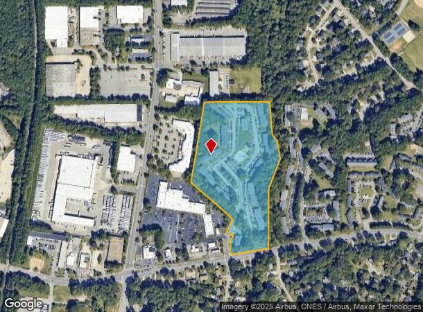
3800 Brentwood Rd
1715.08-89-9609-000
Brentwood Vil Phi
Apartment
BRENTWOOD VIL PHI
AE
Wake
3720171500K
North Carolina
2024
18.28 AC
2024
Brentwood
052704
Raleigh/Durham
263,658 SF
Raleigh, NC
DEMOGRAPHICS near 3800 Brentwood Rd
1 Mile
3 Mile
5 Mile
2024 Total Population
11,687
93,748
242,803
2029 Population
12,582
101,907
264,285
Pop Growth 2024-2029
+ 7.66%
+ 8.70%
+ 8.85%
Average Age
36
39
39
2024 Total Households
4,750
40,737
104,747
HH Growth 2024-2029
+ 7.66%
+ 8.89%
+ 9.04%
Median Household Inc
$48,345
$71,116
$76,874
Avg Household Size
2.40
2.20
2.20
2024 Avg HH Vehicles
2.00
2.00
2.00
Median Home Value
$199,915
$292,063
$345,971
Median Year Built
1979
1988
1990
Nearby Places
- Restaurants
- Banks
- Shops
- Fitness
- Groceries
PUBLIC TRANSPORTATION
COMMUTER RAIL
Raleigh Union Station (Piedmont - North Carolina by Train (NC Train))
DRIVE
WALK
Distance
Raleigh Union Station (Piedmont - North Carolina by Train (NC Train))
12 min
5.7 mi
AIRPORT
Raleigh-Durham International
DRIVE
WALK
Distance
Raleigh-Durham International
26 min
16.8 mi
Freight Ports
Port of Wilmington
DRIVE
WALK
Distance
Port of Wilmington
159 min
136.9 mi
Nearby Properties
Address
Land Use
TOTAL SIZE
Lot Size
Zoning
Address
Land Use
TOTAL SIZE
Lot Size
Zoning
1,085,654 SF
16.87 AC
OX-5
Address
Land Use
TOTAL SIZE
Lot Size
Zoning
465,052 SF
2.65 AC
PD
Address
Land Use
TOTAL SIZE
Lot Size
Zoning
658,580 SF
3.30 AC
PD
Address
Land Use
TOTAL SIZE
Lot Size
Zoning
747,658 SF
11.12 AC
CX-12
Address
Land Use
TOTAL SIZE
Lot Size
Zoning
364,025 SF
2.19 AC
PD
Address
Land Use
TOTAL SIZE
Lot Size
Zoning
539,902 SF
1.28 AC
O&I-1
Address
Land Use
TOTAL SIZE
Lot Size
Zoning
355,931 SF
2.60 AC
PD
Address
Land Use
TOTAL SIZE
Lot Size
Zoning
303,238 SF
12.41 AC
PD
Address
Land Use
TOTAL SIZE
Lot Size
Zoning
354,131 SF
15.23 AC
RX-4
Address
Land Use
TOTAL SIZE
Lot Size
Zoning
368,475 SF
12.25 AC
CX-4
Address
Land Use
TOTAL SIZE
Lot Size
Zoning
544,122 SF
1.49 AC
PD
Address
Land Use
TOTAL SIZE
Lot Size
Zoning
284,958 SF
3.01 AC
PD
Address
Land Use
TOTAL SIZE
Lot Size
Zoning
319,136 SF
22.25 AC
OX-12
Address
Land Use
TOTAL SIZE
Lot Size
Zoning
289,301 SF
20.67 AC
OX-12
Address
Land Use
TOTAL SIZE
Lot Size
Zoning
373,187 SF
6.61 AC
PD
Address
Land Use
TOTAL SIZE
Lot Size
Zoning
282,285 SF
5.29 AC
PD
Address
Land Use
TOTAL SIZE
Lot Size
Zoning
402,163 SF
23.39 AC
RX-3
Address
Land Use
TOTAL SIZE
Lot Size
Zoning
193,990 SF
7.16 AC
RX-5
Address
Land Use
TOTAL SIZE
Lot Size
Zoning
186,221 SF
7.10 AC
RX-5
Address
Land Use
TOTAL SIZE
Lot Size
Zoning
684,730 SF
35.37 AC
CX-3
Address
Land Use
TOTAL SIZE
Lot Size
Zoning
325,835 SF
41.93 AC
R-4
Address
Land Use
TOTAL SIZE
Lot Size
Zoning
358,520 SF
2.46 AC
CX-7
Address
Land Use
TOTAL SIZE
Lot Size
Zoning
211,289 SF
6.87 AC
CX-5
Address
Land Use
TOTAL SIZE
Lot Size
Zoning
382,781 SF
52.73 AC
CX-3
Address
Land Use
TOTAL SIZE
Lot Size
Zoning
299,388 SF
13.83 AC
CX-4
Address
Land Use
TOTAL SIZE
Lot Size
Zoning
306,259 SF
13.35 AC
RX-5
Address
Land Use
TOTAL SIZE
Lot Size
Zoning
285,949 SF
32.91 AC
RX-3
Address
Land Use
TOTAL SIZE
Lot Size
Zoning
251,174 SF
13.98 AC
RX-3
Address
Land Use
TOTAL SIZE
Lot Size
Zoning
189,532 SF
1.53 AC
PD
Address
Land Use
TOTAL SIZE
Lot Size
Zoning
249,798 SF
12.26 AC
OX-3
The World's #1 Commercial Real Estate Marketplace
Connect with us
© 2025 CoStar Group
The information above has been obtained from sources believed reliable. While we do not doubt its accuracy we have not verified it and make no guarantee, warranty or representation about it. It is your responsibility to independently confirm its accuracy and completeness. Any projections, opinions, assumptions, or estimates used are for example only and do not represent the current or future performance of the property. The value of this transaction to you depends on tax and other factors which should be evaluated by your tax, financial, and legal advisors. You and your advisors should conduct a careful, independent investigation of the property to determine to your satisfaction the suitability of the property for your needs.