Property Record
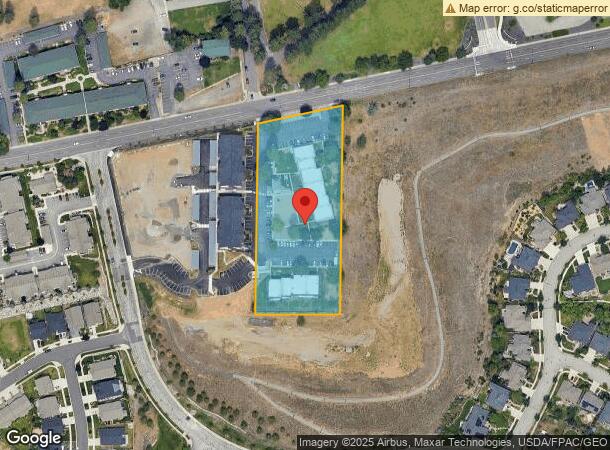
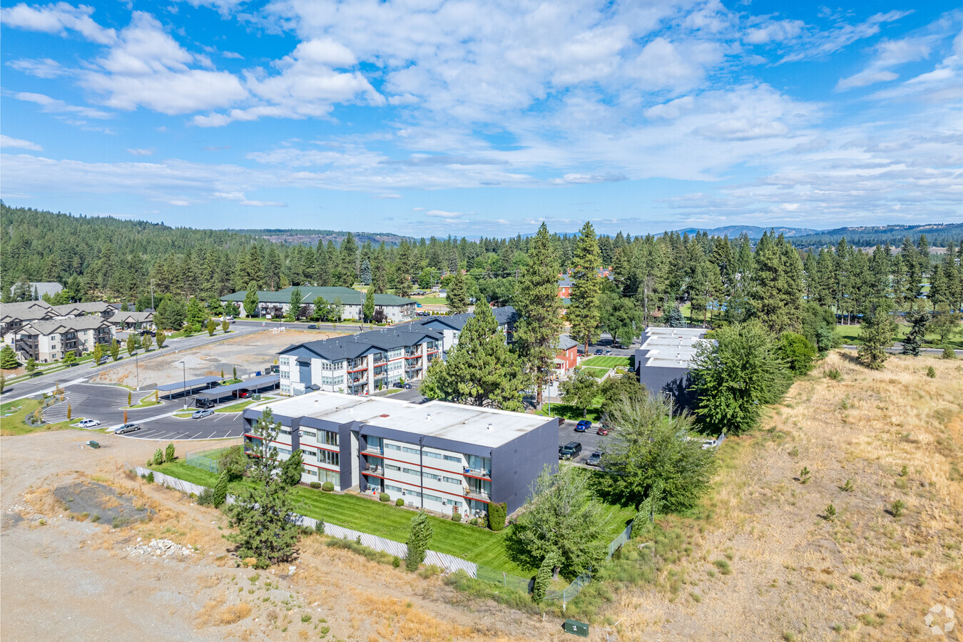
3817 W Whistalks Way, Spokane, WA 99224

NEARBY LISTINGS FOR SALE OR LEASE
Property Detail
3817 W Whistalks Way
25113.0061
11-25-42 CITY OF SPOKANE PTN OF S1/2 OF SW1/4 DAF; BEG AT SW COR OF SEC TH N 32DEG 33MIN 15SDS W 158.1FT TH N 42DEG 22MIN E 83.4FT TO BEG OF CURVE TO RT & RAD OF 573FT TH ALG SD CURVE THRU C/A OF 38DEG 16MIN A DIST OF 382.7FT TH N 80DEG 38MIN E A DIS
Apartment
Spokane
X
Washington
53063C0536D
2.70 AC
2024
West Spokane
2024
Spokane
003601
Spokane-Spokane Valley, WA
49,444 SF
DEMOGRAPHICS near 3817 W Whistalks Way
1 Mile
3 Mile
5 Mile
2024 Total Population
4,154
73,339
190,754
2029 Population
4,414
78,038
202,860
Pop Growth 2024-2029
+ 6.26%
+ 6.41%
+ 6.35%
Average Age
35
39
39
2024 Total Households
1,703
32,901
78,752
HH Growth 2024-2029
+ 6.40%
+ 6.88%
+ 6.68%
Median Household Inc
$46,710
$53,238
$57,351
Avg Household Size
2.30
2.10
2.30
2024 Avg HH Vehicles
1.00
2.00
2.00
Median Home Value
$390,908
$283,233
$305,631
Median Year Built
1991
1952
1957
Nearby Places
- Restaurants
- Banks
- Shops
- Fitness
- Groceries
PUBLIC TRANSPORTATION
COMMUTER RAIL
Spokane (Empire Builder - Amtrak)
DRIVE
WALK
Distance
Spokane (Empire Builder - Amtrak)
11 min
4.0 mi
AIRPORT
Spokane International
DRIVE
WALK
Distance
Spokane International
15 min
6.8 mi
Freight Ports
Port of Everett
DRIVE
WALK
Distance
Port of Everett
344 min
303.7 mi
Nearby Properties
Address
Land Use
TOTAL SIZE
Lot Size
Zoning
Address
Land Use
TOTAL SIZE
Lot Size
Zoning
831,429 SF
119.79 AC
Address
Land Use
TOTAL SIZE
Lot Size
Zoning
157,882 SF
42.70 AC
DTG
Address
Land Use
TOTAL SIZE
Lot Size
Zoning
123,047 SF
3.95 AC
DTG
Address
Land Use
TOTAL SIZE
Lot Size
Zoning
241,106 SF
3.92 AC
CB
Address
Land Use
TOTAL SIZE
Lot Size
Zoning
536,438 SF
1.70 AC
DTC
Address
Land Use
TOTAL SIZE
Lot Size
Zoning
154,800 SF
20.06 AC
DTG
Address
Land Use
TOTAL SIZE
Lot Size
Zoning
251,542 SF
5.78 AC
DTG
Address
Land Use
TOTAL SIZE
Lot Size
Zoning
171,479 SF
67.30 AC
RSF
Address
Land Use
TOTAL SIZE
Lot Size
Zoning
139,485 SF
16.74 AC
RSF
Address
Land Use
TOTAL SIZE
Lot Size
Zoning
91,882 SF
2.07 AC
OR
Address
Land Use
TOTAL SIZE
Lot Size
Zoning
314,149 SF
1.07 AC
DTC
Address
Land Use
TOTAL SIZE
Lot Size
Zoning
53,748 SF
1.26 AC
DTC
Address
Land Use
TOTAL SIZE
Lot Size
Zoning
107,800 SF
3.20 AC
CB
Address
Land Use
TOTAL SIZE
Lot Size
Zoning
289,705 SF
3.36 AC
OR
Address
Land Use
TOTAL SIZE
Lot Size
Zoning
151,667 SF
7.45 AC
DTG
Address
Land Use
TOTAL SIZE
Lot Size
Zoning
50,869 SF
0.61 AC
DTC
Address
Land Use
TOTAL SIZE
Lot Size
Zoning
228,981 SF
5.32 AC
RHD
Address
Land Use
TOTAL SIZE
Lot Size
Zoning
259,221 SF
5.06 AC
DTC
Address
Land Use
TOTAL SIZE
Lot Size
Zoning
124,249 SF
15.45 AC
RHD
Address
Land Use
TOTAL SIZE
Lot Size
Zoning
180,140 SF
0.37 AC
DTC
Address
Land Use
TOTAL SIZE
Lot Size
Zoning
67,831 SF
6.90 AC
DTG
Address
Land Use
TOTAL SIZE
Lot Size
Zoning
16,384 SF
1.21 AC
DTC
Address
Land Use
TOTAL SIZE
Lot Size
Zoning
236,105 SF
5.01 AC
OR
Address
Land Use
TOTAL SIZE
Lot Size
Zoning
46,255 SF
2.06 AC
DTG
Address
Land Use
TOTAL SIZE
Lot Size
Zoning
91,048 SF
3.81 AC
OR
Address
Land Use
TOTAL SIZE
Lot Size
Zoning
280,783 SF
4.91 AC
GC
Address
Land Use
TOTAL SIZE
Lot Size
Zoning
127,826 SF
0.33 AC
DTG
Address
Land Use
TOTAL SIZE
Lot Size
Zoning
30,250 SF
1.05 AC
DTC
Address
Land Use
TOTAL SIZE
Lot Size
Zoning
117,687 SF
1.20 AC
GC
Address
Land Use
TOTAL SIZE
Lot Size
Zoning
114,600 SF
0.87 AC
CB
The World's #1 Commercial Real Estate Marketplace
Connect with us
© 2025 CoStar Group
The information above has been obtained from sources believed reliable. While we do not doubt its accuracy we have not verified it and make no guarantee, warranty or representation about it. It is your responsibility to independently confirm its accuracy and completeness. Any projections, opinions, assumptions, or estimates used are for example only and do not represent the current or future performance of the property. The value of this transaction to you depends on tax and other factors which should be evaluated by your tax, financial, and legal advisors. You and your advisors should conduct a careful, independent investigation of the property to determine to your satisfaction the suitability of the property for your needs.