Property Record
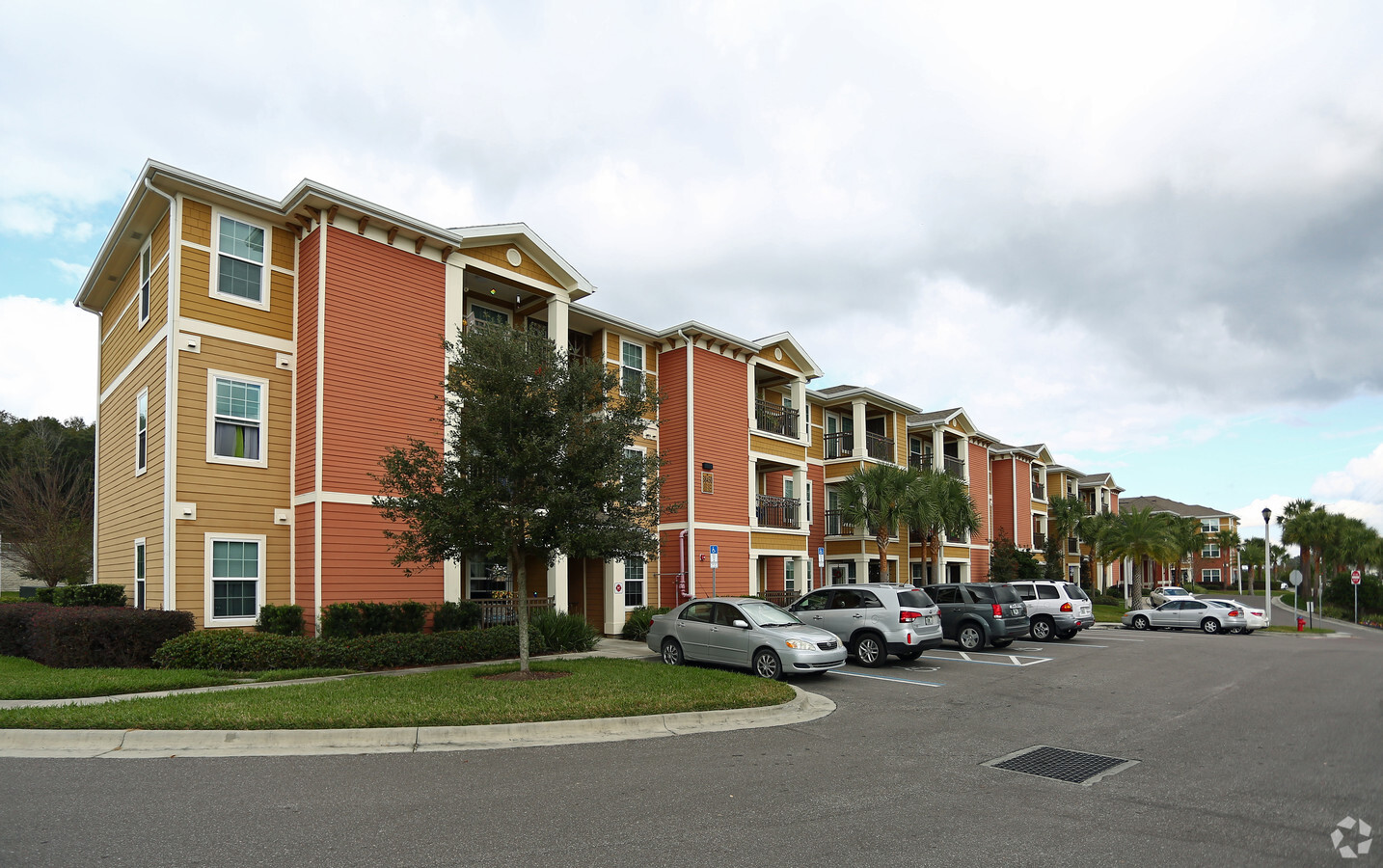
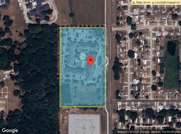
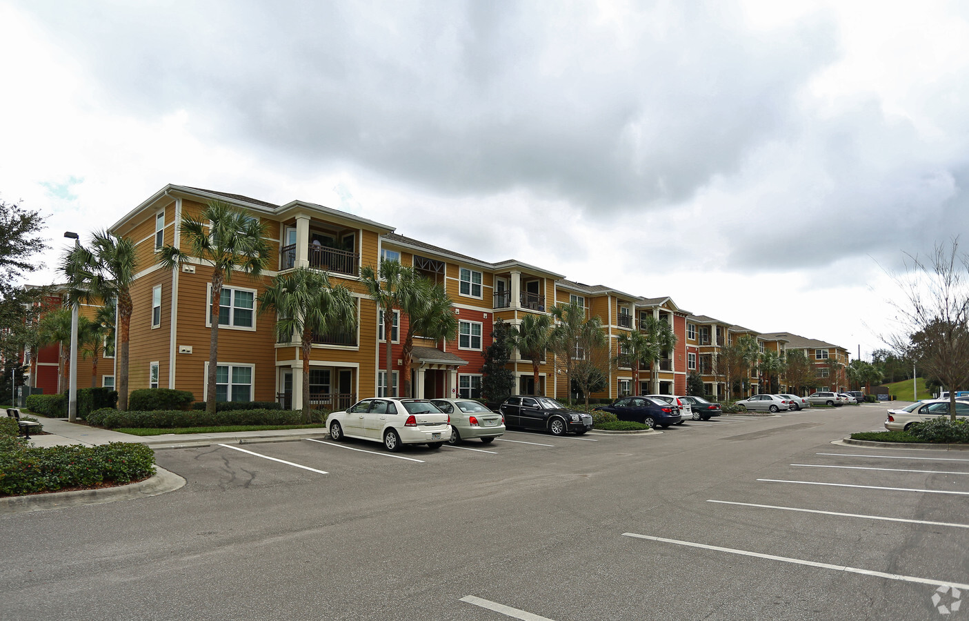
38422 Valley Oaks Cir, Zephyrhills, FL 33540

NEARBY LISTINGS FOR SALE OR LEASE
Property Detail
38422 Valley Oaks Cir
35-25-21-0010-09200-0000
Zephyrhills Colony Company Lands
Multifamilydwelling
ZEPHYRHILLS COLONY COMPANY LANDS PB 1 PG 55 ALL THAT PART OF TRACTS 92 101 108 LESS THE SOUTH 77.43 FT OF SAID TRACT 108 LYING WEST OF WIRE RD EXC THE EAST 38.78 FT THEREOF PER OR 8549 PG 1961 OR 6973 PG 763
X
Pasco
12101C0293F
Florida
2024
11.13 AC
2024
Zephyrhills Area
032804
Tampa/St Petersburg
143,626 SF
Tampa-St. Petersburg-Clearwater, FL
DEMOGRAPHICS near 38422 Valley Oaks Cir
1 Mile
3 Mile
5 Mile
2024 Total Population
8,814
42,841
72,238
2029 Population
10,704
51,984
87,905
Pop Growth 2024-2029
+ 21.44%
+ 21.34%
+ 21.69%
Average Age
50
49
49
2024 Total Households
4,118
19,711
32,670
HH Growth 2024-2029
+ 21.32%
+ 21.40%
+ 21.70%
Median Household Inc
$42,785
$41,828
$45,239
Avg Household Size
2.10
2.10
2.20
2024 Avg HH Vehicles
2.00
2.00
2.00
Median Home Value
$155,797
$121,268
$123,157
Median Year Built
1991
1984
1987
Nearby Places
- Restaurants
- Banks
- Shops
- Fitness
- Groceries
PUBLIC TRANSPORTATION
AIRPORT
Tampa International
DRIVE
WALK
Distance
Tampa International
58 min
38.7 mi
Freight Ports
Port of Tampa Bay
DRIVE
WALK
Distance
Port of Tampa Bay
51 min
32.2 mi
Nearby Properties
Address
Land Use
TOTAL SIZE
Lot Size
Zoning
Address
Land Use
TOTAL SIZE
Lot Size
Zoning
352,321 SF
27.88 AC
OP
Address
Land Use
TOTAL SIZE
Lot Size
Zoning
610,631 SF
45.79 AC
LI
Address
Land Use
TOTAL SIZE
Lot Size
Zoning
199,367 SF
15.46 AC
R2
Address
Land Use
TOTAL SIZE
Lot Size
Zoning
127,340 SF
15.04 AC
AC
Address
Land Use
TOTAL SIZE
Lot Size
Zoning
107,232 SF
12.79 AC
MPUD
Address
Land Use
TOTAL SIZE
Lot Size
Zoning
292,589 SF
52.57 AC
R3
Address
Land Use
TOTAL SIZE
Lot Size
Zoning
98,980 SF
5.36 AC
C2
Address
Land Use
TOTAL SIZE
Lot Size
Zoning
216,202 SF
23.77 AC
C2
Address
Land Use
TOTAL SIZE
Lot Size
Zoning
79,605 SF
3.13 AC
C2
Address
Land Use
TOTAL SIZE
Lot Size
Zoning
105,449 SF
5.14 AC
OP
Address
Land Use
TOTAL SIZE
Lot Size
Zoning
162,278 SF
118.82 AC
AP2
Address
Land Use
TOTAL SIZE
Lot Size
Zoning
101.06 AC
MPUD
Address
Land Use
TOTAL SIZE
Lot Size
Zoning
68,446 SF
3.54 AC
C2
Address
Land Use
TOTAL SIZE
Lot Size
Zoning
32,076 SF
3.58 AC
PUD
Address
Land Use
TOTAL SIZE
Lot Size
Zoning
56,312 SF
8.85 AC
PUD
Address
Land Use
TOTAL SIZE
Lot Size
Zoning
107,022 SF
13.27 AC
C2
Address
Land Use
TOTAL SIZE
Lot Size
Zoning
60,759 SF
7.56 AC
C2
Address
Land Use
TOTAL SIZE
Lot Size
Zoning
94,412 SF
9.67 AC
C2
Address
Land Use
TOTAL SIZE
Lot Size
Zoning
62,320 SF
8.13 AC
R4
Address
Land Use
TOTAL SIZE
Lot Size
Zoning
76,015 SF
9.18 AC
C2
Address
Land Use
TOTAL SIZE
Lot Size
Zoning
123,959 SF
15.18 AC
C2
Address
Land Use
TOTAL SIZE
Lot Size
Zoning
131,274 SF
13.07 AC
R4
Address
Land Use
TOTAL SIZE
Lot Size
Zoning
68,710 SF
7.96 AC
C2
Address
Land Use
TOTAL SIZE
Lot Size
Zoning
72,183 SF
43.32 AC
R3
Address
Land Use
TOTAL SIZE
Lot Size
Zoning
76,818 SF
15 AC
AC
Address
Land Use
TOTAL SIZE
Lot Size
Zoning
28,549 SF
1.49 AC
SD
Address
Land Use
TOTAL SIZE
Lot Size
Zoning
41,812 SF
255.72 AC
AP2
Address
Land Use
TOTAL SIZE
Lot Size
Zoning
61,636 SF
6.84 AC
C2
Address
Land Use
TOTAL SIZE
Lot Size
Zoning
12.29 AC
R4
The World's #1 Commercial Real Estate Marketplace
Connect with us
© 2025 CoStar Group
The information above has been obtained from sources believed reliable. While we do not doubt its accuracy we have not verified it and make no guarantee, warranty or representation about it. It is your responsibility to independently confirm its accuracy and completeness. Any projections, opinions, assumptions, or estimates used are for example only and do not represent the current or future performance of the property. The value of this transaction to you depends on tax and other factors which should be evaluated by your tax, financial, and legal advisors. You and your advisors should conduct a careful, independent investigation of the property to determine to your satisfaction the suitability of the property for your needs.