Property Record
385 Stoneridge Dr N, Ruckersville, VA 22968
NEARBY LISTINGS FOR SALE OR LEASE
-
-
View all Ruckersville listings for sale on LoopNet.com
Property Detail
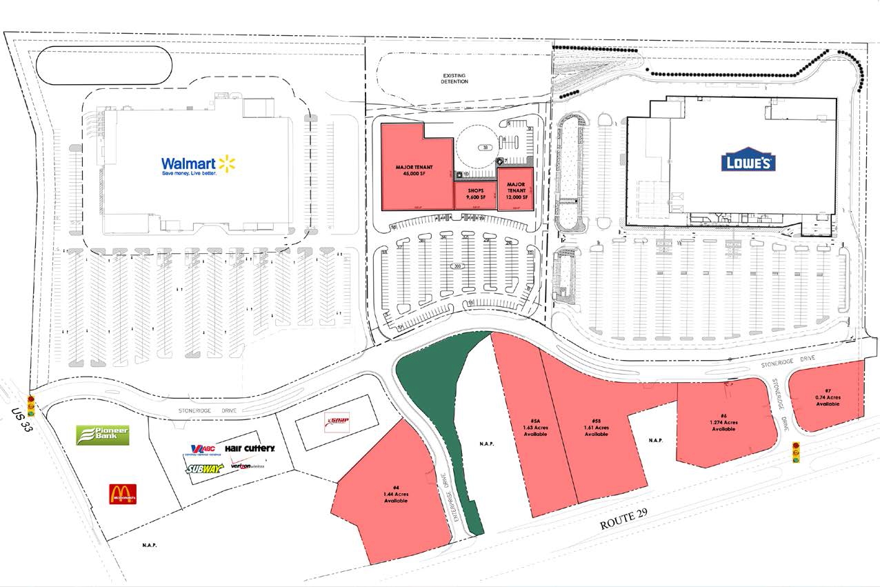
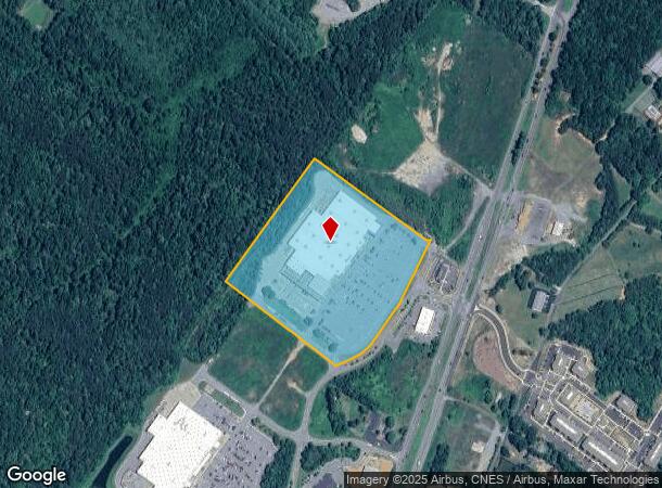
385 Stoneridge Dr N
60-A-C
STONERIDGE DRIVE PARCEL C 17.003 AC
Multipleuses
Greene
X
Virginia
51113C0325D
17 AC
2024
Charlottesville
2024
Other Market Areas
030202
Charlottesville, VA
127,178 SF
DEMOGRAPHICS near 385 Stoneridge Dr N
1 Mile
3 Mile
5 Mile
2024 Total Population
1,356
8,869
17,793
2029 Population
1,450
9,504
19,063
Pop Growth 2024-2029
+ 6.93%
+ 7.16%
+ 7.14%
Average Age
42
41
41
2024 Total Households
509
3,323
6,664
HH Growth 2024-2029
+ 6.88%
+ 7.04%
+ 7.10%
Median Household Inc
$80,729
$88,753
$82,462
Avg Household Size
2.70
2.70
2.60
2024 Avg HH Vehicles
2.00
2.00
2.00
Median Home Value
$269,298
$311,060
$308,437
Median Year Built
1990
1995
1993
Nearby Places
- Restaurants
- Banks
- Shops
- Fitness
- Groceries
PUBLIC TRANSPORTATION
AIRPORT
Charlottesville-Albemarle
DRIVE
WALK
Distance
Charlottesville-Albemarle
17 min
9.8 mi
Freight Ports
Virginia Port Authority - Richmond
DRIVE
WALK
Distance
Virginia Port Authority - Richmond
111 min
86.3 mi
Nearby Properties
Address
Land Use
TOTAL SIZE
Lot Size
Zoning
Address
Land Use
TOTAL SIZE
Lot Size
Zoning
20.27 AC
B-2
Address
Land Use
TOTAL SIZE
Lot Size
Zoning
20.27 AC
B-2
Address
Land Use
TOTAL SIZE
Lot Size
Zoning
116,242 SF
135.39 AC
A-1
Address
Land Use
TOTAL SIZE
Lot Size
Zoning
52,952 SF
6.72 AC
B-2
Address
Land Use
TOTAL SIZE
Lot Size
Zoning
3.93 AC
B-2
Address
Land Use
TOTAL SIZE
Lot Size
Zoning
5.90 AC
M-2
Address
Land Use
TOTAL SIZE
Lot Size
Zoning
13,137 SF
3.22 AC
B-3
Address
Land Use
TOTAL SIZE
Lot Size
Zoning
5.36 AC
M-1
Address
Land Use
TOTAL SIZE
Lot Size
Zoning
3,963 SF
1.24 AC
B-3
Address
Land Use
TOTAL SIZE
Lot Size
Zoning
1.27 AC
B-3
Address
Land Use
TOTAL SIZE
Lot Size
Zoning
30,000 SF
2.52 AC
B-2
Address
Land Use
TOTAL SIZE
Lot Size
Zoning
4.78 AC
B-3
Address
Land Use
TOTAL SIZE
Lot Size
Zoning
1.07 AC
B-3
Address
Land Use
TOTAL SIZE
Lot Size
Zoning
1.07 AC
B-3
Address
Land Use
TOTAL SIZE
Lot Size
Zoning
1.17 AC
B-3
Address
Land Use
TOTAL SIZE
Lot Size
Zoning
175.38 AC
A-1
Address
Land Use
TOTAL SIZE
Lot Size
Zoning
1.81 AC
B-2
Address
Land Use
TOTAL SIZE
Lot Size
Zoning
1.84 AC
B-2
Address
Land Use
TOTAL SIZE
Lot Size
Zoning
13,740 SF
1.71 AC
B-2
Address
Land Use
TOTAL SIZE
Lot Size
Zoning
1.09 AC
B-3
Address
Land Use
TOTAL SIZE
Lot Size
Zoning
3.21 AC
B-3
Address
Land Use
TOTAL SIZE
Lot Size
Zoning
1.55 AC
B-3
The World's #1 Commercial Real Estate Marketplace
Connect with us
© 2025 CoStar Group
The information above has been obtained from sources believed reliable. While we do not doubt its accuracy we have not verified it and make no guarantee, warranty or representation about it. It is your responsibility to independently confirm its accuracy and completeness. Any projections, opinions, assumptions, or estimates used are for example only and do not represent the current or future performance of the property. The value of this transaction to you depends on tax and other factors which should be evaluated by your tax, financial, and legal advisors. You and your advisors should conduct a careful, independent investigation of the property to determine to your satisfaction the suitability of the property for your needs.